Kalispell Falls
By Armen Suny · Last verified Mar 2026
Photo Credits (2)
Difficulty
Moderate
Trail Length
2.4 miles
Trail Type
Out And Back
Elevation Gain
350 ft
About Kalispell Falls
Kalispell Falls is a scenic, quietly secluded cascade tucked into the dense, forested slopes of northeastern Washington. Nestled within the Kaniksu National Forest and managed by the U.S. Forest Service, the falls are framed by lush evergreens and offer a peaceful spot for photographers and hikers seeking a less-crowded nature visit. The setting feels intimate and restorative — a lovely reward after a short forest walk. Access to the falls follows the USFS KALISPELL ROCK Trail (Trail #370). The route is an out-and-back of roughly 2.4 miles (2.35 GIS miles) with about 350 feet of elevation gain, rated moderate; because the trail is less developed than some popular park routes, visits here tend to be quieter and more solitary than along major recreation corridors.
The Setting
Kalispell Falls sits at 3,399 feet within Kaniksu National Forest, fed by the Pend Oreille River, in the mountains of Washington.
Trail & Hike Details
The Approach
The moderate hike follows Kalispell Rock (#370), a 2.4-mile out-and-back trail over natural surface. Expect 350 feet of elevation gain with grades of 12-20%. The trail is developed (Class 3).
USFS Trail
KALISPELL ROCK #370
Trail Class
Developed
Surface
Avg Grade
USFS Segment
2.35 miTrail Description
USFS Trail KALISPELL ROCK (Trail #370) is an out-and-back route of about 2.4 miles (2.35 GIS miles) with approximately 350 feet of gain and a moderate difficulty rating. The tread is native material (NAT) — dirt and natural rock — and the trail is classified as Class 3. While the overall hike is moderate, some sections reach a typical grade of 12–20%, so you’ll encounter steeper pitches along the route. The path is well-shaded through forest; it can become muddy after rain, so sturdy, grippy footwear is recommended. Managed by the U.S. Forest Service within Kaniksu National Forest, Trail #370 provides straightforward access to the falls for day hikers.
What to Expect
Dogs are welcome.
Accessibility
The trail is not wheelchair accessible. Uneven terrain and elevation changes require steady footing.
Frequently Asked Questions
🐶 Are Dogs Allowed at Kalispell Falls?
✅ Dogs are allowed
Are There Any Fees or Permits Required?
🆖 No fees required
🏊 Is There Swimming at Kalispell Falls?
❌ Swimming is not allowed
When to Visit
Spring and early summer are ideal times to visit, as the water flow is typically strongest during these seasons.
Seasonal Access
The best time to visit is Spring, Summer, and Fall. Winter access may be limited. Check with Kaniksu National Forest for seasonal road closures.
Safety Information
Visitors should be cautious of slippery rocks near the falls and avoid venturing too close to the water. Cell service may be limited in the area, so plan accordingly.
Current Water Conditions
Based on a USGS gauge 18 miles away
42,800 ft³/s
Current discharge — how much water is flowing
About average for this time of year
Based on 73 years of record
94.43 ft
Water depth at gauge
7-Day Discharge Trend
What does this mean for your visit?
Flow is about average for this time of year.
About This Gauge
This gauge is on a regional waterway. Conditions at the falls may differ, especially after local rain.
7-Day Flow Outlook
Based on the USGS gauge PEND OREILLE RIVER BELOW BOX CANYON NEAR IONE, WA (29 km away).
Today
Roaring
42800 cfs
9/10Tomorrow
Roaring
43420 cfs
6/10Sat
Roaring
43289 cfs
6/10Sun
Roaring
44086 cfs
6/10Mon
Roaring
38721 cfs
6/10Tue
Roaring
39237 cfs
6/10Wed
Roaring
39010 cfs
6/10Best window: Today — roaring flow, partly sunny (trip score 9/10).
Best time of year: this gauge typically runs highest from mid April to mid July, peaking in June.
How we calculate this
This is a transparent outlook, not a precise forecast. We take the waterfall's current flow strength (how it ranks against its historical normal for today, from the nearest USGS stream gauge), carry that ranking forward along the gauge's seasonal curve, and nudge it for forecast rain. Confidence is highest for the next day or two and falls further out. Always check official conditions and your own judgment before visiting — high flows can be dangerous.
Know when to go.
Get a free email alert when waterfalls near Coolin hit peak flow. We only send when conditions are worth the trip — no weekly newsletters, no spam.
Weather Forecast
Location & Access
Getting There
Kalispell Falls is located within the Colville National Forest. Access is typically via forest service roads, which may require a high-clearance vehicle depending on conditions. Directions should be confirmed with the local ranger station.
Get Directions on Google MapsParking
There is limited parking available near the trailhead. Visitors should plan to arrive early, especially during peak seasons, to secure a spot.
Elevation
3,399 feet above sea level
Coordinates
48.614694° N, -117.111237° W
Land Management
Managed by USFS
Visitor Tips & Gear
Bring bug spray during the summer months as mosquitoes can be present. Check with the Colville National Forest ranger station for current trail conditions before visiting.
As an Amazon Associate, we earn from qualifying purchases.
With 2.4 miles and 350 ft of elevation gain, sturdy boots and trekking poles will help on this moderate trail. Sun exposure on the trail makes good sun protection a must in summer.

Polarized Sunglasses (Knockaround)
Cuts glare off the water so you actually see the falls — and your photos turn out better too.

Columbia Watertight II Rain Jacket
Packs into its own pocket, seam-sealed, and keeps you dry from spray and surprise rain.

Earth Pak Waterproof Dry Bag
Keeps your phone and gear dry when waterfall mist soaks everything else.

Waterproof Phone Pouch (AiRunTech)
Cheap insurance — take photos right next to the falls without killing your phone.

Timberland Euro Sprint Mid Waterproof
Trusted waterproof boot with premium leather and grippy rubber sole — reliable on rocky, wet trails.

TrailBuddy Trekking Poles
Lightweight aluminum, cork grips, and flip-locks that actually hold — a best-seller for good reason.
Where to Stay

Beautiful Bungalow and Bunk House, Close to Lake

Unique Nordman Retreat 1 Mi to Priest Lake!

Beautiful Priest Lake Home on the Golf Course

Scenic Priest Lake Vacation Rental: Deck + Views!
Browse vacation cabins and private rentals nearby
Unique outdoor stays — tents, yurts, and treehouses
Rent a campervan or RV for your waterfall road trip
Some links are affiliate links. We may earn a commission at no extra cost to you.
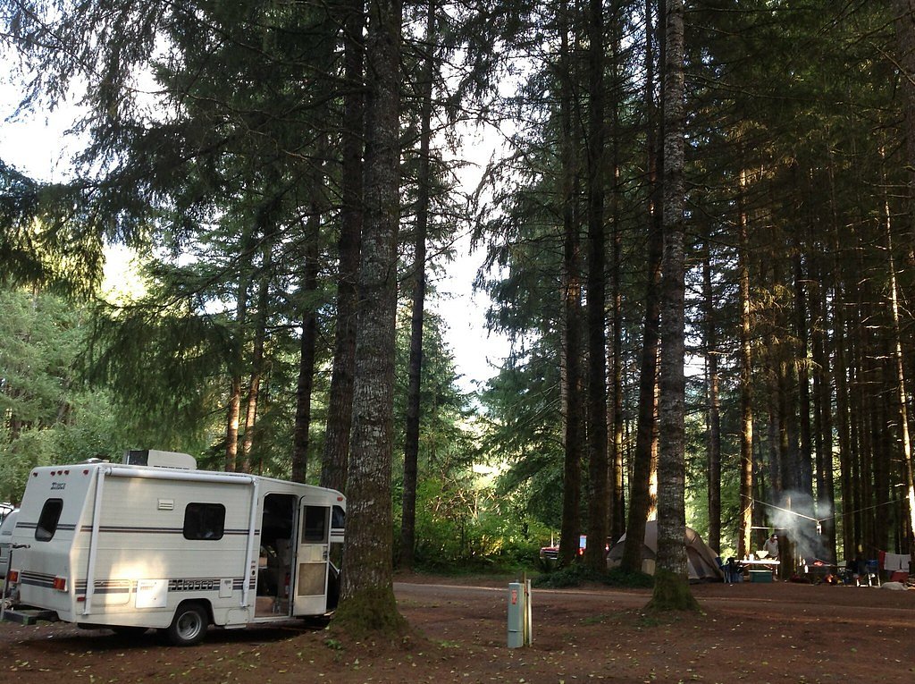
Nearby Campground
Priest Lake Area
9.4 miles away · 0 sites
Priest Lake was originally called Roothaan Lake by Father Desmet in 1846 in honor of his Jesuit Superior in Rome. One of the prominent peaks in the Selkirk Range still bears the name Roothaan. In 1865, Captain John Mullan designated this same lake as Kaniksu Lake on one of his maps. It is believed that "Kaniksu" was the Indian name of Black Robe, although this has never been authenticated. The name was gradually changed in the early 1900's from Kaniksu Lake to its present name of Priest Lake, whi
Book on Recreation.govAdditional Information
Nearby Attractions
Other attractions in the Colville National Forest include Sullivan Lake and the Salmo-Priest Wilderness.
Wildlife
The area is home to a variety of wildlife, including deer, birds, and occasionally black bears. Visitors should practice proper wildlife safety.
Cities near Kalispell Falls
Writing about Kalispell Falls? Embed this waterfall on your site for free.