
Photo Credits (5)
Difficulty
Easy
Trail Length
2.0 miles
Trail Type
Out And Back
Elevation Gain
300 ft
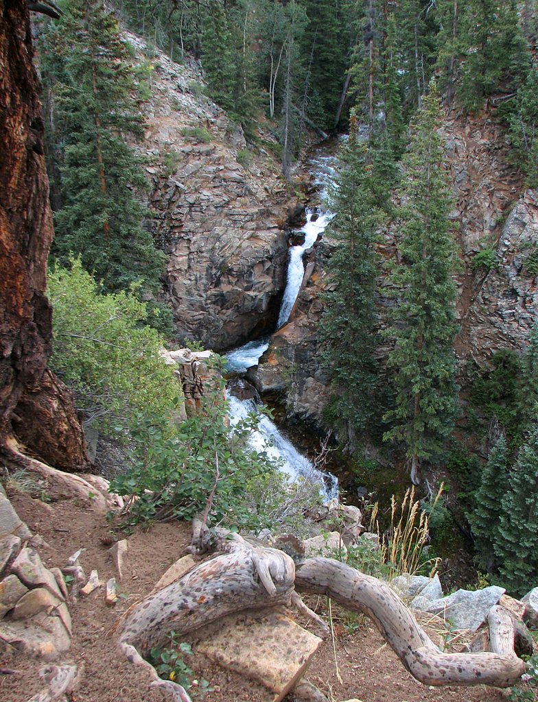
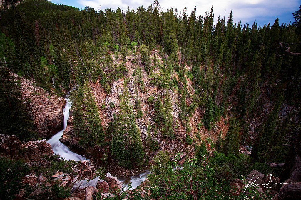
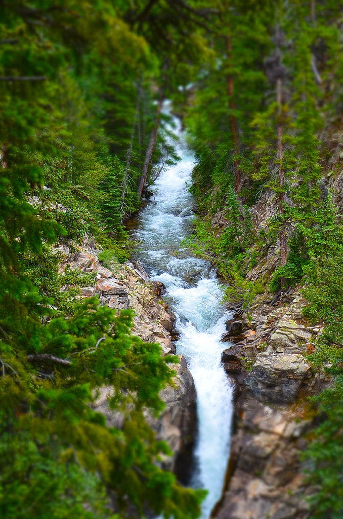
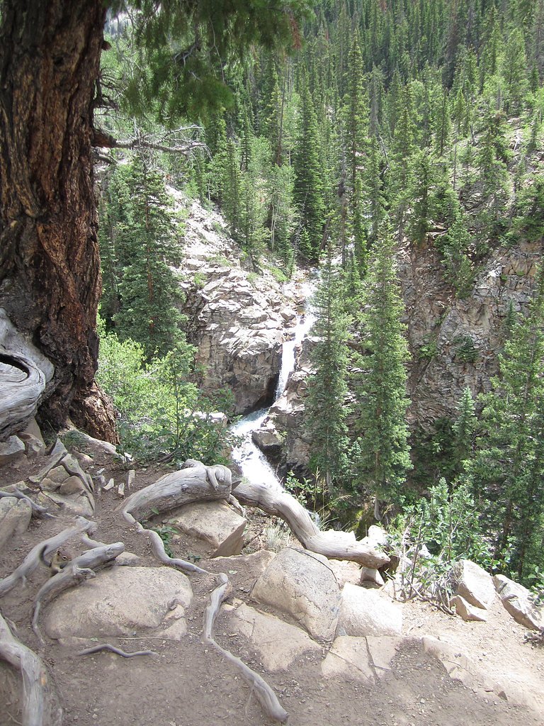
About Judd Falls
Judd Falls is a picturesque waterfall located near Crested Butte, Colorado. It is a popular destination for hikers and nature enthusiasts, offering stunning views of the surrounding mountains and valleys. The waterfall is fed by Copper Creek and is especially beautiful during the spring and early summer when snowmelt increases the water flow.
The Setting
Judd Falls sits at 9,774 feet within Gunnison National Forest, fed by the Coal Creek Abv Mccormick Dtch, in the high alpine of Colorado.
Trail & Hike Details
The Approach
The easy hike follows Copper Creek (#9983), a 2.0-mile out-and-back trail over natural surface. Expect 300 feet of elevation gain with grades of 12-20%. The trail is developed (Class 3).
USFS Trail
COPPER CREEK #9983
Trail Class
Developed
Surface
Avg Grade
USFS Segment
0.01 miTrail Description
The trail to Judd Falls is a short and relatively easy hike, making it suitable for most visitors. The path is well-marked and offers scenic views of the surrounding mountains and valleys. The trail passes through meadows and aspen groves before reaching the waterfall. The final viewpoint provides a clear view of Judd Falls cascading down a rocky cliff.
What to Expect
Dogs are welcome.
Accessibility
The trail is not wheelchair accessible. Uneven terrain and elevation changes require steady footing.
Frequently Asked Questions
🐶 Are Dogs Allowed at Judd Falls?
✅ Dogs are allowed
Are There Any Fees or Permits Required?
🆖 No fees required
🏊 Is There Swimming at Judd Falls?
❌ Swimming is not allowed
When to Visit
The best time to visit Judd Falls is in late spring or early summer when the snowmelt creates a strong flow in the waterfall. Fall is also a great time to visit, as the surrounding aspen trees turn vibrant shades of yellow and orange.
Seasonal Access
The best time to visit is Spring, Summer, and Fall. Access roads and trails may close during winter due to snow. Check with Gunnison National Forest for seasonal road closures.
Safety Information
Be cautious of slippery rocks near the waterfall. Stay on marked trails to avoid damaging the environment and for your safety. Weather in the mountains can change rapidly, so be prepared for sudden rain or temperature drops.
Current Water Conditions
8 ft³/s
Current discharge — how much water is flowing
Much lower than usual for this time of year
Based on 11 years of record
4.36 ft
Water depth at gauge
7-Day Discharge Trend
What does this mean for your visit?
Flow is well below normal for this time of year, so the waterfall may be a trickle.
About This Gauge
This gauge is on a nearby waterway and may not reflect exact conditions at the falls.
7-Day Flow Outlook
Based on the USGS gauge COAL CREEK ABV MCCORMICK DTCH AT CRESTED BUTTE, CO (10 km away).
Today
Roaring
9 cfs
6/10Tomorrow
Roaring
10 cfs
6/10Sun
Roaring
8 cfs
9/10Mon
Strong
8 cfs
10/10Tue
Strong
8 cfs
10/10Wed
Strong
8 cfs
10/10Thu
Strong
8 cfs
10/10Best window: Mon — strong flow, sunny (trip score 10/10).
How we calculate this
This is a transparent outlook, not a precise forecast. We take the waterfall's current flow strength (how it ranks against its historical normal for today, from the nearest USGS stream gauge), carry that ranking forward along the gauge's seasonal curve, and nudge it for forecast rain. Confidence is highest for the next day or two and falls further out. Always check official conditions and your own judgment before visiting — high flows can be dangerous.
Know when to go.
Get a free email alert when waterfalls near Mount Crested Butte hit peak flow. We only send when conditions are worth the trip — no weekly newsletters, no spam.
Weather Forecast
Location & Access
Getting There
Judd Falls is located approximately 6 miles north of Crested Butte, Colorado. To reach the trailhead, take Gothic Road (County Road 317) from Crested Butte. The road is paved for the first few miles but becomes a well-maintained dirt road as you approach the trailhead. Parking is available near the Judd Falls Trailhead.
Get Directions on Google MapsParking
There is a designated parking area near the Judd Falls Trailhead. During peak seasons, parking may fill up quickly, so arriving early is recommended.
Elevation
9,774 feet above sea level
Coordinates
38.959681° N, -106.978609° W
Land Management
Managed by USFS
Visitor Tips & Gear
Wear sturdy hiking shoes, as the trail can be uneven in some sections. Bring water and sunscreen, especially during the summer months. Arrive early to secure parking and avoid crowds. In winter, check trail conditions and consider bringing traction devices for icy sections.
This trail sits at 9,774 ft — the air is noticeably thinner
High AltitudeSome visitors experience headaches, fatigue, or shortness of breath at this elevation. Take it slow, stay hydrated, and consider supplemental oxygen if you're coming from a lower altitude.
As an Amazon Associate, we earn from qualifying purchases.

Coppertone Sport SPF 50 Sunscreen
UV intensity jumps ~4% per 1,000 ft — at this elevation you can burn in half the time.

Sun Bum SPF 30 Lip Balm (3-Pack)
Lips have almost no natural UV protection and burn fast in thin, dry mountain air.

Liquid I.V. Electrolyte Packets
You lose moisture ~2x faster at elevation — electrolytes help you absorb water efficiently.

ROCKNIGHT Polarized UV400 Sunglasses
High-altitude glare off rock and water is intense — UV400 lenses block 99%+ of UVA/UVB.

Boost Oxygen 10L Canister (2-Pack)
Portable supplemental oxygen for quick relief from headaches and shortness of breath.

Altitude Rx OxyBoost Complex
Antioxidant formula designed to support your body's natural altitude acclimation.
As an Amazon Associate, we earn from qualifying purchases.
This easy 2.0 miles hike is straightforward — comfortable trail shoes and plenty of water should do. Sun exposure on the trail makes good sun protection a must in summer.

Polarized Sunglasses (Knockaround)
Cuts glare off the water so you actually see the falls — and your photos turn out better too.

Columbia Watertight II Rain Jacket
Packs into its own pocket, seam-sealed, and keeps you dry from spray and surprise rain.

Earth Pak Waterproof Dry Bag
Keeps your phone and gear dry when waterfall mist soaks everything else.

Waterproof Phone Pouch (AiRunTech)
Cheap insurance — take photos right next to the falls without killing your phone.

JOBY GorillaPod Starter Kit
Wraps around railings and rocks for long-exposure waterfall shots — no flat surface needed.

Osprey Daylite Daypack
Light, organized, and just the right size for a day hike — fits water, snacks, and layers.
Where to Stay

Studio at Trailhead - Top Floor - Mtn Views

Elevation Hotel & Spa

Old Town Inn

The Gant
Browse vacation cabins and private rentals nearby
Unique outdoor stays — tents, yurts, and treehouses
Rent a campervan or RV for your waterfall road trip
Some links are affiliate links. We may earn a commission at no extra cost to you.
Nearby Campground
LAKE IRWIN
8.8 miles away · 45 sites
Overview Lake Irwin Campground is situated on the western banks of its picturesque namesake lake, approximately 9 miles from Crested Butte, Colorado. Visitors enjoy the area for its abundant trail opportunities, fishing and beautiful scenery.Recreation Mountain biking and hiking are popular activities in this challenging, rugged terrain. Canoeing and fishing are favorite pastimes as well. The lake is usually so full of fish, one can see them rise to the calm surface. Facilities The campground off
Book on Recreation.govNearby Hot Springs
Hot springs near Mount Crested Butte, Colorado
Conundrum Hot Springs
Conundrum Hot Springs reaches 100 degrees Fahrenheit at 11,229 feet elevation in the Maroon Bells-Snowmass Wilderness. The spec...
Ranger Hot Spring
Ranger Hot Spring flows at a modest 81°F in the Taylor River Canyon of Gunnison County, emerging near Crested Butte at 8,640 fe...
Cement Creek Hot Spring
Cement Creek Hot Spring flows at 77 degrees Fahrenheit near Crested Butte at 9,223 feet elevation. A moderate 430-foot walk thr...
Penny Hot Springs
Penny Hot Springs flows at 133°F from county-owned open space near Carbondale in Garfield County, providing public access to th...
Avalanche Ranch Hot Springs
Avalanche Ranch Hot Springs flows at 48 degrees Fahrenheit near Carbondale, making it the coolest thermal feature in this datas...
Dotsero Warm Springs
Dotsero Warm Springs flows at 90 degrees Fahrenheit along Eagle River corridor public lands, carrying extraordinary dissolved s...
Looking for a soak after your hike? Explore more hot springs near Mount Crested Butte, Colorado on SoakingSprings.
Explore Colorado springsAdditional Information
Nearby Attractions
Nearby attractions include the town of Crested Butte, Gothic ghost town, and various hiking trails in the Gunnison National Forest.
Wildlife
The area is home to wildlife such as deer, marmots, and various bird species. Be cautious of bears and other larger animals, especially during dawn and dusk.
Cities near Judd Falls
Writing about Judd Falls? Embed this waterfall on your site for free.