Jacks Rock Falls
By Armen Suny · Last verified May 2026

Photo Credits (1)
Difficulty
Moderate
Trail Length
2.0 miles
Trail Type
Out And Back
Elevation Gain
300 ft
About Jacks Rock Falls
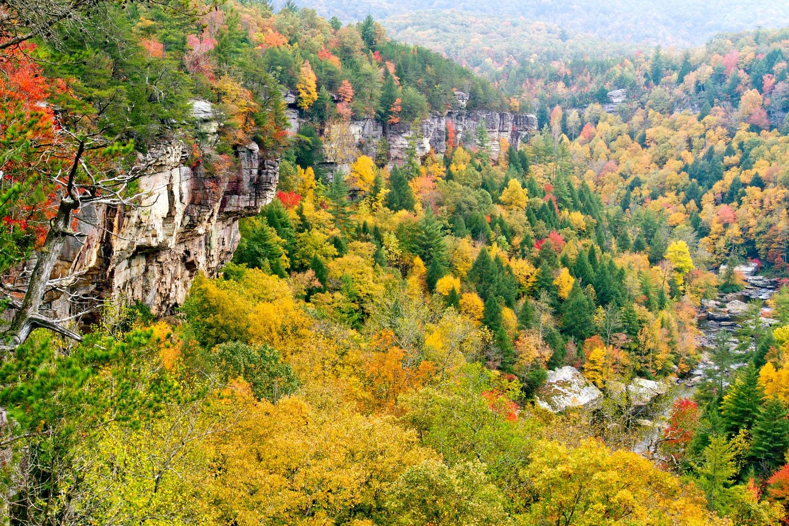
Jacks Rock Falls is a quiet, lesser-known cascade tucked into the Obed Wild and Scenic River corridor and managed by the National Park Service. The falls reward visitors with a peaceful riverside setting framed by forested slopes; because it sits within the Obed WSR (designation: WSR), the site retains a natural, undeveloped character that makes it a great choice for hikers seeking solitude and photography opportunities away from busier parks. Access is via a 2.0-mile out-and-back route that climbs roughly 300 feet and is commonly rated moderate; the approach threads through mixed woods and river corridor terrain before opening to the waterfall and its rocky splash zone. Rock Creek Campground is nearby (about 5.55 km away), offering convenient overnight options for those who want to explore the Obed area for a full day or more. The NPS manages and maintains the corridor, so expect basic trail signage but a rustic, natural experience rather than developed amenities.
The Setting
Jacks Rock Falls sits at 1,073 feet within Obed Wild and Scenic River, fed by the Clear Creek, in the foothills of Tennessee.
Trail & Hike Details
The Approach
The moderate 2.0-mile out-and-back trail gains 300 feet of elevation on the way to the falls.
Trail Description
Trail length: 2.0 miles (out-and-back). Elevation gain: ~300 feet. Difficulty: Moderate. The trail winds through forested terrain with moderate elevation changes and natural tread. Hikers should expect uneven footing with exposed roots and occasional muddy sections after rain; the final approach to Jacks Rock Falls requires careful footing on rocky surfaces and may be slippery. Trail type: out-and-back. Managed by the National Park Service within the Obed Wild and Scenic River; no USFS trail number is provided for this route.
What to Expect
Visitors can expect a tranquil waterfall surrounded by lush greenery. The area is relatively secluded, offering a peaceful experience. The waterfall flow may vary depending on recent rainfall, with spring and early summer typically providing the most impressive views.
Accessibility
The trail is not wheelchair accessible. Uneven terrain and elevation changes require steady footing.
Frequently Asked Questions
🐶 Are Dogs Allowed at Jacks Rock Falls?
❌ Dogs are not allowed
Are There Any Fees or Permits Required?
🆖 No fees required
🏊 Is There Swimming at Jacks Rock Falls?
❌ Swimming is not allowed
When to Visit
Spring and early summer are the best times to visit, as the waterfall flow is usually strongest during these seasons.
Seasonal Access
The best time to visit is Spring, Summer, and Fall. Winter access may be limited. Check the National Park Service website for current conditions.
Safety Information
Visitors should be cautious of slippery rocks near the waterfall and avoid approaching the edge. The trail may become muddy or slick after rain, increasing the risk of falls. Cell service may be unreliable, so inform someone of your plans before visiting.
Current Water Conditions
1,100 ft³/s
Current discharge — how much water is flowing
Much higher than usual for this time of year
Based on 29 years of record
7.34 ft
Water depth at gauge
74°F
ComfortablePleasant for swimming
7-Day Discharge Trend
What does this mean for your visit?
The water is flowing much higher than usual, expect an impressive display. The water is a comfortable 74 degrees F, pleasant for swimming. Expect murky visibility with reduced clarity and excellent dissolved oxygen levels. PH is normal at 7.1 and mineral content is typical.
Water Quality
Dissolved Oxygen
ExcellentSupports aquatic life
pH
NormalWithin healthy range (6.5-8.5)
Water Clarity
MurkyReduced visibility
Conductance
Dissolved minerals in the water
About This Gauge
7-Day Flow Outlook
Based on the USGS gauge CLEAR CREEK AT LILLY BRIDGE NEAR LANCING, TN (1 km away).
Today
Roaring
1310 cfs
9/10Tomorrow
Roaring
1444 cfs
9/10Wed
Roaring
1176 cfs
9/10Thu
Roaring
1532 cfs
6/10Fri
Roaring
1301 cfs
6/10Sat
Roaring
894 cfs
6/10Sun
Roaring
1057 cfs
6/10Best window: Today — roaring flow, mostly sunny (trip score 9/10).
Best time of year: this gauge typically runs highest from mid February to early March, peaking in January.
How we calculate this
This is a transparent outlook, not a precise forecast. We take the waterfall's current flow strength (how it ranks against its historical normal for today, from the nearest USGS stream gauge), carry that ranking forward along the gauge's seasonal curve, and nudge it for forecast rain. Confidence is highest for the next day or two and falls further out. Always check official conditions and your own judgment before visiting — high flows can be dangerous.
Know when to go.
Get a free email alert when waterfalls near Wartburg hit peak flow. We only send when conditions are worth the trip — no weekly newsletters, no spam.
Weather Forecast
Location & Access
Getting There
Jacks Rock Falls is located in a remote area of Tennessee. Access typically involves driving on rural roads, and the trailhead may be unmarked or difficult to locate. Visitors are advised to use GPS coordinates or consult local resources for directions.
Get Directions on Google MapsParking
Parking availability is limited and may consist of roadside pull-offs or small gravel lots near the trailhead.
Elevation
1,073 feet above sea level
Coordinates
36.099796° N, -84.712999° W
Land Management
Managed by NPS
Visitor Tips & Gear
Wear sturdy hiking shoes due to uneven terrain. Bring insect repellent, especially in warmer months, and carry plenty of water. Cell service may be limited, so plan accordingly.
As an Amazon Associate, we earn from qualifying purchases.
With 2.0 miles and 300 ft of elevation gain, sturdy boots and trekking poles will help on this moderate trail. Sun exposure on the trail makes good sun protection a must in summer.
America the Beautiful Annual Pass
Covers entrance fees at 2,000+ federal recreation sites — required at most National Parks.

Polarized Sunglasses (Knockaround)
Cuts glare off the water so you actually see the falls — and your photos turn out better too.

Columbia Watertight II Rain Jacket
Packs into its own pocket, seam-sealed, and keeps you dry from spray and surprise rain.

Earth Pak Waterproof Dry Bag
Keeps your phone and gear dry when waterfall mist soaks everything else.

Waterproof Phone Pouch (AiRunTech)
Cheap insurance — take photos right next to the falls without killing your phone.

Timberland Euro Sprint Mid Waterproof
Trusted waterproof boot with premium leather and grippy rubber sole — reliable on rocky, wet trails.

TrailBuddy Trekking Poles
Lightweight aluminum, cork grips, and flip-locks that actually hold — a best-seller for good reason.
Where to Stay

Comfort Inn Harriman

Holiday Inn Express & Suites Crossville by IHG

Holiday Inn Express Hotel & Suites Harriman by IHG

Comfort Suites Crossville
Browse vacation cabins and private rentals nearby
Unique outdoor stays — tents, yurts, and treehouses
Rent a campervan or RV for your waterfall road trip
Some links are affiliate links. We may earn a commission at no extra cost to you.
Nearby Campground
Rock Creek Campground (TN)
3.4 miles away · 11 sites
Overview Rock Creek Campground is located near the Emory River in the Obed Wild and Scenic River.Recreation Whitewater paddling is available seasonally in the Obed WSR. Rock climbing is another challenging activity, as is boulder climbing. The Obed WSR sports several unique trails for hikers, most notably the Point Trail and a portion of the Cumberland Trail. Those who like to fish will enjoy the Obed WSR, as a variety of bass, bluegill, catfish and other fish populate the river. Birdwatching is
Book on Recreation.govAdditional Information
Nearby Attractions
Nearby attractions may include other hiking trails and natural features in the surrounding area, though specific points of interest are not well-documented.
Wildlife
The area is home to a variety of wildlife, including birds, deer, and small mammals. Visitors should be aware of the potential presence of snakes and other wildlife.
Cities near Jacks Rock Falls
Nearby Waterfalls
Writing about Jacks Rock Falls? Embed this waterfall on your site for free.