Isaqueena Falls
South Carolina • 100 ft
By Armen Suny · Last verified May 2026
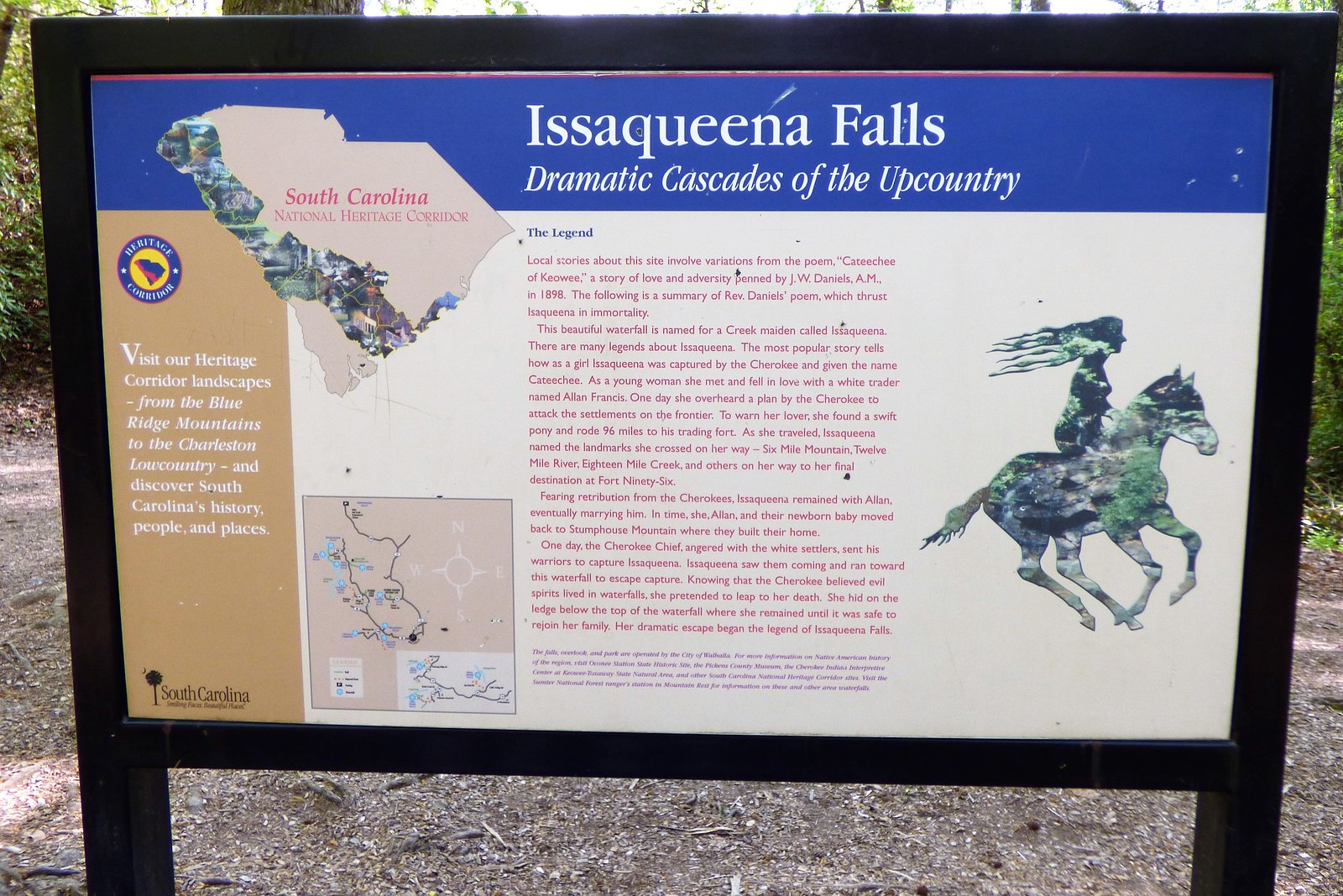
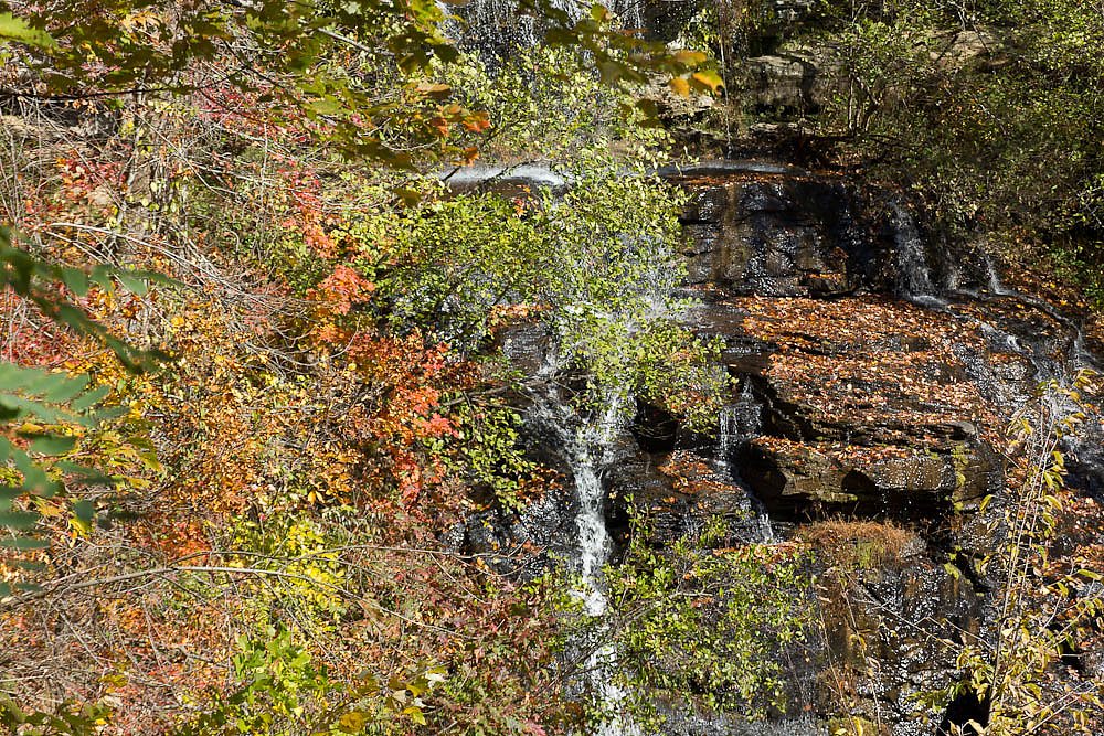

Photo Credits (5)
Difficulty
Moderate
Trail Length
2.4 miles
Trail Type
Out And Back
Elevation Gain
350 ft
About Isaqueena Falls
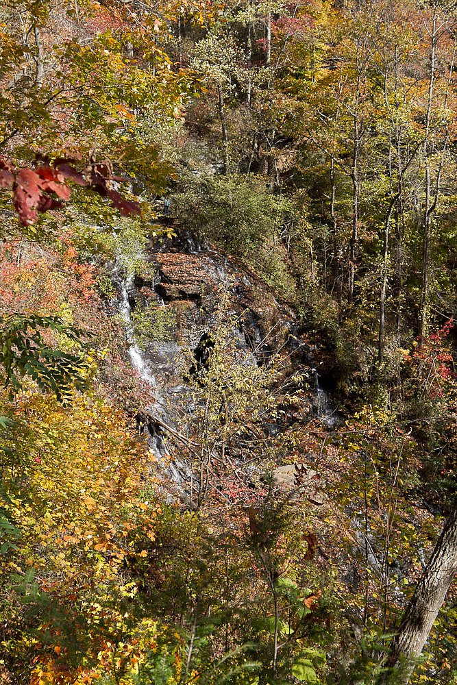
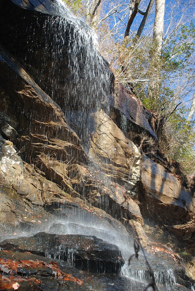
Isaqueena Falls is a striking 100-foot (30 m) cascade tucked near Walhalla in the Oconee District of the Sumter National Forest. The falls sit within the Stumphouse Mountain land unit (Designation: LCA) and are listed with the City as landowner and manager. The waterfall’s name comes from the local legend of Issaqueena, a Cherokee girl reputed to have leapt from the falls with her lover—accounts vary, naming either an Oconee brave, a white trader Allan Francis, or a white silversmith David Francis—adding a layer of romantic folklore to the scenic setting. The site is a popular stop for hikers and history buffs drawn to its cascade and the surrounding woodlands. A short well-maintained approach leads to a viewing platform where visitors can take in the drop and the mossy rock amphitheater. If you’re planning an overnight trip, camping is nearby—the Andrew Pickens Ranger District campground is about 0.78 km from the falls—making it easy to extend a day hike into a weekend in the forest.
The Setting
Isaqueena Falls sits at 1,253 feet within Stumphouse Mountain, fed by the Chattooga River, in the foothills of South Carolina. At 100 feet, it is among the taller waterfalls in South Carolina.
Height: 100 feet
Trail & Hike Details
The Approach
The moderate 2.4-mile out-and-back trail gains 350 feet of elevation on the way to the falls.
Trail Description
The trail to Isaqueena Falls is an out-and-back route of 2.4 miles with roughly 350 feet of elevation gain, rated moderate in difficulty. The path is generally maintained and leads to a viewing platform at the falls; however, walkers should expect some uneven surfaces underfoot. This moderate climb is suitable for hikers with basic fitness and offers a rewarding payoff at the cascade without requiring technical scrambling or specialized gear.
What to Expect
The falls cascade 100 feet. Dogs are welcome.
Accessibility
The trail is not wheelchair accessible. Uneven terrain and elevation changes require steady footing.
Frequently Asked Questions
🐶 Are Dogs Allowed at Isaqueena Falls?
✅ Dogs are allowed
Are There Any Fees or Permits Required?
🤑 Fee: $5.00
🏊 Is There Swimming at Isaqueena Falls?
❌ Swimming is not allowed
When to Visit
Spring and fall are the best times to visit, as the waterfall flow is typically stronger, and the surrounding foliage is vibrant.
Seasonal Access
The best time to visit is Spring, Summer, and Fall. Winter access may be limited.
Safety Information
Exercise caution near the waterfall and avoid climbing on wet or slippery rocks. Stay on designated trails and viewing platforms to ensure safety.
Current Water Conditions
258 ft³/s
Current discharge — how much water is flowing
Lower than usual for this time of year
Based on 86 years of record
1.35 ft
Water depth at gauge
7-Day Discharge Trend
What does this mean for your visit?
Flow is lower than usual for this time of year.
About This Gauge
This gauge is on a nearby waterway and may not reflect exact conditions at the falls.
7-Day Flow Outlook
Based on the USGS gauge CHATTOOGA RIVER NEAR CLAYTON, GA (17 km away).
Today
Low
294 cfs
3/10Tomorrow
Low
306 cfs
3/10Sun
Low
305 cfs
3/10Mon
Low
302 cfs
3/10Tue
Barely Flowing
277 cfs
5/10Wed
Barely Flowing
244 cfs
5/10Thu
Barely Flowing
241 cfs
5/10Best window: Tue — barely flowing flow, sunny (trip score 5/10).
Best time of year: this gauge typically runs highest from late February to late April, peaking in April.
How we calculate this
This is a transparent outlook, not a precise forecast. We take the waterfall's current flow strength (how it ranks against its historical normal for today, from the nearest USGS stream gauge), carry that ranking forward along the gauge's seasonal curve, and nudge it for forecast rain. Confidence is highest for the next day or two and falls further out. Always check official conditions and your own judgment before visiting — high flows can be dangerous.
Know when to go.
Get a free email alert when waterfalls near Walhalla hit peak flow. We only send when conditions are worth the trip — no weekly newsletters, no spam.
Weather Forecast
Location & Access
Getting There
Isaqueena Falls is located off Highway 28 near Walhalla, South Carolina. Visitors can access the falls via a short walk from the parking area near Stumphouse Tunnel Park.
Get Directions on Google MapsParking
There is a parking area available near Stumphouse Tunnel Park, which provides access to the falls. Parking may be limited during peak seasons.
Elevation
1,253 feet above sea level
Coordinates
34.806205° N, -83.120987° W
Land Management
Managed by CITY
Visitor Tips & Gear
Visit early in the day to avoid crowds, especially during weekends and peak seasons. Wear sturdy shoes as the trail may be uneven in some areas. Bring water and a camera to capture the stunning views.
As an Amazon Associate, we earn from qualifying purchases.
With 2.4 miles and 350 ft of elevation gain, sturdy boots and trekking poles will help on this moderate trail. Sun exposure on the trail makes good sun protection a must in summer.

Polarized Sunglasses (Knockaround)
Cuts glare off the water so you actually see the falls — and your photos turn out better too.

Columbia Watertight II Rain Jacket
Packs into its own pocket, seam-sealed, and keeps you dry from spray and surprise rain.

Earth Pak Waterproof Dry Bag
Keeps your phone and gear dry when waterfall mist soaks everything else.

Waterproof Phone Pouch (AiRunTech)
Cheap insurance — take photos right next to the falls without killing your phone.

Timberland Euro Sprint Mid Waterproof
Trusted waterproof boot with premium leather and grippy rubber sole — reliable on rocky, wet trails.

TrailBuddy Trekking Poles
Lightweight aluminum, cork grips, and flip-locks that actually hold — a best-seller for good reason.
Where to Stay

Tru By Hilton Seneca Clemson Sc

Quality Inn Seneca Clemson Area U S 123

Comfort Inn & Suites Clemson - University Area

Microtel Inn and Suites by Wyndham Anderson SC
Browse vacation cabins and private rentals nearby
Unique outdoor stays — tents, yurts, and treehouses
Rent a campervan or RV for your waterfall road trip
Some links are affiliate links. We may earn a commission at no extra cost to you.
Nearby Campground
Andrew Pickens Ranger District
0.5 miles away · 0 sites
The Andrew Pickens Ranger District is home to the Wild and Scenic Chattooga River, a popular angling and whitewater destination. The Ellicott Rock Wilderness offers opportunities for solitude and primitive camping. The district also has numerous waterfalls and hiking trails to satisfy every challenge level.
Book on Recreation.govAdditional Information
Nearby Attractions
Stumphouse Tunnel, a historic railroad tunnel, is located nearby and is worth exploring. The area also offers additional hiking trails and picnic spots.
Wildlife
The area is home to various bird species, small mammals, and reptiles. Visitors may also encounter insects such as mosquitoes, so bug spray is recommended.
Cities near Isaqueena Falls
Nearby Waterfalls
Writing about Isaqueena Falls? Embed this waterfall on your site for free.