Hīpuapua Falls
By Armen Suny · Last verified Oct 2026
LiDAR & 3D terrain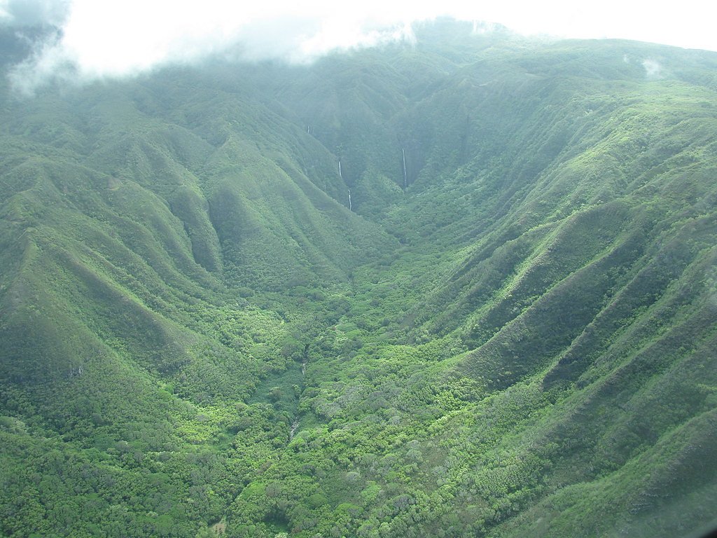
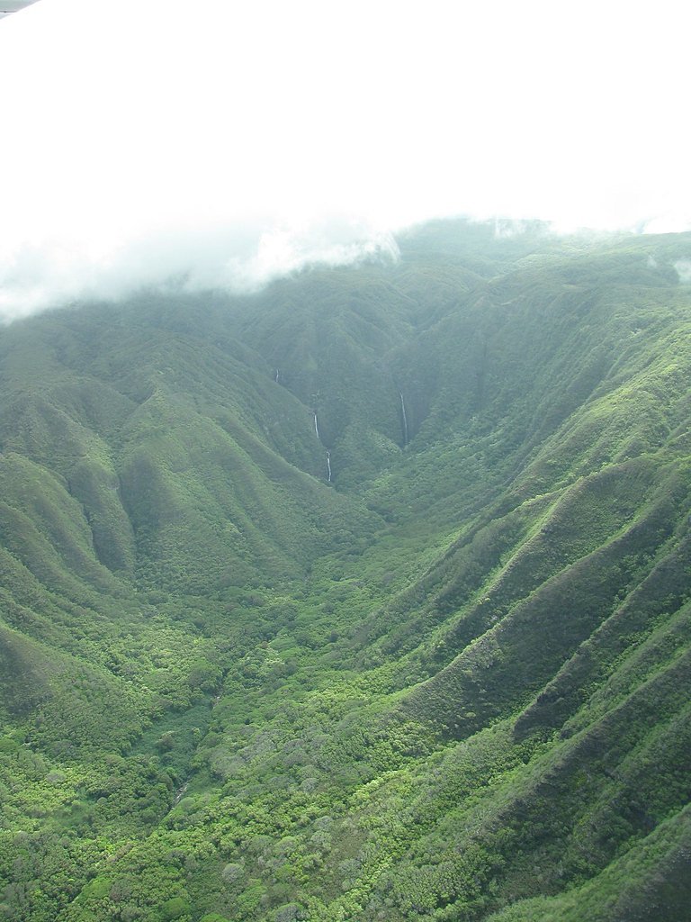
Photo Credits (3)
Difficulty
Hard
Trail Type
Out And Back
About Hīpuapua Falls
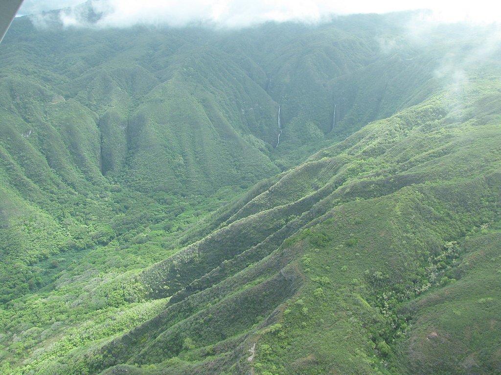
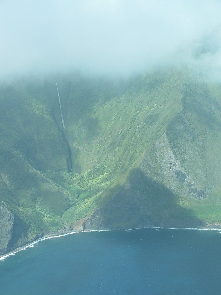
Hīpuapua Falls is a dramatic 500-foot (150 m) cascade tucked into the head of Hālawa Valley on the eastern end of Molokaʻi. The falls plunge from steep valley walls where Hālawa reaches roughly two miles inland from the sea, and they share the valley head with nearby Moʻaula Falls (about 250 feet). Hālawa itself is an ahupuaʻa — a traditional Hawaiian land division — and the valley is known as one of the earliest settlement sites in Hawaiʻi, giving the landscape a strong sense of history alongside its lush, tropical scenery. The setting is secluded and deeply scenic: hikers who follow the valley trail are rewarded with close-up views of the falls and a sweeping sense of the coastal valley below. The quiet, verdant Hālawa Valley and its twin waterfalls make for a memorable visit to Molokaʻi’s eastern shore.
Nearby Falls Worth Visiting
Puʻukaʻōkū Falls, the tallest waterfall in Hawaii at 2,756 feet, lies 5.4 miles to the west. Also nearby: Kahiwa Falls (1749 ft, 2.8 mi) and Pāpalaua Falls (1200 ft, 2.4 mi).
Trail & Hike Details
Trail Description
Difficulty: moderate. The route into Hālawa Valley is a straightforward out-and-back that drops toward the valley head where Hīpuapua and Moʻaula Falls tumble from the cliffs. The approach covers moderate elevation change over a relatively short distance, so expect sustained downhill on the way in and the corresponding climb out. The trail is a natural, unpaved footpath through native and tropical vegetation; conditions can be uneven and may include muddy or slick sections after rain, so sturdy footwear and basic trail skills are recommended.
What to Expect
Visitors can expect a challenging hike with rewarding views of the Waimanu Valley and Hīpuapua Falls. The area is remote and pristine, offering a sense of solitude and connection with nature. Be prepared for changing weather conditions, muddy trails, and potential stream crossings.
Accessibility
The trail involves steep, uneven terrain with significant elevation change and is not accessible to mobility devices.
Frequently Asked Questions
🐶 Are Dogs Allowed at Hīpuapua Falls?
❌ Dogs are not allowed
Are There Any Fees or Permits Required?
🆖 No fees required
Permit required
A permit is required for camping in Waimanu Valley. Permits can be obtained through the Hawaii Department of Land and Natural Resources (DLNR).
🏊 Is There Swimming at Hīpuapua Falls?
❌ Swimming is not allowed
When to Visit
The falls are typically flowing year-round, but the best time to visit is during the dry season (May to October) when trail conditions are more manageable. Avoid heavy rain periods due to the risk of flash floods and slippery trails.
Seasonal Access
The best time to visit is Spring, Summer, Fall, and Winter. Heavy rains during wet season (November through March) bring higher flow but can make trails slippery.
Safety Information
The trail is challenging and includes steep sections, stream crossings, and slippery terrain. Flash floods are a risk, especially during heavy rains. Visitors should check weather conditions before starting the hike and carry appropriate safety gear.
Current Water Conditions
These readings come from the USGS gauge on Halawa Stream, 0.4 miles away, not on Hīpuapua Falls's own stream. Use them as a sign of whether the area is running wet or dry.
13 ft³/s
Current discharge — how much water is flowing
About average for this time of year
Based on 103 years of record
2.10 ft
Water depth at gauge
7-Day Discharge Trend
What does this mean for your visit?
Flow is about average for this time of year.
About This Gauge
7-Day Flow Outlook
Based on the USGS gauge Halawa Stream near Halawa, Molokai, HI (1 km away).
Today
Moderate
14 cfs
6/10Tomorrow
Moderate
15 cfs
6/10Tue
Moderate
18 cfs
6/10Wed
Moderate
15 cfs
6/10Thu
Moderate
17 cfs
6/10Fri
Moderate
15 cfs
6/10Sat
Moderate
18 cfs
6/10Best window: Today — moderate flow, scattered rain showers (trip score 6/10).
Best time of year: this gauge typically runs highest from mid November to late November, peaking in December.
How we calculate this
This is a transparent outlook, not a precise forecast. We take the waterfall's current flow strength (how it ranks against its historical normal for today, from the nearest USGS stream gauge), carry that ranking forward along the gauge's seasonal curve, and nudge it for forecast rain. Confidence is highest for the next day or two and falls further out. Always check official conditions and your own judgment before visiting — high flows can be dangerous.
Know when to go.
Get a free email alert when waterfalls near Ualapue hit peak flow. We only send when conditions are worth the trip — no weekly newsletters, no spam.
Weather Forecast
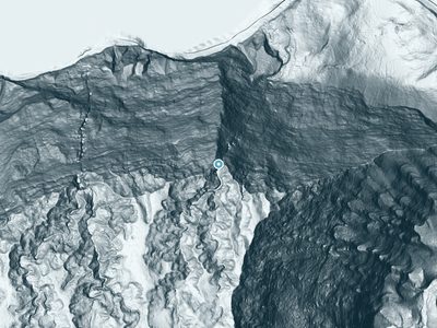
The Terrain, Seen by LiDAR
Aircraft-mounted lasers measured this ground to within inches. Trees and buildings are digitally stripped away, leaving the bare shape of the land the water has carved.
The laser survey finds one clean step here: roughly 869 feet of drop concentrated at the brink. Elevation at the pin is about 1,021 feet.
The whole reach is steep: about 256 feet of descent in the 500 feet above the falls and another 600 feet in the 500 feet below. The falls face east and catch soft morning light.
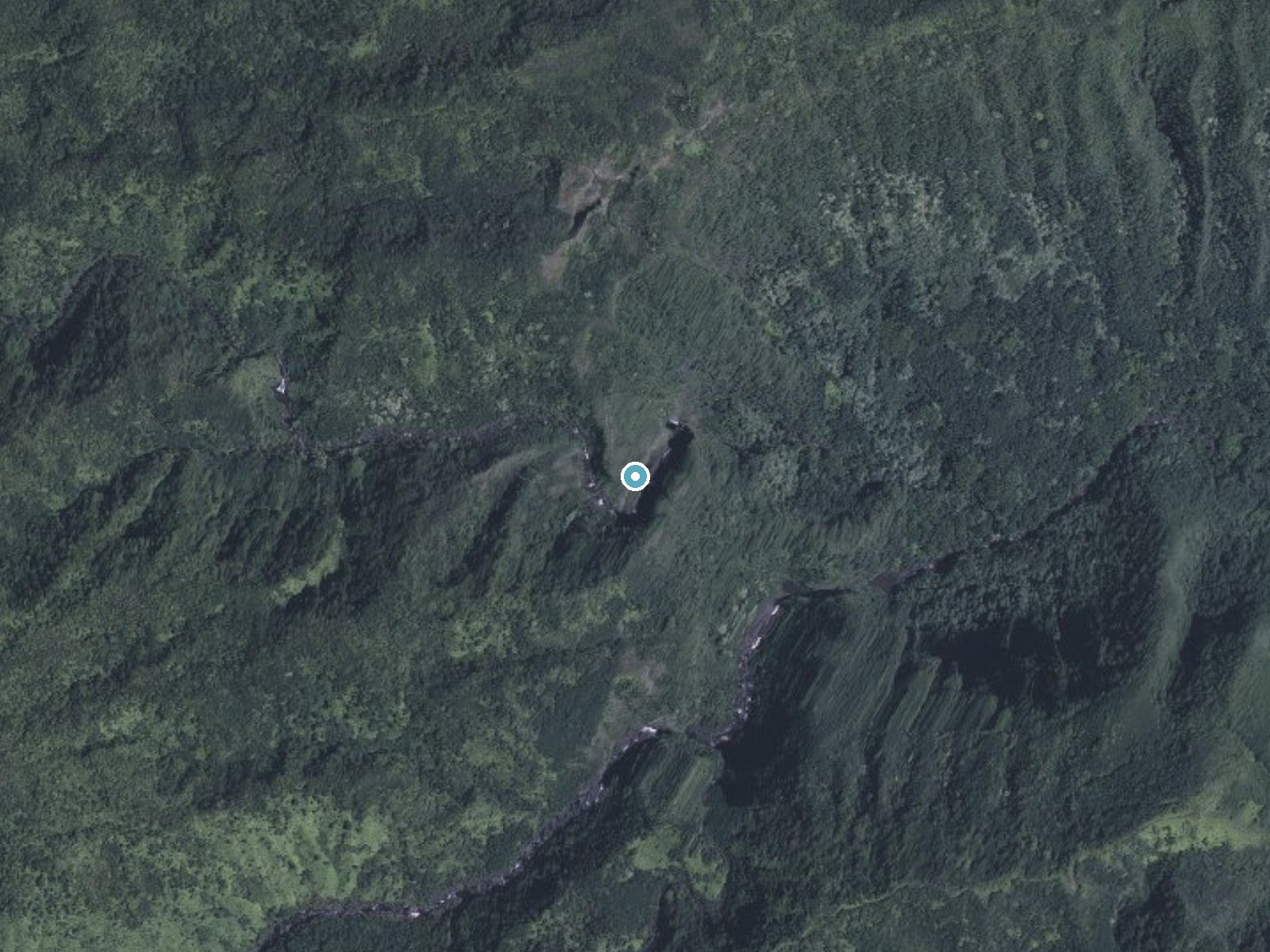
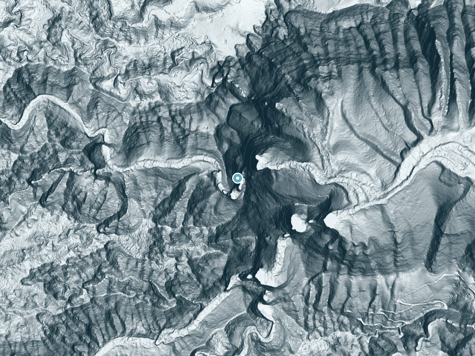
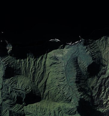
Drag to compare. The dot marks the waterfall. The frame is about a mile across.
- Ground elevation
- 1,021 feet
- Measured by 1-meter lidar
- Drop at the falls
- About 869 feet
- Change in ground height within ~250 feet of the falls
- Faces
- East
- Catches soft morning light.
A slice through the lidar ground surface, from above the falls to downstream (heading east).
Elevation data: USGS 3D Elevation Program. Aerial imagery: USGS The National Map. Public domain.
Location & Access
Getting There
Hīpuapua Falls is located in the Waimanu Valley, which can only be accessed via the challenging Muliwai Trail. The trail begins at Waipio Valley and requires a steep descent into Waipio Valley, followed by a strenuous hike across multiple stream crossings and steep inclines to reach Waimanu Valley. The falls are visible from certain points in the valley but require additional effort to approach closely.
Get Directions on Google MapsParking
Parking is available at the Waipio Valley Lookout, but space is limited. Visitors should arrive early to secure a spot.
Elevation
745 feet above sea level
Coordinates
21.155282° N, -156.767812° W
Visitor Tips & Gear
Start early to allow plenty of time for the hike. Bring sufficient water, food, and proper hiking gear. Be prepared for stream crossings and muddy conditions. Consider camping overnight in Waimanu Valley to fully enjoy the area and reduce the strain of completing the hike in one day.
Where to Stay

High-End Resort Condo Nestled on Molokai Shoreline

Kahana Beach Vacation Club
Gardens at West Maui

OUTRIGGER Kāʻanapali Beach Resort
Browse vacation cabins and private rentals nearby
Unique outdoor stays — tents, yurts, and treehouses
Rent a campervan or RV for your waterfall road trip
Some links are affiliate links. We may earn a commission at no extra cost to you.
Additional Information
Nearby Attractions
Waipio Valley, other waterfalls in Waimanu Valley, and the scenic Muliwai Trail.
Wildlife
The area is home to native Hawaiian birds, insects, and lush tropical vegetation. Visitors may also encounter wild pigs and other wildlife.
Nearby Waterfalls
 LiDAR
LiDAR
 LiDAR
LiDAR
Writing about Hīpuapua Falls? Embed this waterfall on your site for free.