Photo Credits (5)
Difficulty
Moderate
Trail Length
2.0 miles
Trail Type
Out And Back
Elevation Gain
300 ft
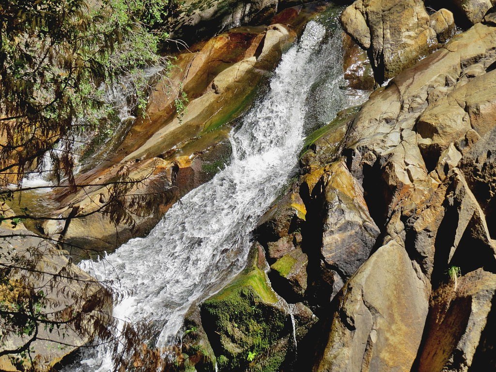
About Hidden Heart Falls
Hidden Heart Falls is a quiet, lesser-known cascade tucked into the trees of the San Bernardino National Forest, managed by the U.S. Forest Service. The falls sit amid lush vegetation and offer a peaceful, photogenic setting for hikers and nature lovers seeking solitude away from busier park attractions. Because it’s on USFS land, the spot retains a backcountry feel that rewards those who take the short trek. Access to Hidden Heart Falls is most commonly via a moderate out-and-back hike of about 2.0 miles with roughly 300 feet of elevation gain, so it’s a great half-day option for day hikers with some experience. For campers, Boulder Basin campground lies about 9.27 km (roughly 5.8 miles) away, making overnight trips possible for those who want to explore the area over multiple days.
The Setting
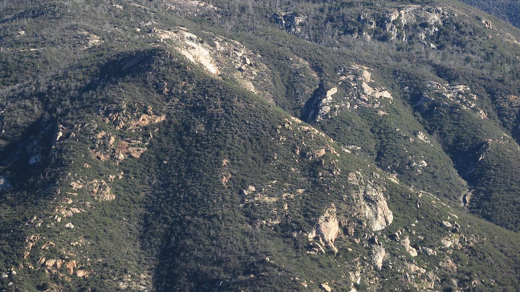
Hidden Heart Falls sits at 2,267 feet within San Bernardino National Forest, in the hills of California.
Trail & Hike Details
The Approach
The moderate 2.0-mile out-and-back trail gains 300 feet of elevation on the way to the falls.
Trail Description
The trail to Hidden Heart Falls is an approximately 2.0-mile out-and-back route on USFS-managed land in San Bernardino National Forest. Expect about 300 feet of cumulative elevation gain and a moderate difficulty rating; the tread winds through forested sections and includes occasional rocky or uneven stretches, so sturdy footwear is recommended. The route is suitable for hikers with some experience and rewards with a secluded waterfall destination—plan for a half-day outing and consider nearby Boulder Basin campground (≈9.27 km away) if you want to camp nearby.
What to Expect
Visitors can expect a tranquil waterfall surrounded by greenery. The area is relatively secluded, providing a peaceful atmosphere. The trail may have some muddy or slippery sections, especially after rainfall.
Accessibility
The trail is not wheelchair accessible. Uneven terrain and elevation changes require steady footing.
Frequently Asked Questions
🐶 Are Dogs Allowed at Hidden Heart Falls?
❌ Dogs are not allowed
Are There Any Fees or Permits Required?
🆖 No fees required
🏊 Is There Swimming at Hidden Heart Falls?
❌ Swimming is not allowed
When to Visit
Spring and early summer are the best times to visit, as the waterfall flow is typically strongest during these seasons due to snowmelt and rainfall.
Seasonal Access
The best time to visit is Spring, Summer, and Fall. Winter access may be limited. Check with San Bernardino National Forest for seasonal road closures.
Safety Information
Visitors should be cautious of slippery rocks near the waterfall and along the trail, especially after rain. Carry a map or GPS device, as cell service may be limited in the area.
Current Water Conditions
0 ft³/s
Current discharge — how much water is flowing
About average for this time of year
Based on 100 years of record
2.67 ft
Water depth at gauge
7-Day Discharge Trend
What does this mean for your visit?
Flow is about average for this time of year.
About This Gauge
7-Day Flow Outlook
Based on the USGS gauge SAN JACINTO R NR SAN JACINTO (5 km away).
Today
Barely Flowing
0 cfs
5/10Tomorrow
Barely Flowing
0 cfs
4/10Tue
Barely Flowing
0 cfs
4/10Wed
Barely Flowing
0 cfs
5/10Thu
Barely Flowing
0 cfs
5/10Fri
Barely Flowing
0 cfs
5/10Sat
Barely Flowing
0 cfs
5/10Best window: Today — barely flowing flow, sunny (trip score 5/10).
Best time of year: this gauge typically runs highest from early March to late April, peaking in March.
How we calculate this
This is a transparent outlook, not a precise forecast. We take the waterfall's current flow strength (how it ranks against its historical normal for today, from the nearest USGS stream gauge), carry that ranking forward along the gauge's seasonal curve, and nudge it for forecast rain. Confidence is highest for the next day or two and falls further out. Always check official conditions and your own judgment before visiting — high flows can be dangerous.
Know when to go.
Get a free email alert when waterfalls near Valle Vista hit peak flow. We only send when conditions are worth the trip — no weekly newsletters, no spam.
Weather Forecast
Location & Access
Getting There
The exact location of Hidden Heart Falls is not widely publicized, but it is typically accessed via a trail in a forested area. Visitors should consult local hiking resources or guides for precise directions.
Get Directions on Google MapsParking
Parking availability may vary depending on the trailhead used to access the falls. It is recommended to arrive early, especially during weekends or peak seasons, to secure a spot.
Elevation
2,267 feet above sea level
Coordinates
33.784426° N, -116.840627° W
Land Management
Managed by USFS
Visitor Tips & Gear
Wear sturdy hiking shoes, bring plenty of water, and consider using trekking poles for added stability. Check weather conditions before heading out, as the trail can become slippery after rain. Arrive early to avoid crowds and secure parking.
As an Amazon Associate, we earn from qualifying purchases.
With 2.0 miles and 300 ft of elevation gain, sturdy boots and trekking poles will help on this moderate trail. Sun exposure on the trail makes good sun protection a must in summer.

Polarized Sunglasses (Knockaround)
Cuts glare off the water so you actually see the falls — and your photos turn out better too.

Columbia Watertight II Rain Jacket
Packs into its own pocket, seam-sealed, and keeps you dry from spray and surprise rain.

Earth Pak Waterproof Dry Bag
Keeps your phone and gear dry when waterfall mist soaks everything else.

Waterproof Phone Pouch (AiRunTech)
Cheap insurance — take photos right next to the falls without killing your phone.

Timberland Euro Sprint Mid Waterproof
Trusted waterproof boot with premium leather and grippy rubber sole — reliable on rocky, wet trails.

TrailBuddy Trekking Poles
Lightweight aluminum, cork grips, and flip-locks that actually hold — a best-seller for good reason.
Where to Stay

Fleur Noire Hotel - 21 and Over

Alhatti Christian Resort

Our Poolside Desert Nirvana

Royal Sun Palm Springs
Browse vacation cabins and private rentals nearby
Unique outdoor stays — tents, yurts, and treehouses
Rent a campervan or RV for your waterfall road trip
Some links are affiliate links. We may earn a commission at no extra cost to you.
Nearby Campground
BOULDER BASIN
5.8 miles away · 37 sites
Overview Black Mountain Road is is poor condition at this time. A four-wheel drive (4WD) vehicle is recommended with a minimum ground clearance of 6 inches. Drive at your own risk. The San Bernardino National Forest is submitting a proposal to increase fees at various sites across the Forest and is seeking public input. Please visit the https://www.fs.usda.gov/sbnf for more information and to submit comments regarding this proposal.Boulder Basin Campground offers solitude and primitive camping in
Book on Recreation.govNearby Hot Springs
Hot springs near Valle Vista, California
Soboda Hot Springs
Soboda Hot Springs flows at 102°F in the San Jacinto Valley near San Jacinto, delivering water 36.5 degrees warmer than ambient...
Gilman Hot Springs
Gilman Hot Springs discharges at 117 degrees Fahrenheit, flowing nearly 52 degrees warmer than ambient in a modest but reliable...

Highland Springs
Highland Springs produces 112°F water in Riverside County near Cherry Valley, positioned just 16 feet from Canyon Place road at...

Palm Springs (Agua Caliente Spring)
Palm Springs (Agua Caliente Spring) flows at 104 degrees Fahrenheit on the Agua Caliente Indian Reservation in the heart of the...
Eden Hot Springs
Eden Hot Springs flows at 109°F from northwestern Riverside County near Lakeview, emerging approximately 44°F warmer than the r...
Unnamed Spring Riverside County 2
This San Jacinto Wildlife Area spring at 1,441 feet elevation near Lakeview remains relatively unknown despite permanent state ...
Looking for a soak after your hike? Explore more hot springs near Valle Vista, California on SoakingSprings.
Explore California springsAdditional Information
Nearby Attractions
Other nearby hiking trails and natural attractions may be available, depending on the specific location of the falls.
Wildlife
The area may feature local wildlife such as birds, deer, and small mammals. Visitors should remain respectful of the natural habitat.
Cities near Hidden Heart Falls
Writing about Hidden Heart Falls? Embed this waterfall on your site for free.