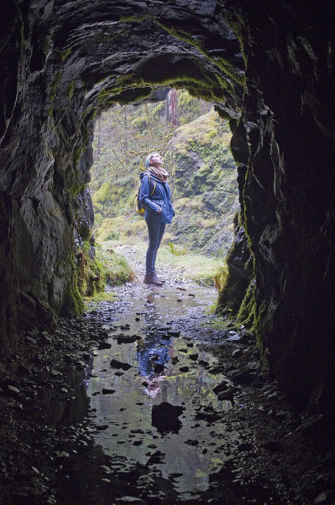
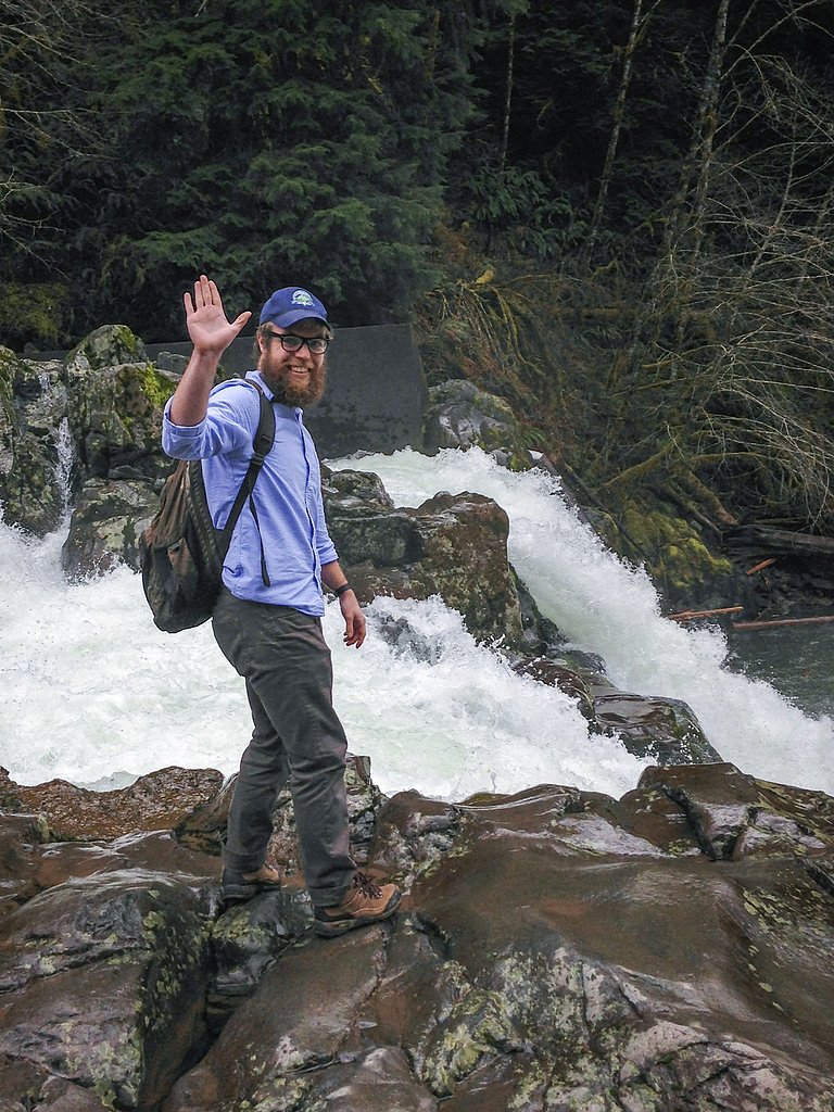
Photo Credits (5)
Difficulty
Easy
Trail Length
1.8 miles
Trail Type
Out And Back
Elevation Gain
200 ft
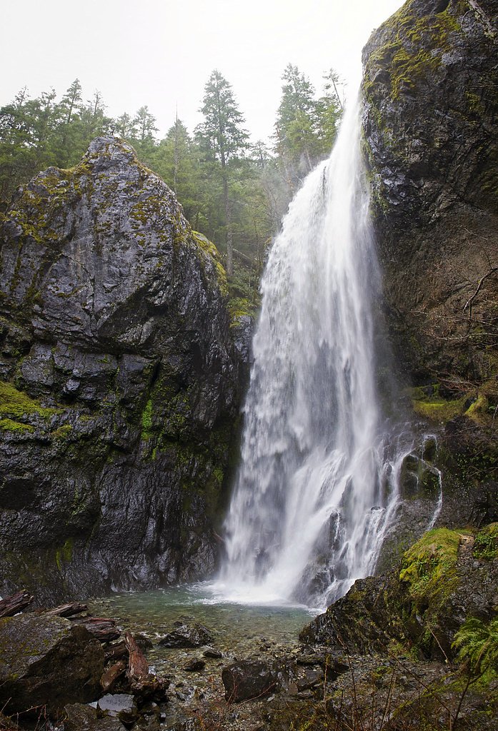
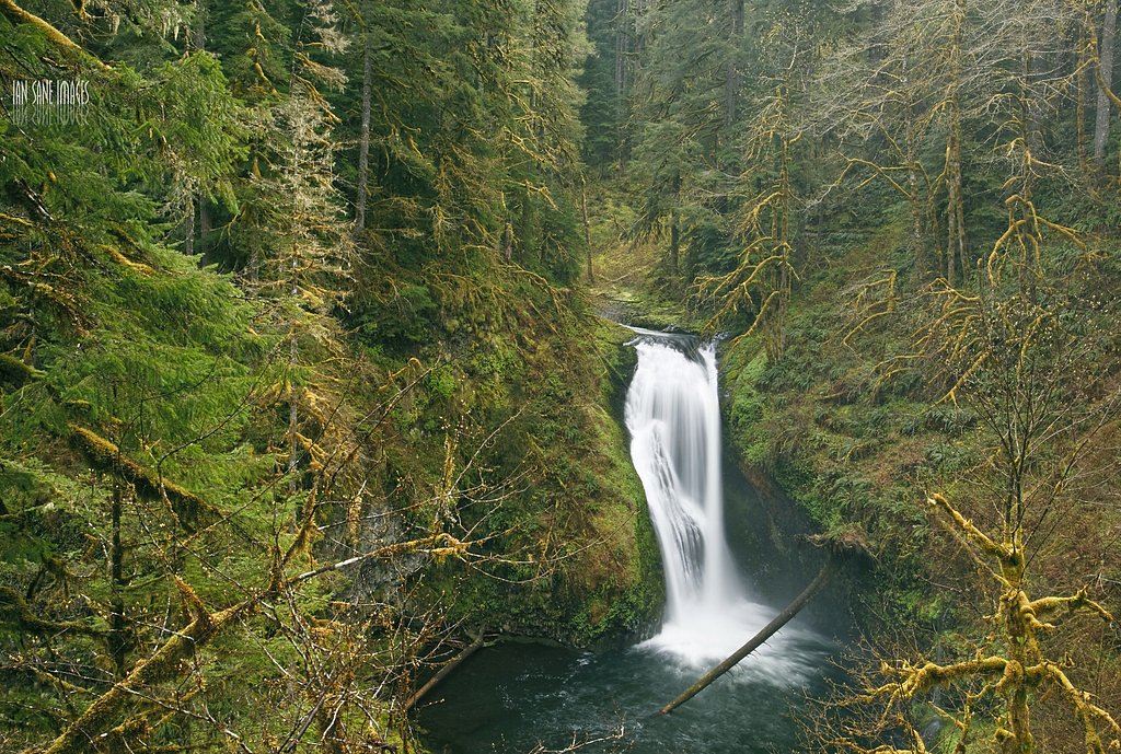
About Henline Falls
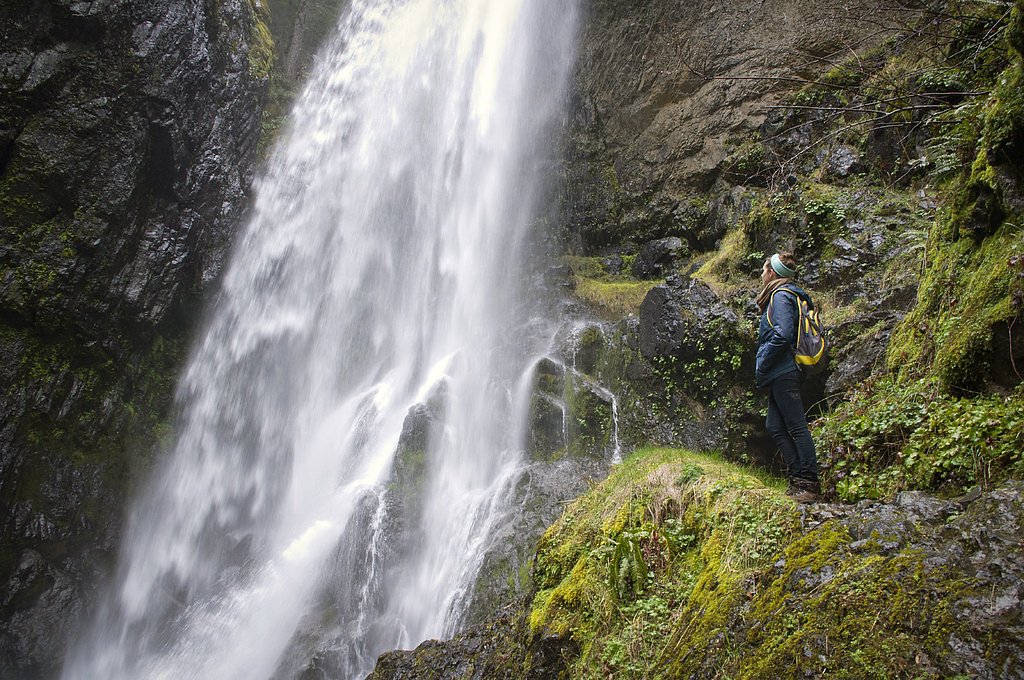
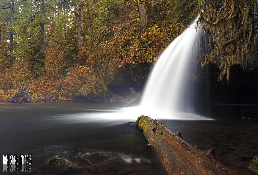
Henline Falls is a picturesque waterfall located in the Opal Creek Wilderness area of Oregon. It cascades over a rocky cliff into a serene pool below, surrounded by lush forest. The trail to the falls is relatively short and offers a peaceful hike through a scenic area.
The Setting
Henline Falls sits at 1,952 feet within Willamette National Forest, fed by the Little N Santiam River Abv Evans Cr,, in the hills of Oregon. At 126 feet, it is among the taller waterfalls in Oregon.
Height: 126 feet
Nearby Falls Worth Visiting
Butte Creek Falls (20 ft) lies 9.9 miles to the northwest.
Trail & Hike Details
The Approach
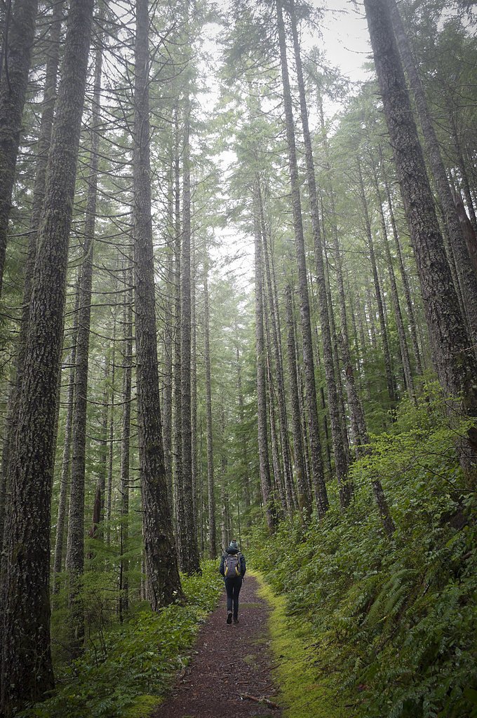
The easy hike follows Henline Falls (#3348), a 1.8-mile out-and-back trail over natural surface. Expect 200 feet of elevation gain with grades of 12-20%. The trail is developed (Class 3).
USFS Trail
HENLINE FALLS #3348
Trail Class
Developed
Surface
Avg Grade
USFS Segment
0.09 miTrail Description
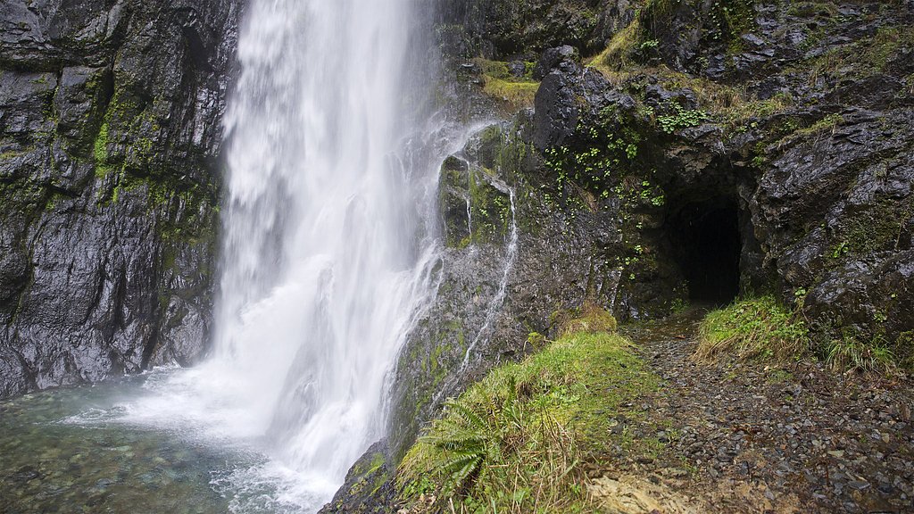
The trail to Henline Falls is a gentle, well-maintained path that winds through a lush forest. Along the way, hikers will pass remnants of old mining operations, adding a historical element to the hike. The trail ends at the base of the falls, where visitors can enjoy the view and relax by the pool.
What to Expect
The falls cascade 126 feet. Dogs are welcome.
Accessibility
The trail is not wheelchair accessible. Uneven terrain and elevation changes require steady footing.
Frequently Asked Questions
🐶 Are Dogs Allowed at Henline Falls?
✅ Dogs are allowed
Are There Any Fees or Permits Required?
🆖 No fees required
🏊 Is There Swimming at Henline Falls?
❌ Swimming is not allowed
When to Visit
Spring and early summer are the best times to visit Henline Falls, as the water flow is strongest during these seasons.
Seasonal Access
The best time to visit is Spring, Summer, and Fall. Winter access may be limited. Check with Willamette National Forest for seasonal road closures.
Safety Information
Be cautious near the waterfall as rocks can be slippery. Watch for changing weather conditions, and avoid the trail during heavy rain or storms as it may become hazardous.
Current Water Conditions
3.86 ft
Water depth at gauge
70°F
WarmVery comfortable
What does this mean for your visit?
Water temperature is a refreshing 70 degrees F, good for a quick swim.
About This Gauge
Know when to go.
Get a free email alert when waterfalls near Gates hit peak flow. We only send when conditions are worth the trip — no weekly newsletters, no spam.
Weather Forecast
Location & Access
Getting There
Henline Falls is located in the Willamette National Forest, near the town of Lyons, Oregon. To reach the trailhead, take Highway 22 to North Fork Road SE, then follow signs for Henline Falls Trailhead.
Get Directions on Google MapsParking
There is a small parking area at the trailhead, but it can fill up quickly during peak seasons. Arrive early to secure a spot.
Elevation
1,952 feet above sea level
Coordinates
44.849289° N, -122.339525° W
Land Management
Managed by USFS
Visitor Tips & Gear
Wear sturdy shoes as the trail can be muddy, especially after rain. Bring water and snacks, and consider visiting early in the day to avoid crowds. Be cautious near the waterfall as rocks can be slippery.
As an Amazon Associate, we earn from qualifying purchases.
This easy 1.8 miles hike is straightforward — comfortable trail shoes and plenty of water should do. Sun exposure on the trail makes good sun protection a must in summer.

Polarized Sunglasses (Knockaround)
Cuts glare off the water so you actually see the falls — and your photos turn out better too.

Columbia Watertight II Rain Jacket
Packs into its own pocket, seam-sealed, and keeps you dry from spray and surprise rain.

Earth Pak Waterproof Dry Bag
Keeps your phone and gear dry when waterfall mist soaks everything else.

Waterproof Phone Pouch (AiRunTech)
Cheap insurance — take photos right next to the falls without killing your phone.

JOBY GorillaPod Starter Kit
Wraps around railings and rocks for long-exposure waterfall shots — no flat surface needed.

Osprey Daylite Daypack
Light, organized, and just the right size for a day hike — fits water, snacks, and layers.
Where to Stay

Rushing River Retreat

Remote Escape Riverside Home with Scenic Views

Walk to Detroit Lake! Family Home with Outdoor Oasis

Oregon Vacation Rental about half Mi to Santiam River!
Browse vacation cabins and private rentals nearby
Unique outdoor stays — tents, yurts, and treehouses
Rent a campervan or RV for your waterfall road trip
Some links are affiliate links. We may earn a commission at no extra cost to you.
Nearby Campground
Elk Lake Campground
10.5 miles away · 0 sites
This 17 site tent-only campground, located adjacent to the Bull of the Woods and Opal Creek Wildernesses, is full of beauty in the summer. Wildflowers are a beautiful sight in the campground's meadows around July. Swim or paddle in the quiet waters of the non-motorized lake, go for a great hike with views of multiple Cascade peaks, or just kick back and relax in the campground.
Book on Recreation.govNearby Hot Springs
Hot springs near Gates, Oregon

Bagby Hot Springs
Bagby Hot Springs flows at 136°F deep in Mount Hood National Forest at 2,272 feet elevation, requiring a 3,720-foot hike from F...

Breitenbush Hot Springs
Breitenbush Hot Springs emerges at 198°F along the Breitenbush River, ranking as one of Oregon's hottest thermal features with ...

Austin Hot Springs
Austin Hot Springs discharges at 186°F along the Clackamas River at 1,680 feet elevation, emerging just 310 feet from Clackamas...

Bigelow Hot Springs
Bigelow Hot Springs, also called Deer Creek Hot Springs, emerges at 142°F just 400 feet from Deer Creek Road in the Willamette ...
Foley Springs
Foley Springs emerges at 178°F in the Cascade Range of Lane County, making it one of Oregon's hottest thermal features with rec...
Belknap Springs
Belknap Springs flows at 160°F along the McKenzie River in the Cascade Range, emerging just 510 feet from North Belknap Springs...
Looking for a soak after your hike? Explore more hot springs near Gates, Oregon on SoakingSprings.
Explore Oregon springsAdditional Information
Nearby Attractions
Nearby attractions include Opal Creek Wilderness, Three Pools, and other waterfalls in the area such as Little North Santiam Falls.
Wildlife
The area is home to a variety of wildlife, including birds, deer, and small mammals. Keep an eye out for wildlife along the trail.
Cities near Henline Falls
Nearby Waterfalls

Writing about Henline Falls? Embed this waterfall on your site for free.