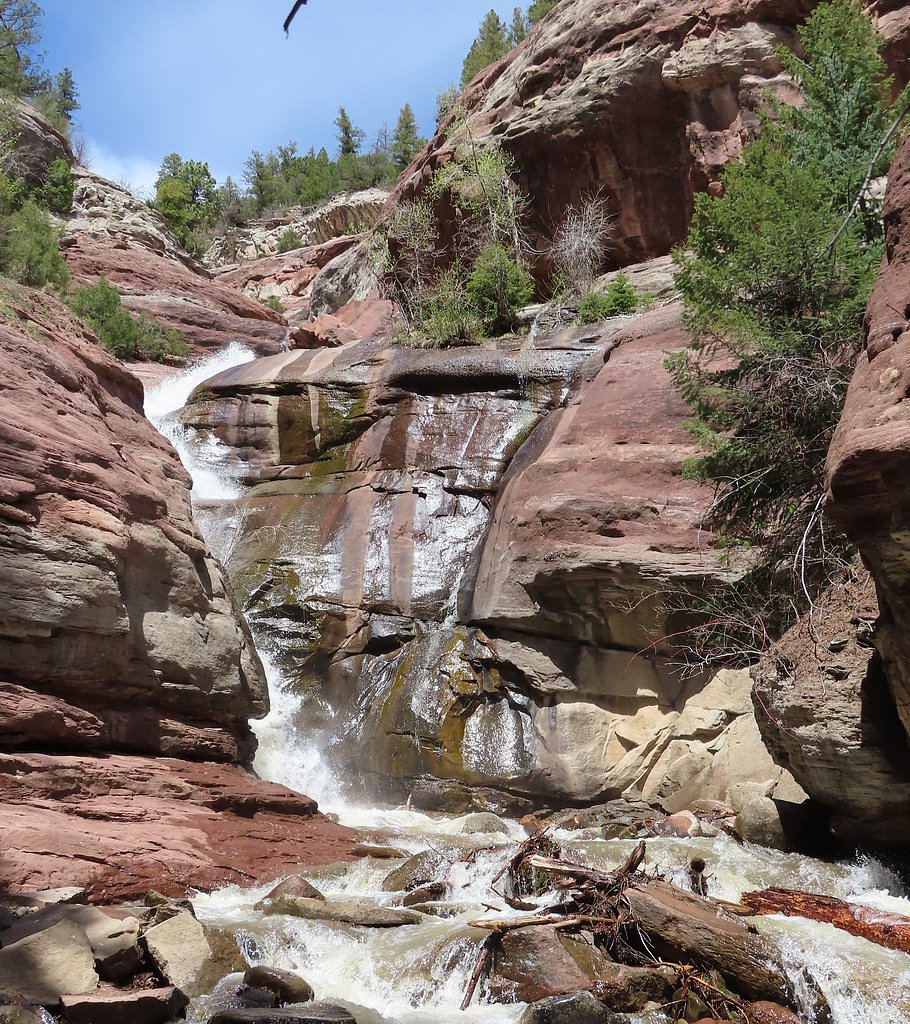
Hayes Creek Falls
By Armen Suny · Last verified Mar 2026
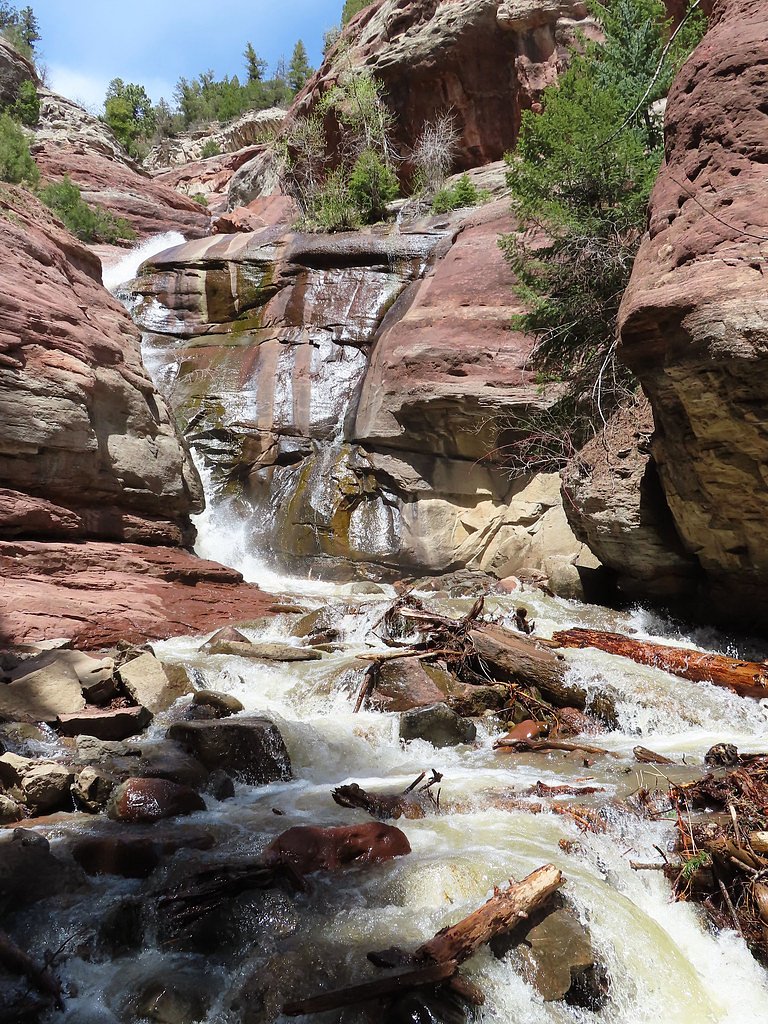
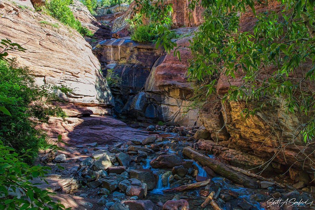
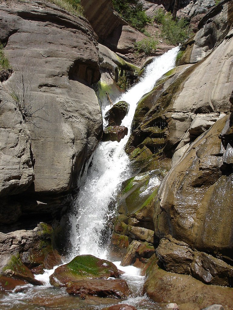

Photo Credits (4)
Difficulty
Moderate
Trail Length
2.4 miles
Trail Type
Out And Back
Elevation Gain
350 ft
About Hayes Creek Falls
Hayes Creek Falls is a quietly scenic roadside cascade along Highway 133 just outside Redstone, Colorado. The falls tumble over a rocky ledge into a small, photogenic pool, making it an easy and satisfying stop for travelers exploring the Crystal River valley. The site sits within the White River National Forest and is managed by the U.S. Forest Service, so interpretive signage and forest stewardship shape the surrounding landscape. Although the waterfall is visible from the highway and requires no formal hike to enjoy, outdoor lovers can extend their visit on a nearby USFS trail. The area is also convenient for overnight stays—the Redstone campground is about 4.24 km away—so you can combine a short photo stop at the falls with a longer walk or an evening under the aspens.
The Setting
Hayes Creek Falls sits at 7,490 feet within White River National Forest, fed by the Crystal River Abv Avalanche Crk,, in the high mountains of Colorado.
Trail & Hike Details
The Approach
The moderate 2.4-mile out-and-back trail gains 350 feet of elevation on the way to the falls.
Trail Description
No hiking is required to view Hayes Creek Falls; the waterfall is visible from the roadside along Highway 133, making it an easy pull-off for photos and a quick break. For visitors who want a longer walk, the site is served by a 2.4-mile out-and-back trail managed by the U.S. Forest Service within White River National Forest. That trail gains about 350 feet of elevation and is rated moderate. (Specific USFS trail surface, grade, or class details are not provided in the available data.)
What to Expect
Dogs are welcome.
Accessibility
The trail is not wheelchair accessible. Uneven terrain and elevation changes require steady footing.
Frequently Asked Questions
🐶 Are Dogs Allowed at Hayes Creek Falls?
✅ Dogs are allowed
Are There Any Fees or Permits Required?
🆖 No fees required
🏊 Is There Swimming at Hayes Creek Falls?
❌ Swimming is not allowed
When to Visit
Spring and early summer are ideal times to visit, as the waterfall is typically more robust due to snowmelt. However, Hayes Creek Falls is accessible and scenic year-round.
Seasonal Access
The best time to visit is Spring, Summer, Fall, and Winter. Check with White River National Forest for seasonal road closures.
Safety Information
Exercise caution when parking and walking near the highway. In winter, the area may be icy and slippery. Avoid climbing on the rocks near the falls, as they can be wet and dangerous.
Current Water Conditions
297 ft³/s
Current discharge — how much water is flowing
Much lower than usual for this time of year
Based on 70 years of record
1.64 ft
Water depth at gauge
7-Day Discharge Trend
What does this mean for your visit?
Flow is well below normal for this time of year, so the waterfall may be a trickle.
About This Gauge
This gauge is on a nearby waterway and may not reflect exact conditions at the falls.
7-Day Flow Outlook
Based on the USGS gauge CRYSTAL RIVER ABV AVALANCHE CRK, NEAR REDSTONE, CO (8 km away).
Today
Moderate
339 cfs
4/10Tomorrow
Moderate
296 cfs
8/10Sun
Moderate
269 cfs
8/10Mon
Moderate
277 cfs
8/10Tue
Moderate
268 cfs
8/10Wed
Moderate
264 cfs
8/10Thu
Moderate
244 cfs
8/10Best window: Tomorrow — moderate flow, sunny (trip score 8/10).
Best time of year: this gauge typically runs highest from late April to late July, peaking in June.
How we calculate this
This is a transparent outlook, not a precise forecast. We take the waterfall's current flow strength (how it ranks against its historical normal for today, from the nearest USGS stream gauge), carry that ranking forward along the gauge's seasonal curve, and nudge it for forecast rain. Confidence is highest for the next day or two and falls further out. Always check official conditions and your own judgment before visiting — high flows can be dangerous.
Know when to go.
Get a free email alert when waterfalls near Redstone hit peak flow. We only send when conditions are worth the trip — no weekly newsletters, no spam.
Weather Forecast
Location & Access
Getting There
Hayes Creek Falls is located along Highway 133, approximately 2 miles south of Redstone, Colorado. The falls are visible from the road, and there is a small pull-off area for parking nearby.
Get Directions on Google MapsParking
There is a small pull-off area along Highway 133 where visitors can park to view the falls. Parking is limited and may be challenging during peak times.
Elevation
7,490 feet above sea level
Coordinates
39.159247° N, -107.252077° W
Land Management
Managed by USFS
Visitor Tips & Gear
Arrive early during peak seasons to secure parking, as the pull-off area is small. Be cautious when parking and exiting your vehicle, as the area is directly off the highway. Winter visitors should be prepared for icy conditions.
This trail sits at 7,490 ft above sea level
Elevated TrailUV radiation is roughly 30% stronger at this elevation than at sea level, and the dry air accelerates dehydration. Extra sun protection and fluids go a long way.
As an Amazon Associate, we earn from qualifying purchases.

Coppertone Sport SPF 50 Sunscreen
UV intensity jumps ~4% per 1,000 ft — at this elevation you can burn in half the time.

Sun Bum SPF 30 Lip Balm (3-Pack)
Lips have almost no natural UV protection and burn fast in thin, dry mountain air.

Liquid I.V. Electrolyte Packets
You lose moisture ~2x faster at elevation — electrolytes help you absorb water efficiently.

ROCKNIGHT Polarized UV400 Sunglasses
High-altitude glare off rock and water is intense — UV400 lenses block 99%+ of UVA/UVB.
As an Amazon Associate, we earn from qualifying purchases.
With 2.4 miles and 350 ft of elevation gain, sturdy boots and trekking poles will help on this moderate trail. Icy conditions are common in winter — traction cleats are a smart addition.

Columbia Watertight II Rain Jacket
Packs into its own pocket, seam-sealed, and keeps you dry from spray and surprise rain.

Polarized Sunglasses (Knockaround)
Cuts glare off the water so you actually see the falls — and your photos turn out better too.

Earth Pak Waterproof Dry Bag
Keeps your phone and gear dry when waterfall mist soaks everything else.

Waterproof Phone Pouch (AiRunTech)
Cheap insurance — take photos right next to the falls without killing your phone.

Timberland Euro Sprint Mid Waterproof
Trusted waterproof boot with premium leather and grippy rubber sole — reliable on rocky, wet trails.

TrailBuddy Trekking Poles
Lightweight aluminum, cork grips, and flip-locks that actually hold — a best-seller for good reason.
Where to Stay

Shadowbrook 304

Gondola Grove Capitol Peak Lodge #3310

Glenwood Hot Springs Resort

Laurelwood Condominiums 115
Browse vacation cabins and private rentals nearby
Unique outdoor stays — tents, yurts, and treehouses
Rent a campervan or RV for your waterfall road trip
Some links are affiliate links. We may earn a commission at no extra cost to you.
Nearby Campground
REDSTONE
2.6 miles away · 37 sites
Overview Redstone Campground is set amidst a scattering of aspen groves on a ridge above the Crystal River at 7,800 feet, creating an ideal setting for guests seeking recreation and relaxation in White River National Forest. Sites in the campground are widely spaced and offer wonderful views of red rock outcroppings and cliffs, though an understory of tall grass and a scattered forest provides plenty of privacy.Recreation Crystal River, a tributary of Roaring Fork River, is renowned for its fly f
Book on Recreation.govNearby Hot Springs
Hot springs near Redstone, Colorado
Penny Hot Springs
Penny Hot Springs flows at 133°F from county-owned open space near Carbondale in Garfield County, providing public access to th...
Avalanche Ranch Hot Springs
Avalanche Ranch Hot Springs flows at 48 degrees Fahrenheit near Carbondale, making it the coolest thermal feature in this datas...

Glenwood Springs
Glenwood Springs reaches 124 degrees Fahrenheit and channels through the Sacred Waters facility in downtown Glenwood, standing ...
Yampah Hot Springs Vapor Caves
Yampah Hot Springs Vapor Caves occupy a unique niche in Colorado geothermal culture as the source of natural steam caves in the...
Conundrum Hot Springs
Conundrum Hot Springs reaches 100 degrees Fahrenheit at 11,229 feet elevation in the Maroon Bells-Snowmass Wilderness. The spec...
Iron Mountain Hot Springs
Iron Mountain Hot Springs occupies the banks of the Colorado River in Glenwood Springs at 5,740 feet elevation, where a develop...
Looking for a soak after your hike? Explore more hot springs near Redstone, Colorado on SoakingSprings.
Explore Colorado springsAdditional Information
Nearby Attractions
Nearby attractions include the historic town of Redstone, the Redstone Castle, and the scenic drive along Highway 133 through the Crystal River Valley.
Wildlife
The area around Hayes Creek Falls may feature local wildlife such as birds, deer, and small mammals. Always observe wildlife from a safe distance.
Cities near Hayes Creek Falls
Writing about Hayes Creek Falls? Embed this waterfall on your site for free.