Hawaii Falls
By Armen Suny · Last verified Sep 2026
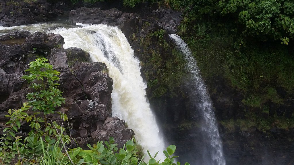
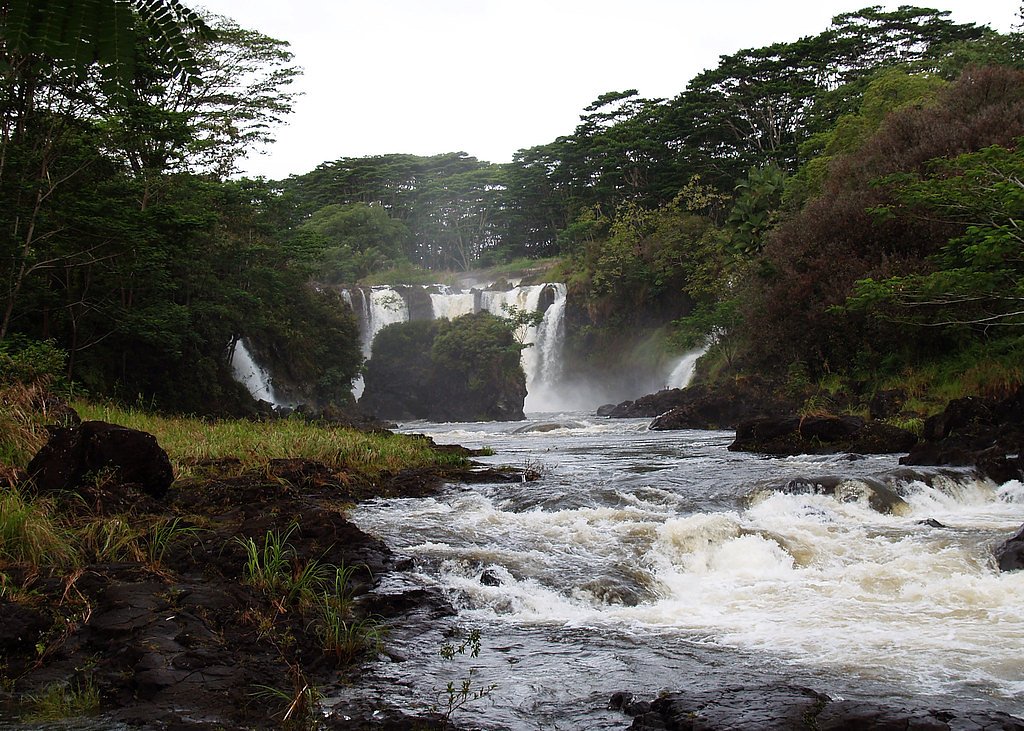
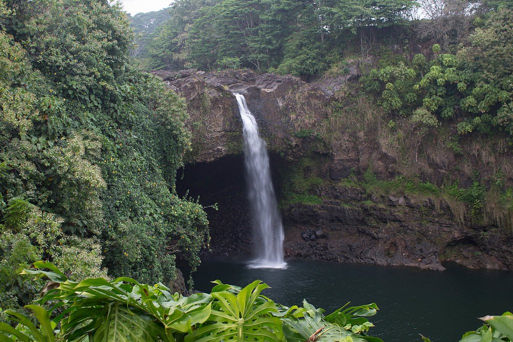
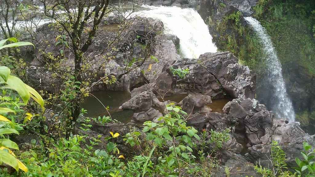
Photo Credits (5)
Difficulty
Easy
Trail Length
0.5 miles
Trail Type
Out And Back
Elevation Gain
100 ft
About Hawaii Falls
Hawaii Falls is a picturesque waterfall tucked into the Hilo Watershed Forest Reserve, a State Conservation Area (SCA) owned and managed by SDNR. The setting is quietly lush and verdant, offering a peaceful spot for nature lovers; specific measurements for the falls’ height and flow are not well-documented but the site is prized for its tranquil forested surroundings. Because the falls sit on SDNR-managed public land, visitors should observe posted rules to protect the watershed and its streamside vegetation. Access is straightforward, making Hawaii Falls a great option for hikers looking for a short, rewarding outing rather than a long backcountry trek. The reserve’s SCA designation helps preserve the area’s natural character while allowing low-impact recreation, so bring sturdy shoes and leave no trace to keep this spot enjoyable for others.
The Setting
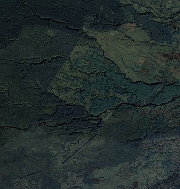
Hawaii Falls sits at 1,772 feet within Hilo Watershed Forest Reserve, fed by the Wailuku River, in the hills of Hawaii.
Trail & Hike Details
The Approach
The easy 0.5-mile out-and-back trail gains 100 feet of elevation on the way to the falls.
Trail Description
The trail to Hawaii Falls is an easy 0.5-mile out-and-back route with roughly 100 feet of elevation gain, making it suitable for most hikers and families. The short distance and modest climb mean most visitors reach the falls quickly from the trailhead; difficulty is rated easy and the route is frequently used for brief visits to the waterfall. This site is managed by SDNR within the Hilo Watershed Forest Reserve (SCA). There is no USFS trail number associated with the route in the provided data. Visitors should check local SDNR notices for any access rules or temporary closures before heading out.
What to Expect
Visitors can expect a tranquil waterfall surrounded by tropical vegetation. The area may be remote, so preparation is recommended.
Accessibility
The trail is short and relatively flat, but the surface may be uneven. Contact the managing agency for accessibility details.
Frequently Asked Questions
🐶 Are Dogs Allowed at Hawaii Falls?
❌ Dogs are not allowed
Are There Any Fees or Permits Required?
🆖 No fees required
🏊 Is There Swimming at Hawaii Falls?
❌ Swimming is not allowed
When to Visit
The waterfall can typically be visited year-round, but conditions may vary depending on rainfall and weather.
Seasonal Access
The best time to visit is Spring, Summer, Fall, and Winter. Heavy rains during wet season (November through March) bring higher flow but can make trails slippery.
Safety Information
Trails may be slippery, especially after rain. Visitors should exercise caution and avoid venturing too close to the waterfall edge.
Current Water Conditions
373 ft³/s
Current discharge — how much water is flowing
Much higher than usual for this time of year
Based on 96 years of record
4.86 ft
Water depth at gauge
7-Day Discharge Trend
What does this mean for your visit?
The water is flowing much higher than usual, expect an impressive display.
About This Gauge
7-Day Flow Outlook
Based on the USGS gauge Wailuku River at Piihonua, HI (3 km away).
Today
Strong
403 cfs
8/10Tomorrow
Strong
383 cfs
8/10Thu
Strong
376 cfs
8/10Fri
Strong
369 cfs
8/10Sat
Strong
418 cfs
8/10Sun
Strong
446 cfs
8/10Mon
Strong
439 cfs
8/10Best window: Today — strong flow, scattered rain showers (trip score 8/10).
Best time of year: this gauge typically runs highest from late March to mid May, peaking in April.
How we calculate this
This is a transparent outlook, not a precise forecast. We take the waterfall's current flow strength (how it ranks against its historical normal for today, from the nearest USGS stream gauge), carry that ranking forward along the gauge's seasonal curve, and nudge it for forecast rain. Confidence is highest for the next day or two and falls further out. Always check official conditions and your own judgment before visiting — high flows can be dangerous.
Know when to go.
Get a free email alert when waterfalls near Hilo hit peak flow. We only send when conditions are worth the trip — no weekly newsletters, no spam.
Weather Forecast
Location & Access
Getting There
The exact directions to Hawaii Falls may vary depending on its location within Hawaii. Visitors are advised to consult local maps or guides for the most accurate route.
Get Directions on Google MapsParking
Parking availability is unclear. Visitors should check with local resources or nearby facilities for parking options.
Elevation
1,772 feet above sea level
Coordinates
19.706566° N, -155.179397° W
Land Management
Managed by SDNR
Visitor Tips & Gear
Bring sturdy footwear, water, and snacks. Check weather conditions before visiting, as trails may become slippery after rain.
As an Amazon Associate, we earn from qualifying purchases.
For this easy 0.5 miles trail, lightweight trail shoes and a water bottle are usually sufficient. Icy conditions are common in winter — traction cleats are a smart addition.

Columbia Watertight II Rain Jacket
Packs into its own pocket, seam-sealed, and keeps you dry from spray and surprise rain.

Polarized Sunglasses (Knockaround)
Cuts glare off the water so you actually see the falls — and your photos turn out better too.

Earth Pak Waterproof Dry Bag
Keeps your phone and gear dry when waterfall mist soaks everything else.

Waterproof Phone Pouch (AiRunTech)
Cheap insurance — take photos right next to the falls without killing your phone.

Kahtoola MICROspikes
Cult-favorite traction cleats that grip ice and wet rock — essential for winter waterfall hikes.

JOBY GorillaPod Starter Kit
Wraps around railings and rocks for long-exposure waterfall shots — no flat surface needed.
Where to Stay

SCP Hilo Hotel

Somewhere over the Rainbow Loft with AC Hilo

Grand Naniloa Hotel, a Doubletree by Hilton

Hawaii Magic Skies B&B Farmstay
Browse vacation cabins and private rentals nearby
Unique outdoor stays — tents, yurts, and treehouses
Rent a campervan or RV for your waterfall road trip
Some links are affiliate links. We may earn a commission at no extra cost to you.
Nearby Hot Springs
Hot springs near Hawaii Falls, Hawaii
Akins Spring
Akins Spring flows 84°F water on Hawaii's Big Island, 11 degrees warmer than the tropical 73°F ambient, requiring a short walk ...

Steam Vents
These high-elevation steam vents rise to 13,426 feet on Mauna Loa's slopes, making them among Hawaii's highest geothermal featu...

Steam Vents
Steam vents emerge where volcanic heat meets restricted military lands on Hawaii's Big Island. These fumaroles sit at 4,003 fee...

Steam Vents
Steam vents at 3,620 feet emerge within Hawai'i Volcanoes National Park where volcanic heat creates dramatic fumarolic activity...

Steam Vents
Steam vents at 3,559 feet emerge on Kilauea's slopes where volcanic heat intersects abundant rainfall to create dramatic fumaro...
Steam Vents
Steam Vents represent superheated geothermal manifestations on Hawaii's Big Island where steam escapes through volcanic bedrock...
Looking for a soak after your hike? Explore more hot springs near Hawaii Falls, Hawaii on SoakingSprings.
Explore Hawaii springsAdditional Information
Nearby Attractions
Hawaii is home to numerous natural attractions, including other waterfalls, beaches, and volcanic landscapes.
Wildlife
The area may feature tropical birds, insects, and other native wildlife.
Nearby Waterfalls
 Aerial

 Aerial
 Aerial
Writing about Hawaii Falls? Embed this waterfall on your site for free.