
About Haraszthy Falls
Haraszthy Falls is a tucked-away California cascade named for Agoston Haraszthy, the Hungarian‑American pioneer often called the “Father of California Viticulture” and the founder of Buena Vista Winery. The waterfall attracts hikers who appreciate quiet, photogenic drops and peaceful forested surroundings; it’s a rewarding destination for those willing to seek out lesser-known natural highlights. Because Haraszthy Falls is not a heavily developed site, visitors should expect limited facilities and a sense of solitude rather than crowds. Bring water, sturdy shoes and a camera, and treat the area with Leave No Trace care—the falls are best enjoyed by hikers prepared for a modest but engaging backcountry outing.
Trail & Hike Details
Trail Description
The approach to Haraszthy Falls is an out-and-back route of roughly 2.4 miles with about 350 feet of elevation gain, typically rated moderate. The trail length and gain make for a doable half‑day hike for most fit hikers; pace yourself on the uphill sections and watch for uneven footing. There is no USFS trail surface/grade/class data provided for this site, and the route can include unmarked or rugged sections, so come prepared with a map or GPS and good footwear. Expect a mix of natural tread and occasional informal use paths; the nearest official day‑use/campground listed is Oak Shores Day Use Area, about 33.8 km away, so plan logistics accordingly.
What to Expect
Expect a remote and tranquil setting with natural beauty. The waterfall may vary in flow depending on the season, with higher flows typically occurring in spring after rainfall.
Accessibility
The trail to Haraszthy Falls is likely not accessible for individuals with mobility challenges due to its remote and potentially rugged nature.
Frequently Asked Questions
🐶 Are Dogs Allowed at Haraszthy Falls?
❌ Dogs are not allowed
Are There Any Fees or Permits Required?
🆖 No fees required
🏊 Is There Swimming at Haraszthy Falls?
❌ Swimming is not allowed
When to Visit
Spring is generally the best time to visit, as the waterfall is likely to have the most water flow due to seasonal rains.
Seasonal Access
The best time to visit is Spring, Summer, Fall, and Winter.
Safety Information
Visitors should be aware of potential hazards such as unmarked trails, slippery rocks, and changing weather conditions. Always inform someone of your plans before heading out.
7-Day Flow Outlook
Based on the USGS gauge NATHANSON C A SONOMA CA (3 km away).
Best time of year: this gauge typically runs highest from mid February to early March, peaking in February.
How we calculate this
This is a transparent outlook, not a precise forecast. We take the waterfall's current flow strength (how it ranks against its historical normal for today, from the nearest USGS stream gauge), carry that ranking forward along the gauge's seasonal curve, and nudge it for forecast rain. Confidence is highest for the next day or two and falls further out. Always check official conditions and your own judgment before visiting — high flows can be dangerous.
Know when to go.
Get a free email alert when waterfalls near Sonoma hit peak flow. We only send when conditions are worth the trip — no weekly newsletters, no spam.
Weather Forecast
The Terrain, Seen by LiDAR
Aircraft-mounted lasers measured this ground to within inches. Trees and buildings are digitally stripped away, leaving the bare shape of the land the water has carved.
The ground through the falls loses about 163 feet in steep steps rather than one leap. The ground at the falls is roughly 195 feet above sea level.
The ground changes about 101 feet in the 500 feet above the falls and 21 feet in the 500 feet below. Facing west, the falls glow in afternoon and evening light.
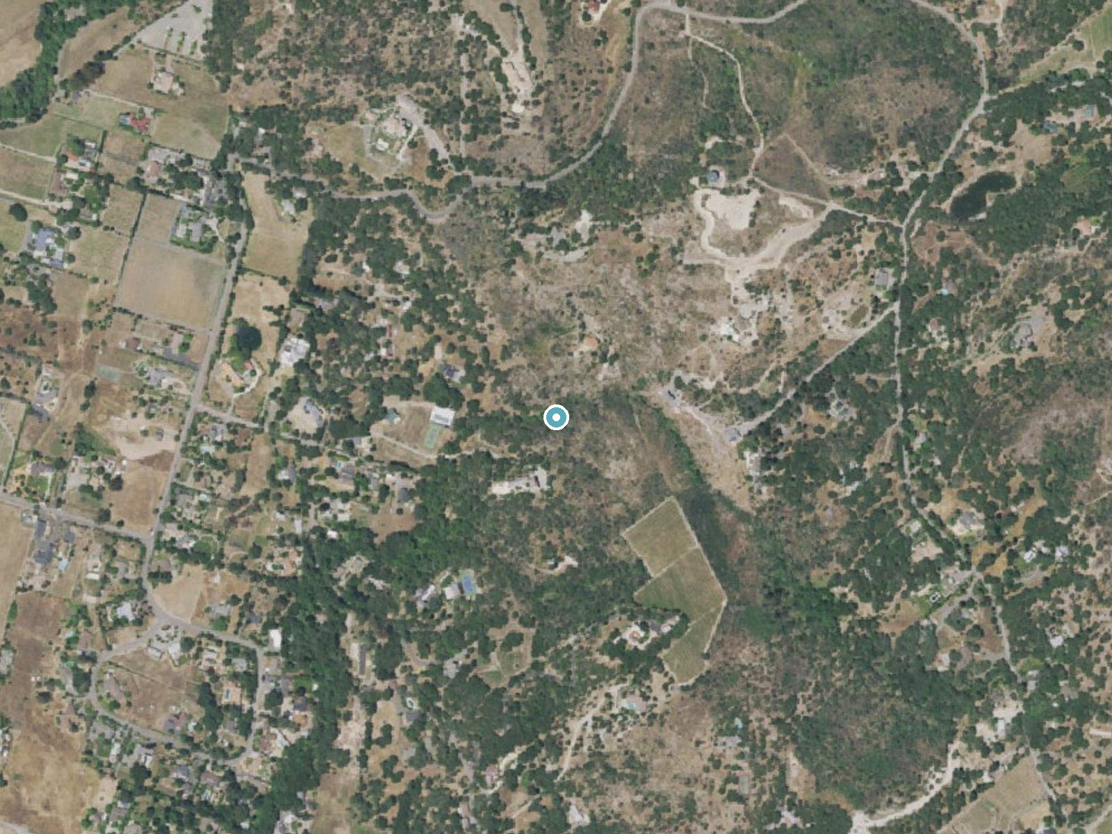
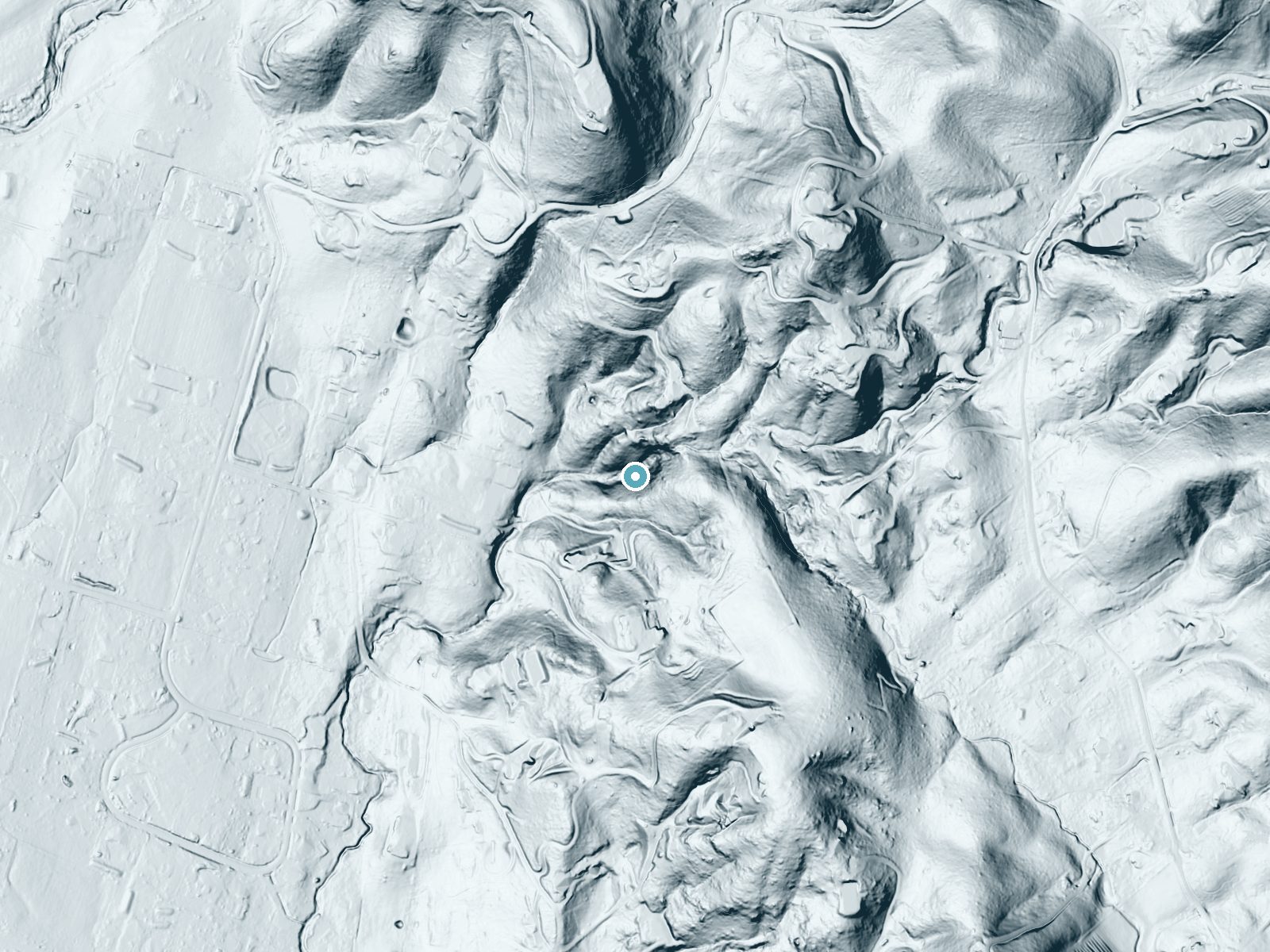
Drag to compare. The dot marks the waterfall. The frame is about a mile across.
- Ground elevation
- 195 feet
- Measured by 1-meter lidar
- Drop at the falls
- About 163 feet
- Change in ground height within ~250 feet of the falls
- Faces
- West
- Glows in afternoon and evening light.
A slice through the lidar ground surface, from above the falls to downstream (heading west).
Elevation data: USGS 3D Elevation Program. Aerial imagery: USGS The National Map. Public domain.
Location & Access
Getting There
Haraszthy Falls is located in a remote area of California, and specific directions may vary depending on the starting point. Visitors are advised to research the route thoroughly before attempting to visit.
Get Directions on Google MapsParking
Parking availability is unclear. Visitors should prepare for limited or no designated parking near the trailhead.
Elevation
194 feet above sea level
Coordinates
38.292692° N, -122.418868° W
Visitor Tips & Gear
Bring a detailed map or GPS device, as the trail may not be well-marked. Wear sturdy hiking boots and carry plenty of water. Check weather conditions before your visit.
Where to Stay
Cinnamon Bear Creekside Inn
The Estate Yountville

Sonoma Valley Inn, Tapestry Collection by Hilton
Olea Hotel
Browse vacation cabins and private rentals nearby
Unique outdoor stays — tents, yurts, and treehouses
Rent a campervan or RV for your waterfall road trip
Some links are affiliate links. We may earn a commission at no extra cost to you.
Nearby Campground
OAK SHORES DAY USE AREA (CA)
21 miles away · 6 sites
Overview Nestled between Blue Ridge and Cedar Roughs east of Napa Valley, Lake Berryessa provides ample public recreation opportunities. Popular activities on and around the large, yet uncrowded lake include fishing, boating, water skiing, wake boarding, jet skiing, sailing, swimming, kayaking, canoeing, wildlife viewing, hiking, biking and picnicking. The Dufer Point Visitor Center offers year-round interpretive events and exhibits highlighting natural and cultural resources. Lake Berryessa is a
Book on Recreation.govNearby Hot Springs
Hot springs near Napa, California

Unnamed Spring Sonoma County 2
Near Eldridge in Sonoma County, this 70-degree thermal spring flows at just 261 feet elevation with exceptional roadside access...
Unnamed Spring Napa County
In Napa Valley, this 83-degree thermal spring emerges at 600 feet just 15 meters from Hagen Road, creating water 22 degrees war...
Napa Vichy Springs
Napa Vichy Springs flows at 76°F (24°C) near Napa, California, at just 600 feet elevation with virtually roadside access and ca...
Los Guilicos Warm Springs
Los Guilicos Warm Springs emerges at 88°F in Sonoma County wine country, producing water 28 degrees above ambient in a gentle M...
Unnamed Spring Sonoma County 1
This 73-degree spring in Sonoma County wine country, with recent USGS measurements of 32°C, flows at just 340 feet elevation wi...
White Sulphur Springs (California)
White Sulphur Springs ranks as California's oldest warm mineral springs resort, founded in 1852 in Napa Valley at just 300 feet...
Looking for a soak after your hike? Explore more hot springs near Napa, California on SoakingSprings.
Explore California springsAdditional Information
Nearby Attractions
The surrounding area may offer additional hiking opportunities and scenic views, but specific attractions are not well-documented.
Wildlife
The area may be home to various wildlife, including birds and small mammals. Visitors should be cautious and respect the natural habitat.
Cities near Haraszthy Falls
Writing about Haraszthy Falls? Embed this waterfall on your site for free.