
Difficulty
Moderate
Trail Length
2.4 miles
Trail Type
Out And Back
Elevation Gain
350 ft
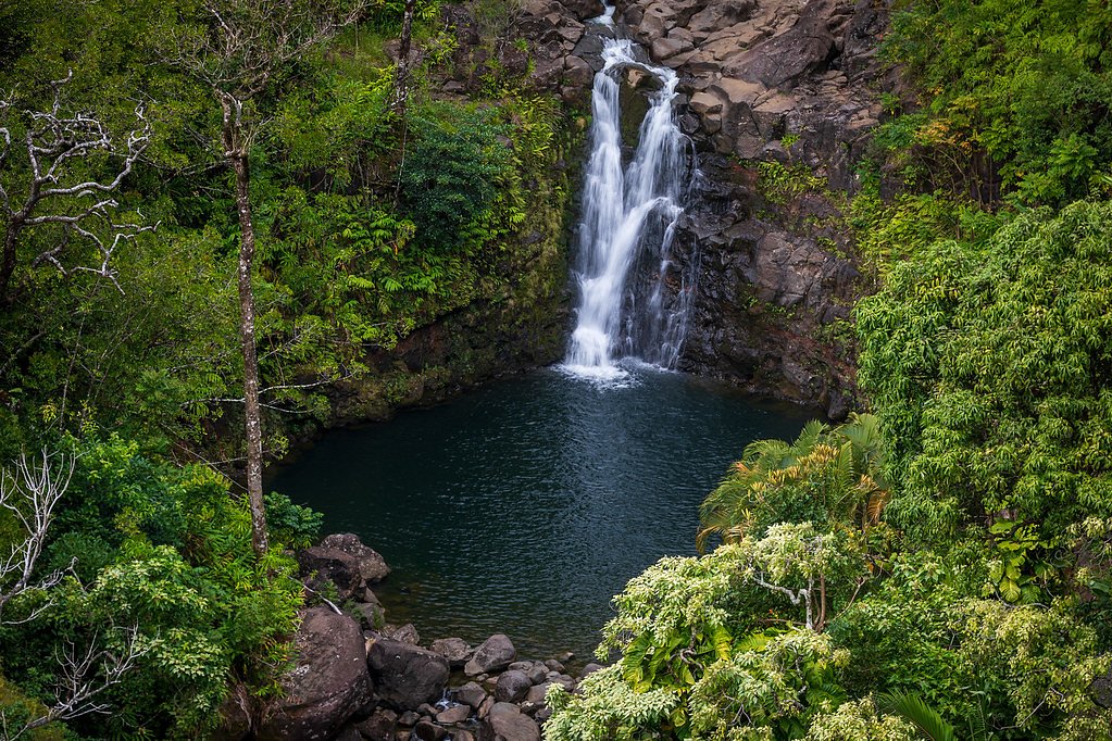
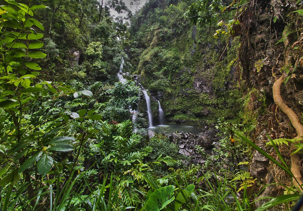
About Haʻipuaʻena Falls
Haʻipuaʻena Falls is a quietly beautiful cascade on Maui, set amid the island’s lush tropical vegetation and a favorite for hikers seeking a peaceful stop along the famed Hana Highway. The falls offer a verdant, intimate setting that’s often less crowded than some of the larger Road to Hana attractions, making it a great spot for photography, a brief picnic, or simply soaking in the scenery. The falls sit within the Koʻolau Forest Reserve, designated as a State Conservation Area (SCA) and managed by SDNR. Visitors should treat the area with care—obey posted signs, pack out what you pack in, and be prepared for wet, slippery conditions after rain. The site’s state-managed status means resources and facilities are limited, so plan accordingly and respect local rules and access points.
The Setting
Haʻipuaʻena Falls sits at 512 feet within Ko'olau Forest Reserve, in the foothills of Hawaii.
Trail & Hike Details
The Approach
The moderate 2.4-mile out-and-back trail gains 350 feet of elevation on the way to the falls.
Trail Description
The route to Haʻipuaʻena Falls is an out-and-back trail of roughly 2.4 miles with about 350 feet of elevation gain and is rated moderate. Trail surface and formal USFS trail-class/grade data are not provided; expect a natural tread through tropical forest that can be muddy, uneven, and slippery, especially after rain. Sturdy footwear, insect protection, and basic navigation awareness are recommended. The trail and falls lie within the Koʻolau Forest Reserve SCA managed by SDNR—stay on established paths and follow any posted guidance.
What to Expect
Swimming is permitted.
Accessibility
The trail is not wheelchair accessible. Uneven terrain and elevation changes require steady footing.
Frequently Asked Questions
🐶 Are Dogs Allowed at Haʻipuaʻena Falls?
❌ Dogs are not allowed
Are There Any Fees or Permits Required?
🆖 No fees required
🏊 Is There Swimming at Haʻipuaʻena Falls?
✅ Swimming is allowed
When to Visit
The waterfall flows year-round, but visiting after light rain can enhance the water flow. Avoid visiting during heavy rain due to potential flash flooding and slippery conditions.
Seasonal Access
The best time to visit is Spring, Summer, Fall, and Winter. Heavy rains during wet season (November through March) bring higher flow but can make trails slippery.
Safety Information
Be cautious of slippery rocks and muddy trails. Avoid visiting during heavy rain due to the risk of flash flooding. Do not leave valuables in your car as break-ins have been reported along the Hana Highway.
Current Water Conditions
12 ft³/s
Current discharge — how much water is flowing
About average for this time of year
Based on 58 years of record
2.58 ft
Water depth at gauge
7-Day Discharge Trend
What does this mean for your visit?
Flow is about average for this time of year.
About This Gauge
7-Day Flow Outlook
Based on the USGS gauge Puohokamoa Str ab Spreckels Ditch, Maui, HI (2 km away).
Today
Moderate
11 cfs
6/10Tomorrow
Moderate
19 cfs
6/10Wed
Moderate
16 cfs
6/10Thu
Moderate
17 cfs
6/10Fri
Moderate
14 cfs
6/10Sat
Moderate
15 cfs
6/10Sun
Moderate
14 cfs
6/10Best window: Today — moderate flow, occasional rain showers (trip score 6/10).
Best time of year: this gauge typically runs highest from late March to late April, peaking in April.
How we calculate this
This is a transparent outlook, not a precise forecast. We take the waterfall's current flow strength (how it ranks against its historical normal for today, from the nearest USGS stream gauge), carry that ranking forward along the gauge's seasonal curve, and nudge it for forecast rain. Confidence is highest for the next day or two and falls further out. Always check official conditions and your own judgment before visiting — high flows can be dangerous.
Know when to go.
Get a free email alert when waterfalls near Olinda hit peak flow. We only send when conditions are worth the trip — no weekly newsletters, no spam.
Weather Forecast
Location & Access
Getting There
Haʻipuaʻena Falls is located at Mile Marker 11 on the Hana Highway (HI-360). It is accessible by car, and visitors can park along the roadside near the trailhead. Be cautious as parking is limited and the road can be narrow.
Get Directions on Google MapsParking
Roadside parking is available near Mile Marker 11, but spaces are limited and may require careful maneuvering. Ensure your vehicle is parked safely off the road.
Elevation
512 feet above sea level
Coordinates
20.865509° N, -156.176199° W
Land Management
Managed by SDNR
Visitor Tips & Gear
Arrive early to secure parking and avoid crowds. Wear sturdy, non-slip footwear as the trail can be muddy. Be cautious of slippery rocks near the waterfall. Bring insect repellent to protect against mosquitoes.
As an Amazon Associate, we earn from qualifying purchases.
With 2.4 miles and 350 ft of elevation gain, sturdy boots and trekking poles will help on this moderate trail. Icy conditions are common in winter — traction cleats are a smart addition.

Columbia Watertight II Rain Jacket
Packs into its own pocket, seam-sealed, and keeps you dry from spray and surprise rain.

Polarized Sunglasses (Knockaround)
Cuts glare off the water so you actually see the falls — and your photos turn out better too.

Earth Pak Waterproof Dry Bag
Keeps your phone and gear dry when waterfall mist soaks everything else.

Waterproof Phone Pouch (AiRunTech)
Cheap insurance — take photos right next to the falls without killing your phone.

Timberland Euro Sprint Mid Waterproof
Trusted waterproof boot with premium leather and grippy rubber sole — reliable on rocky, wet trails.

TrailBuddy Trekking Poles
Lightweight aluminum, cork grips, and flip-locks that actually hold — a best-seller for good reason.
Where to Stay

Leinaala Oceanfront #303 Panoramic Ocean Front View, A/C Great Location, Pool

Lovely Oceanfront 3 Bedroom, First Floor Corner Unit

Puu Koa Palms vacation rental

This place is different!! Award winning! Oceanfront, View View!
Browse vacation cabins and private rentals nearby
Unique outdoor stays — tents, yurts, and treehouses
Rent a campervan or RV for your waterfall road trip
Some links are affiliate links. We may earn a commission at no extra cost to you.
Nearby Campground
Haleakalā National Park (Wilderness Tent Permit)
9.1 miles away · 10 sites
Overview There are two primitive wilderness tent areas which are accessible only by trail, Hōlua and Palikū. Backcountry users must plan to enter the park entrance for their stay no earlier than 7 am unless they have also obtained a sunrise reservation granting access to the park between 3 and 7 am. Sunrise reservations can be made on recreation.gov. Hōlua, the wilderness tent area reached by the shortest hike, lies at 6,940 ft (2,115m) in the shrubland near Koʻolau Gap. Hōlua is 3.7 mi (6 km) on
Book on Recreation.govAdditional Information
Nearby Attractions
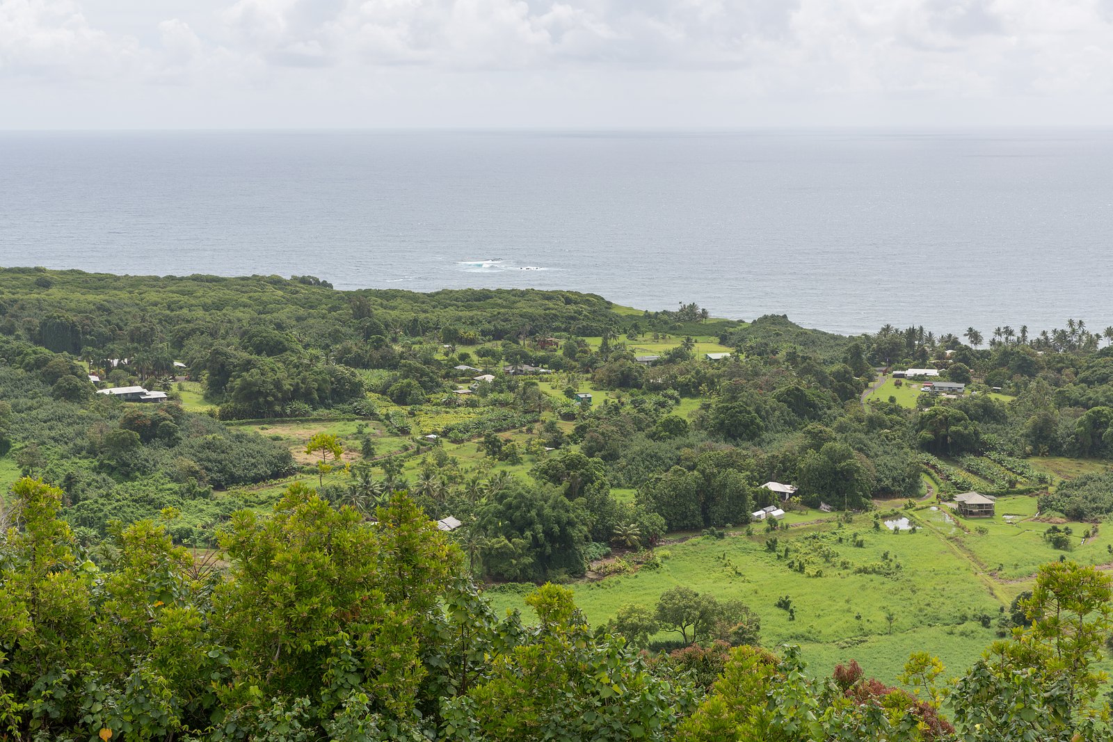
Other waterfalls along the Hana Highway, such as Twin Falls and Upper Waikani Falls, as well as the town of Hana and Waiʻanapanapa State Park.
Wildlife
The area is home to native Hawaiian birds and various tropical plants. Be mindful of insects, including mosquitoes.
Cities near Haʻipuaʻena Falls
Nearby Waterfalls

Writing about Haʻipuaʻena Falls? Embed this waterfall on your site for free.