Great Falls of Dan
By Armen Suny · Last verified May 2026
Difficulty
Moderate
Trail Length
2.4 miles
Trail Type
Out And Back
Elevation Gain
350 ft
About Great Falls of Dan
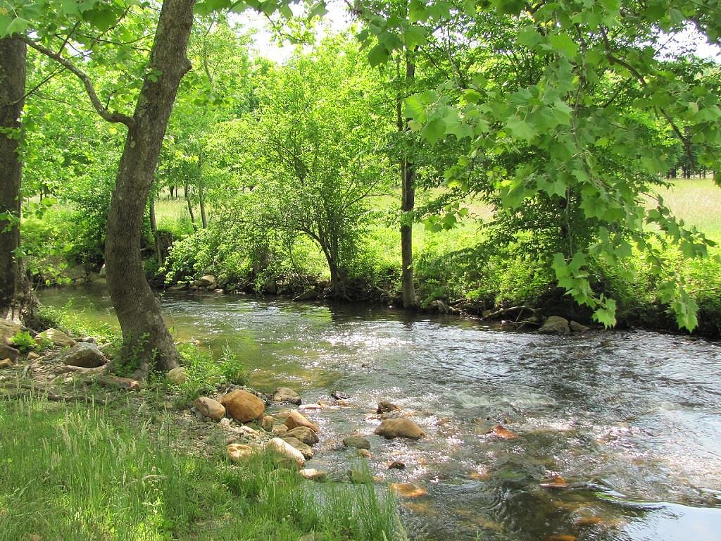
Great Falls of the Dan is a dramatic stretch of the Dan River tucked into southern Virginia near the North Carolina border, where the river drops and threads over rocky ledges to form a series of scenic cascades and viewpoints. The site sits on county-managed land held by Danville Hydro_Elec Holdings (designation: LP) and is overseen by the county (manager: CNTY), giving the falls a locally managed, low-key feel that’s popular with photographers, day hikers, and anyone seeking a peaceful riverside outing. Access to the falls is straightforward but rewarding: the main route is an out-and-back trail that climbs through mixed woods to reach overlooks where the river’s flow and rock formations are at their most photogenic. Seasonal water levels change the character of the cascades, so spring runoff and falls after rain are often the most dramatic times to visit. The setting is rural and natural rather than developed, so come prepared for uneven terrain and bring water, sturdy shoes, and a camera.
The Setting
Great Falls of Dan sits at 1,995 feet within Danville Hydro_Elec Holdings, fed by the Smith River, in the hills of Virginia.
Trail & Hike Details
The Approach
The moderate 2.4-mile out-and-back trail gains 350 feet of elevation on the way to the falls.
Trail Description
The primary approach to Great Falls of the Dan is a 2.4-mile out-and-back trail with roughly 350 feet of elevation gain, rated moderate. The route winds through forested terrain with some short, steeper sections and rocky footing near the river; sturdy footwear is recommended. This is a county-managed access (land unit: Danville Hydro_Elec Holdings; manager: CNTY) rather than a USFS trail, and no USFS trail number/surface/grade/class data is provided for this route, so expect primitive trail conditions and natural tread underfoot.
What to Expect
Dogs are welcome.
Accessibility
The trail is not wheelchair accessible. Uneven terrain and elevation changes require steady footing.
Frequently Asked Questions
🐶 Are Dogs Allowed at Great Falls of Dan?
✅ Dogs are allowed
Are There Any Fees or Permits Required?
🆖 No fees required
🏊 Is There Swimming at Great Falls of Dan?
❌ Swimming is not allowed
When to Visit
Spring and fall are ideal for visiting due to mild weather and vibrant foliage. Summer is also popular, but it may be warmer and more crowded.
Seasonal Access
The best time to visit is Spring, Summer, and Fall. Winter access may be limited.
Safety Information
Exercise caution near the water as rocks can be slippery, and currents may be strong. Stay on marked trails and avoid venturing too close to the edge of the falls.
Current Water Conditions
7 ft³/s
Current discharge — how much water is flowing
Much lower than usual for this time of year
Based on 31 years of record
2.05 ft
Water depth at gauge
7-Day Discharge Trend
What does this mean for your visit?
Flow is well below normal for this time of year, so the waterfall may be a trickle.
About This Gauge
This gauge is on a nearby waterway and may not reflect exact conditions at the falls.
7-Day Flow Outlook
Based on the USGS gauge SMITH RIVER AT SMITH RIV CHURCH NR WOOLWINE, VA (20 km away).
Today
Strong
8 cfs
7/10Tomorrow
Roaring
9 cfs
6/10Mon
Strong
7 cfs
10/10Tue
Moderate
6 cfs
9/10Wed
Moderate
7 cfs
9/10Thu
Strong
8 cfs
7/10Fri
Roaring
8 cfs
6/10Best window: Mon — strong flow, mostly sunny (trip score 10/10).
Best time of year: this gauge typically runs highest from mid April to early May, peaking in April.
How we calculate this
This is a transparent outlook, not a precise forecast. We take the waterfall's current flow strength (how it ranks against its historical normal for today, from the nearest USGS stream gauge), carry that ranking forward along the gauge's seasonal curve, and nudge it for forecast rain. Confidence is highest for the next day or two and falls further out. Always check official conditions and your own judgment before visiting — high flows can be dangerous.
Know when to go.
Get a free email alert when waterfalls near Meadows of Dan hit peak flow. We only send when conditions are worth the trip — no weekly newsletters, no spam.
Weather Forecast
Location & Access
Getting There
The Great Falls of the Dan is located near the town of Danbury, Virginia. Access is typically via local roads, and visitors should follow signs or GPS directions to the falls. The area may be remote, so plan accordingly.
Get Directions on Google MapsParking
Parking availability is limited and may be located near the trailhead or along the roadside. Visitors should check for designated parking areas to avoid blocking access.
Elevation
1,995 feet above sea level
Coordinates
36.685414° N, -80.436730° W
Land Management
Managed by CNTY
Visitor Tips & Gear
Arrive early to secure parking and enjoy the falls without crowds. Bring water and wear comfortable shoes. Be cautious of slippery rocks near the water.
As an Amazon Associate, we earn from qualifying purchases.
With 2.4 miles and 350 ft of elevation gain, sturdy boots and trekking poles will help on this moderate trail. Sun exposure on the trail makes good sun protection a must in summer.

Columbia Watertight II Rain Jacket
Packs into its own pocket, seam-sealed, and keeps you dry from spray and surprise rain.

Earth Pak Waterproof Dry Bag
Keeps your phone and gear dry when waterfall mist soaks everything else.

Waterproof Phone Pouch (AiRunTech)
Cheap insurance — take photos right next to the falls without killing your phone.

Timberland Euro Sprint Mid Waterproof
Trusted waterproof boot with premium leather and grippy rubber sole — reliable on rocky, wet trails.

TrailBuddy Trekking Poles
Lightweight aluminum, cork grips, and flip-locks that actually hold — a best-seller for good reason.

Polarized Sunglasses (Knockaround)
Cuts glare off the water so you actually see the falls — and your photos turn out better too.
Where to Stay

Gorgeous Log Cabin - Wineries, Dan River, Hiking

2 Mi to Blue Ridge Pkwy! Mtn Escape w/ Fireplace

Romantic Cabin Getaway - King Bed - Fast Wi-Fi - Pet-Friendly

2 Mi to Mabry Mill Mtn-View Cabin with Porch!
Browse vacation cabins and private rentals nearby
Unique outdoor stays — tents, yurts, and treehouses
Rent a campervan or RV for your waterfall road trip
Some links are affiliate links. We may earn a commission at no extra cost to you.
Nearby Campground
Rock Castle Gorge Backcountry Camping
10 miles away · 8 sites
Overview Rock Castle Gorge Backcountry Campground is a primitive camp located along the Rock Castle Gorge Trail in the Rocky Knob Recreational Area which is part of the Blue Ridge Parkway. The Rock Castle Gorge Backcountry Campsites can be reached from various points ranging in distance from 1/2 mile to 8 miles. The complete Rock Castle Gorge Trail is a 10.8 mile loop, there are several other loop trails that connect to it. Rock Castle Creek, Little Rock Castle Creek and many other streams and
Book on Recreation.govNearby Hot Springs
Hot springs near Meadows of Dan, Virginia

New River White Sulphur Springs
New River White Sulphur Springs produces 85-degree water that flows 30.3 degrees above ambient temperature at 1,780 feet elevat...
Alum Springs
Alum Springs flows at 72°F in Pulaski County, Virginia, emerging 18.4 degrees above the 53.6°F ambient temperature at 1,967 fee...
Looking for a soak after your hike? Explore more hot springs near Meadows of Dan, Virginia on SoakingSprings.
Explore Virginia springsAdditional Information
Nearby Attractions
The Dan River offers opportunities for kayaking and fishing. Nearby towns like Danbury provide dining and lodging options.
Wildlife
The area is home to various bird species, deer, and other small wildlife. Visitors may also encounter insects, so bug spray is advised.
Cities near Great Falls of Dan
Nearby Waterfalls
Writing about Great Falls of Dan? Embed this waterfall on your site for free.