Photo Credits (5)
Trail Length
2.0 miles
About Great Falls of Catawba
Great Falls of Catawba is a dramatic stretch of rapids where the Catawba River tumbles across the Piedmont Plateau, sitting on the border of Lancaster and Chester counties near the town of Great Falls. The river here cuts a scenic corridor of cascades and rocky shoals roughly 55 miles south of Charlotte, making it a striking natural landmark for locals and visitors alike. The falls were once one of the river’s most notable features before the creation of Fishing Creek Reservoir and other artificial lakes by Duke Power. A short hike rewards visitors with viewpoints over the rapids and easy access to the riverbanks, offering a mix of photography, birdwatching, and quiet riverside time. The setting blends natural geology and regional history, and the trail is a great choice for hikers seeking a moderate, out-and-back route that brings you close to one of the Catawba River’s most recognizable stretches.
The Setting
Great Falls of Catawba sits at 302 feet along the Catawba River, in the coastal lowlands of South Carolina.
Trail & Hike Details
Trail Description
The primary hiking route to the Great Falls is a 2.4-mile out-and-back trail with about 350 feet of elevation gain, rated moderate. Expect a steadily rolling hike with some short climbs that open to viewpoints overlooking the rapids and stretches of riverbank; the trail is well suited to day hikers looking for a relatively brief but rewarding outing. Bring sturdy footwear for uneven footing near the water, and plan for limited services—this is a back-to-nature experience focused on river views and the falls themselves.
What to Expect
Visitors can expect picturesque views of the cascading waterfalls, opportunities for photography, and a chance to enjoy the natural beauty of the Catawba River. Restoration efforts in the area may enhance the experience over time.
Accessibility
Accessibility may vary depending on the trail or viewpoint. Some areas may not be suitable for visitors with mobility challenges.
Frequently Asked Questions
🐶 Are Dogs Allowed at Great Falls of Catawba?
❌ Dogs are not allowed
Are There Any Fees or Permits Required?
🆖 No fees required
🏊 Is There Swimming at Great Falls of Catawba?
❌ Swimming is not allowed
When to Visit
Spring and fall are typically the best times to visit, as the weather is mild and the scenery is vibrant. However, the falls can be enjoyed year-round.
Seasonal Access
The best time to visit is Spring, Summer, Fall, and Winter.
Safety Information
Exercise caution near the river and waterfalls, as rocks may be slippery and currents strong. Be aware of weather conditions and avoid visiting during heavy rain or flooding.
Current Water Conditions
351.11 ft
Water depth at gauge
78°F
ComfortablePleasant for swimming
What does this mean for your visit?
The water is a comfortable 78 degrees F, pleasant for swimming. Expect low dissolved oxygen levels.
Water Quality
Dissolved Oxygen
PoorLow oxygen — stressed ecosystem
About This Gauge
Know when to go.
Get a free email alert when waterfalls near Great Falls hit peak flow. We only send when conditions are worth the trip — no weekly newsletters, no spam.
Weather Forecast
The Terrain, Seen by LiDAR
Aircraft-mounted lasers measured this ground to within inches. Trees and buildings are digitally stripped away, leaving the bare shape of the land the water has carved.
1-meter lidar measures about 20 feet of drop in the ground within a few hundred feet of Great Falls of Catawba. The ground at the falls is roughly 299 feet above sea level.
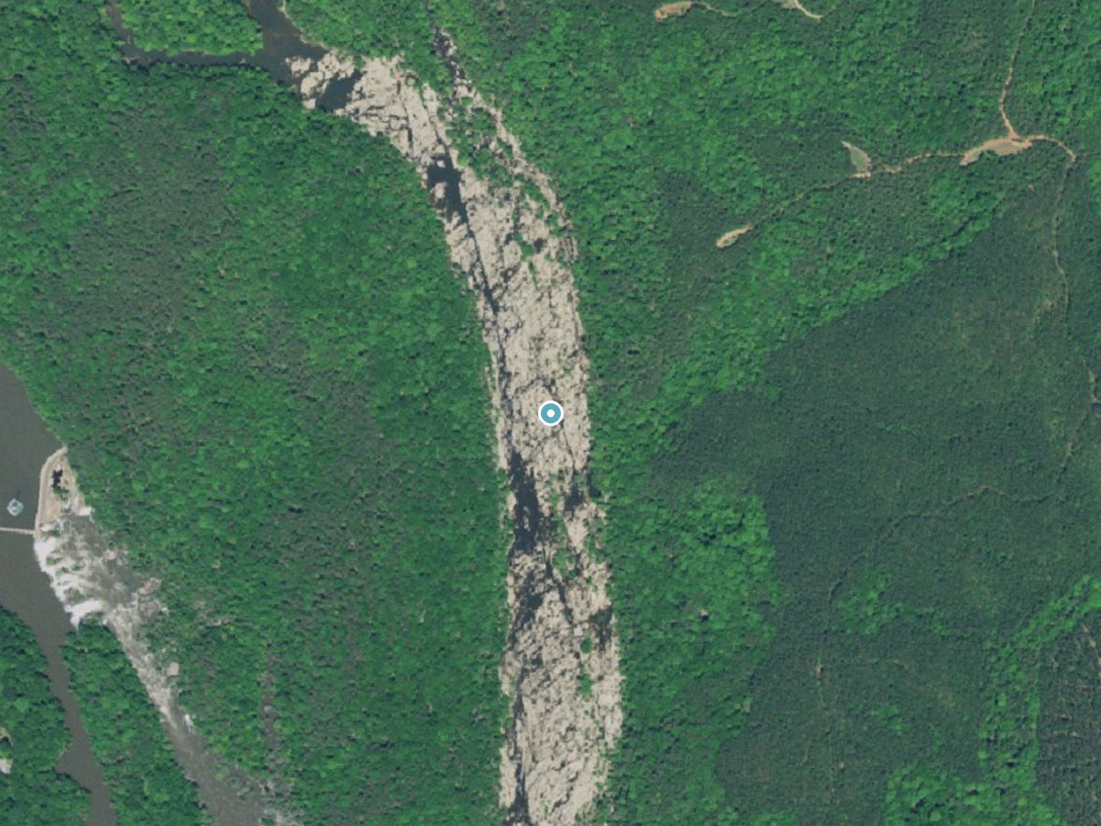
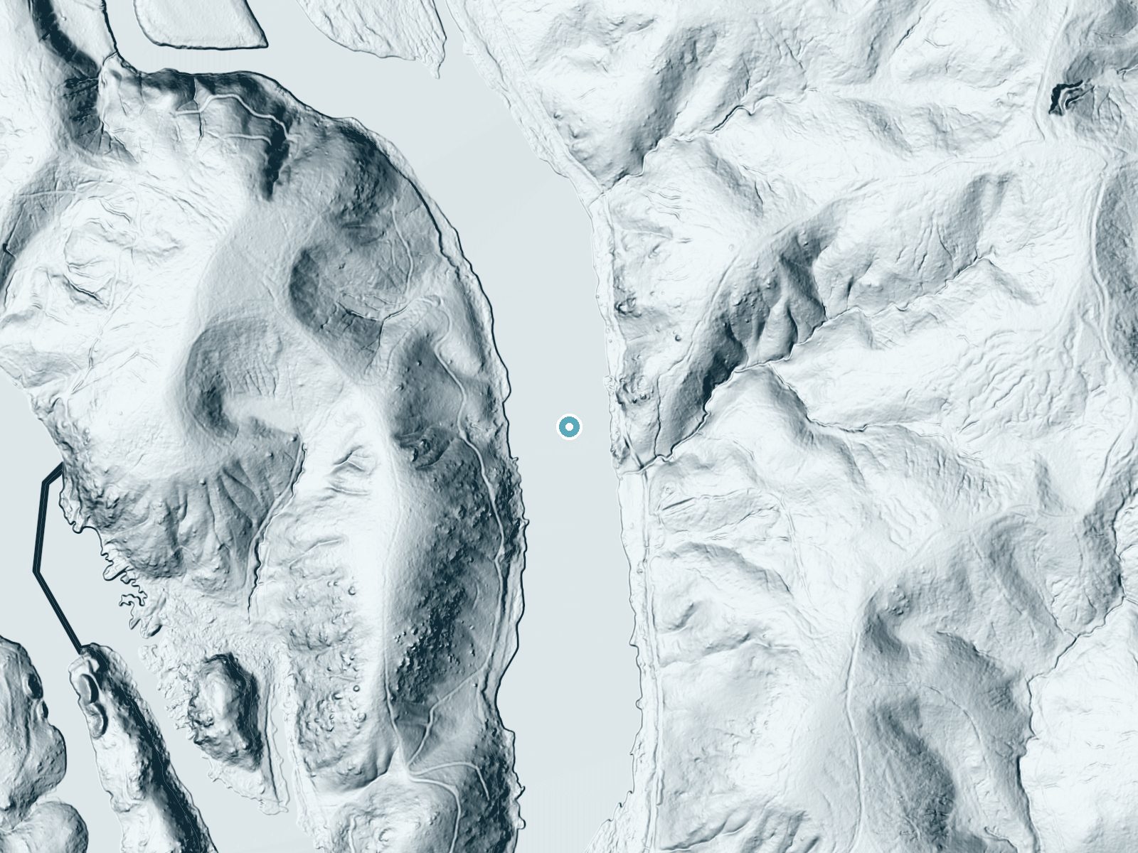
Drag to compare. The dot marks the waterfall. The frame is about a mile across.
- Ground elevation
- 299 feet
- Measured by 1-meter lidar
- Drop at the falls
- About 20 feet
- Change in ground height within ~250 feet of the falls
Elevation data: USGS 3D Elevation Program. Aerial imagery: USGS The National Map. Public domain.
Location & Access
Getting There
The Great Falls of Catawba is located near the town of Great Falls, South Carolina. It can be accessed via local roads, with signage directing visitors to the area. The falls are part of the Great Falls-Dearborn Reservoir area.
Get Directions on Google MapsParking
Parking is available near the trailheads and access points, though availability may vary depending on the specific area visited.
Elevation
302 feet above sea level
Coordinates
34.579034° N, -80.877856° W
Visitor Tips & Gear
Wear sturdy footwear, as trails may be uneven or muddy in places. Bring water and snacks, especially if planning to explore multiple trails. Check local conditions before visiting, as access may be affected by weather or restoration work.
Where to Stay

Quality Inn Lancaster

Home2 Suites By Hilton Newberry

Holiday Inn Express and Suites Newberry by IHG

Landsford Inn
Browse vacation cabins and private rentals nearby
Unique outdoor stays — tents, yurts, and treehouses
Rent a campervan or RV for your waterfall road trip
Some links are affiliate links. We may earn a commission at no extra cost to you.
Additional Information
Nearby Attractions
Nearby attractions include the Great Falls Reservoir and other scenic areas along the Catawba River.
Wildlife
The area is home to a variety of wildlife, including birds, fish, and small mammals. Visitors may also see native plants and trees.
Cities near Great Falls of Catawba
Writing about Great Falls of Catawba? Embed this waterfall on your site for free.