Grandfather Falls
By Armen Suny · Last verified May 2026
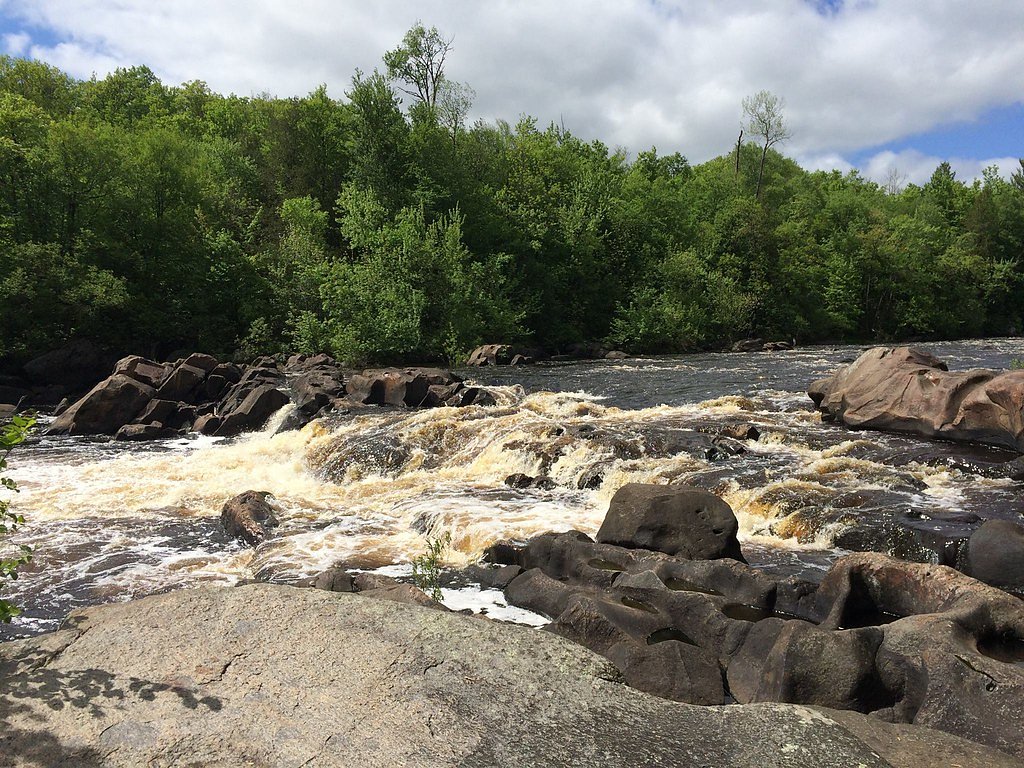
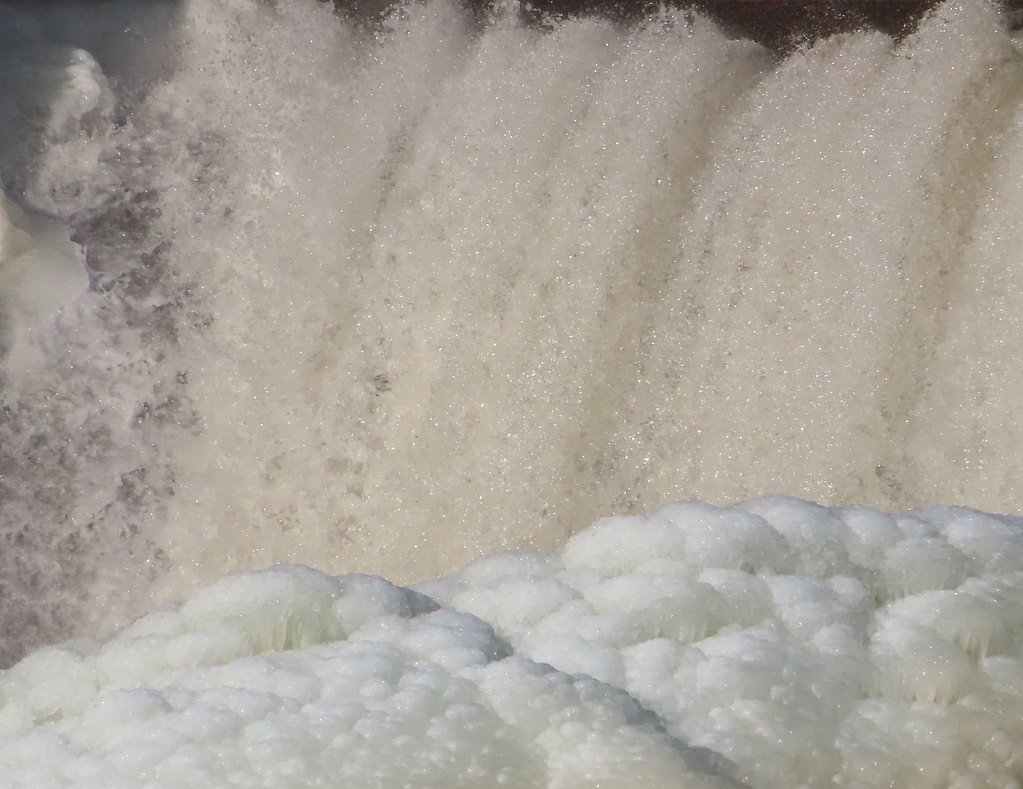

Photo Credits (3)
Difficulty
Moderate
Trail Length
2.4 miles
Trail Type
Out And Back
Elevation Gain
350 ft
About Grandfather Falls
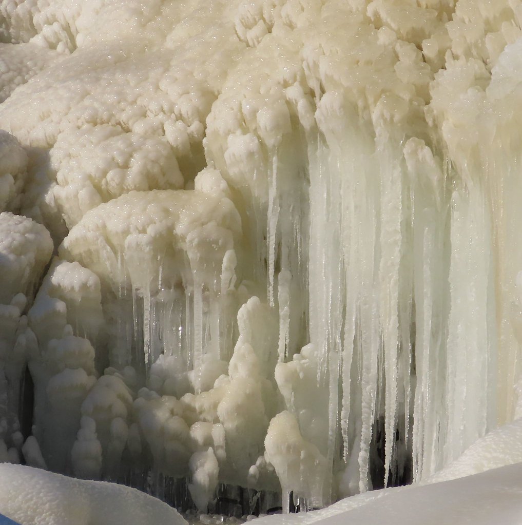
Grandfather Falls, just upriver from Merrill on the Wisconsin River, is the river's highest waterfall — an 89-foot drop dispersed as a mile of cascades and rapids rather than a single vertical plunge. The series of falls unfolds across rocky ledges and offers a cinematic stretch of moving water and forested banks. Note that the upper third of the falls (and most of the flow except during spring snowmelt) is diverted through a canal and a set of penstocks to feed hydroelectric generators; the dam and power facility are owned and operated by Wisconsin Public Service Corporation, so seasonal flow can vary considerably. The site is a favorite for photographers, anglers, and hikers who appreciate dynamic river scenery more than a single dramatic drop. Several viewpoints along the river give good photo angles and listening spots for the rush of cascades. Visitors should exercise caution on slick rocks near the water and time visits for spring runoff if you want to see the falls at fuller volume.
The Setting
Grandfather Falls sits at 1,319 feet along the Prairie River, in the foothills of Wisconsin.
Trail & Hike Details
The Approach
The moderate 2.4-mile out-and-back trail gains 350 feet of elevation on the way to the falls.
Trail Description
The access trail to Grandfather Falls is a 2.4-mile out-and-back route with about 350 feet of elevation gain, typically rated moderate in difficulty. The path follows the Wisconsin River and provides multiple lookout spots over the cascades; trail surfaces and conditions vary with season and weather. Expect a moderately steady climb on the return and take extra care near the river’s edge where rocks are often slippery. Because much of the upper flow is diverted to a hydroelectric canal except during spring runoff, plan your visit seasonally if you want higher water levels for photography or viewing.
What to Expect
Dogs are welcome.
Accessibility
The trail is not wheelchair accessible. Uneven terrain and elevation changes require steady footing.
Frequently Asked Questions
🐶 Are Dogs Allowed at Grandfather Falls?
✅ Dogs are allowed
Are There Any Fees or Permits Required?
🆖 No fees required
🏊 Is There Swimming at Grandfather Falls?
❌ Swimming is not allowed
When to Visit
Spring and fall are ideal times to visit due to cooler temperatures and vibrant foliage. Summer is also popular, but it may be busier.
Seasonal Access
The best time to visit is Spring, Summer, and Fall. Winter access may be limited.
Safety Information
Be cautious near the water, as rocks can be slippery and currents strong. Stay on marked trails to avoid getting lost. Check weather conditions before visiting, as the trail may become muddy or slippery after rain.
Current Water Conditions
125 ft³/s
Current discharge — how much water is flowing
About average for this time of year
Based on 104 years of record
2.12 ft
Water depth at gauge
7-Day Discharge Trend
What does this mean for your visit?
Flow is about average for this time of year.
About This Gauge
This gauge is on a nearby waterway and may not reflect exact conditions at the falls.
7-Day Flow Outlook
Based on the USGS gauge PRAIRIE RIVER NEAR MERRILL, WI (13 km away).
Today
Low
143 cfs
3/10Tomorrow
Low
146 cfs
3/10Tue
Low
143 cfs
3/10Wed
Low
148 cfs
3/10Thu
Low
142 cfs
3/10Fri
Low
139 cfs
3/10Sat
Low
138 cfs
3/10Best window: Today — low flow, chance showers and thunderstorms then partly sunny (trip score 3/10).
Best time of year: this gauge typically runs highest from late March to mid June, peaking in April.
How we calculate this
This is a transparent outlook, not a precise forecast. We take the waterfall's current flow strength (how it ranks against its historical normal for today, from the nearest USGS stream gauge), carry that ranking forward along the gauge's seasonal curve, and nudge it for forecast rain. Confidence is highest for the next day or two and falls further out. Always check official conditions and your own judgment before visiting — high flows can be dangerous.
Know when to go.
Get a free email alert when waterfalls near Merrill hit peak flow. We only send when conditions are worth the trip — no weekly newsletters, no spam.
Weather Forecast
Location & Access
Getting There
Grandfather Falls is located near Merrill, Wisconsin. Visitors can access the falls via a trailhead off Grandfather Dam Road. The area is managed by Wisconsin Public Service Corporation, as it is near a hydroelectric dam.
Get Directions on Google MapsParking
Parking is available near the trailhead on Grandfather Dam Road. Spaces may be limited, especially during peak seasons.
Elevation
1,319 feet above sea level
Coordinates
45.303856° N, -89.790410° W
Visitor Tips & Gear
Wear sturdy shoes as the trail may have uneven terrain. Bring insect repellent during the summer months. Be cautious near the water, as rocks can be slippery. Check weather conditions before visiting, as the trail may be muddy after rain.
As an Amazon Associate, we earn from qualifying purchases.
With 2.4 miles and 350 ft of elevation gain, sturdy boots and trekking poles will help on this moderate trail. Sun exposure on the trail makes good sun protection a must in summer.

Polarized Sunglasses (Knockaround)
Cuts glare off the water so you actually see the falls — and your photos turn out better too.

Columbia Watertight II Rain Jacket
Packs into its own pocket, seam-sealed, and keeps you dry from spray and surprise rain.

Earth Pak Waterproof Dry Bag
Keeps your phone and gear dry when waterfall mist soaks everything else.

Waterproof Phone Pouch (AiRunTech)
Cheap insurance — take photos right next to the falls without killing your phone.

Timberland Euro Sprint Mid Waterproof
Trusted waterproof boot with premium leather and grippy rubber sole — reliable on rocky, wet trails.

TrailBuddy Trekking Poles
Lightweight aluminum, cork grips, and flip-locks that actually hold — a best-seller for good reason.
Where to Stay

Woodland Inn & Suites

Cobblestone Inn & Suites - Merrill

Bridge Inn Tomhawk - 2nd Floor, 1 King Size Bed, Balcony, River View

Rodeway Inn & Suites Tomahawk
Browse vacation cabins and private rentals nearby
Unique outdoor stays — tents, yurts, and treehouses
Rent a campervan or RV for your waterfall road trip
Some links are affiliate links. We may earn a commission at no extra cost to you.
Additional Information
Nearby Attractions
Nearby attractions include Council Grounds State Park and the city of Merrill, which offers dining and shopping options.
Wildlife
The area is home to various bird species, deer, and other wildlife. Visitors may also see fish in the river.
Cities near Grandfather Falls
Writing about Grandfather Falls? Embed this waterfall on your site for free.