Photo Credits (1)
Difficulty
Moderate
Trail Length
2.4 miles
Trail Type
Out And Back
Elevation Gain
350 ft
About Glynns Falls
Glynns Falls is a quietly scenic desert waterfall tucked into the rugged arid country of Arizona’s Barry Goldwater Range. Though exact measurements of the falls aren’t well documented, it offers a striking contrast of flowing water against weathered rock and sparse desert vegetation — a rewarding find for hikers who enjoy off-the-beaten-path scenery. The site lies on land managed by the Department of Defense (land unit: Barry Goldwater Range; land owner: DESG), so visitors should plan ahead and confirm access before heading out. The approach to Glynns Falls feels exploratory rather than highly developed: expect raw desert character, rock-hopping, and the kind of solitude that comes with lesser-known destinations. The area’s military designation means conditions and access can change, so check current restrictions and practice leave-no-trace principles when you visit.
The Setting
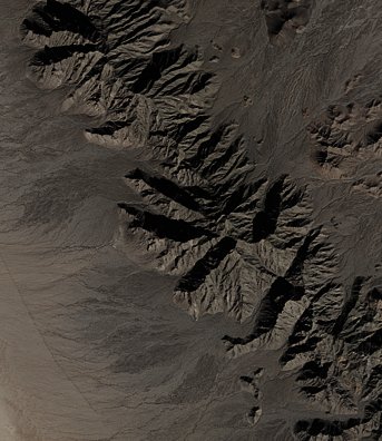
Glynns Falls sits at 1,496 feet within Barry Goldwater Range, in the foothills of Arizona.
Trail & Hike Details
The Approach
The moderate 2.4-mile out-and-back trail gains 350 feet of elevation on the way to the falls.
Trail Description
The primary route to Glynns Falls is a moderate, 2.4-mile out-and-back hike with roughly 350 feet of elevation gain. Trail conditions are primitive: the path can be rugged and intermittently unmarked, so hikers should be prepared for uneven terrain, loose rock, and desert exposure. There is no USFS trail number or surface/grade/class data available for this route; because the falls sit within the Barry Goldwater Range (managed by the DOD, designation MIL), confirm access and any temporary closures before you go, bring plenty of water, and be ready for straightforward route-finding on the return.
What to Expect
Visitors can expect a remote and potentially challenging experience. The waterfall is likely surrounded by desert vegetation and rocky terrain, typical of Arizona's landscape.
Accessibility
The trail is not wheelchair accessible. Uneven terrain and elevation changes require steady footing.
Frequently Asked Questions
🐶 Are Dogs Allowed at Glynns Falls?
❌ Dogs are not allowed
Are There Any Fees or Permits Required?
🆖 No fees required
🏊 Is There Swimming at Glynns Falls?
❌ Swimming is not allowed
When to Visit
Spring and fall are typically the best times to visit due to milder temperatures. Summer may be extremely hot, and winter conditions can vary.
Seasonal Access
The best time to visit is Spring, Summer, Fall, and Winter. Watch for flash flood warnings during monsoon season (July through September).
Safety Information
Be prepared for remote conditions. Carry sufficient water, be aware of potential wildlife encounters, and avoid visiting during extreme heat. Cell service may be limited.
Know when to go.
Get a free email alert when waterfalls near Dateland hit peak flow. We only send when conditions are worth the trip — no weekly newsletters, no spam.
Weather Forecast
Location & Access
Getting There
The exact location and directions to Glynns Falls are not widely documented. Visitors are advised to consult local hiking resources or contact nearby park services for guidance.
Get Directions on Google MapsParking
Parking availability is unclear. It is recommended to check with local authorities or trail resources before visiting.
Elevation
1,496 feet above sea level
Coordinates
32.588106° N, -113.653531° W
Land Management
Managed by DOD
Visitor Tips & Gear
Bring plenty of water, as the area is likely to be hot and dry. Wear sturdy footwear and be prepared for uneven or unmarked trails. Check weather conditions and ensure you have a reliable map or GPS device.
As an Amazon Associate, we earn from qualifying purchases.
With 2.4 miles and 350 ft of elevation gain, sturdy boots and trekking poles will help on this moderate trail. Icy conditions are common in winter — traction cleats are a smart addition.

Columbia Watertight II Rain Jacket
Packs into its own pocket, seam-sealed, and keeps you dry from spray and surprise rain.

Polarized Sunglasses (Knockaround)
Cuts glare off the water so you actually see the falls — and your photos turn out better too.

Earth Pak Waterproof Dry Bag
Keeps your phone and gear dry when waterfall mist soaks everything else.

Waterproof Phone Pouch (AiRunTech)
Cheap insurance — take photos right next to the falls without killing your phone.

Timberland Euro Sprint Mid Waterproof
Trusted waterproof boot with premium leather and grippy rubber sole — reliable on rocky, wet trails.

TrailBuddy Trekking Poles
Lightweight aluminum, cork grips, and flip-locks that actually hold — a best-seller for good reason.
Where to Stay

Browse vacation cabins and private rentals nearby
Unique outdoor stays — tents, yurts, and treehouses
Rent a campervan or RV for your waterfall road trip
Some links are affiliate links. We may earn a commission at no extra cost to you.
Nearby Hot Springs
Hot springs near Dateland, Arizona
Radium Hot Springs
Radium Hot Springs emerges at an impressive 140°F in the Gila Valley near Wellton, ranking among Arizona's hottest thermal feat...
Agua Caliente Springs
Agua Caliente Springs near Gila Bend flows at an impressive 102 degrees Fahrenheit at just 449 feet elevation, emerging 26 degr...

Quitobaquito Springs
Quitobaquito Springs flows at 90°F within Organ Pipe Cactus National Monument near the Mexican border, 16 degrees warmer than t...
Looking for a soak after your hike? Explore more hot springs near Dateland, Arizona on SoakingSprings.
Explore Arizona springsAdditional Information
Nearby Attractions
Nearby attractions are not well-documented. Visitors may explore other natural features in the surrounding area.
Wildlife
The area may host desert wildlife such as lizards, snakes, and birds. Be cautious and aware of your surroundings.
Cities near Glynns Falls
Writing about Glynns Falls? Embed this waterfall on your site for free.