
Photo Credits (2)
Difficulty
Moderate
Trail Length
2.4 miles
Trail Type
Out And Back
Elevation Gain
350 ft
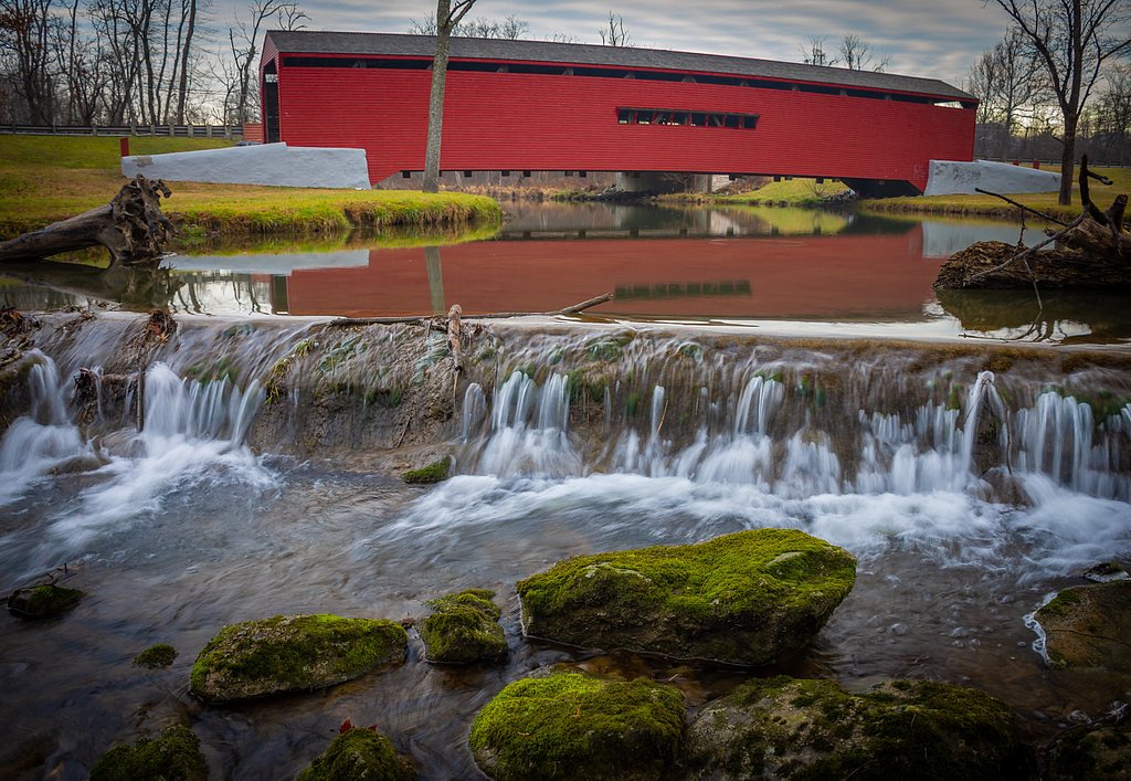
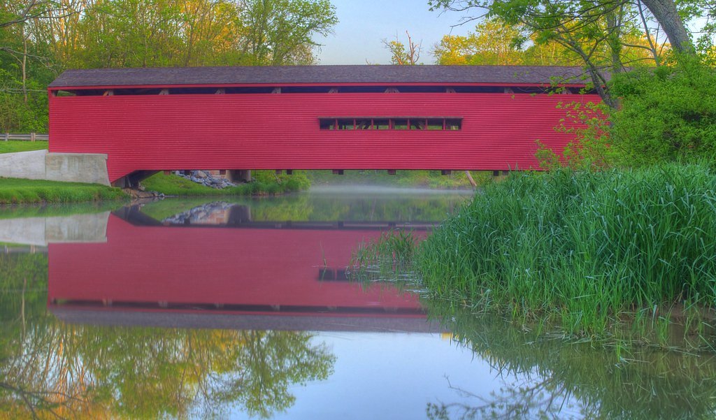
About Gilpins Falls
Gilpins Falls is a scenic waterfall located in Cecil County, Maryland. It is part of North East Creek and is known for its picturesque setting and historical significance, as it is near the Gilpin's Falls Covered Bridge, a local landmark.
The Setting
Gilpins Falls sits at 207 feet along the Big Elk Creek, in the coastal lowlands of Maryland.
Trail & Hike Details
The Approach
The moderate 2.4-mile out-and-back trail gains 350 feet of elevation on the way to the falls.
Trail Description
There is no established trail leading directly to Gilpins Falls. Visitors may need to navigate uneven terrain or follow informal paths to view the falls.
What to Expect
Visitors can expect a small but scenic waterfall surrounded by natural beauty. The nearby Gilpin's Falls Covered Bridge adds a historical element to the visit.
Accessibility
The trail is not wheelchair accessible. Uneven terrain and elevation changes require steady footing.
Frequently Asked Questions
🐶 Are Dogs Allowed at Gilpins Falls?
❌ Dogs are not allowed
Are There Any Fees or Permits Required?
🆖 No fees required
🏊 Is There Swimming at Gilpins Falls?
❌ Swimming is not allowed
When to Visit
Spring and early summer are ideal times to visit, as the water flow is typically stronger during these seasons.
Seasonal Access
The best time to visit is Spring, Summer, Fall, and Winter.
Safety Information
Be cautious of slippery rocks near the falls. The area may have uneven terrain, and there are no safety barriers. Exercise caution, especially with children.
Current Water Conditions
27 ft³/s
Current discharge — how much water is flowing
Lower than usual for this time of year
Based on 94 years of record
3.15 ft
Water depth at gauge
7-Day Discharge Trend
What does this mean for your visit?
Flow is lower than usual for this time of year.
About This Gauge
This gauge is on a nearby waterway and may not reflect exact conditions at the falls.
7-Day Flow Outlook
Based on the USGS gauge BIG ELK CREEK AT ELK MILLS, MD (11 km away).
Today
Moderate
27 cfs
8/10Tomorrow
Moderate
27 cfs
9/10Wed
Moderate
26 cfs
9/10Thu
Moderate
27 cfs
9/10Fri
Moderate
31 cfs
6/10Sat
Strong
32 cfs
7/10Sun
Strong
33 cfs
7/10Best window: Tomorrow — moderate flow, mostly sunny (trip score 9/10).
Best time of year: this gauge typically runs highest from mid February to late April, peaking in March.
How we calculate this
This is a transparent outlook, not a precise forecast. We take the waterfall's current flow strength (how it ranks against its historical normal for today, from the nearest USGS stream gauge), carry that ranking forward along the gauge's seasonal curve, and nudge it for forecast rain. Confidence is highest for the next day or two and falls further out. Always check official conditions and your own judgment before visiting — high flows can be dangerous.
Know when to go.
Get a free email alert when waterfalls near North East hit peak flow. We only send when conditions are worth the trip — no weekly newsletters, no spam.
Weather Forecast
Location & Access
Getting There
Gilpins Falls is located near the town of North East, Maryland. Visitors can access the area via Route 272, and the falls are close to the Gilpin's Falls Covered Bridge.
Get Directions on Google MapsParking
There is limited parking available near the Gilpin's Falls Covered Bridge. Visitors should be cautious as parking may be on the roadside.
Elevation
207 feet above sea level
Coordinates
39.647612° N, -75.952167° W
Visitor Tips & Gear
Wear sturdy shoes as the terrain near the falls may be uneven. Be cautious of slippery rocks if you approach the water. Consider visiting during the spring or after rainfall for a more robust water flow.
As an Amazon Associate, we earn from qualifying purchases.
With 2.4 miles and 350 ft of elevation gain, sturdy boots and trekking poles will help on this moderate trail. Icy conditions are common in winter — traction cleats are a smart addition.

Columbia Watertight II Rain Jacket
Packs into its own pocket, seam-sealed, and keeps you dry from spray and surprise rain.

Polarized Sunglasses (Knockaround)
Cuts glare off the water so you actually see the falls — and your photos turn out better too.

Earth Pak Waterproof Dry Bag
Keeps your phone and gear dry when waterfall mist soaks everything else.

Waterproof Phone Pouch (AiRunTech)
Cheap insurance — take photos right next to the falls without killing your phone.

Timberland Euro Sprint Mid Waterproof
Trusted waterproof boot with premium leather and grippy rubber sole — reliable on rocky, wet trails.

TrailBuddy Trekking Poles
Lightweight aluminum, cork grips, and flip-locks that actually hold — a best-seller for good reason.
Where to Stay

Wingate by Wyndham North East

Comfort Inn & Suites North East

Holiday Inn Express Hotel & Suites-North East by IHG

Red Roof Inn Perryville
Browse vacation cabins and private rentals nearby
Unique outdoor stays — tents, yurts, and treehouses
Rent a campervan or RV for your waterfall road trip
Some links are affiliate links. We may earn a commission at no extra cost to you.
Additional Information
Nearby Attractions
Gilpin's Falls Covered Bridge, Elk Neck State Park, and the town of North East, Maryland.
Wildlife
The area may feature local wildlife such as birds, deer, and small mammals. Be cautious of ticks and other insects.
Cities near Gilpins Falls
Writing about Gilpins Falls? Embed this waterfall on your site for free.