
Photo Credits (5)
Difficulty
Easy
Trail Length
0.6 miles
Trail Type
Out And Back
Elevation Gain
100 ft
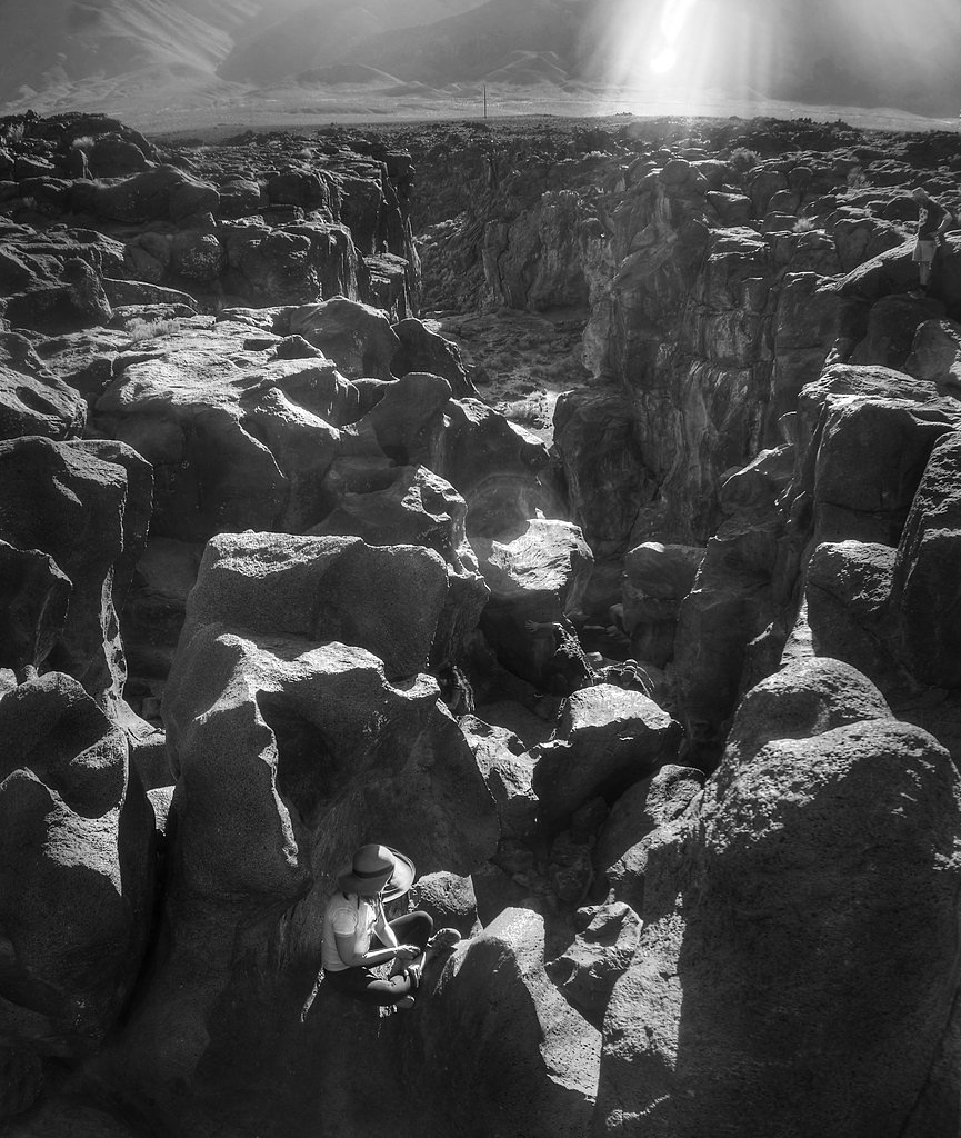
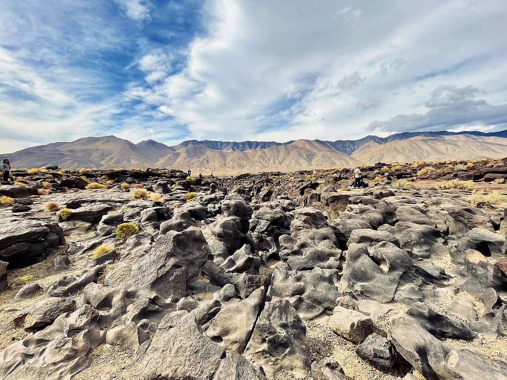
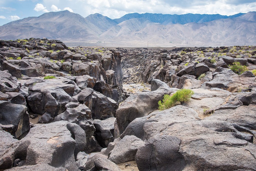
About Fossil Falls
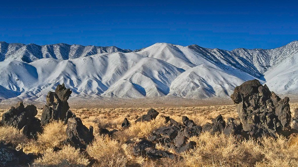
Fossil Falls sits in the Mojave Desert's Coso Range in Inyo County, California, a striking example of how fire and ice shaped the landscape. Volcanic activity left a bed of hard volcanic rock that was later sculpted by glacial meltwater from the Sierra Nevada, leaving a dry, channeled “waterfall” and a maze of smoothed potholes and sculpted basalt. The site is just outside the small community of Little Lake—about 1.0 mile off US 395 at a red cinder cone called Red Hill; follow Cinder Road toward Red Hill and watch for signs to Fossil Falls. Visiting is like stepping into a natural open-air gallery: there’s no flowing water today, but the dramatic channels, rippled rock surfaces, and stark desert setting make it a rewarding short outing for photographers, geology buffs, and families. Interpretive signs and established footpaths help guide visitors, and the usually-short visit pairs well with a drive along US 395 through this remote stretch of eastern California.
Trail & Hike Details
The Approach
The easy 0.6-mile out-and-back trail gains 100 feet of elevation on the way to the falls.
Trail Description
The trail to Fossil Falls is a short 0.6-mile out-and-back with about 100 feet of elevation gain, rated easy. The route crosses and follows exposed volcanic rock, so expect uneven surfaces and areas that require careful footing; the grade is generally gentle. The path is well-marked from the parking area reached via Cinder Road (signed from US 395 near Red Hill), making it a straightforward, family-friendly stroll to the dry waterfall and surrounding sculpted rock formations.
What to Expect
Dogs are welcome.
Accessibility
The trail is short and relatively flat, but the surface may be uneven. Contact the managing agency for accessibility details.
Frequently Asked Questions
🐶 Are Dogs Allowed at Fossil Falls?
✅ Dogs are allowed
Are There Any Fees or Permits Required?
🆖 No fees required
🏊 Is There Swimming at Fossil Falls?
❌ Swimming is not allowed
When to Visit
The best time to visit is during the cooler months of spring, fall, or winter. Summer visits are possible but can be very hot due to the desert climate.
Seasonal Access
The best time to visit is Spring, Fall, and Winter.
Safety Information
Be cautious when walking on the volcanic rock, as it can be sharp and uneven. Carry plenty of water, especially in hot weather, and watch for wildlife such as snakes.
Current Water Conditions
Based on a USGS gauge 21.8 miles away
31 ft³/s
Current discharge — how much water is flowing
About average for this time of year
Based on 98 years of record
3.22 ft
Water depth at gauge
7-Day Discharge Trend
What does this mean for your visit?
Flow is about average for this time of year.
About This Gauge
This gauge is on a regional waterway. Conditions at the falls may differ, especially after local rain.
7-Day Flow Outlook
Based on the USGS gauge SF KERN R NR ONYX CA (35 km away).
Today
Low
31 cfs
6/10Tomorrow
Low
30 cfs
6/10Fri
Low
28 cfs
6/10Sat
Low
27 cfs
6/10Sun
Low
26 cfs
6/10Mon
Low
26 cfs
6/10Tue
Low
25 cfs
6/10Best window: Today — low flow, sunny (trip score 6/10).
Best time of year: this gauge typically runs highest from early March to early June, peaking in April.
How we calculate this
This is a transparent outlook, not a precise forecast. We take the waterfall's current flow strength (how it ranks against its historical normal for today, from the nearest USGS stream gauge), carry that ranking forward along the gauge's seasonal curve, and nudge it for forecast rain. Confidence is highest for the next day or two and falls further out. Always check official conditions and your own judgment before visiting — high flows can be dangerous.
Know when to go.
Get a free email alert when waterfalls near Kennedy Meadows hit peak flow. We only send when conditions are worth the trip — no weekly newsletters, no spam.
Weather Forecast
Location & Access
Getting There
Fossil Falls is located off Highway 395, approximately 45 minutes south of Lone Pine, California. Look for the Fossil Falls turnoff and follow the signs to the parking area.
Get Directions on Google MapsParking
There is a designated parking area near the trailhead, which is accessible via a short dirt road. Parking is free.
Elevation
3,248 feet above sea level
Coordinates
35.969764° N, -117.909021° W
Visitor Tips & Gear
Wear sturdy shoes with good grip, as the volcanic rock can be uneven and sharp. Bring water and sun protection, as the area is exposed and can get very hot, especially in summer. Visit during cooler months for a more comfortable experience.
As an Amazon Associate, we earn from qualifying purchases.
For this easy 0.6 miles trail, lightweight trail shoes and a water bottle are usually sufficient. Icy conditions are common in winter — traction cleats are a smart addition.

Columbia Watertight II Rain Jacket
Packs into its own pocket, seam-sealed, and keeps you dry from spray and surprise rain.

Earth Pak Waterproof Dry Bag
Keeps your phone and gear dry when waterfall mist soaks everything else.

Waterproof Phone Pouch (AiRunTech)
Cheap insurance — take photos right next to the falls without killing your phone.

Kahtoola MICROspikes
Cult-favorite traction cleats that grip ice and wet rock — essential for winter waterfall hikes.

JOBY GorillaPod Starter Kit
Wraps around railings and rocks for long-exposure waterfall shots — no flat surface needed.

Polarized Sunglasses (Knockaround)
Cuts glare off the water so you actually see the falls — and your photos turn out better too.
Where to Stay

Whispering Pines Lodge

Corral Creek Lodge

Wofford Village Studios

Sequoia Lodge
Browse vacation cabins and private rentals nearby
Unique outdoor stays — tents, yurts, and treehouses
Rent a campervan or RV for your waterfall road trip
Some links are affiliate links. We may earn a commission at no extra cost to you.
Nearby Campground
Chimney Creek Campground
11.7 miles away · 0 sites
Chimney Creek Campground is located within Chimney Peak Recreation Area and is cherry stemmed out of Owens Peak Wilderness. The campground contains 36 sites and is nestled among beautiful pinyon pines, grey pines, and oaks along Chimney Creek at 5,700 feet in elevation. Each site in the campground has a picnic table and fire ring. Potable water is available during the summer months near the very end of the campground loop at site 36. During the summer, days can be warm and dry. The Pacific Crest
Book on Recreation.govNearby Hot Springs
Hot springs near Kennedy Meadows, California

Unnamed Spring Kern County 1
An 80-degree spring rises at 3,200 feet in the Mojave Desert's high country, 15.5 degrees warmer than the surrounding air, acce...
Fumarole
Fumarole emerges at an extraordinary 203°F within the restricted Naval Air Weapons Station China Lake at 4,280 feet elevation, ...
Devils Kitchen
Devils Kitchen emerges at an extreme 207°F from volcanic terrain within Naval Air Weapons Station China Lake, featuring some of...

Coso Hot Springs
Coso Hot Springs surges from the earth at an extreme 207°F (97°C) within the Coso Volcanic Field, representing one of Californi...

Dirty Socks Hot Spring
Dirty Socks Hot Spring emerges at 93°F from the Owens Valley floor, named for the distinctive sulfurous odor that has defined t...
Soda Springs
Soda Springs flows at 100°F in the high Sierra Nevada at 7,857 feet elevation, delivering water 54.5 degrees warmer than the fr...
Looking for a soak after your hike? Explore more hot springs near Kennedy Meadows, California on SoakingSprings.
Explore California springsAdditional Information
Nearby Attractions
Nearby attractions include the Alabama Hills, Red Rock Canyon State Park, and the town of Lone Pine.
Wildlife
The area is home to desert wildlife such as lizards, birds, and small mammals. Be cautious of snakes, especially during warmer months.
Cities near Fossil Falls
Writing about Fossil Falls? Embed this waterfall on your site for free.