
Fish Ladder
By Armen Suny · Last verified Oct 2026
3D terrainBefore you go
No road access: reach the Bakewell Lake trailhead by boat or float plane from Ketchikan, and there is no mooring buoy.


Photo Credits (3)
Trail Type
Out And Back
About Fish Ladder
This fish ladder and waterfall are on the 1-mile Bakewell Lake Trail, which links Bakewell Arm of Smeaton Bay to Bakewell Lake in Misty Fjords National Monument Wilderness, about 40 air miles east of Ketchikan. The Forest Service lists a fish ladder and a 40-foot waterfall as the trail's highlights. Sockeye, pink, chum and coho salmon run to the lake from July through September. There is no road access.
Trail & Hike Details
Trail Description
The Bakewell Lake Trail runs about 1 mile between saltwater at Bakewell Arm and the north end of Bakewell Lake, passing the fish ladder and a 40-foot waterfall. The trail does not continue to Bakewell Lake Cabin, which is about 2 miles down the lake.
What to Expect
Dogs are welcome.
Accessibility
Not accessible to people with limited mobility; access is by boat or float plane and a primitive trail.
Frequently Asked Questions
🐶 Are Dogs Allowed at Fish Ladder?
✅ Dogs are allowed
Dogs are allowed on Tongass National Forest land; keep them under control in brown bear country.
Are There Any Fees or Permits Required?
🆖 No fees required
🏊 Is There Swimming at Fish Ladder?
❌ Swimming is not allowed
When to Visit
July through September, when salmon run to Bakewell Lake.
Seasonal Access
The best time to visit is Spring, Summer, and Fall. Winter access may be limited.
Safety Information
The area has a large brown bear population, especially during salmon runs; carry bear protection and make noise.
Current Water Conditions
Based on a USGS gauge 22.4 miles away
742 ft³/s
Current discharge — how much water is flowing
About average for this time of year
Based on 109 years of record
2.16 ft
Water depth at gauge
7-Day Discharge Trend
What does this mean for your visit?
Flow is about average for this time of year.
About This Gauge
This gauge is on a regional waterway. Conditions at the falls may differ, especially after local rain.
7-Day Flow Outlook
Based on the USGS gauge FISH C NR KETCHIKAN AK (36 km away).
Today
Barely Flowing
742 cfs
5/10Tomorrow
Barely Flowing
772 cfs
5/10Sun
Barely Flowing
745 cfs
5/10Mon
Barely Flowing
725 cfs
5/10Tue
Barely Flowing
672 cfs
5/10Wed
Barely Flowing
675 cfs
5/10Thu
Low
723 cfs
4/10Best window: Today — barely flowing flow, partly sunny (trip score 5/10).
Best time of year: this gauge typically runs highest from late September to early November, peaking in October.
How we calculate this
This is a transparent outlook, not a precise forecast. We take the waterfall's current flow strength (how it ranks against its historical normal for today, from the nearest USGS stream gauge), carry that ranking forward along the gauge's seasonal curve, and nudge it for forecast rain. Confidence is highest for the next day or two and falls further out. Always check official conditions and your own judgment before visiting — high flows can be dangerous.
Know when to go.
Get a free email alert when waterfalls near Saxman hit peak flow. We only send when conditions are worth the trip — no weekly newsletters, no spam.
Weather Forecast
The Terrain Around Fish Ladder
High-resolution lidar hasn't been flown here yet, so this is the aerial view of the ground around the falls. Open the 3D view to tilt and spin the landscape.
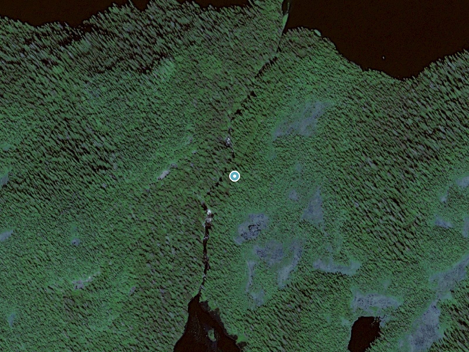
The dot marks the waterfall. The frame is about a mile across.
Aerial imagery: USGS The National Map. Public domain.
Location & Access
Getting There
Reach the Bakewell Lake trailhead on Bakewell Arm of Smeaton Bay by boat or float plane from Ketchikan. There is no mooring buoy at the trailhead. Helicopter access is illegal in this wilderness.
Get Directions on Google MapsParking
No road or parking; access is by boat or float plane only.
Elevation
154 feet above sea level
Coordinates
55.293056° N, -130.651944° W
Visitor Tips & Gear
Arrange boat or float plane transport from Ketchikan in advance. Bring your own supplies and treat any water from streams.
Where to Stay
Browse vacation cabins and private rentals nearby
Unique outdoor stays — tents, yurts, and treehouses
Rent a campervan or RV for your waterfall road trip
Some links are affiliate links. We may earn a commission at no extra cost to you.
Nearby Campground
BAKEWELL LAKE CABIN
2.1 miles away · 1 sites
Overview Bakewell Lake Cabin is located on the mainland, near the Bakewell Arm of Smeaton Bay. It is within the Misty Fjords National Monument Wilderness and is an ideal retreat for families with kids or anyone who enjoys relaxing days on the beach. The cabin also offers the chance to enjoy a variety of recreational activities and sightseeing year-round.The site can be accessed by float plane or by boating into Smeaton Bay and then canoeing or kayaking two miles to the cabin. Guests are responsib
Book on Recreation.govNearby Hot Springs
Hot springs near Fish Ladder, Alaska
Bell Island Hot Springs
Bell Island Hot Springs discharge at an impressive 165 degrees Fahrenheit from the Cleveland Peninsula north of Ketchikan, emer...
Bailey Hot Spring
Bailey Hot Spring discharges at a scalding 198 degrees Fahrenheit from the remote Tongass National Forest, maintaining temperat...
Looking for a soak after your hike? Explore more hot springs near Fish Ladder, Alaska on SoakingSprings.
Explore Alaska springsAdditional Information
Nearby Attractions
Bakewell Lake Cabin, a Forest Service rental cabin about 2 miles down the lake, and the rest of Misty Fjords National Monument.
Wildlife
Brown bears, Sitka black-tailed deer, beavers, otters, eagles and loons live in the area, and wolves are sometimes heard.
Writing about Fish Ladder? Embed this waterfall on your site for free.