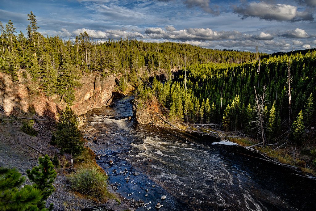
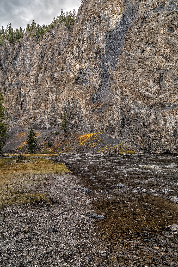
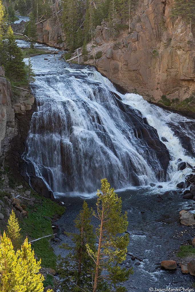
Firehole Falls
Wyoming • 40 ft
By Armen Suny · Last verified Mar 2026
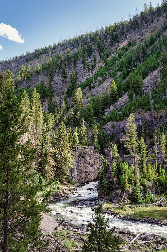
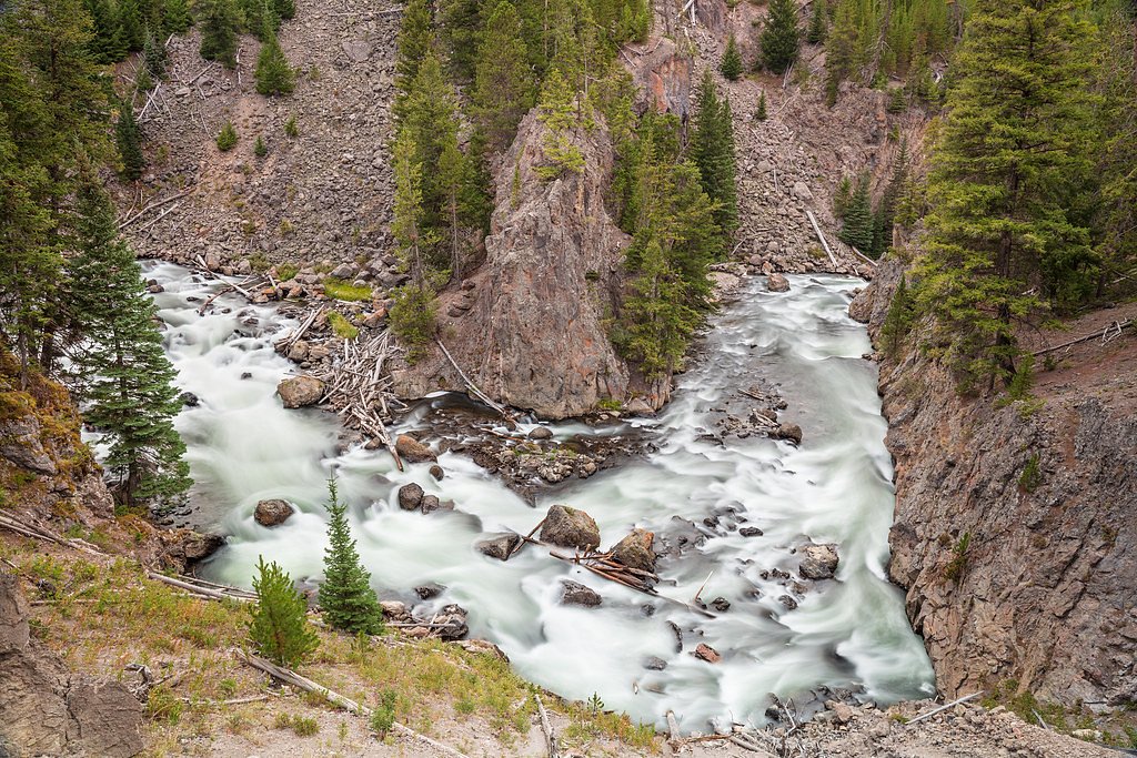

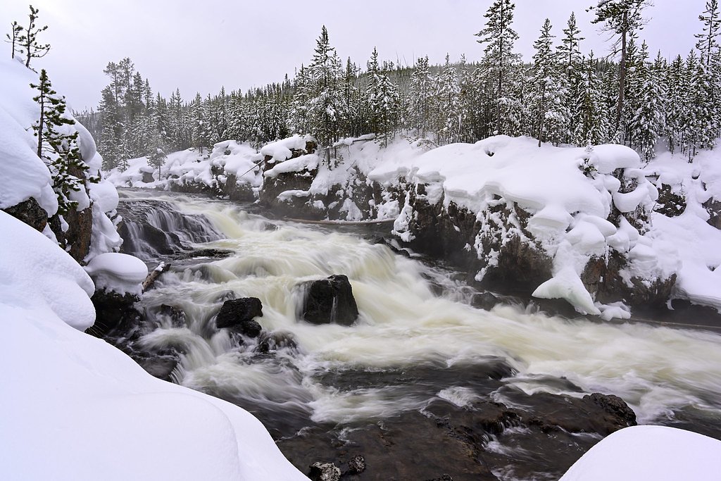

Photo Credits (5)
Difficulty
Easy
Trail Length
0.6 miles
Trail Type
Out And Back
Elevation Gain
100 ft
About Firehole Falls
Firehole Falls is a picturesque waterfall located on the Firehole River in Yellowstone National Park, Wyoming. It is a popular roadside attraction known for its scenic beauty and accessibility. The falls cascade approximately 40 feet over volcanic rock formations, creating a stunning natural feature.
The Setting
Firehole Falls sits at 6,890 feet within Yellowstone National Park, fed by the Gibbon River, in the high mountains of Wyoming. The falls drop 40 feet.
Height: 40 feet
Nearby Falls Worth Visiting
Fairy Falls (200 ft) lies 7.4 miles to the south. Also nearby: Gibbon Falls (84 ft, 4.9 mi).
Trail & Hike Details
The Approach
The easy 0.6-mile out-and-back trail gains 100 feet of elevation on the way to the falls.
Trail Description
No hiking is required to view Firehole Falls, as it is visible from the roadside along Firehole Canyon Drive. Visitors can stop at designated pullouts to enjoy the view and take photographs.
What to Expect
The falls drop 40 feet.
Accessibility
The trail is short and relatively flat, but the surface may be uneven. Contact the managing agency for accessibility details.
Frequently Asked Questions
🐶 Are Dogs Allowed at Firehole Falls?
❌ Dogs are not allowed
Are There Any Fees or Permits Required?
🤑 Fee: $35.00
🏊 Is There Swimming at Firehole Falls?
❌ Swimming is not allowed
When to Visit
The best time to visit Firehole Falls is during the late spring, summer, and early fall when the Firehole Canyon Drive is open. The falls are particularly beautiful in the spring when water flow is at its peak.
Seasonal Access
The best time to visit is Spring, Summer, Fall, and Winter. Check the National Park Service website for current conditions.
Safety Information
Be cautious when stopping along the road, as traffic can be heavy. Stay on designated pullouts and avoid walking on the road. Wildlife is common in the area, so remain vigilant and do not approach animals.
Current Water Conditions
87 ft³/s
Current discharge — how much water is flowing
Much lower than usual for this time of year
Based on 24 years of record
4.69 ft
Water depth at gauge
64°F
CoolRefreshing for swimming
7-Day Discharge Trend
What does this mean for your visit?
Flow is well below normal for this time of year, so the waterfall may be a trickle. Water temperature is a refreshing 64 degrees F, good for a quick swim.
About This Gauge
7-Day Flow Outlook
Based on the USGS gauge Gibbon River at Madison Jct, YNP (1 km away).
Today
Moderate
99 cfs
4/10Tomorrow
Moderate
103 cfs
4/10Fri
Moderate
103 cfs
4/10Sat
Moderate
99 cfs
4/10Sun
Moderate
103 cfs
4/10Mon
Moderate
102 cfs
4/10Tue
Moderate
88 cfs
8/10Best window: Tue — moderate flow, sunny (trip score 8/10).
Best time of year: this gauge typically runs highest from mid April to mid July, peaking in May.
How we calculate this
This is a transparent outlook, not a precise forecast. We take the waterfall's current flow strength (how it ranks against its historical normal for today, from the nearest USGS stream gauge), carry that ranking forward along the gauge's seasonal curve, and nudge it for forecast rain. Confidence is highest for the next day or two and falls further out. Always check official conditions and your own judgment before visiting — high flows can be dangerous.
Know when to go.
Get a free email alert when waterfalls near West Yellowstone hit peak flow. We only send when conditions are worth the trip — no weekly newsletters, no spam.
Weather Forecast
Location & Access
Getting There
Firehole Falls is located along the Firehole Canyon Drive, a one-way road off the Grand Loop Road in Yellowstone National Park. The drive is easily accessible by car and is well-marked with signs.
Get Directions on Google MapsParking
There is a small parking area near the falls along Firehole Canyon Drive. Parking may be limited during peak seasons.
Elevation
6,890 feet above sea level
Coordinates
44.630766° N, -110.864379° W
Land Management
Managed by NPS
Visitor Tips & Gear
Visit early in the morning or later in the afternoon to avoid crowds. Be cautious when parking and exiting your vehicle, as the road can be narrow and busy during peak times.
This trail sits at 6,890 ft above sea level
Elevated TrailUV radiation is roughly 28% stronger at this elevation than at sea level, and the dry air accelerates dehydration. Extra sun protection and fluids go a long way.
As an Amazon Associate, we earn from qualifying purchases.

Coppertone Sport SPF 50 Sunscreen
UV intensity jumps ~4% per 1,000 ft — at this elevation you can burn in half the time.

Sun Bum SPF 30 Lip Balm (3-Pack)
Lips have almost no natural UV protection and burn fast in thin, dry mountain air.

Liquid I.V. Electrolyte Packets
You lose moisture ~2x faster at elevation — electrolytes help you absorb water efficiently.

ROCKNIGHT Polarized UV400 Sunglasses
High-altitude glare off rock and water is intense — UV400 lenses block 99%+ of UVA/UVB.
As an Amazon Associate, we earn from qualifying purchases.
For this easy 0.6 miles trail, lightweight trail shoes and a water bottle are usually sufficient. Icy conditions are common in winter — traction cleats are a smart addition.
America the Beautiful Annual Pass
Covers entrance fees at 2,000+ federal recreation sites — required at most National Parks.

Columbia Watertight II Rain Jacket
Packs into its own pocket, seam-sealed, and keeps you dry from spray and surprise rain.

Polarized Sunglasses (Knockaround)
Cuts glare off the water so you actually see the falls — and your photos turn out better too.

Earth Pak Waterproof Dry Bag
Keeps your phone and gear dry when waterfall mist soaks everything else.

Waterproof Phone Pouch (AiRunTech)
Cheap insurance — take photos right next to the falls without killing your phone.

Kahtoola MICROspikes
Cult-favorite traction cleats that grip ice and wet rock — essential for winter waterfall hikes.

JOBY GorillaPod Starter Kit
Wraps around railings and rocks for long-exposure waterfall shots — no flat surface needed.
Where to Stay

Yellowstone Lodge

Clubhouse Inn

Yellowstone West Gate Hotel

Explorer Cabins at Yellowstone
Browse vacation cabins and private rentals nearby
Unique outdoor stays — tents, yurts, and treehouses
Rent a campervan or RV for your waterfall road trip
Some links are affiliate links. We may earn a commission at no extra cost to you.
Nearby Campground
Hebgen Lake District
11.8 miles away · 0 sites
The Hebgen Lake district encompasses the soutwest portion of Custer Gallatin National Forest stretching down the west boundary of Yellowstone National Park. West Yellowstone, MT is included. Hebgen Lake covers the central part of the district.
Book on Recreation.govNearby Hot Springs
Hot springs near West Yellowstone, Wyoming
Flat Cone Spring, Steep Cone
Flat Cone Spring flows at 205 degrees Fahrenheit, among the hottest features in Yellowstone's inventory, paired with Steep Cone...
Queens Laundry
Queens Laundry flows at 192 degrees Fahrenheit—156 degrees above ambient—in Yellowstone's backcountry, requiring a 2.7-kilomete...

Springs On Fairy Creek
Springs on Fairy Creek emerges in Yellowstone National Park's Lower Geyser Basin at 7,217 feet elevation, requiring a 2.2-kilom...

Fairy Springs
Fairy Springs flows at 201 degrees Fahrenheit within Yellowstone National Park's Lower Geyser Basin, distinguished by its extre...

River Group
River Group in Yellowstone's Lower Geyser Basin produces waters at 205 degrees Fahrenheit—169 degrees above the 36-degree ambie...

River Group
River Group emerges at 196 degrees Fahrenheit—159 degrees above ambient—at 7,191 feet elevation in Yellowstone National Park, a...
Looking for a soak after your hike? Explore more hot springs near West Yellowstone, Wyoming on SoakingSprings.
Explore Wyoming springsAdditional Information
Nearby Attractions
Other attractions in the area include the Firehole Swimming Area, Fountain Paint Pot, and the Grand Prismatic Spring.
Wildlife
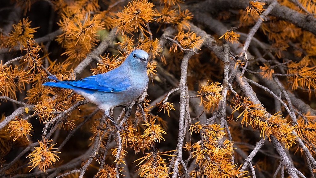
Visitors may spot wildlife such as bison, elk, and various bird species in the surrounding area. Always maintain a safe distance from wildlife.
Cities near Firehole Falls
Nearby Waterfalls
Writing about Firehole Falls? Embed this waterfall on your site for free.