

Photo Credits (5)
Difficulty
Hard
Trail Length
8.6 miles
Trail Type
Out And Back
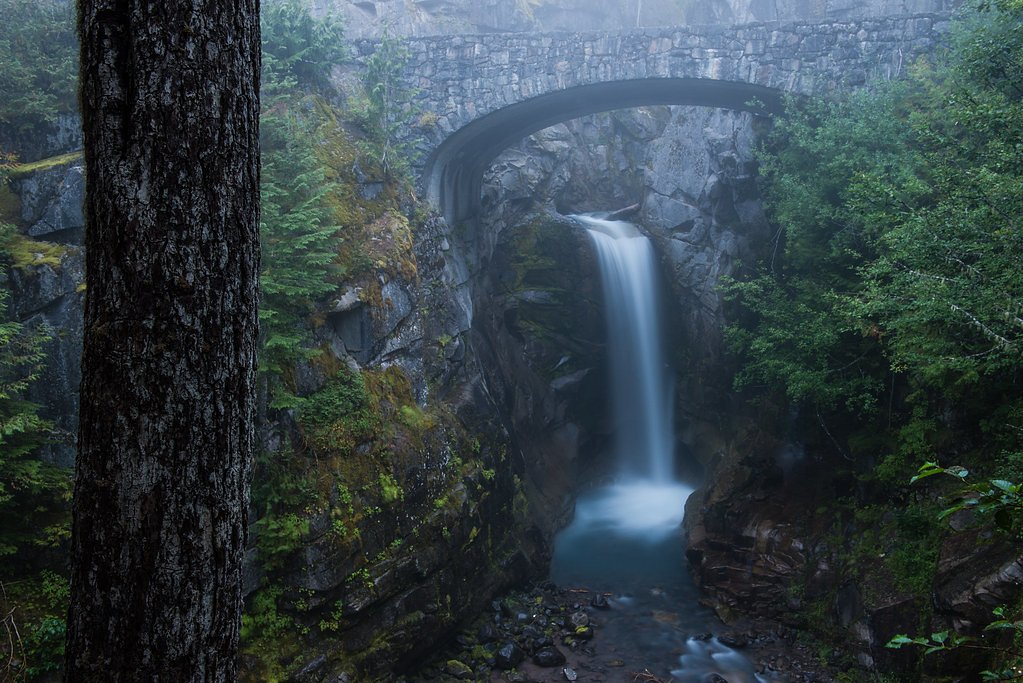
About Feather Falls
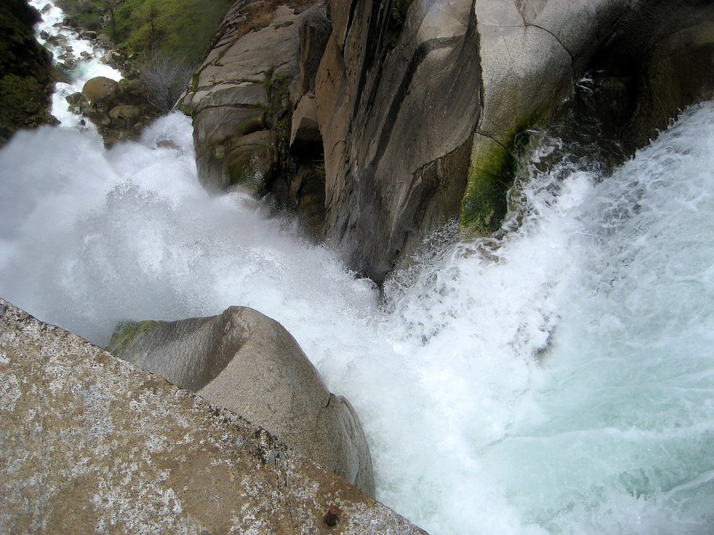
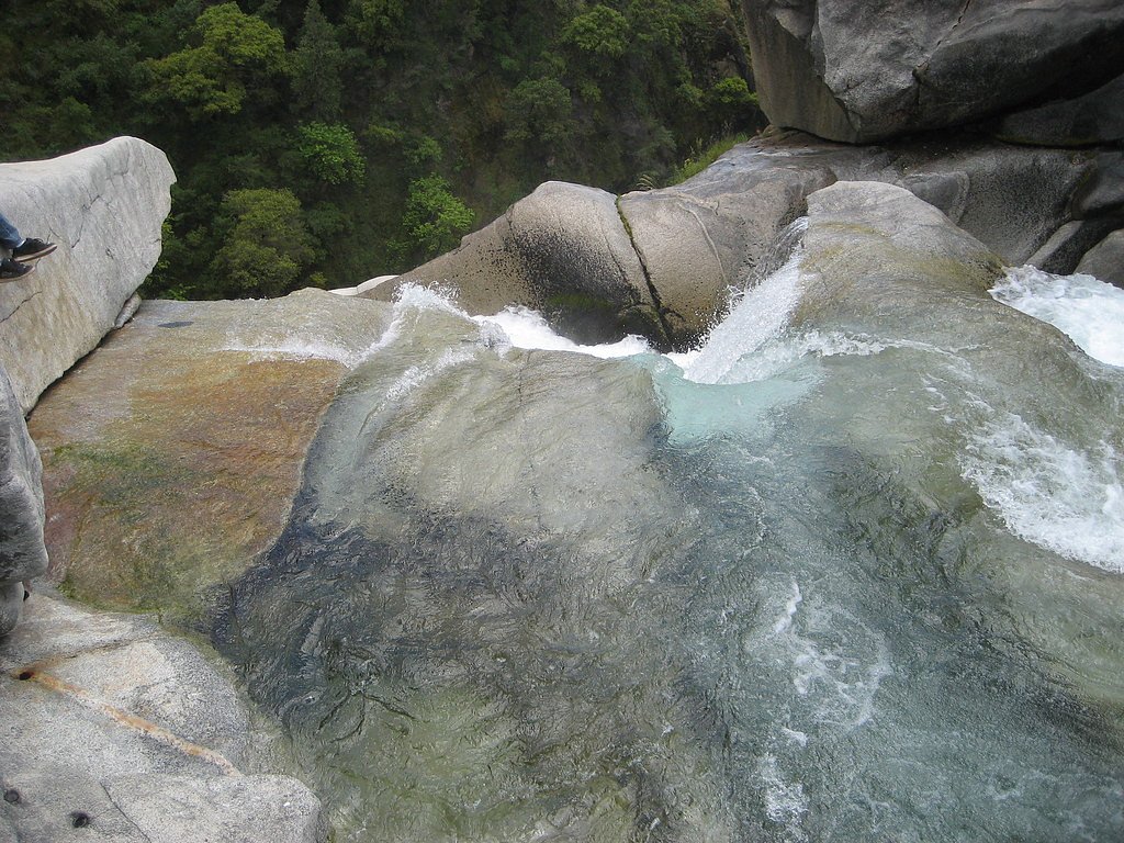
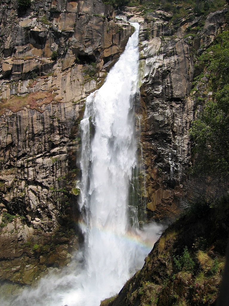
Feather Falls is a stunning 410-foot waterfall located in Plumas National Forest, California. It is one of the tallest waterfalls in the state and is known for its breathtaking views and lush surroundings.
The Setting
Feather Falls sits at 1,634 feet within Plumas National Forest, in the hills of California. At 410 feet, it is among the taller waterfalls in California.
Height: 410 feet
Trail & Hike Details
The Approach
The hard hike follows Feather Falls Lower (#6E33A), a 8.6-mile out-and-back trail over natural surface. The trail is highly developed (Class 4).
USFS Trail
FEATHER FALLS LOWER #6E33A
Trail Class
Highly Developed
Surface
Avg Grade
USFS Segment
0.10 miTrail Description
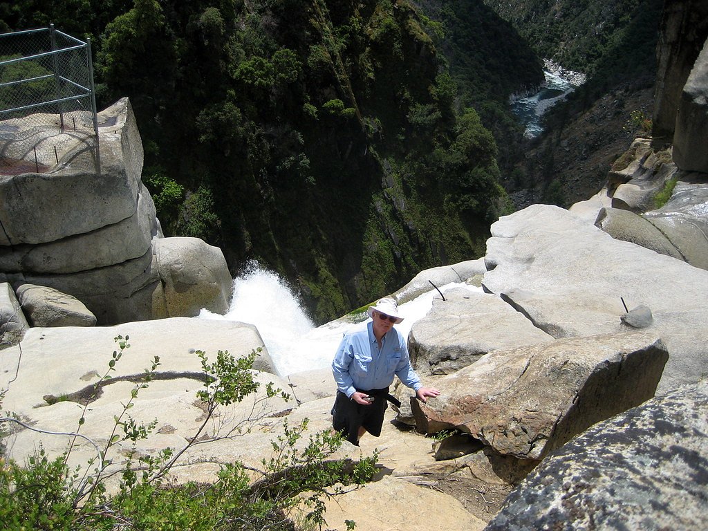
The Feather Falls Trail is a well-maintained loop trail that offers two routes: a shorter but steeper path and a longer, more gradual path. Both routes lead to a viewing platform with spectacular views of the waterfall. The trail passes through dense forest and offers opportunities to see wildflowers and wildlife.
What to Expect
The falls plunge a dramatic 410 feet. Dogs are welcome.
Accessibility
The trail involves steep, uneven terrain with significant elevation change and is not accessible to mobility devices.
Frequently Asked Questions
🐶 Are Dogs Allowed at Feather Falls?
✅ Dogs are allowed
Are There Any Fees or Permits Required?
🆖 No fees required
🏊 Is There Swimming at Feather Falls?
❌ Swimming is not allowed
When to Visit
Spring and fall are the best times to visit Feather Falls, as the weather is mild and the waterfall flow is typically at its peak during spring due to snowmelt.
Seasonal Access
The best time to visit is Spring and Fall. Winter access may be limited. Check with Plumas National Forest for seasonal road closures.
Safety Information
The trail can be slippery after rain, and there are steep drop-offs near the viewing platform. Stay on marked trails and supervise children closely. Carry enough water to stay hydrated, especially during warmer months.
Know when to go.
Get a free email alert when waterfalls near Forbestown hit peak flow. We only send when conditions are worth the trip — no weekly newsletters, no spam.
Weather Forecast
Location & Access
Getting There
Feather Falls is located in Plumas National Forest, approximately 30 miles from Oroville, California. The trailhead can be accessed via Lumpkin Road. Follow signs for Feather Falls Scenic Area.
Get Directions on Google MapsParking
There is a designated parking area at the Feather Falls Trailhead. Parking is free, but it may fill up quickly during peak seasons.
Elevation
1,634 feet above sea level
Coordinates
39.643098° N, -121.274375° W
Land Management
Managed by USFS
Visitor Tips & Gear
Start your hike early to avoid crowds and ensure you have enough daylight to complete the trail. Wear sturdy hiking shoes, bring plenty of water, and pack snacks. Check weather conditions before your visit, as the trail can become slippery after rain.
Where to Stay

Little House in the Big Woods

Hampton Inn & Suites Oroville

Doubletree By Hilton Chico, Ca

Quality Inn Near Chico State
Browse vacation cabins and private rentals nearby
Unique outdoor stays — tents, yurts, and treehouses
Rent a campervan or RV for your waterfall road trip
Some links are affiliate links. We may earn a commission at no extra cost to you.
Nearby Campground
Garden Point Boat-in Campground
16.6 miles away · 16 sites
Overview Bullards Bar Reservoir is located on the North Yuba River at an elevation of 2000 feet. It is located approximately 21 miles north of Nevada City, California. It has a maximum surface area of 4,760 acres and a length of over 16 miles and shoreline of more than 60 miles. Recreation This is a boat-in campground. You can not drive to this campground. You must launch a boat a Dark Day boat launch and boat to the campground. Activities include wildlife viewing, hiking, mountain biking, horseb
Book on Recreation.govNearby Hot Springs
Hot springs near Forbestown, California
Spring
This thermal spring emerges at 99°F along the Feather River Highway in Plumas County, delivering water 44 degrees warmer than a...
Mclear Warm Springs
McLear Warm Springs flows at 86°F in the high Sierra Nevada near Portola, generating a remarkable 36.5-degree temperature rise ...
Indian Valley Hot Springs
Indian Valley Hot Springs flows at 106 degrees Fahrenheit from the Sierra Nevada foothills at 3,900 feet elevation, with a 53-d...
Campbell Hot Springs
Campbell Hot Springs produces 111-degree water near Sierraville at modest elevation with low mineral content and nearby campgro...
Marble Hot Springs
Marble Hot Springs sits at 4,883 feet elevation in the northern Sierra Nevada, just 59 feet from Marble Hot Springs Road near P...
Tuscan Springs
Tuscan Springs flows at 86°F in Tehama County near Red Bluff, with borax-impregnated waters chemically similar to the famous sp...
Looking for a soak after your hike? Explore more hot springs near Forbestown, California on SoakingSprings.
Explore California springsAdditional Information
Nearby Attractions
Lake Oroville, Bald Rock Dome, and the Oroville Dam are popular nearby attractions.
Wildlife
The area is home to deer, squirrels, various bird species, and occasionally black bears. Keep an eye out for wildlife along the trail.
Cities near Feather Falls
Nearby Waterfalls
Writing about Feather Falls? Embed this waterfall on your site for free.