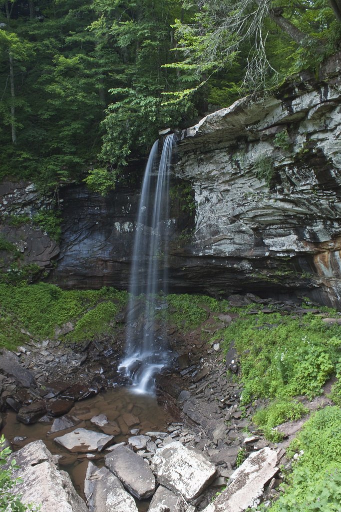
Falls of Hills Creek
West Virginia • 63 ft
By Armen Suny · Last verified Mar 2026
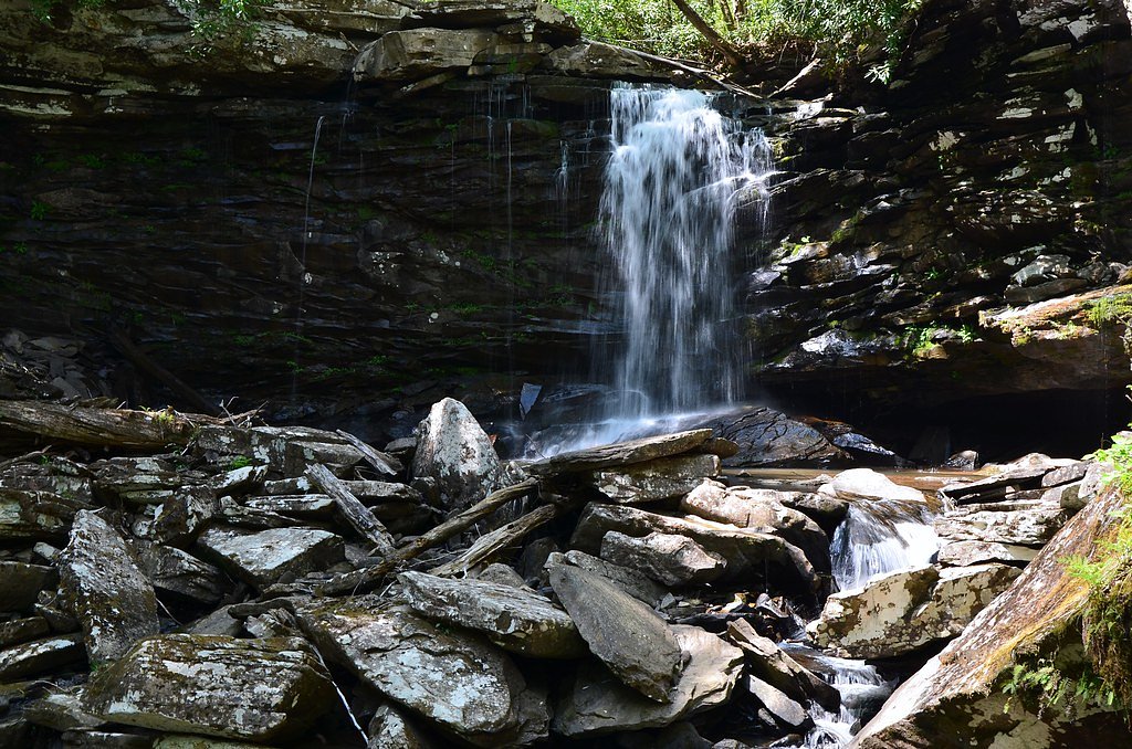
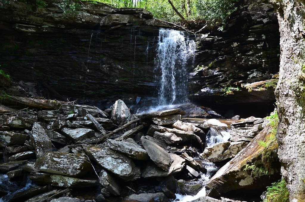
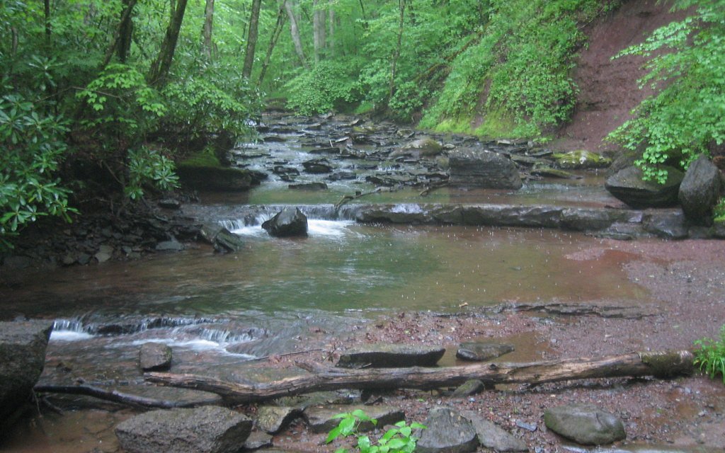
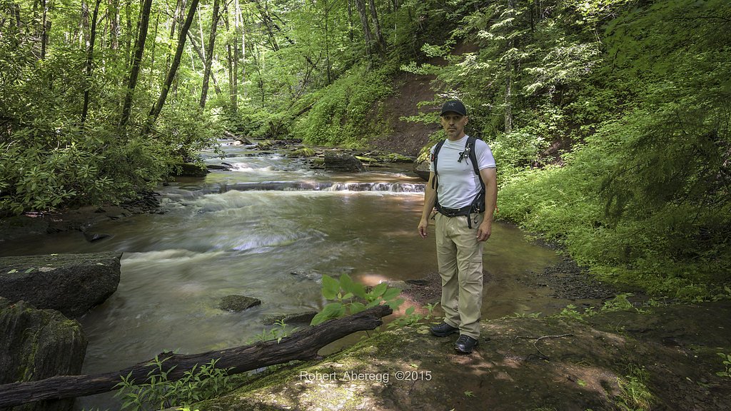
Photo Credits (5)
Difficulty
Moderate
Trail Length
1.3 miles
Trail Type
Out And Back
Elevation Gain
200 ft
About Falls of Hills Creek
The Falls of Hills Creek is a series of three stunning waterfalls located in the Monongahela National Forest in West Virginia. The area is known for its lush forest surroundings and well-maintained trails that lead visitors to the upper, middle, and lower falls. The lower falls, the tallest of the three, is particularly impressive.
The Setting
Falls of Hills Creek sits at 3,205 feet within Monongahela National Forest, fed by the Greenbrier River, in the mountains of West Virginia. The falls drop 63 feet.
Height: 63 feet
Trail & Hike Details
The Approach
The moderate hike follows Falls Of Hills Creek Trail (#249), a 1.3-mile out-and-back trail over other. Expect 200 feet of elevation gain with grades of 10-12%. The trail is highly developed (Class 4).
USFS Trail
FALLS OF HILLS CREEK TRAIL #249
Trail Class
Highly Developed
Surface
Avg Grade
USFS Segment
0.20 miTrail Description
The trail to the Falls of Hills Creek is a combination of paved paths, boardwalks, and stairs. The first 0.2 miles to the upper falls is paved and wheelchair accessible. Beyond this point, the trail becomes steeper and includes stairs leading to the middle and lower falls. The lower falls, at 63 feet, is the most dramatic and requires descending a significant number of stairs.
What to Expect
The falls drop 63 feet. Dogs are welcome.
Accessibility
The trail is not wheelchair accessible. Uneven terrain and elevation changes require steady footing.
Frequently Asked Questions
🐶 Are Dogs Allowed at Falls of Hills Creek?
✅ Dogs are allowed
Are There Any Fees or Permits Required?
🆖 No fees required
🏊 Is There Swimming at Falls of Hills Creek?
❌ Swimming is not allowed
When to Visit
Spring and early summer are ideal for visiting, as the waterfalls are typically at their fullest due to snowmelt and rainfall. Fall offers beautiful foliage, while winter may provide a chance to see the falls partially frozen.
Seasonal Access
The best time to visit is Spring, Summer, and Fall. Winter access may be limited. Check with Monongahela National Forest for seasonal road closures.
Safety Information
The stairs to the lower falls can be steep and slippery, especially after rain. Exercise caution and use handrails where available. Stay on designated trails and do not climb on rocks near the waterfalls, as they can be very slippery.
Current Water Conditions
364 ft³/s
Current discharge — how much water is flowing
About average for this time of year
Based on 96 years of record
2.79 ft
Water depth at gauge
7-Day Discharge Trend
What does this mean for your visit?
Flow is about average for this time of year.
About This Gauge
This gauge is on a nearby waterway and may not reflect exact conditions at the falls.
7-Day Flow Outlook
Based on the USGS gauge GREENBRIER RIVER AT BUCKEYE, WV (18 km away).
Today
Roaring
415 cfs
6/10Tomorrow
Roaring
384 cfs
6/10Thu
Strong
357 cfs
10/10Fri
Strong
328 cfs
10/10Sat
Roaring
411 cfs
6/10Sun
Roaring
386 cfs
6/10Mon
Roaring
409 cfs
6/10Best window: Thu — strong flow, mostly sunny (trip score 10/10).
Best time of year: this gauge typically runs highest from mid February to late April, peaking in March.
How we calculate this
This is a transparent outlook, not a precise forecast. We take the waterfall's current flow strength (how it ranks against its historical normal for today, from the nearest USGS stream gauge), carry that ranking forward along the gauge's seasonal curve, and nudge it for forecast rain. Confidence is highest for the next day or two and falls further out. Always check official conditions and your own judgment before visiting — high flows can be dangerous.
Know when to go.
Get a free email alert when waterfalls near Hillsboro hit peak flow. We only send when conditions are worth the trip — no weekly newsletters, no spam.
Weather Forecast
Location & Access
Getting There
The Falls of Hills Creek is located off WV Route 39/55, approximately 5 miles west of the Cranberry Mountain Nature Center. A well-marked parking area provides access to the trailhead.
Get Directions on Google MapsParking
A designated parking lot is available at the trailhead, with ample space for visitors.
Elevation
3,205 feet above sea level
Coordinates
38.173729° N, -80.335076° W
Land Management
Managed by USFS
Visitor Tips & Gear
Wear sturdy shoes, as the trail can be slippery, especially after rain. Bring water and take breaks if needed when climbing the stairs. Visit early in the day to avoid crowds, especially during peak seasons.
As an Amazon Associate, we earn from qualifying purchases.
With 1.3 miles and 200 ft of elevation gain, sturdy boots and trekking poles will help on this moderate trail. Sun exposure on the trail makes good sun protection a must in summer.

Polarized Sunglasses (Knockaround)
Cuts glare off the water so you actually see the falls — and your photos turn out better too.

Columbia Watertight II Rain Jacket
Packs into its own pocket, seam-sealed, and keeps you dry from spray and surprise rain.

Earth Pak Waterproof Dry Bag
Keeps your phone and gear dry when waterfall mist soaks everything else.

Waterproof Phone Pouch (AiRunTech)
Cheap insurance — take photos right next to the falls without killing your phone.

Timberland Euro Sprint Mid Waterproof
Trusted waterproof boot with premium leather and grippy rubber sole — reliable on rocky, wet trails.

TrailBuddy Trekking Poles
Lightweight aluminum, cork grips, and flip-locks that actually hold — a best-seller for good reason.
Where to Stay

Smiths In-law suite! Pet friendly! Hot Tub!

2 Mi to Green Bank Observatory! Mtn-View Cabin

Moore House Inn & Cabins

La Quinta Inn & Suites - New River Gorge National Park
Browse vacation cabins and private rentals nearby
Unique outdoor stays — tents, yurts, and treehouses
Rent a campervan or RV for your waterfall road trip
Some links are affiliate links. We may earn a commission at no extra cost to you.
Nearby Campground
Gauley Ranger District
7.8 miles away · 0 sites
The Gauley Ranger District is located in Richwood, WV.
Book on Recreation.govNearby Hot Springs
Hot springs near Hillsboro, West Virginia
Minnehaha Springs
Minnehaha Springs flows at 70°F from a roadside location just 27.5 meters from State Route 92 in Pocahontas County, West Virgin...

Warm Springs
Warm Springs flows at 95 degrees Fahrenheit, producing water 43.7 degrees above ambient temperature at 2,335 feet elevation in ...
Sweet Chalybeate Spring
Sweet Chalybeate Spring flows at 75 degrees Fahrenheit, emerging 21.1 degrees above ambient temperature at 2,010 feet elevation...

Hot Springs
Hot Springs produces 106-degree water that flows 54.4 degrees above ambient temperature at 2,298 feet elevation in Bath County,...
Layton Spring
Layton Spring produces 72-degree water that flows 17.2 degrees above ambient temperature at 1,334 feet elevation in the City of...
Bolar Spring
Bolar Spring flows at 73°F near Warm Springs in Bath County, Virginia, emerging 22 degrees above the 51°F ambient temperature a...
Looking for a soak after your hike? Explore more hot springs near Hillsboro, West Virginia on SoakingSprings.
Explore West Virginia springsAdditional Information
Nearby Attractions
Cranberry Glades Botanical Area, Cranberry Mountain Nature Center, and the Highland Scenic Highway.
Wildlife
The area is home to a variety of wildlife, including deer, black bears, and numerous bird species. Visitors may also see unique plant life, such as ferns and mosses.
Cities near Falls of Hills Creek
Writing about Falls of Hills Creek? Embed this waterfall on your site for free.