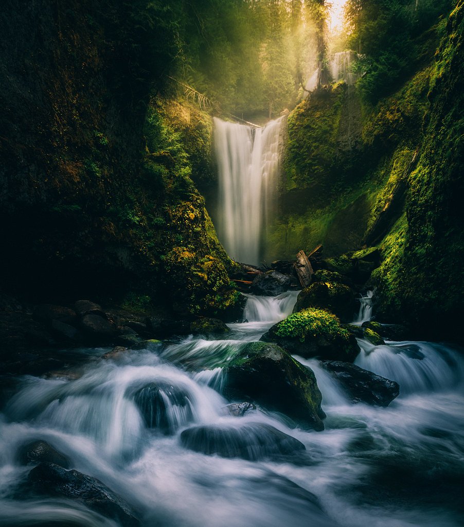
Falls Creek Falls
By Armen Suny · Last verified Mar 2026
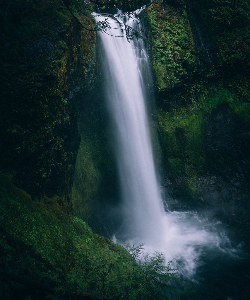
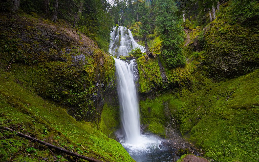
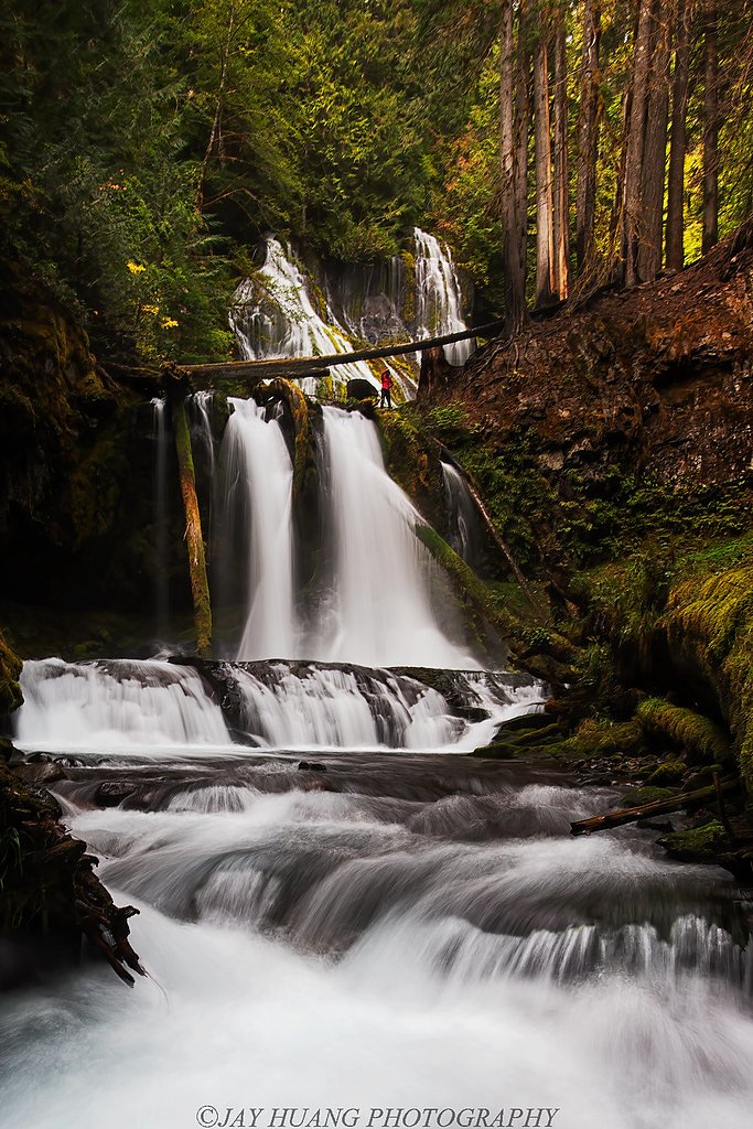
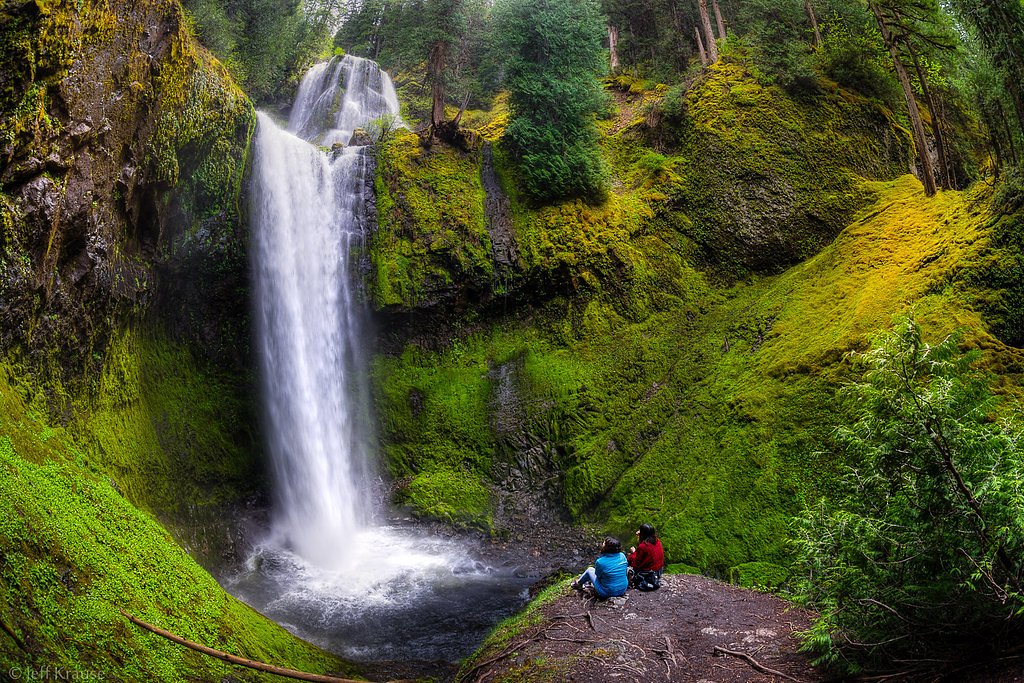
Photo Credits (5)
Difficulty
Moderate
Trail Length
2.5 miles
Trail Type
Out And Back
Elevation Gain
500 ft
About Falls Creek Falls
Falls Creek Falls is a picturesque waterfall located in the Okanogan-Wenatchee National Forest near Winthrop, Washington. It is a multi-tiered waterfall surrounded by lush forest, making it a popular destination for hikers and nature enthusiasts.
The Setting
Falls Creek Falls sits at 2,470 feet within Okanogan National Forest, fed by the Methow River, in the hills of Washington.
Trail & Hike Details
The Approach
The moderate hike follows Falls Creek Falls (#518.1), a 2.5-mile out-and-back trail over n/a. Expect 500 feet of elevation gain with grades of N/A.
USFS Trail
FALLS CREEK FALLS #518.1
Trail Class
Class 0
Surface
Avg Grade
USFS Segment
1.55 miTrail Description
The trail to Falls Creek Falls is well-maintained and winds through a dense forest with occasional views of the surrounding mountains. The path includes some moderate elevation gain and can be muddy or slippery after rain. The waterfall itself is a stunning multi-tiered cascade, best viewed from a designated observation area near the end of the trail.
What to Expect
Dogs are welcome.
Accessibility
The trail is not wheelchair accessible. Uneven terrain and elevation changes require steady footing.
Frequently Asked Questions
🐶 Are Dogs Allowed at Falls Creek Falls?
✅ Dogs are allowed
Are There Any Fees or Permits Required?
🤑 Fee: $5.00
Permit required
A Northwest Forest Pass or equivalent is required for parking at the trailhead. Passes can be purchased online or at local ranger stations.
🏊 Is There Swimming at Falls Creek Falls?
❌ Swimming is not allowed
When to Visit
Spring and early summer are ideal times to visit, as the waterfall is typically at its fullest due to snowmelt. Fall offers beautiful foliage, while summer provides warmer weather for hiking.
Seasonal Access
The best time to visit is Spring, Summer, and Fall. Winter access may be limited. Check with Okanogan National Forest for seasonal road closures.
Safety Information
Be cautious of slippery rocks near the waterfall and stay on designated trails. Check weather conditions before visiting, as the trail can become hazardous during heavy rain or snow.
Current Water Conditions
662 ft³/s
Current discharge — how much water is flowing
Lower than usual for this time of year
Based on 34 years of record
15.02 ft
Water depth at gauge
7-Day Discharge Trend
What does this mean for your visit?
Flow is lower than usual for this time of year.
About This Gauge
This gauge is on a nearby waterway and may not reflect exact conditions at the falls.
7-Day Flow Outlook
Based on the USGS gauge METHOW RIVER ABOVE GOAT CREEK NEAR MAZAMA, WA (18 km away).
Today
Barely Flowing
715 cfs
3/10Tomorrow
Barely Flowing
638 cfs
5/10Mon
Barely Flowing
638 cfs
3/10Tue
Low
632 cfs
4/10Wed
Low
577 cfs
4/10Thu
Low
523 cfs
4/10Fri
Low
537 cfs
4/10Best window: Tomorrow — barely flowing flow, mostly sunny (trip score 5/10).
Best time of year: this gauge typically runs highest from mid April to mid July, peaking in June.
How we calculate this
This is a transparent outlook, not a precise forecast. We take the waterfall's current flow strength (how it ranks against its historical normal for today, from the nearest USGS stream gauge), carry that ranking forward along the gauge's seasonal curve, and nudge it for forecast rain. Confidence is highest for the next day or two and falls further out. Always check official conditions and your own judgment before visiting — high flows can be dangerous.
Know when to go.
Get a free email alert when waterfalls near Winthrop hit peak flow. We only send when conditions are worth the trip — no weekly newsletters, no spam.
Weather Forecast
Location & Access
Getting There
Falls Creek Falls is located approximately 8.8 miles from Winthrop, Washington. To reach the trailhead, take Highway 20 and follow signs for Falls Creek. The trailhead is accessible via a forest road, which may be unpaved and rough in some sections.
Get Directions on Google MapsParking
There is a small parking area near the trailhead. Parking may be limited during peak seasons, so arriving early is recommended.
Elevation
2,470 feet above sea level
Coordinates
48.636871° N, -120.162377° W
Land Management
Managed by USFS
Visitor Tips & Gear
Wear sturdy hiking shoes, especially if visiting after rain, as the trail can be slippery. Bring water and snacks, and consider bug spray during the summer months. Arrive early to secure parking and avoid crowds.
As an Amazon Associate, we earn from qualifying purchases.
With 2.5 miles and 500 ft of elevation gain, sturdy boots and trekking poles will help on this moderate trail. Sun exposure on the trail makes good sun protection a must in summer.

Polarized Sunglasses (Knockaround)
Cuts glare off the water so you actually see the falls — and your photos turn out better too.

Columbia Watertight II Rain Jacket
Packs into its own pocket, seam-sealed, and keeps you dry from spray and surprise rain.

Earth Pak Waterproof Dry Bag
Keeps your phone and gear dry when waterfall mist soaks everything else.

Waterproof Phone Pouch (AiRunTech)
Cheap insurance — take photos right next to the falls without killing your phone.

Timberland Euro Sprint Mid Waterproof
Trusted waterproof boot with premium leather and grippy rubber sole — reliable on rocky, wet trails.

TrailBuddy Trekking Poles
Lightweight aluminum, cork grips, and flip-locks that actually hold — a best-seller for good reason.
Where to Stay

AbbyCreek Inn

Chewuch Inn & Cabins

River's Edge Resort

Mt Gardner Inn
Browse vacation cabins and private rentals nearby
Unique outdoor stays — tents, yurts, and treehouses
Rent a campervan or RV for your waterfall road trip
Some links are affiliate links. We may earn a commission at no extra cost to you.
Nearby Campground
Methow Valley Ranger District
11 miles away · 0 sites
With its big valleys, open wildspaces, high ridges and beautiful rivers, the Methow Valley Ranger District's 1.3 million acres extends from near the town of Twisp Washington to the crest of the Cascade Mountains in the Pasayten Wilderness. Alpine lakes are a hideaway for anglers while diverse wilderness awaits explorers of all types. There are bassalt formations for rock climbers and winter sports opportunities abound. The highest peak is Jack Mountain at 9,066 feet, with many other peaks above
Book on Recreation.govNearby Hot Springs
Hot springs near Winthrop, Washington
Poison Lake
Poison Lake reaches 122 degrees Fahrenheit in north-central Washington's Okanogan County, creating a thermal difference of 70.7...
Hot Lake
Hot Lake reaches 122 degrees at 1,902 feet elevation on Bureau of Land Management property in Okanogan County, producing water ...
Sulphur Creek Hot Springs
Sulphur Creek Hot Springs flows at 99 degrees Fahrenheit at 2,973 feet elevation in Mount Baker National Forest's remote backco...
Gamma Hot Springs
Gamma Hot Springs produces 140-degree water at 5,397 feet elevation in the Mt. Baker National Forest, emerging 104.6 degrees ab...
Kennedy Hot Spring
Kennedy Hot Spring flows at 100 degrees at 3,520 feet elevation in the Mt. Baker National Forest, emerging 58.7 degrees above a...
Looking for a soak after your hike? Explore more hot springs near Winthrop, Washington on SoakingSprings.
Explore Washington springsAdditional Information
Nearby Attractions
Nearby attractions include the town of Winthrop, the Methow Valley, and other hiking trails in the Okanogan-Wenatchee National Forest.
Wildlife
The area is home to a variety of wildlife, including deer, birds, and small mammals. Be cautious of bears and carry bear spray if hiking in the area.
Cities near Falls Creek Falls
Other waterfalls named Falls Creek Falls
2 other waterfalls share this name across the U.S.
Writing about Falls Creek Falls? Embed this waterfall on your site for free.