Fall Brook Falls
By Armen Suny · Last verified Sep 2026
LiDAR & 3D terrain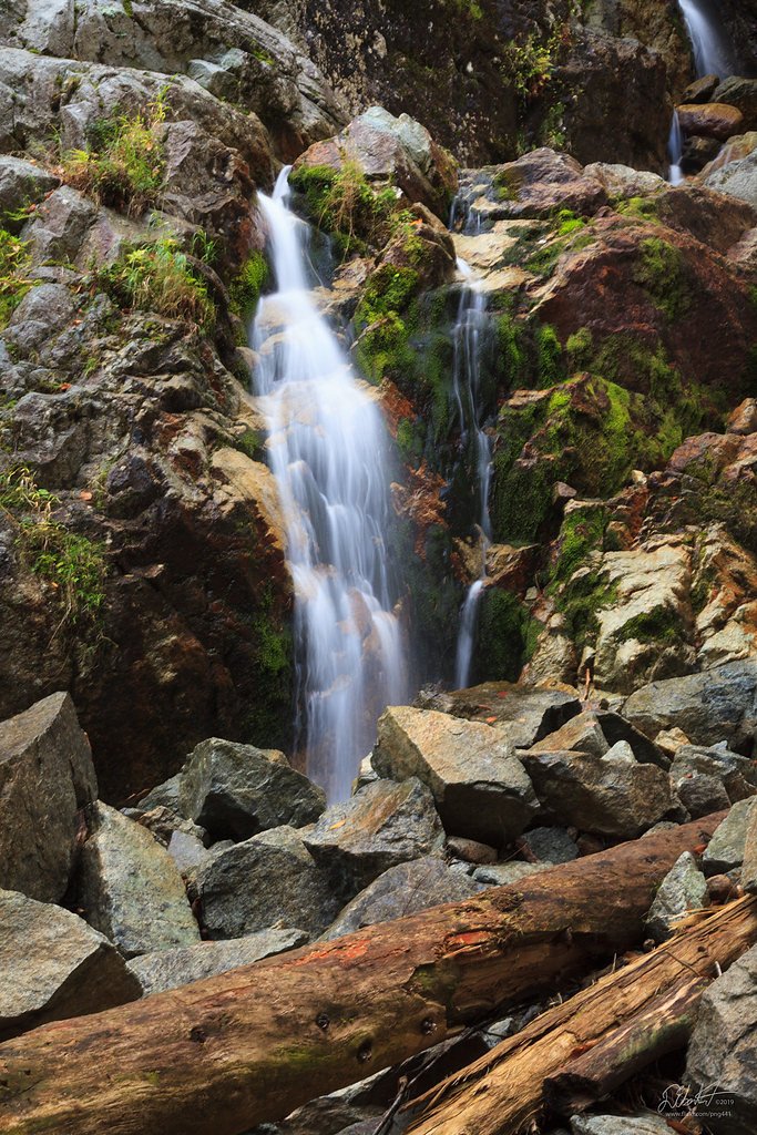
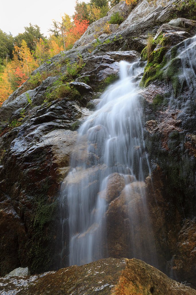
Photo Credits (3)
Difficulty
Easy
Trail Length
0.5 miles
Trail Type
Out And Back
About Fall Brook Falls
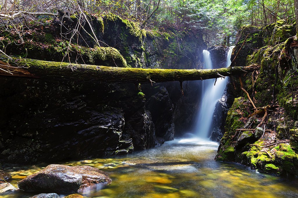
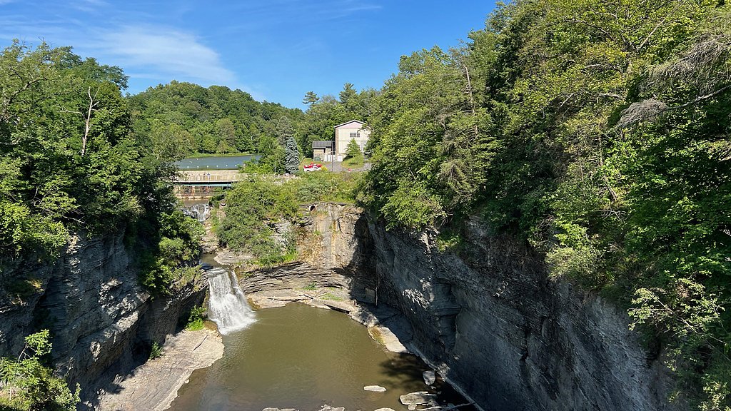
Fall Brook Falls is a picturesque cascade tucked into New York’s Finger Lakes area, beloved for its quiet gorge setting and photogenic drop. The waterfall sits within the Fallbrook land unit on private property and is managed by a local nonprofit organization (designation: OTHE), so visitors should be respectful of the site and any posted access guidance. The combination of wooded slopes, mossy rock, and the steady curtain of water makes it a rewarding stop for nature lovers and photographers alike. The hike to the falls is an approachable outing for most active hikers: the route is a 2.4-mile out-and-back with about 350 feet of elevation gain and is typically rated moderate. Expect a fairly direct walk through mixed forest that opens into the gorge where the falls tumble — a compact, scenic experience that’s great as a half-day excursion or a longer stroll when paired with other Finger Lakes stops.
The Setting
Fall Brook Falls sits at 597 feet within Fallbrook, fed by the Genesee River, in the foothills of New York.
Nearby Falls Worth Visiting
Triphammer Falls (55 ft) lies 6.8 miles to the northeast.
Trail & Hike Details
Trail Description
The trail to Fall Brook Falls is a 2.4-mile out-and-back route with approximately 350 feet of total elevation gain and a moderate difficulty rating. The path leads through forested terrain into the gorge, ending at viewpoints near the cascade; the route is direct and commonly used for day hikes and photography stops. Note that the falls lie on private land in the Fallbrook land unit managed by an NGO (designation: OTHE), so follow any posted rules and stay on the established trail.
What to Expect
Dogs are welcome.
Accessibility
The trail is short and relatively flat, but the surface may be uneven. Contact the managing agency for accessibility details.
Frequently Asked Questions
🐶 Are Dogs Allowed at Fall Brook Falls?
✅ Dogs are allowed
Are There Any Fees or Permits Required?
🆖 No fees required
🏊 Is There Swimming at Fall Brook Falls?
❌ Swimming is not allowed
When to Visit
Spring and early summer are ideal for visiting, as the waterfall flow is typically strongest during these seasons.
Seasonal Access
The best time to visit is Spring, Summer, and Fall. Winter access may be limited.
Safety Information
The area near the falls can be slippery, especially after rain. Visitors should exercise caution and stay on marked trails. Flash flooding may occur in the gorge during heavy rain.
Current Water Conditions
317 ft³/s
Current discharge — how much water is flowing
About average for this time of year
Based on 74 years of record
2.53 ft
Water depth at gauge
7-Day Discharge Trend
What does this mean for your visit?
Flow is about average for this time of year.
About This Gauge
7-Day Flow Outlook
Based on the USGS gauge GENESEE RIVER NEAR MOUNT MORRIS NY (1 km away).
Today
Barely Flowing
317 cfs
4/10Tomorrow
Barely Flowing
392 cfs
3/10Mon
Low
502 cfs
4/10Tue
Barely Flowing
490 cfs
5/10Wed
Barely Flowing
492 cfs
5/10Thu
Barely Flowing
489 cfs
5/10Fri
Barely Flowing
502 cfs
3/10Best window: Tue — barely flowing flow, partly sunny (trip score 5/10).
Best time of year: this gauge typically runs highest from late February to early May, peaking in April.
How we calculate this
This is a transparent outlook, not a precise forecast. We take the waterfall's current flow strength (how it ranks against its historical normal for today, from the nearest USGS stream gauge), carry that ranking forward along the gauge's seasonal curve, and nudge it for forecast rain. Confidence is highest for the next day or two and falls further out. Always check official conditions and your own judgment before visiting — high flows can be dangerous.
Know when to go.
Get a free email alert when waterfalls near Cuylerville hit peak flow. We only send when conditions are worth the trip — no weekly newsletters, no spam.
Weather Forecast
The Terrain, Seen by LiDAR
Aircraft-mounted lasers measured this ground to within inches. Trees and buildings are digitally stripped away, leaving the bare shape of the land the water has carved.
1-meter lidar shows Fall Brook Falls dropping about 148 feet in a single sheer step. The brink sits at about 608 feet above sea level.
Steep ground runs through the entire stretch: about 136 feet of descent in the 500 feet above the pin and 126 feet in the 500 feet below it. Facing north, the falls stay mostly shaded, with soft, even light all day.
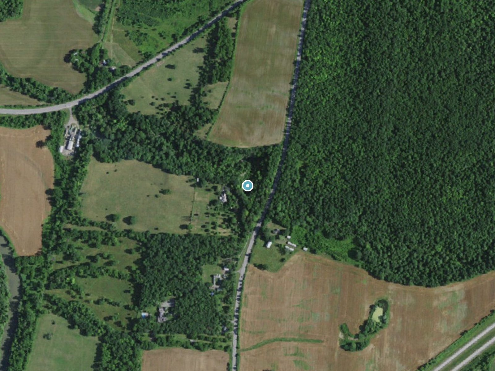
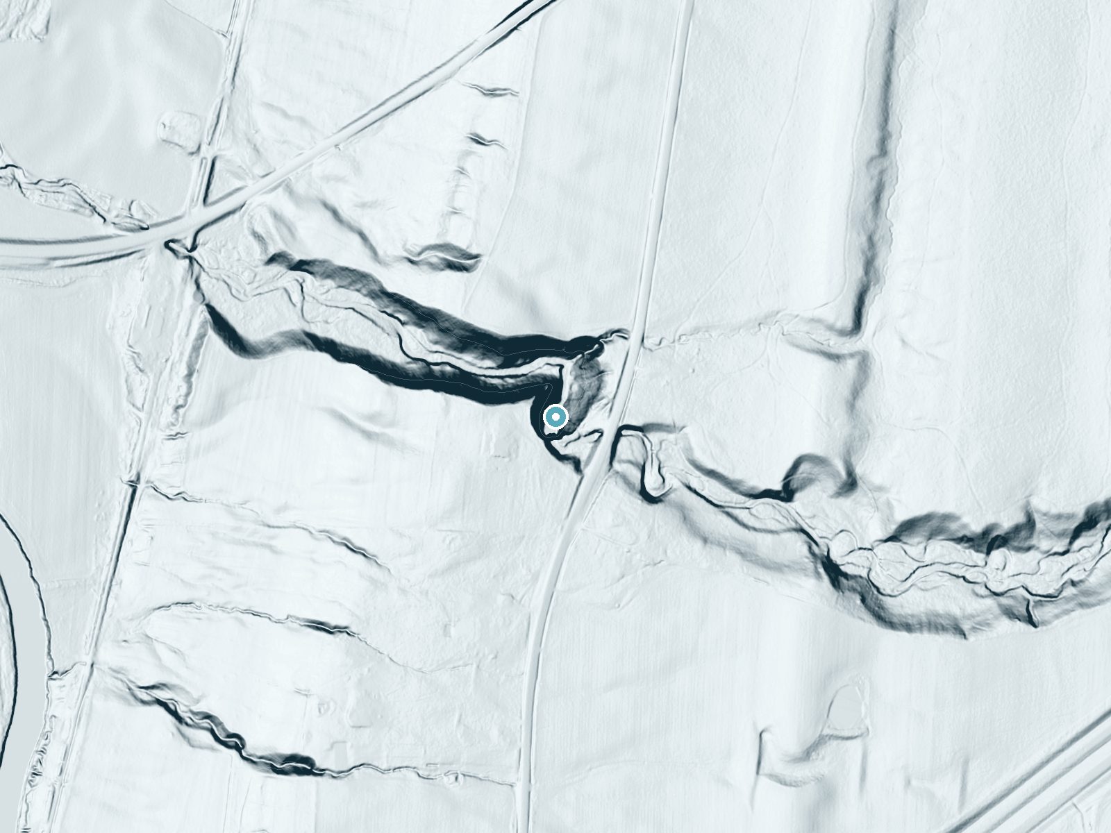
Drag to compare. The dot marks the waterfall. The frame is about a mile across.
- Ground elevation
- 608 feet
- Measured by 1-meter lidar
- Drop at the falls
- About 148 feet
- Change in ground height within ~250 feet of the falls
- Faces
- North
- Mostly shaded, so the light stays soft and even all day.
A slice through the lidar ground surface, from above the falls to downstream (heading north).
Elevation data: USGS 3D Elevation Program. Aerial imagery: USGS The National Map. Public domain.
Location & Access
Getting There
Fall Brook Falls is located near the town of Geneseo, New York, within the Fall Brook Gorge. Access is typically via a short walk from the parking area, but specific directions should be confirmed before visiting.
Get Directions on Google MapsParking
Parking is available near the trailhead, but spaces may be limited during peak seasons.
Elevation
597 feet above sea level
Coordinates
42.774785° N, -77.828614° W
Land Management
Managed by NGO
Visitor Tips & Gear
Wear sturdy footwear, as the trail may be muddy or slippery, especially after rain. Arrive early during peak seasons to secure parking.
Where to Stay

Hampton Inn Geneseo

Temple Hill Bed and Breakfast

Quality Inn Geneseo

Letchworth Farm Guesthouses
Browse vacation cabins and private rentals nearby
Unique outdoor stays — tents, yurts, and treehouses
Rent a campervan or RV for your waterfall road trip
Some links are affiliate links. We may earn a commission at no extra cost to you.
Additional Information
Nearby Attractions
Letchworth State Park, known as the 'Grand Canyon of the East,' is located nearby and offers additional hiking and waterfall viewing opportunities.
Wildlife
The area is home to various bird species, deer, and small mammals. Visitors may also encounter amphibians near the water.
Cities near Fall Brook Falls
Nearby Waterfalls
Writing about Fall Brook Falls? Embed this waterfall on your site for free.