Photo Credits (5)
Difficulty
Moderate
Trail Length
2.4 miles
Trail Type
Out And Back
Elevation Gain
350 ft
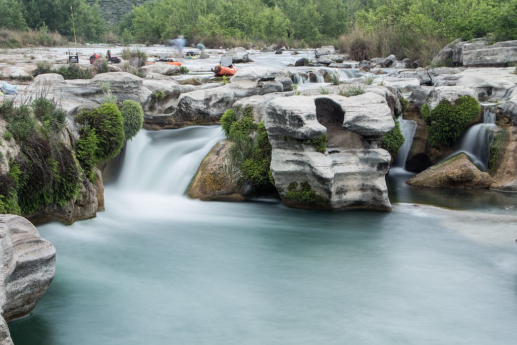
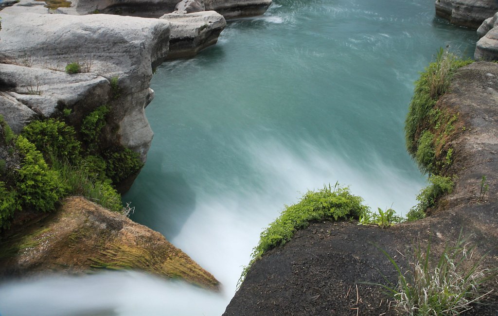
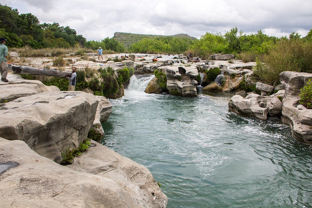
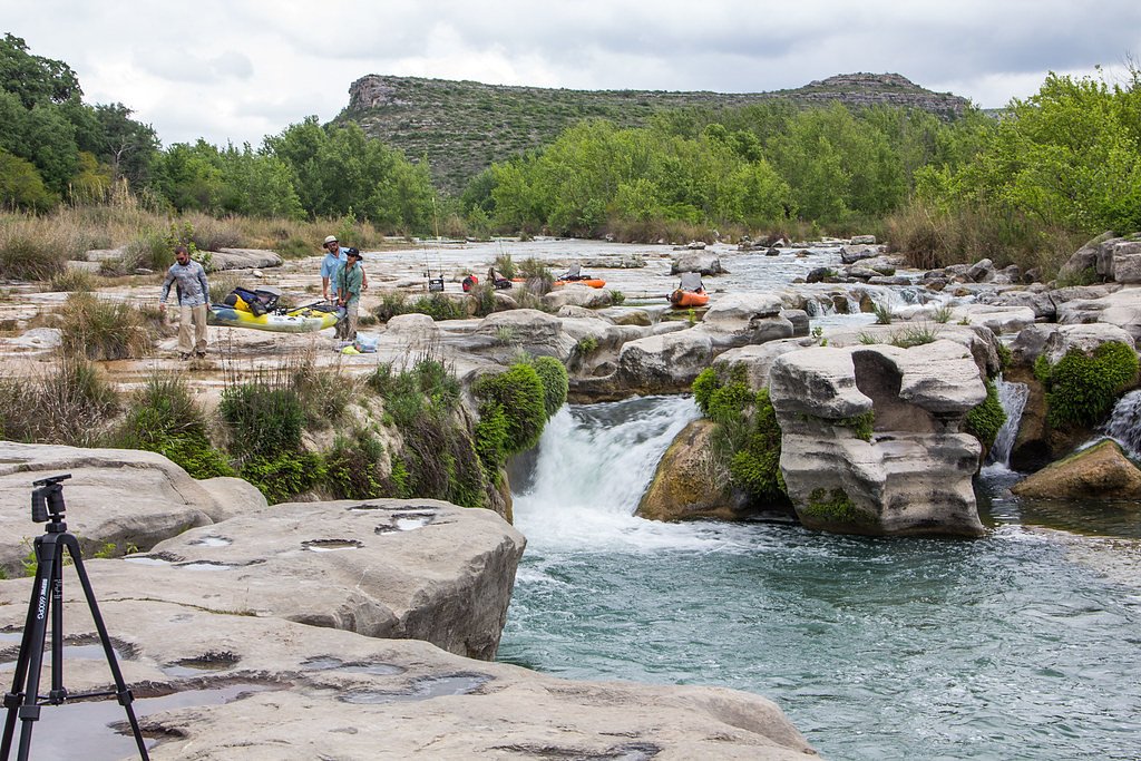
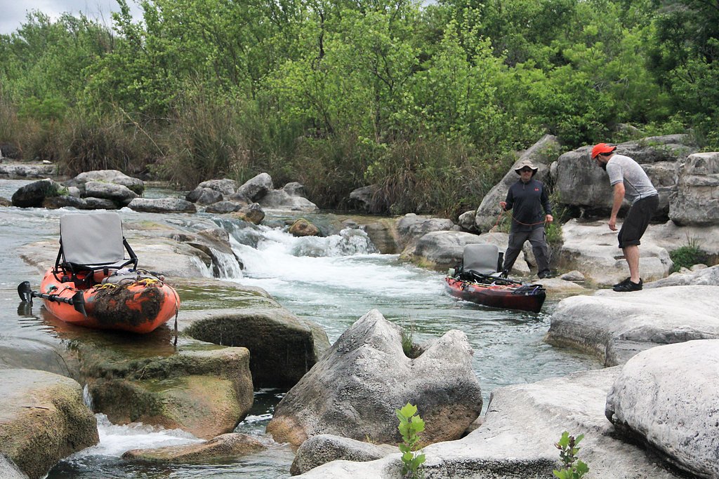
About Dolan Falls
Dolan Falls is a stunning waterfall located within the Dolan Falls Preserve in Val Verde County, Texas. It is part of the Devils River, a pristine and ecologically significant waterway. The falls are known for their cascading waters and the surrounding rugged, remote landscape.
The Setting
Dolan Falls sits at 1,322 feet within Dolan Falls Preserve, fed by the Dolan Ck Abv Devils River, in the foothills of Texas.
Trail & Hike Details
The Approach
The moderate 2.4-mile out-and-back trail gains 350 feet of elevation on the way to the falls.
Trail Description
There is no publicly accessible trail to Dolan Falls without prior permission. Visitors typically access the area as part of guided tours or special arrangements with The Nature Conservancy.
What to Expect
Visitors can expect a remote and pristine natural environment with limited facilities. The waterfall is surrounded by rugged terrain and is part of a protected ecological area. The preserve is home to diverse wildlife and unique plant species.
Accessibility
The trail is not wheelchair accessible. Uneven terrain and elevation changes require steady footing.
Frequently Asked Questions
🐶 Are Dogs Allowed at Dolan Falls?
❌ Dogs are not allowed
Are There Any Fees or Permits Required?
🤑 Fees are required
Permit required
Access to Dolan Falls requires prior permission from The Nature Conservancy. Permits or participation in guided tours are mandatory.
🏊 Is There Swimming at Dolan Falls?
❌ Swimming is not allowed
When to Visit
Spring and fall are the best times to visit due to milder temperatures and more comfortable conditions for outdoor activities.
Seasonal Access
The best time to visit is Spring and Fall. Winter access may be limited.
Safety Information
Visitors should be aware of the remote location, lack of cell service, and rugged terrain. Bring sufficient water and supplies, and be prepared for extreme weather conditions. Follow all guidelines provided by The Nature Conservancy to ensure safety and protect the environment.
Current Water Conditions
11 ft³/s
Current discharge — how much water is flowing
About average for this time of year
Based on 13 years of record
2.58 ft
Water depth at gauge
7-Day Discharge Trend
What does this mean for your visit?
Flow is about average for this time of year.
About This Gauge
7-Day Flow Outlook
Based on the USGS gauge Dolan Ck abv Devils River nr Comstock, TX (1 km away).
Today
Barely Flowing
11 cfs
5/10Tomorrow
Barely Flowing
11 cfs
5/10Mon
Barely Flowing
11 cfs
5/10Tue
Barely Flowing
12 cfs
5/10Wed
Barely Flowing
12 cfs
5/10Thu
Barely Flowing
11 cfs
5/10Fri
Barely Flowing
11 cfs
5/10Best window: Today — barely flowing flow, sunny (trip score 5/10).
Best time of year: this gauge typically runs highest from late October to mid November, peaking in May.
How we calculate this
This is a transparent outlook, not a precise forecast. We take the waterfall's current flow strength (how it ranks against its historical normal for today, from the nearest USGS stream gauge), carry that ranking forward along the gauge's seasonal curve, and nudge it for forecast rain. Confidence is highest for the next day or two and falls further out. Always check official conditions and your own judgment before visiting — high flows can be dangerous.
Know when to go.
Get a free email alert when waterfalls near Lake View hit peak flow. We only send when conditions are worth the trip — no weekly newsletters, no spam.
Weather Forecast
Location & Access
Getting There
Dolan Falls is located on private property managed by The Nature Conservancy. Access is strictly controlled, and visitors must obtain prior permission or participate in guided tours to visit the preserve. The preserve is located approximately 45 miles north of Del Rio, Texas, and access is via unpaved roads.
Get Directions on Google MapsParking
Parking is available at designated areas within the preserve for those with prior permission or part of guided tours.
Elevation
1,322 feet above sea level
Coordinates
29.884554° N, -100.993713° W
Land Management
Managed by NGO
Visitor Tips & Gear
Plan your visit well in advance and ensure you have obtained the necessary permissions. Bring plenty of water, sun protection, and sturdy footwear. Be prepared for remote conditions with no cell service or nearby amenities.
As an Amazon Associate, we earn from qualifying purchases.
With 2.4 miles and 350 ft of elevation gain, sturdy boots and trekking poles will help on this moderate trail.

Columbia Watertight II Rain Jacket
Packs into its own pocket, seam-sealed, and keeps you dry from spray and surprise rain.

Earth Pak Waterproof Dry Bag
Keeps your phone and gear dry when waterfall mist soaks everything else.

Waterproof Phone Pouch (AiRunTech)
Cheap insurance — take photos right next to the falls without killing your phone.

Timberland Euro Sprint Mid Waterproof
Trusted waterproof boot with premium leather and grippy rubber sole — reliable on rocky, wet trails.

TrailBuddy Trekking Poles
Lightweight aluminum, cork grips, and flip-locks that actually hold — a best-seller for good reason.

JOBY GorillaPod Starter Kit
Wraps around railings and rocks for long-exposure waterfall shots — no flat surface needed.
Where to Stay
Browse vacation cabins and private rentals nearby
Unique outdoor stays — tents, yurts, and treehouses
Rent a campervan or RV for your waterfall road trip
Some links are affiliate links. We may earn a commission at no extra cost to you.
Additional Information
Nearby Attractions
Nearby attractions include the Devils River State Natural Area and Seminole Canyon State Park & Historic Site.
Wildlife
The area is home to diverse wildlife, including birds, fish, and other species unique to the Devils River ecosystem.
Cities near Dolan Falls
Writing about Dolan Falls? Embed this waterfall on your site for free.