Dog Slaughter Falls
Kentucky • 15 ft
By Armen Suny · Last verified Mar 2026
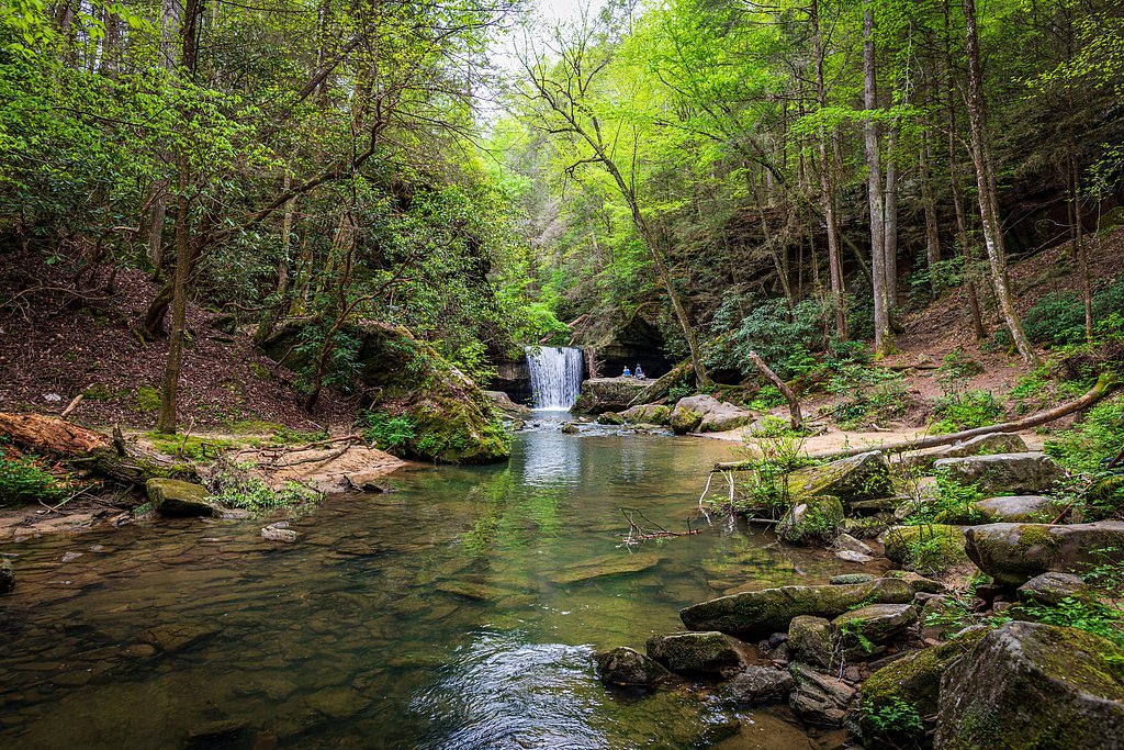
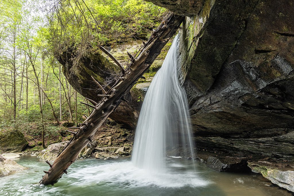
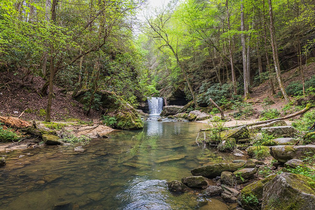
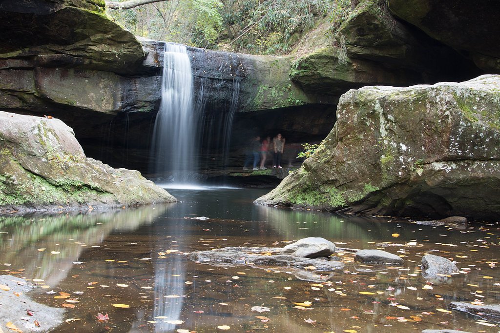
Photo Credits (5)
Difficulty
Moderate
Trail Length
2.4 miles
Trail Type
Out And Back
Elevation Gain
200 ft
About Dog Slaughter Falls
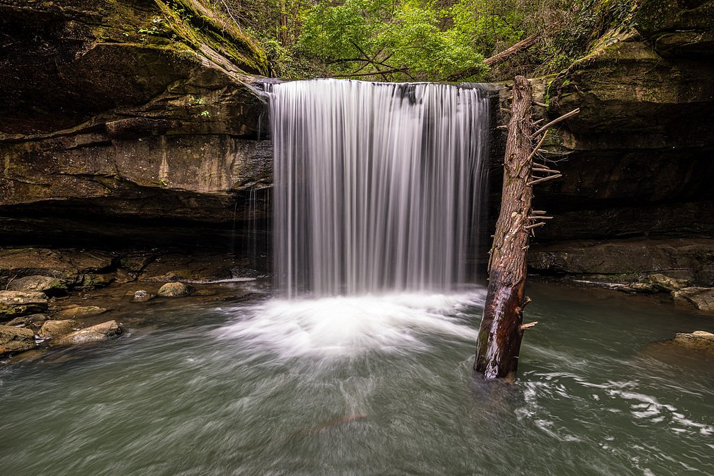
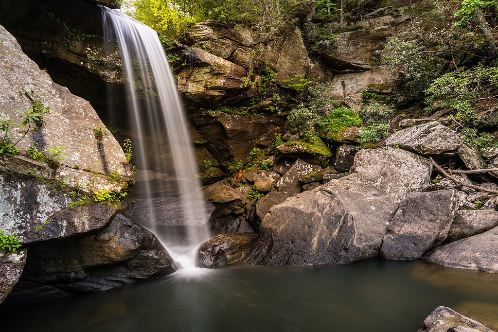
Dog Slaughter Falls is a picturesque 15-foot waterfall located in the Daniel Boone National Forest near Corbin, Kentucky. It is known for its serene setting, surrounded by lush forest and rocky outcrops, making it a popular destination for hikers and nature enthusiasts.
The Setting
Dog Slaughter Falls sits at 843 feet within Daniel Boone National Forest, fed by the Cumberland River, in the foothills of Kentucky. The falls drop 15 feet.
Height: 15 feet
Nearby Falls Worth Visiting
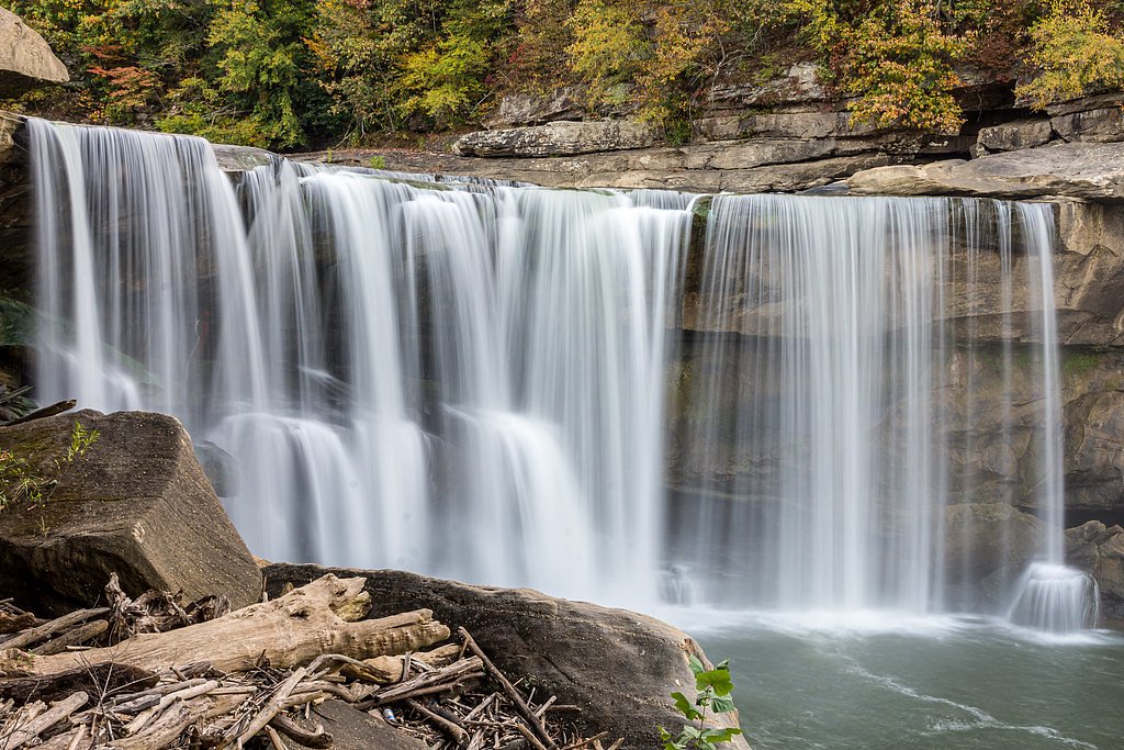
Cumberland Falls (68 ft) lies 2.3 miles to the southwest.
Trail & Hike Details
The Approach
The moderate hike follows Dog Slaughter (#414), a 2.4-mile out-and-back trail over n/a. Expect 200 feet of elevation gain with grades of N/A.
USFS Trail
DOG SLAUGHTER #414
Trail Class
Class 0
Surface
Avg Grade
USFS Segment
3.78 miTrail Description
The trail to Dog Slaughter Falls is a moderately challenging out-and-back hike that follows Dog Slaughter Creek. The path is well-marked but can be rocky and uneven in places, with some minor elevation changes. The trail passes through a dense forest, offering scenic views of the creek and small cascades along the way.
What to Expect
The falls drop a gentle 15 feet. Dogs are welcome.
Accessibility
The trail is not wheelchair accessible. Uneven terrain and elevation changes require steady footing.
Frequently Asked Questions
🐶 Are Dogs Allowed at Dog Slaughter Falls?
✅ Dogs are allowed
Are There Any Fees or Permits Required?
🆖 No fees required
🏊 Is There Swimming at Dog Slaughter Falls?
❌ Swimming is not allowed
When to Visit
Spring and early summer are ideal for visiting Dog Slaughter Falls, as the water flow is typically stronger during these seasons. Fall offers beautiful foliage, while winter provides a chance to see the falls partially frozen.
Seasonal Access
The best time to visit is Spring, Summer, and Fall. Winter access may be limited. Check with Daniel Boone National Forest for seasonal road closures.
Safety Information
Be cautious of slippery rocks near the waterfall and along the trail, especially after rain. Watch for snakes and other wildlife. Cell phone service may be limited in the area, so plan accordingly.
Current Water Conditions
890 ft³/s
Current discharge — how much water is flowing
About average for this time of year
Based on 98 years of record
7-Day Discharge Trend
What does this mean for your visit?
Flow is about average for this time of year.
About This Gauge
7-Day Flow Outlook
Based on the USGS gauge CUMBERLAND RIVER AT CUMBERLAND FALLS, KY (4 km away).
Today
Moderate
1170 cfs
9/10Tomorrow
Moderate
1305 cfs
6/10Sat
Moderate
1166 cfs
6/10Sun
Moderate
1226 cfs
6/10Mon
Moderate
1034 cfs
9/10Tue
Moderate
884 cfs
9/10Wed
Moderate
864 cfs
9/10Best window: Today — moderate flow, mostly sunny (trip score 9/10).
Best time of year: this gauge typically runs highest from mid February to mid April, peaking in March.
How we calculate this
This is a transparent outlook, not a precise forecast. We take the waterfall's current flow strength (how it ranks against its historical normal for today, from the nearest USGS stream gauge), carry that ranking forward along the gauge's seasonal curve, and nudge it for forecast rain. Confidence is highest for the next day or two and falls further out. Always check official conditions and your own judgment before visiting — high flows can be dangerous.
Know when to go.
Get a free email alert when waterfalls near Rockholds hit peak flow. We only send when conditions are worth the trip — no weekly newsletters, no spam.
Weather Forecast
Location & Access
Getting There
Dog Slaughter Falls is accessible via the Dog Slaughter Trailhead, located off Forest Road 195. The trailhead is approximately 3.5 miles from the Cumberland Falls State Resort Park.
Get Directions on Google MapsParking
Parking is available at the Dog Slaughter Trailhead, but spaces may be limited, especially during peak seasons.
Elevation
843 feet above sea level
Coordinates
36.858458° N, -84.311841° W
Land Management
Managed by USFS
Visitor Tips & Gear
Wear sturdy hiking shoes due to the rocky terrain. Bring water and snacks, as there are no facilities along the trail. Arrive early to secure parking, especially during weekends and holidays. Be cautious of slippery rocks near the waterfall.
As an Amazon Associate, we earn from qualifying purchases.
With 2.4 miles and 200 ft of elevation gain, sturdy boots and trekking poles will help on this moderate trail. Sun exposure on the trail makes good sun protection a must in summer.

Polarized Sunglasses (Knockaround)
Cuts glare off the water so you actually see the falls — and your photos turn out better too.

Columbia Watertight II Rain Jacket
Packs into its own pocket, seam-sealed, and keeps you dry from spray and surprise rain.

Earth Pak Waterproof Dry Bag
Keeps your phone and gear dry when waterfall mist soaks everything else.

Waterproof Phone Pouch (AiRunTech)
Cheap insurance — take photos right next to the falls without killing your phone.

Timberland Euro Sprint Mid Waterproof
Trusted waterproof boot with premium leather and grippy rubber sole — reliable on rocky, wet trails.

TrailBuddy Trekking Poles
Lightweight aluminum, cork grips, and flip-locks that actually hold — a best-seller for good reason.
Where to Stay

Pine Mountain Inn

Hampton Inn Corbin

Baymont by Wyndham Corbin

Laurel Lake Cabins
Browse vacation cabins and private rentals nearby
Unique outdoor stays — tents, yurts, and treehouses
Rent a campervan or RV for your waterfall road trip
Some links are affiliate links. We may earn a commission at no extra cost to you.
Nearby Campground
GROVE
7.8 miles away · 99 sites
Overview Grove Campground is perched on a forested ridge above Laurel River Lake in Kentucky's Daniel Boone National Forest. The lake, fed by the Laurel River, is considered one of the most scenic lakes in the state. Boating, fishing, hiking and biking are greatly enjoyed by campers.Recreation Hikers, horseback riders and mountain bikers can trek more than 600 miles of road and trail in Daniel Boone National Forest. Duff Branch, Oak Branch, Fishing Point and Singing Hills Trails can all be access
Book on Recreation.govAdditional Information
Nearby Attractions
Cumberland Falls, also known as the 'Niagara of the South,' is located nearby and is a must-visit. The Cumberland Falls State Resort Park offers additional hiking trails and scenic views.
Wildlife
The area is home to various wildlife, including deer, birds, and small mammals. Be cautious of snakes, especially in warmer months.
Cities near Dog Slaughter Falls
Nearby Waterfalls
Writing about Dog Slaughter Falls? Embed this waterfall on your site for free.