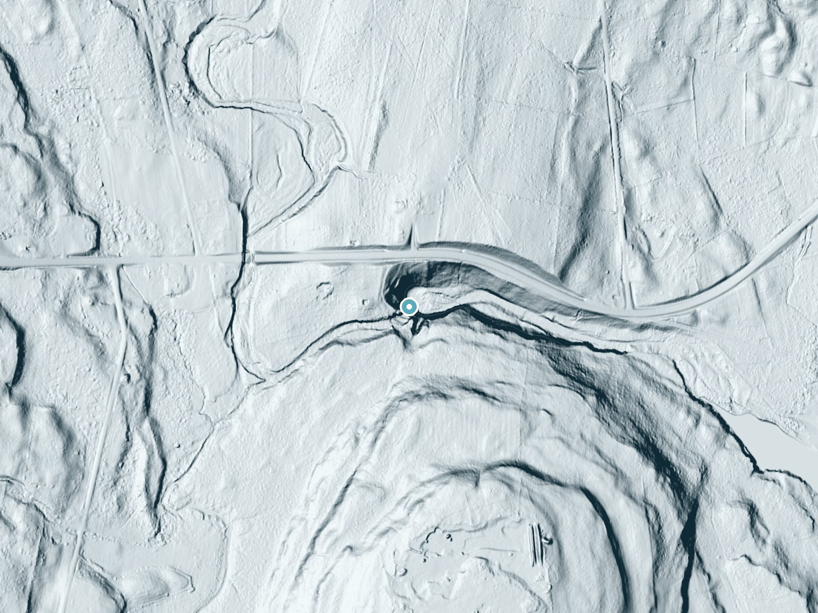
 LiDAR terrain view · USGS 3DEP
Dickinson Falls
By Armen Suny · Last verified Oct 2026
LiDAR & 3D terrainAbout Dickinson Falls
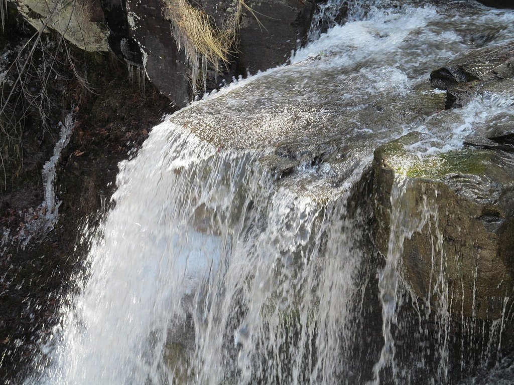
Dickinson Falls is a tucked-away cascade on Albany Water Board Land in New York, managed by RWD and designated LOTH. The falls sit in a quiet, wooded setting that rewards hikers with a peaceful spot for photography, birdwatching, or simply soaking in the sound of falling water—a nice alternative to busier state parks for those seeking solitude. Because the site is on land managed by the RWD, visitors should follow posted guidance, stay on the established trail, and practice Leave No Trace to help preserve this low-key natural gem.
The Setting
Dickinson Falls sits at 659 feet within Albany Water Board Land, in the foothills of New York.
Trail & Hike Details
Trail Description
Difficulty: Moderate. The trail to Dickinson Falls is an out-and-back route of moderate grade; hikers should expect natural tread and some uneven sections—roots and rocks may be present—so sturdy footwear is recommended. No USFS trail name/number or formal surface/grade/class data is available for this route; the path lies on Albany Water Board Land managed by RWD, so check for any local access notes before you go.
What to Expect
Expect a tranquil and scenic environment with the sound of cascading water. The area may be surrounded by forested landscapes, offering opportunities for photography and relaxation.
Accessibility
Accessibility information is not available. The trail may not be suitable for individuals with mobility challenges.
Frequently Asked Questions
🐶 Are Dogs Allowed at Dickinson Falls?
❌ Dogs are not allowed
Are There Any Fees or Permits Required?
🆖 No fees required
🏊 Is There Swimming at Dickinson Falls?
❌ Swimming is not allowed
When to Visit
Spring and early summer are typically the best times to visit, as the waterfall may have higher flow due to snowmelt and rainfall.
Seasonal Access
The best time to visit is Spring, Summer, and Fall. Winter access may be limited.
Safety Information
Visitors should be cautious of slippery rocks near the waterfall and uneven terrain. Check weather conditions before visiting, as rain may make trails more hazardous.
Current Water Conditions
These readings come from the USGS gauge on Normans Kill, 12.9 miles away, not on Dickinson Falls's own stream. Use them as a sign of whether the area is running wet or dry.
365 ft³/s
Current discharge — how much water is flowing
Higher than usual for this time of year
Based on 17 years of record
3.95 ft
Water depth at gauge
7-Day Discharge Trend
What does this mean for your visit?
The water is flowing higher than usual for this time of year.
About This Gauge
This gauge is on a nearby waterway and may not reflect exact conditions at the falls.
7-Day Flow Outlook
Based on the USGS gauge NORMANS KILL AT ALBANY NY (21 km away).
Today
Strong
365 cfs
10/10Tomorrow
Strong
264 cfs
10/10Tue
Strong
336 cfs
10/10Wed
Strong
327 cfs
10/10Thu
Strong
418 cfs
10/10Fri
Strong
394 cfs
10/10Sat
Strong
365 cfs
10/10Best window: Today — strong flow, partly sunny (trip score 10/10).
Best time of year: this gauge typically runs highest from late February to late April, peaking in April.
How we calculate this
This is a transparent outlook, not a precise forecast. We take the waterfall's current flow strength (how it ranks against its historical normal for today, from the nearest USGS stream gauge), carry that ranking forward along the gauge's seasonal curve, and nudge it for forecast rain. Confidence is highest for the next day or two and falls further out. Always check official conditions and your own judgment before visiting — high flows can be dangerous.
Know when to go.
Get a free email alert when waterfalls near Ravena hit peak flow. We only send when conditions are worth the trip — no weekly newsletters, no spam.
Is Dickinson Falls Frozen?
Updated about 17 hours agoNot frozen highs above freezing lately strong flow slows freezing
Dickinson Falls is not frozen right now; highs have been above freezing. Yesterday ran 36°F to 32°F.
- Days below freezing
- 0 of the last 14
- Current cold streak
- 0 days
- Freezing days ahead
- 0 of the next 7
- Flow
- 565 ft³/s
Winter safety. Frozen falls are the one waterfall trip with a documented injury pattern: falling ice, and ice-glazed rock and trail. Wear microspikes, keep well back from the base and from overhangs, and never walk out on ice over moving water.
Estimate from Open-Meteo daily temperatures at the falls, the LiDAR-measured facing direction, and the nearest stream gauge. It is a likelihood, not a report from the trail. See every frozen waterfall in New York.
Weather Forecast
The Terrain, Seen by LiDAR
Aircraft-mounted lasers measured this ground to within inches. Trees and buildings are digitally stripped away, leaving the bare shape of the land the water has carved.
Through the falls the surface drops roughly 101 feet over a short, steep run of tiers. Elevation at the pin is about 650 feet.
The ground changes about 44 feet in the 500 feet above the falls and 35 feet in the 500 feet below. The falls face east and catch soft morning light.
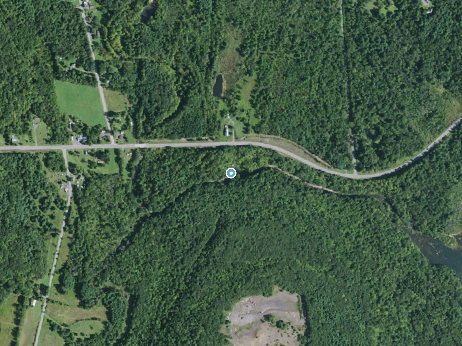
Drag to compare. The dot marks the waterfall. The frame is about a mile across.
- Ground elevation
- 650 feet
- Measured by 1-meter lidar
- Drop at the falls
- About 101 feet
- Change in ground height within ~250 feet of the falls
- Faces
- East
- Catches soft morning light.
A slice through the lidar ground surface, from above the falls to downstream (heading east).
Elevation data: USGS 3D Elevation Program. Aerial imagery: USGS The National Map. Public domain.
Location & Access
Getting There
The exact location of Dickinson Falls may require local guidance or GPS navigation, as it is not widely documented. It is recommended to research nearby landmarks or trails for accurate directions.
Get Directions on Google MapsParking
Parking availability is unclear, but visitors may need to park along nearby roads or designated areas if available.
Elevation
659 feet above sea level
Coordinates
42.496191° N, -73.975408° W
Land Management
Managed by RWD
Visitor Tips & Gear
Check local resources or visitor centers for updated information about access and trail conditions. Bring a map or GPS device as the area may not be well-marked.
Where to Stay

Eastwind

Ski In Ski Out Cabin on Hunter Mtn Seasonal Pool Access w Panoramic Views Hike Swim Fish Relax

Beautiful Chalet, mins to Hunter/Windham slopes

Bear House Catskills Quiet Luxury Retreat - Private Pool, Pond, Hot Tub, Dog-Friendly Sleeps 8 Adults
Browse vacation cabins and private rentals nearby
Unique outdoor stays — tents, yurts, and treehouses
Rent a campervan or RV for your waterfall road trip
Some links are affiliate links. We may earn a commission at no extra cost to you.
Nearby Hot Springs
Hot springs near Albany, New York

Lebanon Spring
Lebanon Spring discharges at 72°F at 663 feet elevation in Columbia County, flowing 24 degrees above ambient air temperature ju...
Sand Spring
Sand Spring surfaces at 75°F in Williamstown, Massachusetts — one of the few thermal features in New England. At just 670 feet ...
Looking for a soak after your hike? Explore more hot springs near Albany, New York on SoakingSprings.
Explore New York springsAdditional Information
Nearby Attractions
Nearby attractions are not well-documented, but the surrounding area may offer additional hiking trails or natural features.
Wildlife
The area may host typical New York wildlife such as birds, deer, and small mammals. Visitors should be cautious of ticks and other insects.
Cities near Dickinson Falls
Nearby Waterfalls
 LiDAR
Writing about Dickinson Falls? Embed this waterfall on your site for free.