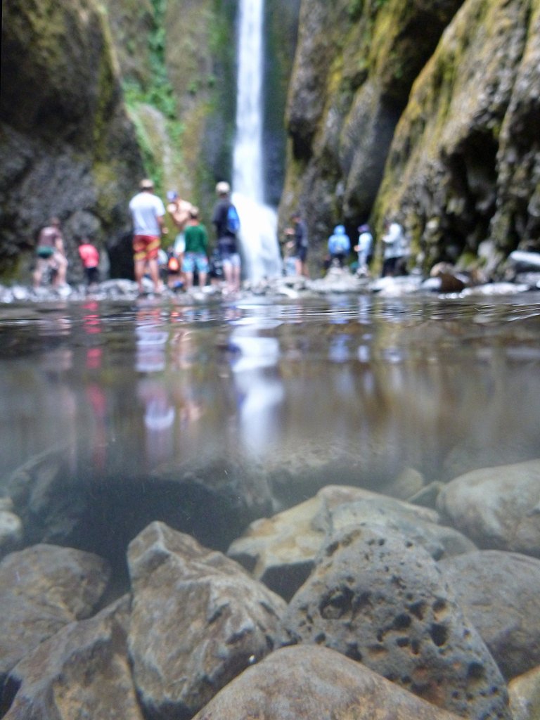

Photo Credits (5)
Difficulty
Moderate
Trail Length
2.5 miles
Trail Type
Out And Back
Elevation Gain
400 ft
About Deep Creek Falls
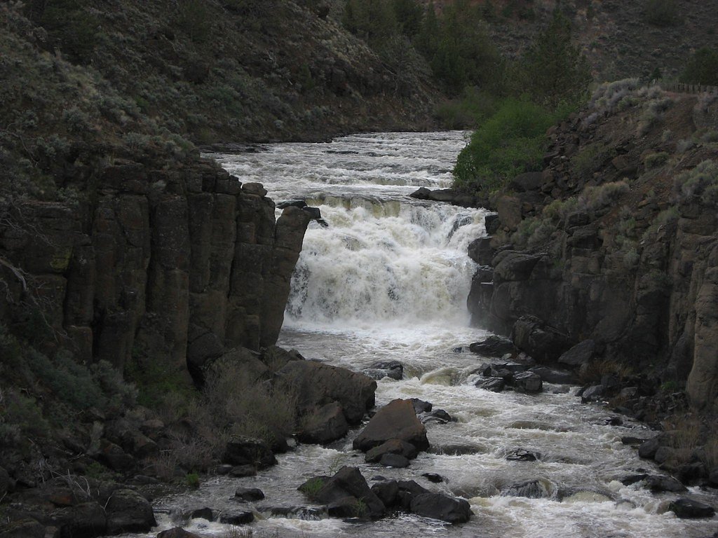
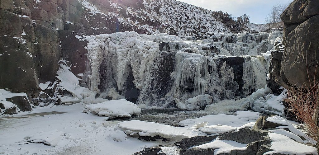
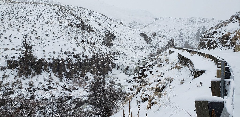
Deep Creek Falls tumbles along Gibson Canyon at the south end of Warner Valley on the east side of Lakeview, Oregon, offering a compact, scenic cascade set against canyon walls and riparian vegetation. The site sits on public land managed by the Bureau of Land Management (Lakeview District, Lakeview Field Office), and access is informal—reached from Oregon Route 140 by short unmarked paths that drop down to the stream and the base of the falls. The falls are not only photogenic but ecologically notable: they form a natural barrier to upstream fish migration, and species such as the Warner sucker are found only downstream of the falls. Visiting Deep Creek Falls feels like a little backcountry discovery—perfect for hikers who enjoy short outings and a bit of route-finding. Because the approach uses unmarked footpaths on BLM land, come prepared with a map or GPS, wear sturdy footwear for uneven footing, and practice Leave No Trace to protect the canyon and its aquatic habitat. Check with the Lakeview Field Office for current access notes or seasonal conditions before you go.
The Setting
Deep Creek Falls sits at 4,865 feet within Lakeview District Lakeview Field Office, in the mountains of Oregon.
Trail & Hike Details
The Approach
The moderate 2.5-mile out-and-back trail gains 400 feet of elevation on the way to the falls.
Trail Description
Distance: 2.5 miles round-trip (out-and-back). Elevation gain: ~400 feet. Difficulty: Moderate. The route begins from pullouts along Oregon Route 140 and follows informal, unmarked footpaths descending into Gibson Canyon to the base of Deep Creek Falls. The trail traverses wooded canyon terrain with occasional clearings that reveal the canyon and stream; footing can be uneven and the grade moderate as you descend to the creek. There is no USFS trail number for this route (the site is managed by the BLM Lakeview District, Lakeview Field Office), so expect minimal infrastructure and rely on map/GPS and good route-finding skills.
What to Expect
Dogs are welcome.
Accessibility
The trail is not wheelchair accessible. Uneven terrain and elevation changes require steady footing.
Frequently Asked Questions
🐶 Are Dogs Allowed at Deep Creek Falls?
✅ Dogs are allowed
Are There Any Fees or Permits Required?
🆖 No fees required
🏊 Is There Swimming at Deep Creek Falls?
❌ Swimming is not allowed
When to Visit
Spring and early summer are ideal times to visit, as the waterfall is usually at its fullest due to snowmelt and seasonal rains.
Seasonal Access
The best time to visit is Spring, Summer, and Fall. Winter access may be limited.
Safety Information
Be cautious of slippery rocks near the waterfall. Check weather conditions before your visit, as the trail can become muddy or icy. Cell service may be limited in the area.
Know when to go.
Get a free email alert when waterfalls near Plush hit peak flow. We only send when conditions are worth the trip — no weekly newsletters, no spam.
Weather Forecast
The Terrain, Seen by LiDAR
Aircraft-mounted lasers measured this ground to within inches. Trees and buildings are digitally stripped away, leaving the bare shape of the land the water has carved.
The ground through the falls loses about 153 feet in steep steps rather than one leap. The ground at the falls is roughly 4,869 feet above sea level.
Steep ground runs through the entire stretch: about 88 feet of descent in the 500 feet above the pin and 136 feet in the 500 feet below it. Facing northeast, the falls stay mostly shaded, with soft, even light all day.
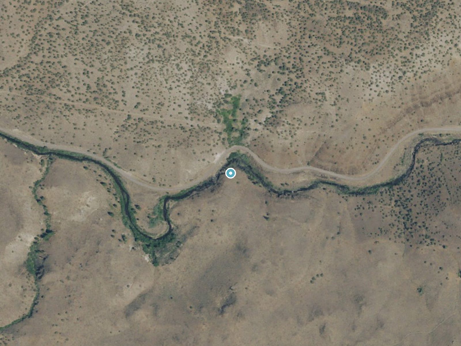
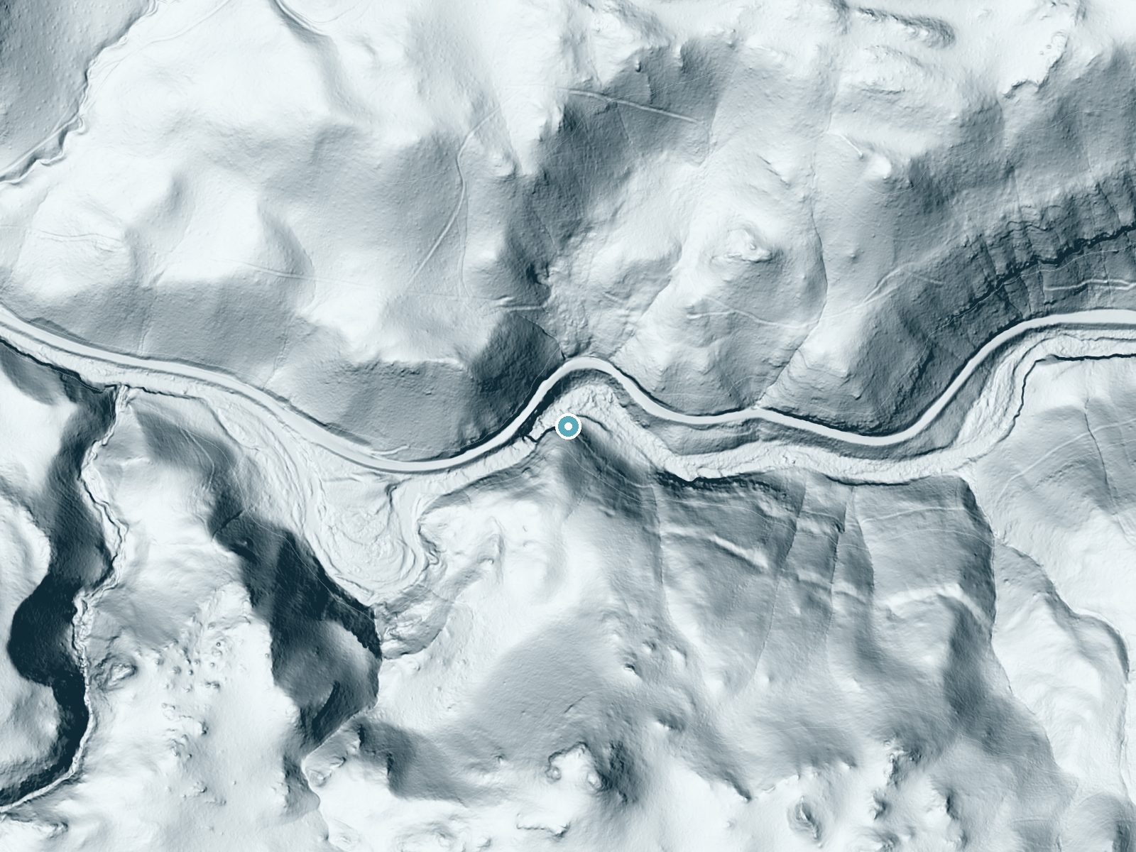
Drag to compare. The dot marks the waterfall. The frame is about a mile across.
- Ground elevation
- 4,869 feet
- Measured by 1-meter lidar
- Drop at the falls
- About 153 feet
- Change in ground height within ~250 feet of the falls
- Faces
- Northeast
- Mostly shaded, so the light stays soft and even all day.
A slice through the lidar ground surface, from above the falls to downstream (heading northeast).
Elevation data: USGS 3D Elevation Program. Aerial imagery: USGS The National Map. Public domain.
Location & Access
Getting There
Deep Creek Falls is located in northeastern Oregon, near the town of La Grande. Access typically involves driving along forest roads, and the trailhead is marked but may require careful navigation.
Get Directions on Google MapsParking
Parking is available at the trailhead, but spaces may be limited during peak seasons.
Elevation
4,865 feet above sea level
Coordinates
42.174054° N, -119.949392° W
Land Management
Managed by BLM
Visitor Tips & Gear
Wear sturdy hiking shoes as the trail can be uneven in places. Bring plenty of water, especially during warmer months. Check trail conditions ahead of time, particularly in winter or after heavy rains.
As an Amazon Associate, we earn from qualifying purchases.
With 2.5 miles and 400 ft of elevation gain, sturdy boots and trekking poles will help on this moderate trail. Sun exposure on the trail makes good sun protection a must in summer.

Polarized Sunglasses (Knockaround)
Cuts glare off the water so you actually see the falls — and your photos turn out better too.

Columbia Watertight II Rain Jacket
Packs into its own pocket, seam-sealed, and keeps you dry from spray and surprise rain.

Earth Pak Waterproof Dry Bag
Keeps your phone and gear dry when waterfall mist soaks everything else.

Waterproof Phone Pouch (AiRunTech)
Cheap insurance — take photos right next to the falls without killing your phone.

Timberland Euro Sprint Mid Waterproof
Trusted waterproof boot with premium leather and grippy rubber sole — reliable on rocky, wet trails.

TrailBuddy Trekking Poles
Lightweight aluminum, cork grips, and flip-locks that actually hold — a best-seller for good reason.
Where to Stay

Oregon Trail Inn and Suites

Best Western Skyline Motor Lodge

Interstate 8 Motel

Fremont Inn
Browse vacation cabins and private rentals nearby
Unique outdoor stays — tents, yurts, and treehouses
Rent a campervan or RV for your waterfall road trip
Some links are affiliate links. We may earn a commission at no extra cost to you.
Nearby Campground
DRAKE PEAK LOOKOUT
13.8 miles away · 1 sites
Overview Located on the crest of the Warner Mountain Range at an elevation of 8,222 feet, Drake Peak Lookout hugs the wind-swept land surrounding it, offering unparalleled views into Oregon, California and Nevada. The lookout was built in 1948 and has served as a fire detection site for the surrounding area. Historically, Forest Service personnel lived long seasons in the cabin, scanning the region for lightning, flames, curls of smoke or any other indicator of possible forest fires. At one time,
Book on Recreation.govNearby Hot Springs
Hot springs near Deep Creek Falls, Oregon
Warner Valley Ranch
Warner Valley Ranch Hot Springs emerges at 198°F at 4,490 feet in Lake County's remote Warner Valley, ranking among North Ameri...
Crump Geyser (Crump Spring)
Crump Geyser erupts at 172 degrees Fahrenheit with roadside access requiring just 15 feet from County Highway 3-10. The feature...
Hallinan Spring
Hallinan Spring flows at 113°F from roadside terrain just 10 meters from the nearest road in Lake County near Lakeview, emergin...
Moss Ranch Springs
Moss Ranch Springs—plural, distinguishing them from nearby Moss Ranch Spring—flows at 83°F in Lake County's Warner Valley, runn...
Moss Ranch Spring
Moss Ranch Spring flows at 72°F—approximately 22 degrees above the local air temperature—requiring a 125-meter walk from the ne...
Fisher Hot Springs
Fisher Hot Springs near Lakeview flows at 154°F on Bureau of Land Management public lands at 4,586 feet elevation, emerging 104...
Looking for a soak after your hike? Explore more hot springs near Deep Creek Falls, Oregon on SoakingSprings.
Explore Oregon springsAdditional Information
Nearby Attractions
The nearby town of La Grande offers dining and lodging options. The Wallowa-Whitman National Forest is also close by, offering additional hiking and outdoor activities.
Wildlife
The area is home to a variety of wildlife, including deer, birds, and small mammals. Be cautious of potential encounters with bears or other larger animals.
Writing about Deep Creek Falls? Embed this waterfall on your site for free.