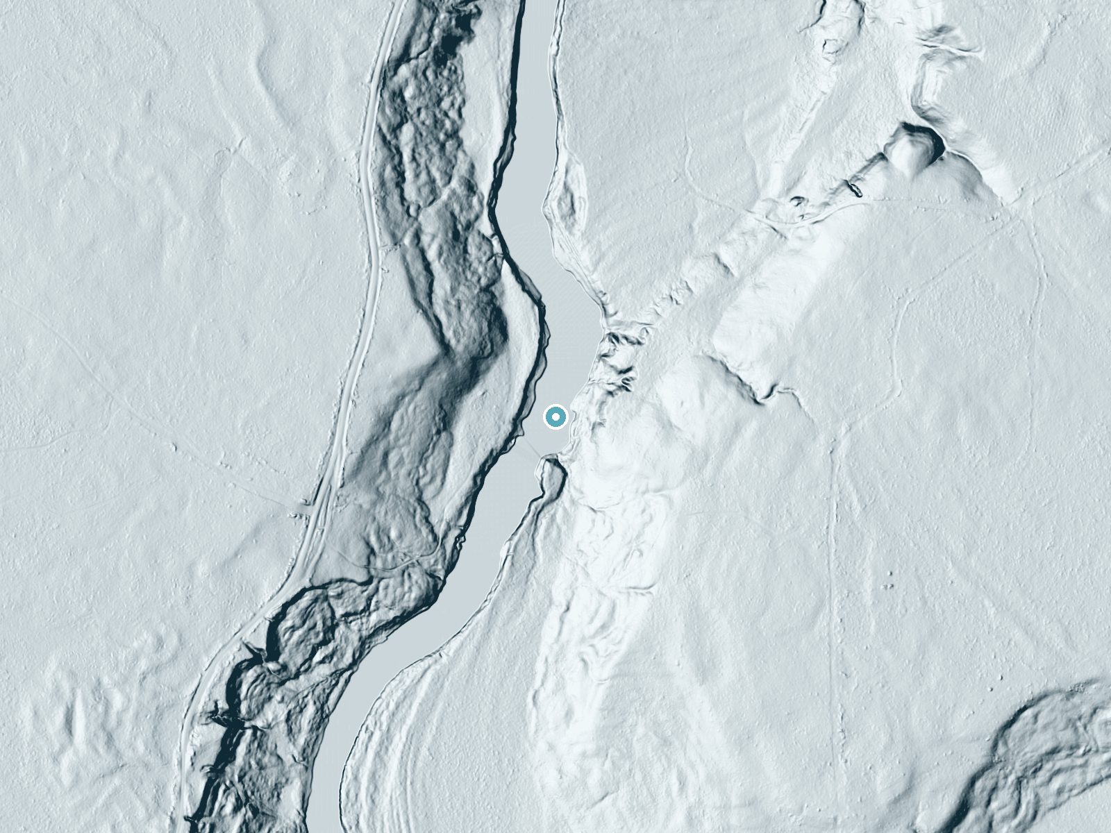
 LiDAR terrain view · USGS 3DEP
Before you go
No road or hiking trail reaches these rapids. They are reached by canoe or kayak on the Little Fork River, and much of the shoreline is private.
About Deadmans Rapids
Deadmans Rapids is a stretch of Class II-III rapids on the Little Fork River in Koochiching County, in a remote section about 8 river miles upstream of the State Highway 65 bridge. It is a set of rapids rather than a waterfall, and the Minnesota DNR notes it is less difficult than its name implies and washes out in high water. It is reached by canoe or kayak on the Little Fork River State Water Trail, not by a hiking trail.
Trail & Hike Details
Trail Description
There is no hiking trail. Paddlers use a 75-yard portage on the right bank (facing downstream); the DNR map also describes a 200-yard route from a large ledge rock that passes through the Deadman's watercraft campsite.
What to Expect
Rapids over rock ledges between low, densely forested banks of pine, spruce, fir, aspen, birch and cedar. Flow usually peaks in late April and drops through summer, when the rapids can be too shallow to run.
Accessibility
There is no road or trail access; the rapids can only be reached by boat.
Frequently Asked Questions
🐶 Are Dogs Allowed at Deadmans Rapids?
❌ Dogs are not allowed
Are There Any Fees or Permits Required?
🆖 No fees required
🏊 Is There Swimming at Deadmans Rapids?
❌ Swimming is not allowed
When to Visit
Late April through early summer, when flow is highest. By mid-summer the rapids may be too shallow unless there has been heavy rain.
Seasonal Access
The best time to visit is Spring, Summer, Fall, and Winter.
Safety Information
Scout before running; the rapids are rated Class II-III and change with water level. Wear a life jacket and use the right-bank portage if unsure.
Know when to go.
Get a free email alert when waterfalls near Littlefork hit peak flow. We only send when conditions are worth the trip — no weekly newsletters, no spam.
Is Deadmans Rapids Frozen?
Updated about 7 hours agoNot frozen highs above freezing lately
Deadmans Rapids is not frozen right now; highs have been above freezing. Yesterday ran 57°F to 31°F.
- Days below freezing
- 0 of the last 14
- Current cold streak
- 0 days
- Freezing days ahead
- 0 of the next 7
- Flow
- no gauge
Winter safety. Frozen falls are the one waterfall trip with a documented injury pattern: falling ice, and ice-glazed rock and trail. Wear microspikes, keep well back from the base and from overhangs, and never walk out on ice over moving water.
Estimate from Open-Meteo daily temperatures at the falls, the LiDAR-measured facing direction, and the nearest stream gauge. It is a likelihood, not a report from the trail. See every frozen waterfall in Minnesota.
Weather Forecast
The Terrain, Seen by LiDAR
Aircraft-mounted lasers measured this ground to within inches. Trees and buildings are digitally stripped away, leaving the bare shape of the land the water has carved.
Here the descent is spread out: 1-meter lidar measures about 46 feet of drop through Deadmans Rapids, stretched along the creek rather than stacked in one wall. The brink sits at about 1,141 feet above sea level.
The ground changes about 71 feet in the 500 feet above the falls and 58 feet in the 500 feet below. The falls face west and glow in afternoon and evening light.
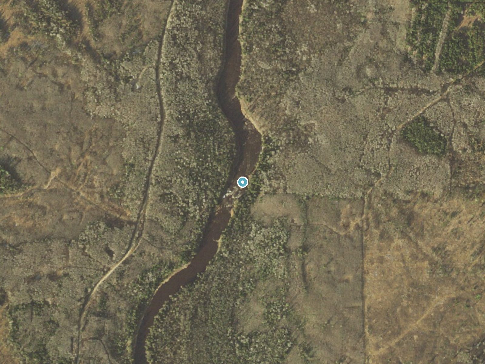
Drag to compare. The dot marks the waterfall. The frame is about a mile across.
- Ground elevation
- 1,141 feet
- Measured by 1-meter lidar
- Drop at the falls
- About 46 feet
- Change in ground height within ~250 feet of the falls
- Faces
- West
- Glows in afternoon and evening light.
A slice through the lidar ground surface, from above the falls to downstream (heading west).
Elevation data: USGS 3D Elevation Program. Aerial imagery: USGS The National Map. Public domain.
Location & Access
Getting There
Paddle the Little Fork River State Water Trail; the rapids are at river miles 67.3 to 66.0 on DNR Little Fork map 2. The DNR describes the river from mile 90 to mile 57 as wild and nearly inaccessible; the nearest carry-in access downstream is Dentaybow (mile 57.9), just off Township Road 36 below the Highway 65 bridge.
Get Directions on Google MapsElevation
1,142 feet above sea level
Coordinates
48.142161° N, -93.487945° W
Visitor Tips & Gear
Check river levels first: the DNR says a reading of 3 feet or lower on the USGS gauge at river mile 21.6 near Littlefork means most rapids are too shallow for easy passage. Much of the shoreline is private, so stop only at designated sites.
Where to Stay
Cabin O' Pines - A Family Friendly Resort
Gorgeous Views, Fishing at Private Cabin on Pelican Lake, Orr MN
Pet-Friendly Cook Vacation Rental on Battle Lake!
Browse vacation cabins and private rentals nearby
Unique outdoor stays — tents, yurts, and treehouses
Rent a campervan or RV for your waterfall road trip
Some links are affiliate links. We may earn a commission at no extra cost to you.
Additional Information
Nearby Attractions
The Deadman's watercraft campsite is at river mile 67.2, and Seller's Rapids (Class II-III) is upstream at river miles 74.7 to 74.3.
Wildlife
The area is home to a variety of wildlife, including deer, birds, and small mammals. Visitors may also spot bald eagles along the river.
Cities near Deadmans Rapids
Writing about Deadmans Rapids? Embed this waterfall on your site for free.