
Photo Credits (4)
Difficulty
Moderate
Trail Length
2.7 miles
Trail Type
Out And Back
Elevation Gain
400 ft
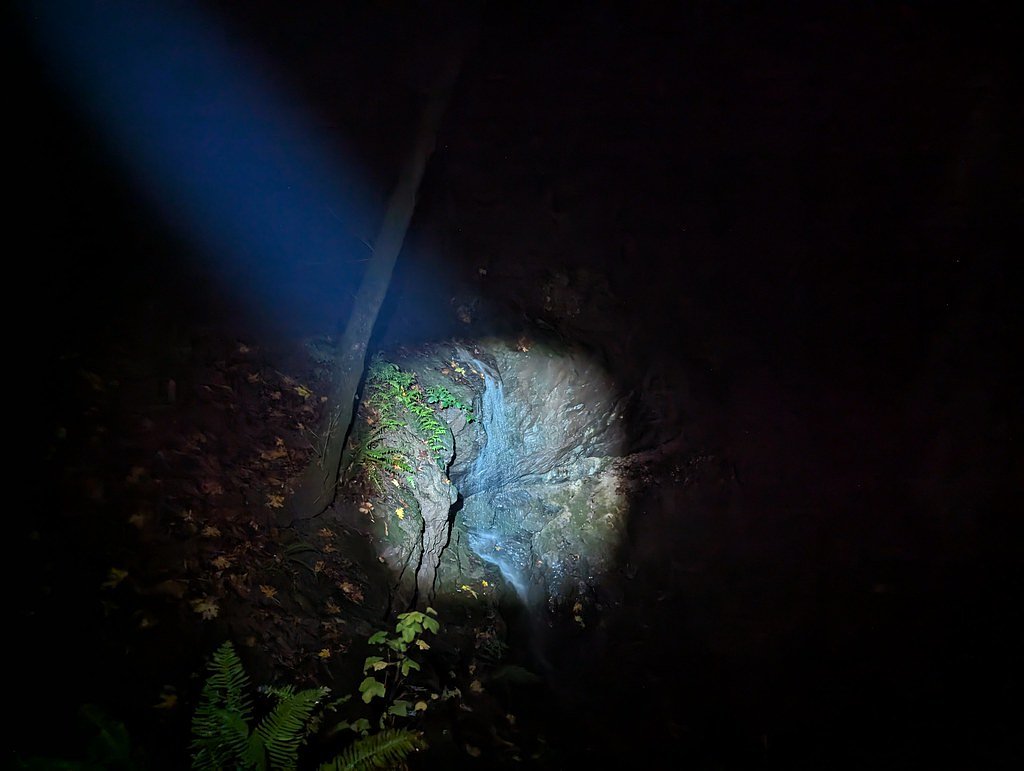
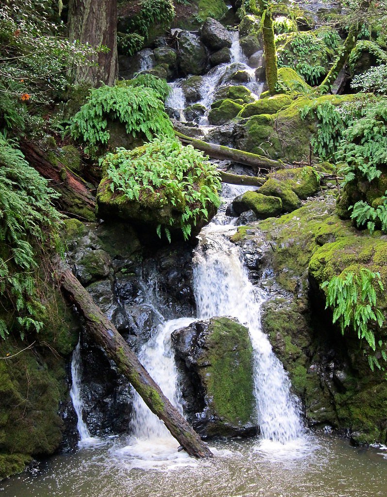
About Dawn Falls
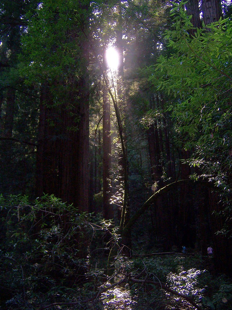
Dawn Falls is a serene waterfall located in the Baltimore Canyon Open Space Preserve in Marin County, California. It is a seasonal waterfall that flows most prominently during the rainy months, typically in winter and early spring. The surrounding area features lush redwood forests and a peaceful hiking environment.
The Setting
Dawn Falls sits at 423 feet within Baltimore Canyon Open Space Preserve, in the coastal lowlands of California.
Trail & Hike Details
The Approach
The moderate 2.7-mile out-and-back trail gains 400 feet of elevation on the way to the falls.
Trail Description
The trail to Dawn Falls is a moderately challenging hike through a beautiful redwood forest. The path is well-maintained but includes some steep sections and uneven terrain. The waterfall is most impressive after significant rainfall, as it is seasonal and may dry up during the summer months.
What to Expect
Dogs are welcome.
Accessibility
The trail is not wheelchair accessible. Uneven terrain and elevation changes require steady footing.
Frequently Asked Questions
🐶 Are Dogs Allowed at Dawn Falls?
✅ Dogs are allowed
Are There Any Fees or Permits Required?
🆖 No fees required
🏊 Is There Swimming at Dawn Falls?
❌ Swimming is not allowed
When to Visit
The best time to visit Dawn Falls is during the winter and early spring months, typically from December to March, when the waterfall is most likely to be flowing.
Seasonal Access
The best time to visit is Spring and Winter.
Safety Information
Be cautious of slippery rocks near the waterfall, especially after rain. Poison oak is present in the area, so stay on the trail and avoid touching vegetation. Carry sufficient water and be prepared for changing weather conditions.
Current Water Conditions
2 ft³/s
Current discharge — how much water is flowing
Higher than usual for this time of year
Based on 56 years of record
4.26 ft
Water depth at gauge
7-Day Discharge Trend
What does this mean for your visit?
The water is flowing higher than usual for this time of year.
About This Gauge
7-Day Flow Outlook
Based on the USGS gauge CORTE MADERA C A ROSS CA (3 km away).
Today
Moderate
1 cfs
9/10Tomorrow
Moderate
1 cfs
9/10Sun
Moderate
2 cfs
9/10Mon
Moderate
1 cfs
9/10Tue
Moderate
1 cfs
9/10Wed
Moderate
1 cfs
9/10Thu
Moderate
1 cfs
9/10Best window: Today — moderate flow, sunny (trip score 9/10).
Best time of year: this gauge typically runs highest from mid January to late March, peaking in February.
How we calculate this
This is a transparent outlook, not a precise forecast. We take the waterfall's current flow strength (how it ranks against its historical normal for today, from the nearest USGS stream gauge), carry that ranking forward along the gauge's seasonal curve, and nudge it for forecast rain. Confidence is highest for the next day or two and falls further out. Always check official conditions and your own judgment before visiting — high flows can be dangerous.
Know when to go.
Get a free email alert when waterfalls near Kentfield hit peak flow. We only send when conditions are worth the trip — no weekly newsletters, no spam.
Weather Forecast
Location & Access
Getting There
Dawn Falls can be accessed via the Dawn Falls Trail, which begins near the end of Madrone Avenue in Larkspur, California. The trailhead is located in a residential area, so parking may be limited.
Get Directions on Google MapsParking
Street parking is available near the trailhead, but it is limited and may require walking a short distance to the trail entrance. Be mindful of local parking restrictions.
Elevation
423 feet above sea level
Coordinates
37.938536° N, -122.562478° W
Land Management
Managed by REG
Visitor Tips & Gear
Visit after recent rainfall for the best waterfall flow. Arrive early to secure parking, as the area can get busy on weekends. Wear sturdy shoes due to uneven terrain, and bring water and snacks for the hike.
As an Amazon Associate, we earn from qualifying purchases.
With 2.7 miles and 400 ft of elevation gain, sturdy boots and trekking poles will help on this moderate trail. Icy conditions are common in winter — traction cleats are a smart addition.

Columbia Watertight II Rain Jacket
Packs into its own pocket, seam-sealed, and keeps you dry from spray and surprise rain.

Earth Pak Waterproof Dry Bag
Keeps your phone and gear dry when waterfall mist soaks everything else.

Waterproof Phone Pouch (AiRunTech)
Cheap insurance — take photos right next to the falls without killing your phone.

Timberland Euro Sprint Mid Waterproof
Trusted waterproof boot with premium leather and grippy rubber sole — reliable on rocky, wet trails.

TrailBuddy Trekking Poles
Lightweight aluminum, cork grips, and flip-locks that actually hold — a best-seller for good reason.

Kahtoola MICROspikes
Cult-favorite traction cleats that grip ice and wet rock — essential for winter waterfall hikes.
Where to Stay

Holiday Inn Express Mill Valley San Francisco Area by IHG

Muir Woods Lodge

Marin Suites Hotel

Riu Plaza Fisherman's Wharf
Browse vacation cabins and private rentals nearby
Unique outdoor stays — tents, yurts, and treehouses
Rent a campervan or RV for your waterfall road trip
Some links are affiliate links. We may earn a commission at no extra cost to you.
Nearby Campground
Haypress Campground
5.4 miles away · 6 sites
Overview Haypress Campground is nestled within the coastal scrub of Tennessee Valley, near Mill Valley. The hike to this campground is 1 mile from the Tennessee Valley Trail head parking lot, which means car or RV camping is not allowed. Typical Haypress campers enjoy hiking to Tennessee Cove, where they can admire the dramatic geology and colorful sand of this unique beach. Recreation Tennessee Valley and the Marin Headlands are noted for great hiking, and trails are often populated with hikers
Book on Recreation.govNearby Hot Springs
Hot springs near Kentfield, California

Rocky Point Springs
Rocky Point Springs emerges at 90°F along the Marin County coastline near Bolinas at the unusual elevation of negative 5 feet, ...
Unnamed Spring Sonoma County 1
This 73-degree spring in Sonoma County wine country, with recent USGS measurements of 32°C, flows at just 340 feet elevation wi...

Sulphur Spring
Sulphur Spring emerges at 75°F near San Francisco Bay, reaching temperatures 14.4 degrees warmer than the mild East Bay climate...
Los Guilicos Warm Springs
Los Guilicos Warm Springs emerges at 88°F in Sonoma County wine country, producing water 28 degrees above ambient in a gentle M...

Unnamed Spring Sonoma County 2
Near Eldridge in Sonoma County, this 70-degree thermal spring flows at just 261 feet elevation with exceptional roadside access...
Unnamed Spring Solano County
Near Benicia in Solano County, this 73-degree spring flows at 218 feet, 14 degrees warmer than ambient, just 68.5 meters from L...
Looking for a soak after your hike? Explore more hot springs near Kentfield, California on SoakingSprings.
Explore California springsAdditional Information
Nearby Attractions
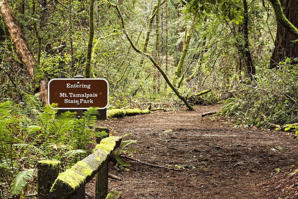
Nearby attractions include Mount Tamalpais State Park, Muir Woods National Monument, and the town of Larkspur with its charming shops and restaurants.
Wildlife
The area is home to various wildlife, including deer, squirrels, and a variety of bird species. Keep an eye out for banana slugs on the trail.
Cities near Dawn Falls
Nearby Waterfalls
Writing about Dawn Falls? Embed this waterfall on your site for free.