Danforth Falls
By Armen Suny · Last verified May 2026
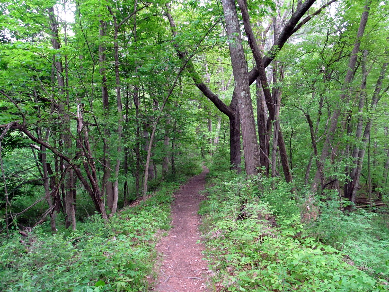
Photo Credits (2)
Difficulty
Easy
Trail Length
1.0 miles
Trail Type
Out And Back
Elevation Gain
100 ft
About Danforth Falls
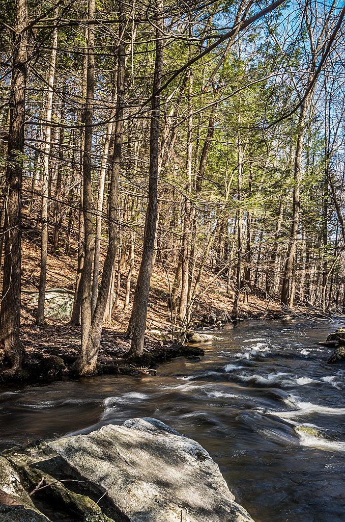
Danforth Falls is a small, picturesque cascade tucked into Hudson, Massachusetts, within the city-owned Danforth Creek Conservation Area (designation: LOTH). The falls sit in a pleasant stretch of mixed woods and offer a peaceful, close-to-town nature break that’s especially photogenic after spring runoff or a heavy rain. Its modest size and easy approach make it a favorite spot for local hikers, dog walkers, and families looking for a short outdoor outing. Access to the falls is straightforward: a short, well-traveled woodland route leads down to the stream and viewing spots. The conservation area is municipally held rather than federal land, so trail amenities are minimal — bring appropriate footwear and a picnic if you plan to linger. Camping isn’t nearby; the closest developed campground is West Hill Park, roughly 32.85 km away.
The Setting
Danforth Falls sits at 276 feet within Danforth Creek Conservation Area, fed by the Nashua River, Water Street Bridge,, in the coastal lowlands of Massachusetts.
Trail & Hike Details
The Approach
The easy 1.0-mile out and back trail gains 100 feet of elevation on the way to the falls.
Trail Description
This is a short, easy 1.0-mile out-and-back trail with about 100 feet of elevation gain, suitable for families and casual hikers. The route follows a simple woodland footpath through the Danforth Creek Conservation Area and is generally low-grade and easy to navigate. The trail can become muddy after rain, so wear shoes with traction; expect natural surface conditions and minimal built infrastructure. No USFS trail number applies—this is a municipal conservation-area trail rather than a Forest Service route.
What to Expect
Dogs are welcome.
Accessibility
The trail is not wheelchair accessible. Uneven terrain and elevation changes require steady footing.
Frequently Asked Questions
🐶 Are Dogs Allowed at Danforth Falls?
✅ Dogs are allowed
Are There Any Fees or Permits Required?
🆖 No fees required
🏊 Is There Swimming at Danforth Falls?
❌ Swimming is not allowed
When to Visit
Spring is the best time to visit, as the waterfall flow is typically strongest during this season. Fall offers beautiful foliage, while summer provides a lush, green setting.
Seasonal Access
The best time to visit is Spring, Summer, and Fall. Winter access may be limited.
Safety Information
The trail may be slippery or muddy after rain. Visitors should wear appropriate footwear and be cautious near the waterfall, as rocks can be slippery.
Current Water Conditions
2 ft³/s
Current discharge — how much water is flowing
Much lower than usual for this time of year
Based on 14 years of record
0.68 ft
Water depth at gauge
70°F
WarmVery comfortable
7-Day Discharge Trend
What does this mean for your visit?
Flow is well below normal for this time of year, so the waterfall may be a trickle. Water temperature is a refreshing 70 degrees F, good for a quick swim.
About This Gauge
7-Day Flow Outlook
Based on the USGS gauge NASHUA RIVER, WATER STREET BRIDGE, AT CLINTON, MA (7 km away).
Today
Low
3 cfs
3/10Tomorrow
Barely Flowing
3 cfs
5/10Sat
Barely Flowing
3 cfs
5/10Sun
Low
3 cfs
3/10Mon
Low
3 cfs
4/10Tue
Low
3 cfs
4/10Wed
Low
3 cfs
4/10Best window: Tomorrow — barely flowing flow, sunny (trip score 5/10).
Best time of year: this gauge typically runs highest from mid June to early July, peaking in April.
How we calculate this
This is a transparent outlook, not a precise forecast. We take the waterfall's current flow strength (how it ranks against its historical normal for today, from the nearest USGS stream gauge), carry that ranking forward along the gauge's seasonal curve, and nudge it for forecast rain. Confidence is highest for the next day or two and falls further out. Always check official conditions and your own judgment before visiting — high flows can be dangerous.
Know when to go.
Get a free email alert when waterfalls near Marlborough hit peak flow. We only send when conditions are worth the trip — no weekly newsletters, no spam.
Weather Forecast
Location & Access
Getting There
Danforth Falls is located in Hudson, Massachusetts, and can be accessed via Danforth Street. The trailhead is near a small parking area, but parking may be limited.
Get Directions on Google MapsParking
Limited parking is available near the trailhead on Danforth Street. Visitors should plan to arrive early, especially on weekends, to secure a spot.
Hours
Elevation
276 feet above sea level
Coordinates
42.406818° N, -71.579514° W
Land Management
Managed by UNK
Visitor Tips & Gear
Visit after recent rainfall for the best waterfall flow. Wear sturdy shoes, as the trail can be muddy. Arrive early to secure parking, and bring bug spray during warmer months.
As an Amazon Associate, we earn from qualifying purchases.
This easy 1.0 miles hike is straightforward — comfortable trail shoes and plenty of water should do. Sun exposure on the trail makes good sun protection a must in summer.

Polarized Sunglasses (Knockaround)
Cuts glare off the water so you actually see the falls — and your photos turn out better too.

Columbia Watertight II Rain Jacket
Packs into its own pocket, seam-sealed, and keeps you dry from spray and surprise rain.

Earth Pak Waterproof Dry Bag
Keeps your phone and gear dry when waterfall mist soaks everything else.

Waterproof Phone Pouch (AiRunTech)
Cheap insurance — take photos right next to the falls without killing your phone.

JOBY GorillaPod Starter Kit
Wraps around railings and rocks for long-exposure waterfall shots — no flat surface needed.

Osprey Daylite Daypack
Light, organized, and just the right size for a day hike — fits water, snacks, and layers.
Where to Stay

Holiday Inn Express Hotel & Suites Boston - Marlboro by IHG

Embassy Suites by Hilton Boston Marlborough

Hampton Inn Boston / Marlborough

Residences at Solomon Pond
Browse vacation cabins and private rentals nearby
Unique outdoor stays — tents, yurts, and treehouses
Rent a campervan or RV for your waterfall road trip
Some links are affiliate links. We may earn a commission at no extra cost to you.
Nearby Campground
WEST HILL PARK
20.4 miles away · 3 sites
Overview On a quiet back road and across an old fieldstone bridge lies West Hill Park, where the West River widens to form a large, natural pool. The park and its many services and activities, including a swimming beach, accessible playground, nature trails and calm, clean water, attract visitors of all ages. Three group shelters, one near the dam, are ideal facilities for hosting graduation parties, family reunions and church or other organization events. The recreation area can be reserved duri
Book on Recreation.govAdditional Information
Nearby Attractions
Nearby attractions include the Assabet River Rail Trail and other local parks in Hudson, Massachusetts.
Wildlife
Visitors may encounter birds, squirrels, and other small woodland animals. Be cautious of ticks during warmer months.
Cities near Danforth Falls
Writing about Danforth Falls? Embed this waterfall on your site for free.