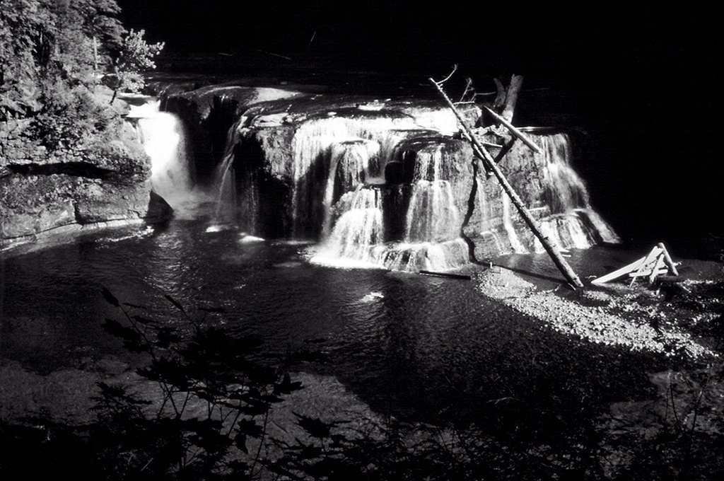
Curly Creek Falls
By Armen Suny · Last verified Mar 2026
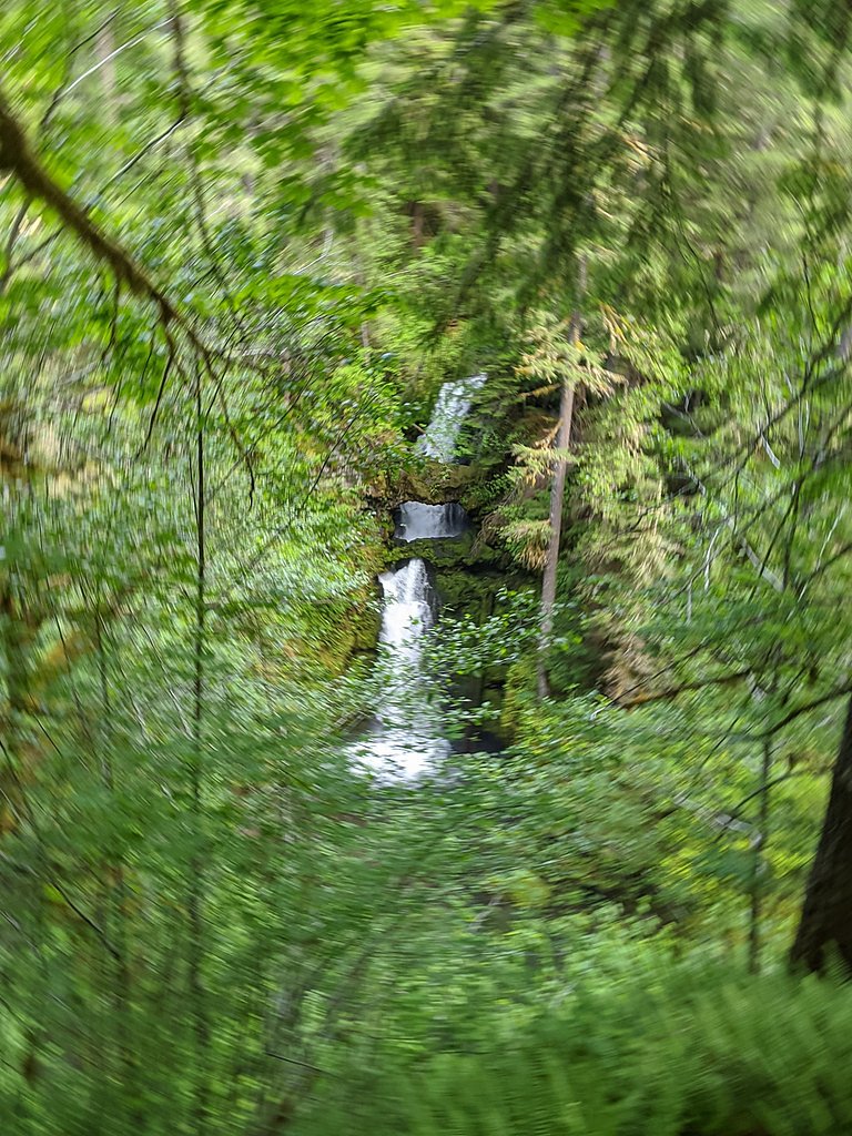
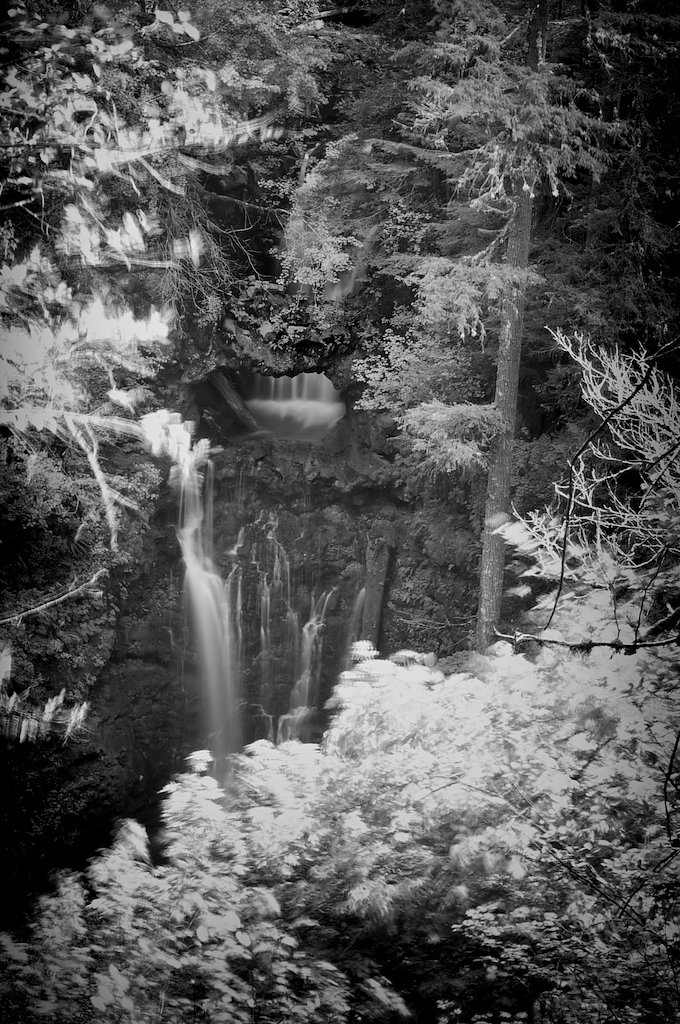

Photo Credits (5)
Difficulty
Moderate
Trail Length
2.4 miles
Trail Type
Out And Back
Elevation Gain
350 ft
About Curly Creek Falls
Curly Creek Falls is a unique waterfall located in the Gifford Pinchot National Forest in Washington. It is notable for its natural rock arch formations through which the water flows, creating a stunning and rare geological feature. The falls are surrounded by lush forest, making it a picturesque destination for nature enthusiasts.
The Setting
Curly Creek Falls sits at 1,270 feet within Gifford Pinchot National Forest, fed by the Lewis River, in the foothills of Washington.
Nearby Falls Worth Visiting
Middle Falls (265 ft) lies 9.2 miles to the northeast. Also nearby: Lower Falls (43 ft, 8.0 mi).
Trail & Hike Details
The Approach
The moderate hike follows Curly/Miller Falls (#31A), a 2.4-mile out-and-back trail over imported compacted material. Expect 350 feet of elevation gain with grades of 0-5%. The trail is fully developed (Class 5).
USFS Trail
CURLY/MILLER FALLS #31A
Trail Class
Fully Developed
Surface
Avg Grade
USFS Segment
0.34 miTrail Description
The trail to Curly Creek Falls is short and well-maintained, making it accessible for most visitors. It winds through a forested area and leads to a viewpoint where the falls can be observed. The trail is relatively flat and easy to navigate.
What to Expect
Dogs are welcome.
Accessibility
The trail is not wheelchair accessible. Uneven terrain and elevation changes require steady footing.
Frequently Asked Questions
🐶 Are Dogs Allowed at Curly Creek Falls?
✅ Dogs are allowed
Are There Any Fees or Permits Required?
🆖 No fees required
🏊 Is There Swimming at Curly Creek Falls?
❌ Swimming is not allowed
When to Visit
Spring and early summer are the best times to visit, as the water flow is typically strongest during these seasons.
Seasonal Access
The best time to visit is Spring, Summer, and Fall. Winter access may be limited. Check with Gifford Pinchot National Forest for seasonal road closures.
Safety Information
Be cautious near the viewpoint, as the area may be slippery. Stay on designated trails to avoid damaging the environment or putting yourself at risk.
Current Water Conditions
367 ft³/s
Current discharge — how much water is flowing
Much lower than usual for this time of year
Based on 43 years of record
1.41 ft
Water depth at gauge
7-Day Discharge Trend
What does this mean for your visit?
Flow is well below normal for this time of year, so the waterfall may be a trickle.
About This Gauge
7-Day Flow Outlook
Based on the USGS gauge LEWIS RIVER ABOVE MUDDY RIVER NEAR COUGAR, WA (1 km away).
Today
Moderate
418 cfs
4/10Tomorrow
Moderate
427 cfs
5/10Mon
Moderate
405 cfs
5/10Tue
Moderate
381 cfs
5/10Wed
Moderate
345 cfs
8/10Thu
Moderate
351 cfs
5/10Fri
Moderate
344 cfs
5/10Best window: Wed — moderate flow, partly sunny (trip score 8/10).
Best time of year: this gauge typically runs highest from late March to mid June, peaking in May.
How we calculate this
This is a transparent outlook, not a precise forecast. We take the waterfall's current flow strength (how it ranks against its historical normal for today, from the nearest USGS stream gauge), carry that ranking forward along the gauge's seasonal curve, and nudge it for forecast rain. Confidence is highest for the next day or two and falls further out. Always check official conditions and your own judgment before visiting — high flows can be dangerous.
Know when to go.
Get a free email alert when waterfalls near Cougar hit peak flow. We only send when conditions are worth the trip — no weekly newsletters, no spam.
Weather Forecast
Location & Access
Getting There
Curly Creek Falls is located off Forest Road 90 in the Gifford Pinchot National Forest. The trailhead is accessible by car, and the falls are a short walk from the parking area.
Get Directions on Google MapsParking
There is a small parking area near the trailhead, but spaces may be limited during peak seasons.
Elevation
1,270 feet above sea level
Coordinates
46.058169° N, -121.972031° W
Land Management
Managed by USFS
Visitor Tips & Gear
Visit during spring or early summer for the best water flow. Bring a camera to capture the unique rock formations. Arrive early to secure parking, especially on weekends.
As an Amazon Associate, we earn from qualifying purchases.
With 2.4 miles and 350 ft of elevation gain, sturdy boots and trekking poles will help on this moderate trail. Sun exposure on the trail makes good sun protection a must in summer.

Polarized Sunglasses (Knockaround)
Cuts glare off the water so you actually see the falls — and your photos turn out better too.

Columbia Watertight II Rain Jacket
Packs into its own pocket, seam-sealed, and keeps you dry from spray and surprise rain.

Earth Pak Waterproof Dry Bag
Keeps your phone and gear dry when waterfall mist soaks everything else.

Waterproof Phone Pouch (AiRunTech)
Cheap insurance — take photos right next to the falls without killing your phone.

Timberland Euro Sprint Mid Waterproof
Trusted waterproof boot with premium leather and grippy rubber sole — reliable on rocky, wet trails.

TrailBuddy Trekking Poles
Lightweight aluminum, cork grips, and flip-locks that actually hold — a best-seller for good reason.
Where to Stay

Lone Fir Resort

4-Bedroom Chateau in Southern Washington- Luxurious Retreat with Pond & Creek

Explore Mt St Helens A-Frame Chalet with Deck!

Riverfront Woodland Cabin: Wooded & Forested Views
Browse vacation cabins and private rentals nearby
Unique outdoor stays — tents, yurts, and treehouses
Rent a campervan or RV for your waterfall road trip
Some links are affiliate links. We may earn a commission at no extra cost to you.
Nearby Campground
Paradise Creek campground
7.7 miles away · 42 sites
Overview Paradise Creek sits at the confluence of Paradise Creek and the Wind River, nestled under an old-growth forest of cedars, firs, alder and maples. The sites by the river enjoy privacy from an abundance of lush undergrowth, while the other sites have a more open and spacious feel. The campground's remote location is ideal for campers seeking a quiet and relaxed environment. Recreation The Wind River provides excellent fishing, with a population of steelhead and Chinook salmon. Check state
Book on Recreation.govNearby Hot Springs
Hot springs near Cougar, Washington

Mt St Helens Fumaroles
Mount St. Helens fumaroles reach 190 degrees at 6,906 feet elevation on the crater rim, emerging 159.1 degrees above ambient in...
Rock Creek Hot Springs
Rock Creek Hot Springs emerges in the Columbia River Gorge in Skamania County, Washington, with water documented as 'hot' witho...
Moffetts (Bonneville) Hot Springs
Moffetts Hot Springs, also called Bonneville Hot Springs, flows at 97 degrees in the Gifford Pinchot National Forest at just 75...
St Martins Hot Springs
St. Martins Hot Springs flows at 120 degrees Fahrenheit at just 432 feet elevation in the Columbia River Gorge near Carson in S...

Mount Adams Fumaroles
Mount Adams fumaroles reach 150 degrees at 12,269 feet elevation, emerging 136 degrees above ambient on Washington's second-hig...

Collins Hot Springs
Collins Hot Springs emerges at 122 degrees just 127 feet above sea level in the Columbia River Gorge, producing water 68.4 degr...
Looking for a soak after your hike? Explore more hot springs near Cougar, Washington on SoakingSprings.
Explore Washington springsAdditional Information
Nearby Attractions
Nearby attractions include Lower Lewis River Falls and the Ape Caves, both of which are also located in the Gifford Pinchot National Forest.
Wildlife
The area is home to various wildlife, including birds, deer, and small mammals. Visitors should be cautious of bears and other larger animals in the forest.
Cities near Curly Creek Falls
Nearby Waterfalls
Writing about Curly Creek Falls? Embed this waterfall on your site for free.