Cummins Falls
Tennessee • 75 ft
By Armen Suny · Last verified Mar 2026
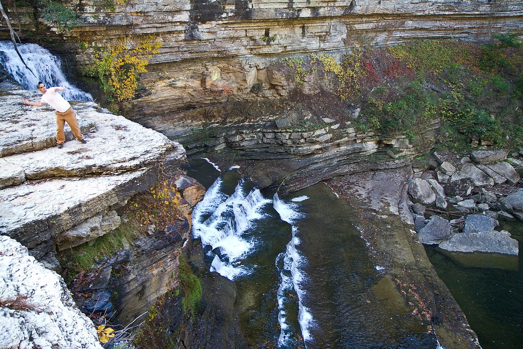
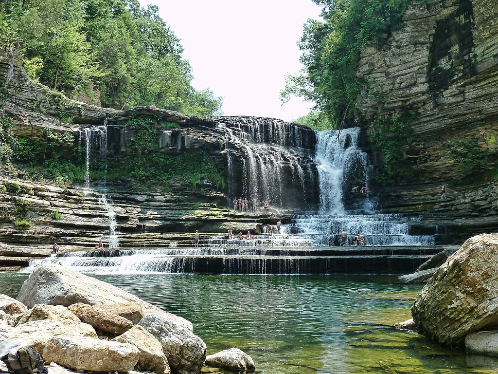
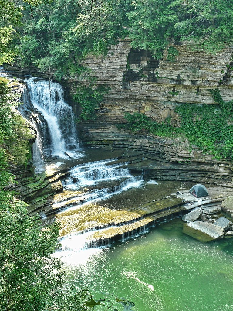
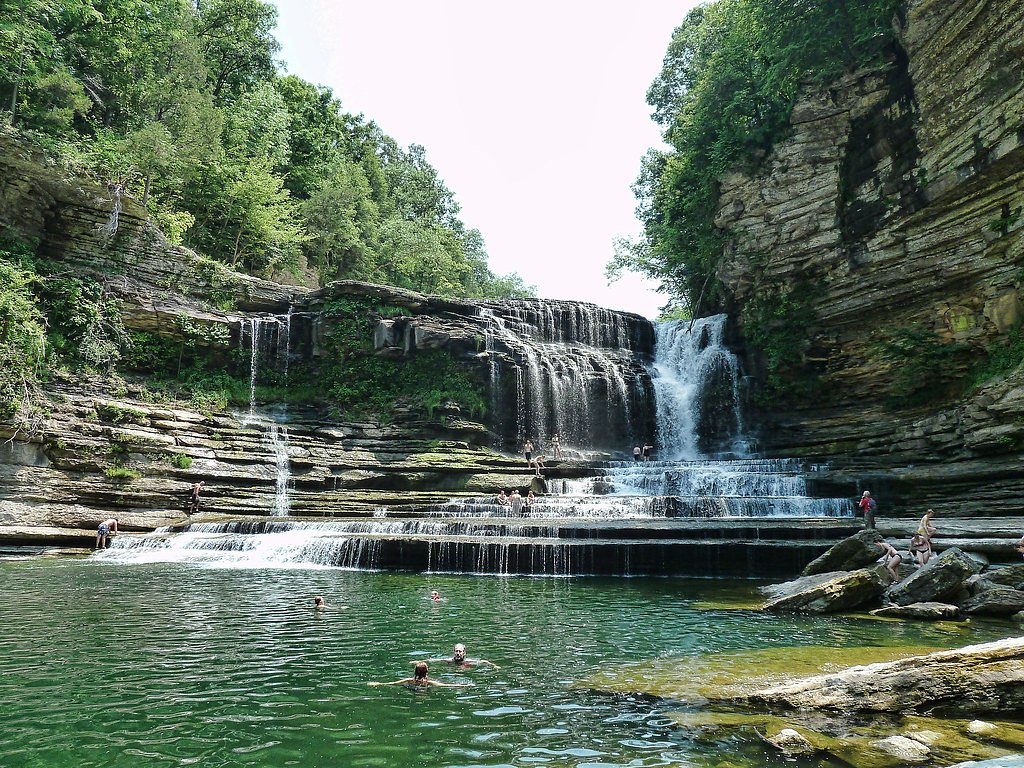

Photo Credits (5)
Difficulty
Moderate
Trail Length
2.5 miles
Trail Type
Out And Back
Elevation Gain
200 ft
About Cummins Falls
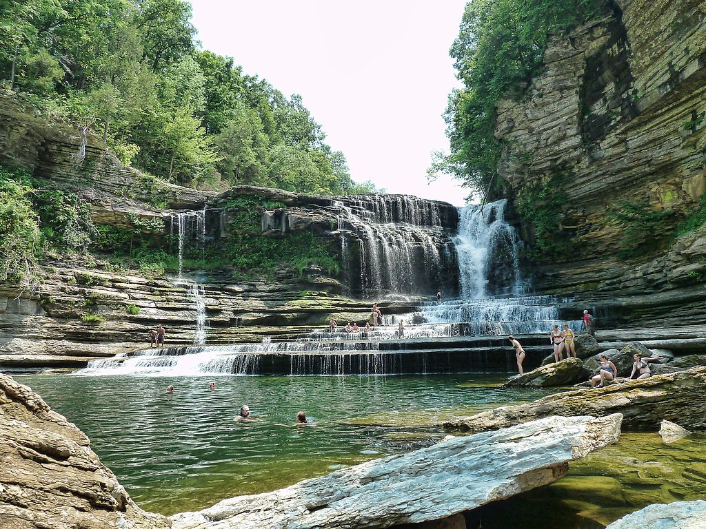
Cummins Falls is a stunning 75-foot waterfall located in Cummins Falls State Park, Tennessee. It is a popular destination for hiking, swimming, and enjoying scenic views. The waterfall cascades into a large swimming hole, making it a favorite spot during warmer months.
The Setting
Cummins Falls sits at 735 feet within Cummins Falls, fed by the Roaring River, in the foothills of Tennessee. The falls drop 75 feet.
Height: 75 feet
Trail & Hike Details
The Approach
The moderate 2.5-mile out-and-back trail gains 200 feet of elevation on the way to the falls.
Trail Description
The trail to Cummins Falls is an out-and-back hike that includes a mix of forested paths, rocky terrain, and creek crossings. The trail can be slippery and uneven, especially near the waterfall. Proper footwear is highly recommended.
What to Expect
The falls drop 75 feet. Swimming is permitted. Dogs are welcome.
Accessibility
The trail is not wheelchair accessible. Uneven terrain and elevation changes require steady footing.
Frequently Asked Questions
🐶 Are Dogs Allowed at Cummins Falls?
✅ Dogs are allowed
Are There Any Fees or Permits Required?
🤑 Fee: $6.00
Permit required
A Gorge Access Permit is required for visitors who wish to access the waterfall and swimming area. Permits can be purchased online or at the park for $6 per person.
🏊 Is There Swimming at Cummins Falls?
✅ Swimming is allowed
When to Visit
The best time to visit is during late spring through early fall when the weather is warm, and the swimming hole is accessible. However, the waterfall is also beautiful in winter, though swimming is not recommended during colder months.
Seasonal Access
The best time to visit is Spring, Summer, and Fall. Winter access may be limited.
Safety Information
The trail includes creek crossings and slippery rocks, which can be hazardous. Swimming is at your own risk, and visitors should be cautious of strong currents and deep water. Always check weather conditions before visiting, as heavy rain can cause flash flooding.
Current Water Conditions
25 ft³/s
Current discharge — how much water is flowing
Lower than usual for this time of year
Based on 7 years of record
11.58 ft
Water depth at gauge
7-Day Discharge Trend
What does this mean for your visit?
Flow is lower than usual for this time of year.
About This Gauge
This gauge is on a nearby waterway and may not reflect exact conditions at the falls.
7-Day Flow Outlook
Based on the USGS gauge ROARING RIVER NEAR HILHAM, TN (17 km away).
Today
Moderate
25 cfs
9/10Tomorrow
Moderate
26 cfs
6/10Fri
Strong
22 cfs
7/10Sat
Strong
19 cfs
7/10Sun
Strong
19 cfs
7/10Mon
Strong
19 cfs
7/10Tue
Strong
17 cfs
7/10Best window: Today — moderate flow, sunny (trip score 9/10).
Best time of year: this gauge typically runs highest from early February to early March, peaking in February.
How we calculate this
This is a transparent outlook, not a precise forecast. We take the waterfall's current flow strength (how it ranks against its historical normal for today, from the nearest USGS stream gauge), carry that ranking forward along the gauge's seasonal curve, and nudge it for forecast rain. Confidence is highest for the next day or two and falls further out. Always check official conditions and your own judgment before visiting — high flows can be dangerous.
Know when to go.
Get a free email alert when waterfalls near Dodson Branch hit peak flow. We only send when conditions are worth the trip — no weekly newsletters, no spam.
Weather Forecast
Location & Access
Getting There
Cummins Falls State Park is located near Cookeville, Tennessee, approximately 90 miles east of Nashville. The park is accessible via Cummins Mill Road, and clear signage directs visitors to the parking area.
Get Directions on Google MapsParking
There is a designated parking area at Cummins Falls State Park. Parking is typically sufficient, but it can fill up quickly during peak seasons or weekends.
Elevation
735 feet above sea level
Coordinates
36.249504° N, -85.571644° W
Land Management
Managed by OTHS
Visitor Tips & Gear
Arrive early to secure parking and avoid crowds. Wear sturdy, water-resistant shoes for the hike, as the trail includes creek crossings and rocky sections. Bring water and snacks, and be prepared for limited cell service in the area.
As an Amazon Associate, we earn from qualifying purchases.
With 2.5 miles and 200 ft of elevation gain, sturdy boots and trekking poles will help on this moderate trail. Sun exposure on the trail makes good sun protection a must in summer.

Polarized Sunglasses (Knockaround)
Cuts glare off the water so you actually see the falls — and your photos turn out better too.

Columbia Watertight II Rain Jacket
Packs into its own pocket, seam-sealed, and keeps you dry from spray and surprise rain.

Earth Pak Waterproof Dry Bag
Keeps your phone and gear dry when waterfall mist soaks everything else.

Waterproof Phone Pouch (AiRunTech)
Cheap insurance — take photos right next to the falls without killing your phone.

Timberland Euro Sprint Mid Waterproof
Trusted waterproof boot with premium leather and grippy rubber sole — reliable on rocky, wet trails.

TrailBuddy Trekking Poles
Lightweight aluminum, cork grips, and flip-locks that actually hold — a best-seller for good reason.
Where to Stay

Country Inn & Suites by Radisson, Cookeville, TN

Best Western Thunderbird Motel

Home2 Suites By Hilton Cookeville

La Quinta by Wyndham Cookeville
Browse vacation cabins and private rentals nearby
Unique outdoor stays — tents, yurts, and treehouses
Rent a campervan or RV for your waterfall road trip
Some links are affiliate links. We may earn a commission at no extra cost to you.
Nearby Campground
ROARING RIVER PARK
9.6 miles away · 1 sites
Overview Roaring River Park is located on Cordell Hull Lake on the Cumberland River System, near Gainesboro, TN. The lake itself was named after one of America's outstanding statesmen and one of Tennessee's finest volunteers. Hull was born in a log cabin in the foothills of the Cumberland Mountains. Many people enjoy boating, fishing, swimming, hunting and hiking in this wonderful natural area. Click here for a virtual tour of the Cordell Hull Lake facilities.Recreation The 12,000-acre lake stret
Book on Recreation.govAdditional Information
Nearby Attractions
Nearby attractions include Burgess Falls State Park, Fall Creek Falls State Park, and the city of Cookeville, which offers dining and lodging options.
Wildlife
The park is home to various wildlife, including birds, deer, and small mammals. Visitors may also encounter snakes, so caution is advised.
Cities near Cummins Falls
Nearby Waterfalls
Writing about Cummins Falls? Embed this waterfall on your site for free.