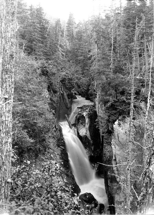
Crow Creek Falls
By Armen Suny · Last verified May 2026
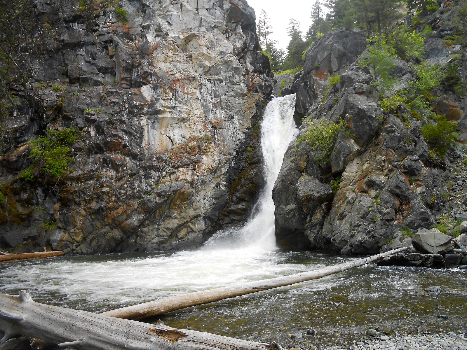
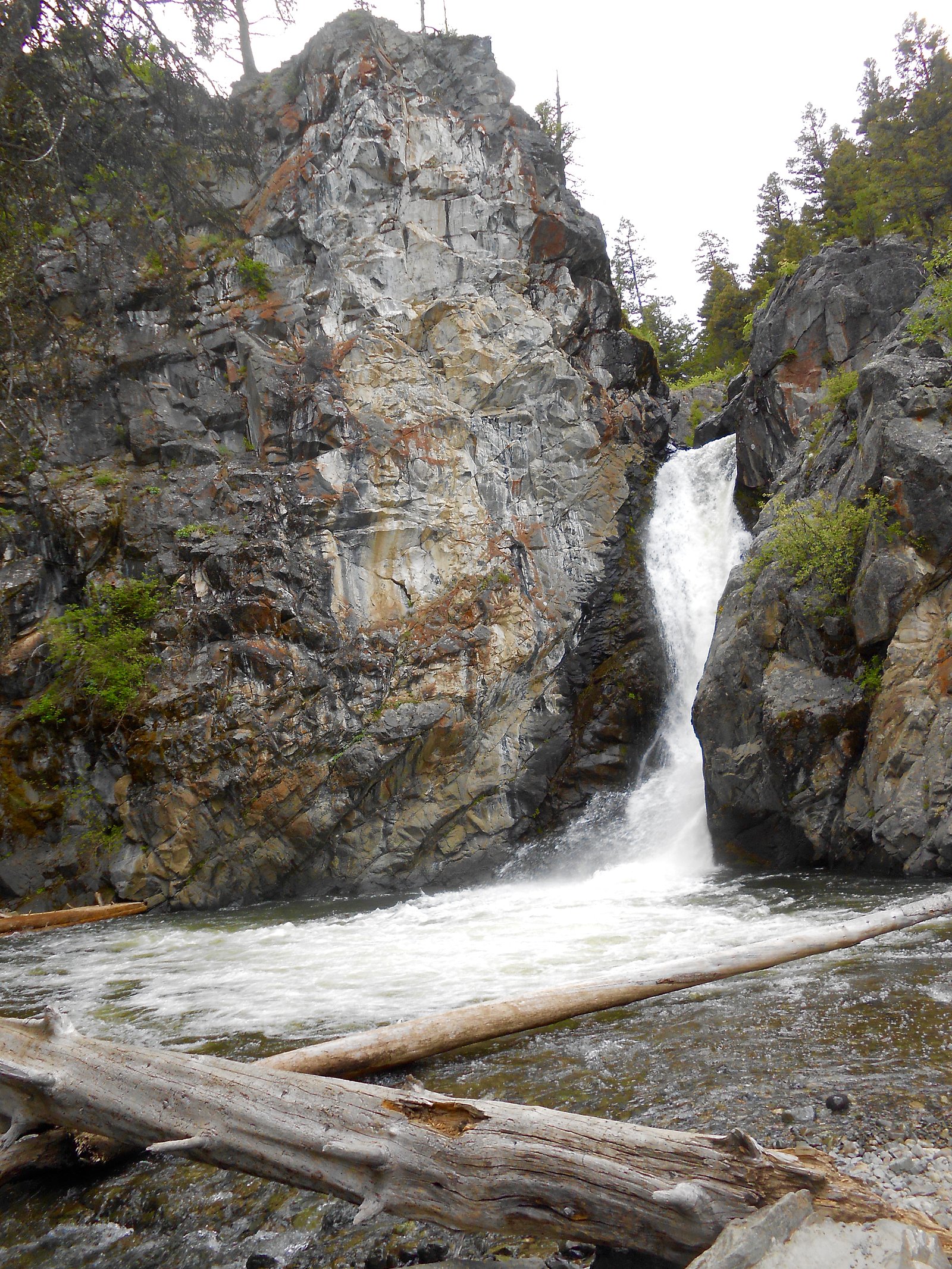
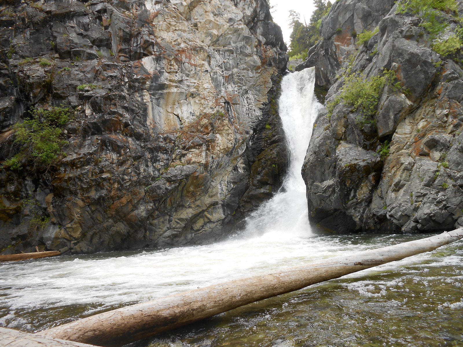
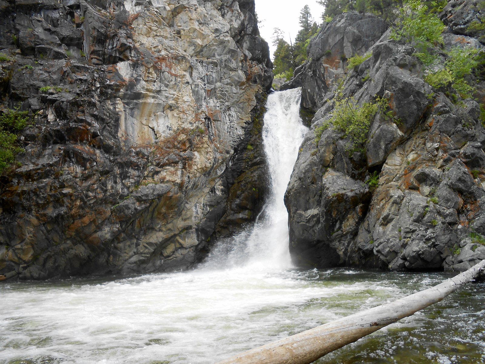

Photo Credits (5)
Difficulty
Moderate
Trail Length
6.5 miles
Trail Type
Out And Back
Elevation Gain
800 ft
About Crow Creek Falls
Crow Creek Falls is a scenic waterfall located in the Elkhorn Mountains of Montana. It is a popular destination for hikers and outdoor enthusiasts, offering a rewarding view after a moderately challenging hike through forested terrain.
The Setting
Crow Creek Falls sits at 5,636 feet within Helena National Forest, fed by the Prickly Pear Creek, in the high mountains of Montana.
Trail & Hike Details
The Approach
The moderate hike follows Crow Creek (#109), a 6.5-mile out-and-back trail over natural surface. Expect 800 feet of elevation gain. The trail is developed (Class 3).
USFS Trail
CROW CREEK #109
Trail Class
Developed
Surface
USFS Segment
1.97 miTrail Description
The trail to Crow Creek Falls is a moderately challenging hike through a mix of forested areas and open meadows. The path is well-marked and features gradual elevation gain, with some rocky sections. The waterfall is located at the end of the trail, offering a picturesque spot for relaxation and photography.
What to Expect
Dogs are welcome.
Accessibility
The trail is not wheelchair accessible. Uneven terrain and elevation changes require steady footing.
Frequently Asked Questions
🐶 Are Dogs Allowed at Crow Creek Falls?
✅ Dogs are allowed
Are There Any Fees or Permits Required?
🆖 No fees required
🏊 Is There Swimming at Crow Creek Falls?
❌ Swimming is not allowed
When to Visit
The best time to visit Crow Creek Falls is late spring through early fall, when the trail is clear of snow and the waterfall is flowing at its fullest.
Seasonal Access
The best time to visit is Spring, Summer, and Fall. Access roads and trails may close during winter due to snow. Check with Helena National Forest for seasonal road closures.
Safety Information
Be prepared for changing weather conditions, as Montana's weather can be unpredictable. Carry bear spray and know how to use it. Watch for loose rocks on the trail, and avoid hiking alone.
Current Water Conditions
14 ft³/s
Current discharge — how much water is flowing
Much lower than usual for this time of year
Based on 89 years of record
0.42 ft
Water depth at gauge
7-Day Discharge Trend
What does this mean for your visit?
Flow is well below normal for this time of year, so the waterfall may be a trickle.
About This Gauge
This gauge is on a nearby waterway and may not reflect exact conditions at the falls.
7-Day Flow Outlook
Based on the USGS gauge Prickly Pear Creek near Clancy MT (23 km away).
Today
Low
14 cfs
6/10Tomorrow
Low
14 cfs
6/10Wed
Moderate
15 cfs
4/10Thu
Moderate
14 cfs
8/10Fri
Low
12 cfs
6/10Sat
Low
12 cfs
6/10Sun
Low
12 cfs
6/10Best window: Thu — moderate flow, sunny (trip score 8/10).
Best time of year: this gauge typically runs highest from mid April to mid July, peaking in June.
How we calculate this
This is a transparent outlook, not a precise forecast. We take the waterfall's current flow strength (how it ranks against its historical normal for today, from the nearest USGS stream gauge), carry that ranking forward along the gauge's seasonal curve, and nudge it for forecast rain. Confidence is highest for the next day or two and falls further out. Always check official conditions and your own judgment before visiting — high flows can be dangerous.
Know when to go.
Get a free email alert when waterfalls near Elkhorn hit peak flow. We only send when conditions are worth the trip — no weekly newsletters, no spam.
Weather Forecast
Location & Access
Getting There
Crow Creek Falls is accessed via the Crow Creek Trailhead, located near Radersburg, Montana. The trailhead can be reached by driving on gravel roads, which may require a high-clearance vehicle depending on conditions.
Get Directions on Google MapsParking
Parking is available at the Crow Creek Trailhead, but it is limited. Arrive early to secure a spot, especially during weekends or peak seasons.
Elevation
5,636 feet above sea level
Coordinates
46.337986° N, -111.790816° W
Land Management
Managed by USFS
Visitor Tips & Gear
Wear sturdy hiking shoes, as the trail can be rocky in places. Bring plenty of water and snacks, especially during warmer months. Bug spray is recommended in the summer. Check trail conditions before heading out, as snow or mud may make the hike more difficult in early spring or late fall.
This trail sits at 5,636 ft above sea level
Elevated TrailUV radiation is roughly 23% stronger at this elevation than at sea level, and the dry air accelerates dehydration. Extra sun protection and fluids go a long way.
As an Amazon Associate, we earn from qualifying purchases.

Coppertone Sport SPF 50 Sunscreen
UV intensity jumps ~4% per 1,000 ft — at this elevation you can burn in half the time.

Sun Bum SPF 30 Lip Balm (3-Pack)
Lips have almost no natural UV protection and burn fast in thin, dry mountain air.

Liquid I.V. Electrolyte Packets
You lose moisture ~2x faster at elevation — electrolytes help you absorb water efficiently.

ROCKNIGHT Polarized UV400 Sunglasses
High-altitude glare off rock and water is intense — UV400 lenses block 99%+ of UVA/UVB.
As an Amazon Associate, we earn from qualifying purchases.
With 6.5 miles and 800 ft of elevation gain, sturdy boots and trekking poles will help on this moderate trail. Sun exposure on the trail makes good sun protection a must in summer.

Polarized Sunglasses (Knockaround)
Cuts glare off the water so you actually see the falls — and your photos turn out better too.

Columbia Watertight II Rain Jacket
Packs into its own pocket, seam-sealed, and keeps you dry from spray and surprise rain.

Earth Pak Waterproof Dry Bag
Keeps your phone and gear dry when waterfall mist soaks everything else.

Waterproof Phone Pouch (AiRunTech)
Cheap insurance — take photos right next to the falls without killing your phone.

Timberland Euro Sprint Mid Waterproof
Trusted waterproof boot with premium leather and grippy rubber sole — reliable on rocky, wet trails.

TrailBuddy Trekking Poles
Lightweight aluminum, cork grips, and flip-locks that actually hold — a best-seller for good reason.
Where to Stay

9 Mi to Helena: Mtn-View & Hot Tub at Huge Home

Historic Helena Retreat - Near Dtwn & Mt Helena!

Secluded Mountaintop Home ~11 Miles to Helena
Browse vacation cabins and private rentals nearby
Unique outdoor stays — tents, yurts, and treehouses
Rent a campervan or RV for your waterfall road trip
Some links are affiliate links. We may earn a commission at no extra cost to you.
Nearby Campground
EAGLE GUARD STATION
2.4 miles away · 1 sites
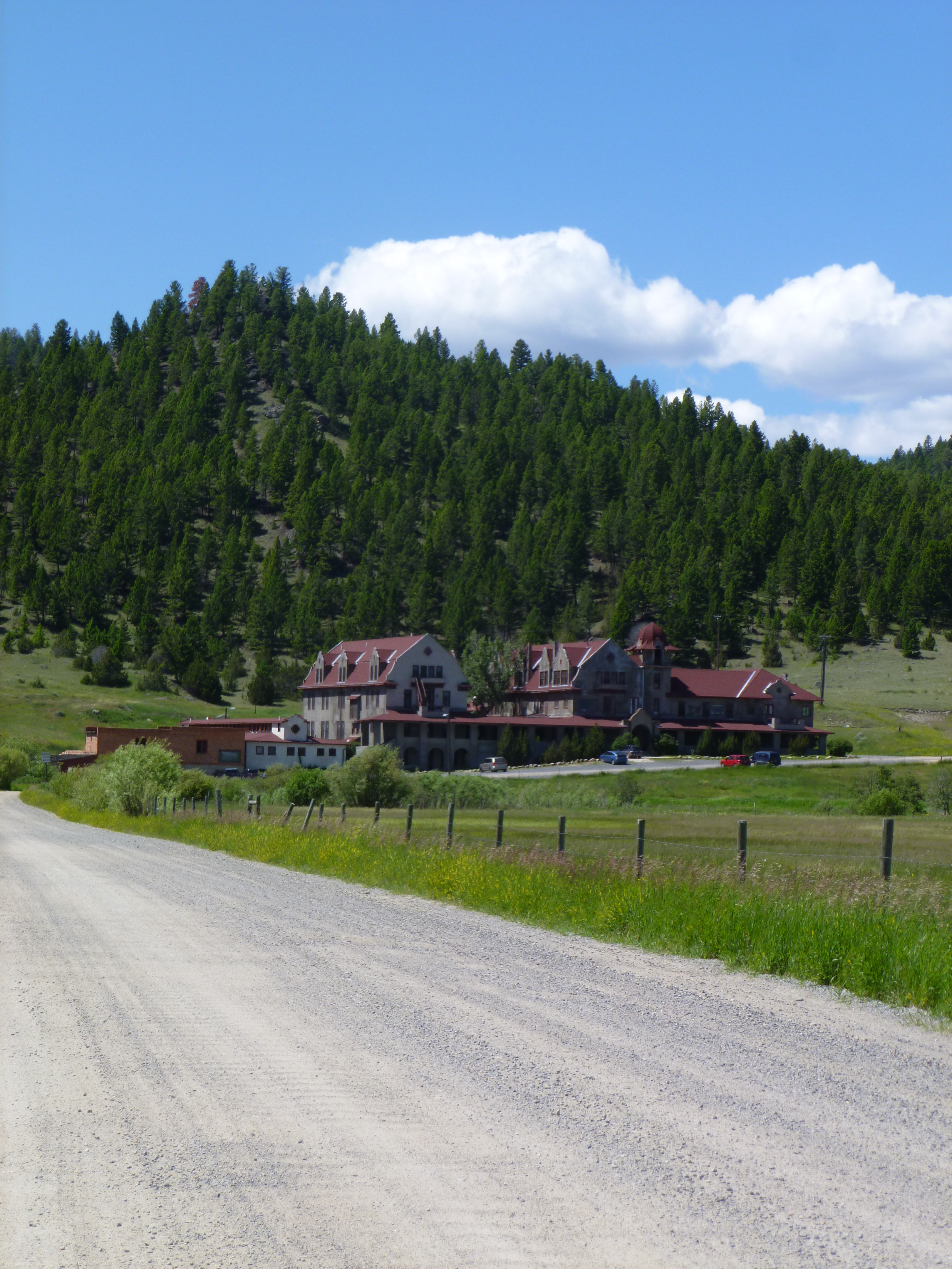
Overview Eagle Guard Station is located in high grasslands and surrounded by a scattered forest in the Elkhorn Mountains in west-central Montana. The former Eagle Creek Ranger Station was built by miner Richard Owen in 1895. While his family lived there, the area was in a booming gold rush. In 1908, the cabin was taken over by the Forest Service for administrative use. It is the oldest administrative log structure on the Helena National Forest, predating the establishment of the Forest. Today the
Book on Recreation.govNearby Hot Springs
Hot springs near Elkhorn, Montana
Bedford Hot Springs
Bedford Hot Springs discharges at 74°F with alkaline water (pH 8.2) in Broadwater County, Montana, at 3,966 feet elevation. USG...
Alhambra Hot Springs
Alhambra Hot Springs produces 138°F water at 4,297 feet elevation in Jefferson County, Montana, just 84 feet from Warm Springs ...
Boulder Hot Springs
Boulder Hot Springs ranks among Montana's hottest natural thermal features at 169°F, confirmed by USGS measurement at 74.4°C. T...

Broadwater (Helena) Hot Springs
Broadwater Hot Springs delivers 151°F water at roadside elevation of 4,033 feet near Helena, Montana's capital. The alkaline so...
Pipestone Hot Springs
Pipestone Hot Springs ranks among Montana's hotter thermal sources at 135°F, with sodium-dominant alkaline water at pH 8.1 carr...
Renova Hot Springs
Renova Hot Springs surfaces at 122 degrees Fahrenheit on BLM public land in Jefferson County, Montana, with open public access....
Looking for a soak after your hike? Explore more hot springs near Elkhorn, Montana on SoakingSprings.
Explore Montana springsAdditional Information
Nearby Attractions
The Elkhorn Mountains offer additional hiking trails and opportunities for wildlife viewing. The nearby town of Radersburg provides a glimpse into Montana's history.
Wildlife
The area is home to deer, elk, and a variety of bird species. Be aware of the potential presence of bears and carry bear spray.
Cities near Crow Creek Falls
Writing about Crow Creek Falls? Embed this waterfall on your site for free.