Photo Credits (3)
Difficulty
Easy
Trail Length
1.5 miles
Trail Type
Out And Back
Elevation Gain
300 ft
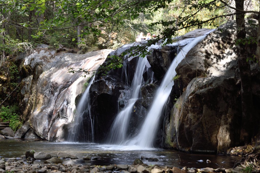
About Corlieu Falls
Corlieu Falls is a picturesque waterfall located in the Sierra National Forest near Oakhurst, California. It is part of the Lewis Creek Trail and is known for its cascading waters surrounded by lush forest scenery.
The Setting
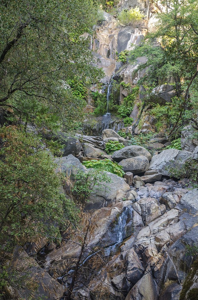
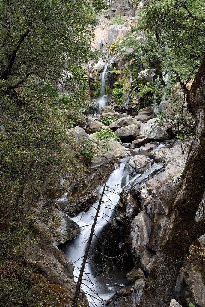
Corlieu Falls sits at 3,658 feet within Sierra National Forest, in the mountains of California. The falls drop 80 feet.
Height: 80 feet
Trail & Hike Details
The Approach
The easy hike follows Shady North (#21E228), a 1.5-mile out-and-back trail over natural surface. Expect 300 feet of elevation gain with grades of 8-10%. The trail is moderately developed (Class 2).
USFS Trail
SHADY NORTH #21E228
Trail Class
Moderately Developed
Surface
Avg Grade
USFS Segment
0.06 miTrail Description
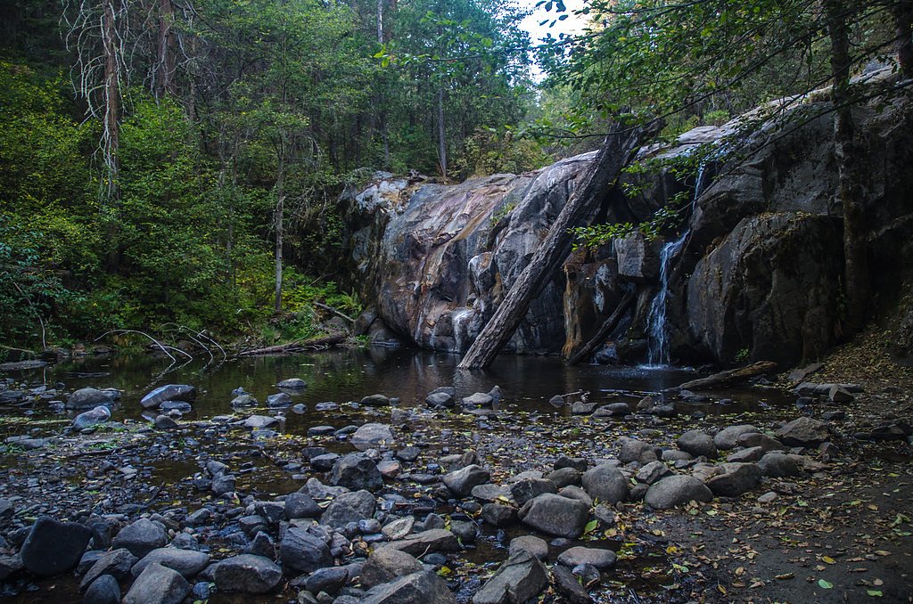
The trail to Corlieu Falls is a short and relatively easy hike through a forested area. The path is well-maintained, with some gentle inclines and a few rocky sections. The waterfall is visible from a viewing area near the trail.
What to Expect
The falls cascade 80 feet. Dogs are welcome.
Accessibility
The trail is not wheelchair accessible. Uneven terrain and elevation changes require steady footing.
Frequently Asked Questions
🐶 Are Dogs Allowed at Corlieu Falls?
✅ Dogs are allowed
Are There Any Fees or Permits Required?
🆖 No fees required
🏊 Is There Swimming at Corlieu Falls?
❌ Swimming is not allowed
When to Visit
Spring is the best time to visit Corlieu Falls, as the snowmelt ensures a strong flow. Summer and fall are also good times, but the flow may be reduced.
Seasonal Access
The best time to visit is Spring, Summer, and Fall. Winter access may be limited. Check with Sierra National Forest for seasonal road closures.
Safety Information
Watch your footing on rocky sections of the trail, especially near the falls. Be cautious of slippery rocks and avoid getting too close to the edge.
Know when to go.
Get a free email alert when waterfalls near Oakhurst hit peak flow. We only send when conditions are worth the trip — no weekly newsletters, no spam.
Weather Forecast
Location & Access
Getting There
Corlieu Falls is accessible via the Lewis Creek Trailhead, located off Highway 41, approximately 7 miles north of Oakhurst, California. The trailhead is well-marked and has a small parking area.
Get Directions on Google MapsParking
There is a small parking lot at the trailhead, but it can fill up quickly during peak seasons. Arrive early to secure a spot.
Elevation
3,658 feet above sea level
Coordinates
37.416052° N, -119.624595° W
Land Management
Managed by USFS
Visitor Tips & Gear
Wear sturdy shoes as the trail can be uneven in places. Visit in the spring for the best water flow, but the falls are also beautiful in summer and fall. Arrive early to avoid crowds and secure parking.
As an Amazon Associate, we earn from qualifying purchases.
This easy 1.5 miles hike is straightforward — comfortable trail shoes and plenty of water should do. Sun exposure on the trail makes good sun protection a must in summer.

Polarized Sunglasses (Knockaround)
Cuts glare off the water so you actually see the falls — and your photos turn out better too.

Columbia Watertight II Rain Jacket
Packs into its own pocket, seam-sealed, and keeps you dry from spray and surprise rain.

Earth Pak Waterproof Dry Bag
Keeps your phone and gear dry when waterfall mist soaks everything else.

Waterproof Phone Pouch (AiRunTech)
Cheap insurance — take photos right next to the falls without killing your phone.

JOBY GorillaPod Starter Kit
Wraps around railings and rocks for long-exposure waterfall shots — no flat surface needed.

Osprey Daylite Daypack
Light, organized, and just the right size for a day hike — fits water, snacks, and layers.
Where to Stay

River Falls Retreat

Yosemite Southgate Hotel & Suites

Best Western Plus Yosemite Gateway Inn

Sierra Sky Ranch
Browse vacation cabins and private rentals nearby
Unique outdoor stays — tents, yurts, and treehouses
Rent a campervan or RV for your waterfall road trip
Some links are affiliate links. We may earn a commission at no extra cost to you.
Nearby Campground
SOQUEL CAMPGROUND
3.4 miles away · 24 sites
Overview Soquel Campground consists of two loops on the banks of Willow Creek. The primitive sites are well-shaded by pine and fir trees and can accommodate small trailers and tents. Reservations for this campground are now site-specific. Recreation Trails can be found off Highway 41 west of the campground, including the 3.7-mile Lewis Creek National Recreation Trail and the Miami Motorcycle Trails, a network of forest roads and trails for dirt bikes and off-road vehicles. The Shadow of the Gian
Book on Recreation.govNearby Hot Springs
Hot springs near Oakhurst, California
Unnamed Spring Mono County 1
High in the Sierra National Forest near Mammoth Lakes, this 95-degree thermal spring flows at 5,585 feet elevation, creating 46...

Mono Hot Springs
Mono Hot Springs emerges at 109°F in the High Sierra's alpine terrain, set at 6,561 feet where thermal water feeds a series of ...
Fish Creek Hot Springs
Fish Creek Hot Springs, also called Iva Bell Hot Springs, emerges at 110°F deep in Sierra National Forest's backcountry at 7,24...

Reds Meadow Hot Springs
Reds Meadow Hot Springs flows at an impressive 115°F high in the Eastern Sierra at 7,638 feet elevation, delivering water 72 de...

Fumaroles
Fumaroles vent superheated steam high in the Sierra at 8,167 feet, where the geothermal system expresses itself through mountai...

Blaney Meadows Hot Springs
Blaney Meadows Hot Springs emerges at 109 degrees Fahrenheit from the Sierra National Forest at 7,676 feet elevation, deliverin...
Looking for a soak after your hike? Explore more hot springs near Oakhurst, California on SoakingSprings.
Explore California springsAdditional Information
Nearby Attractions
Nearby attractions include Red Rock Falls, Bass Lake, and Yosemite National Park, which is about 30 miles away.
Wildlife
The area is home to various wildlife, including deer, squirrels, and a variety of birds. Be cautious of ticks and other insects.
Cities near Corlieu Falls
Nearby Waterfalls
Writing about Corlieu Falls? Embed this waterfall on your site for free.