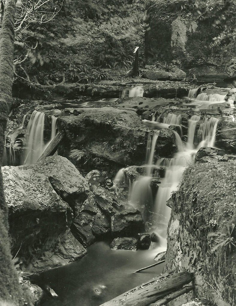
Coquille River Falls
By Armen Suny · Last verified May 2026
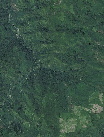
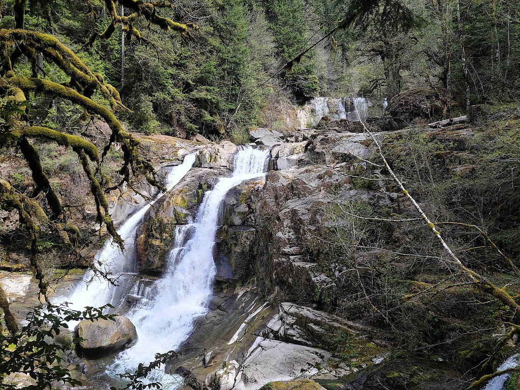
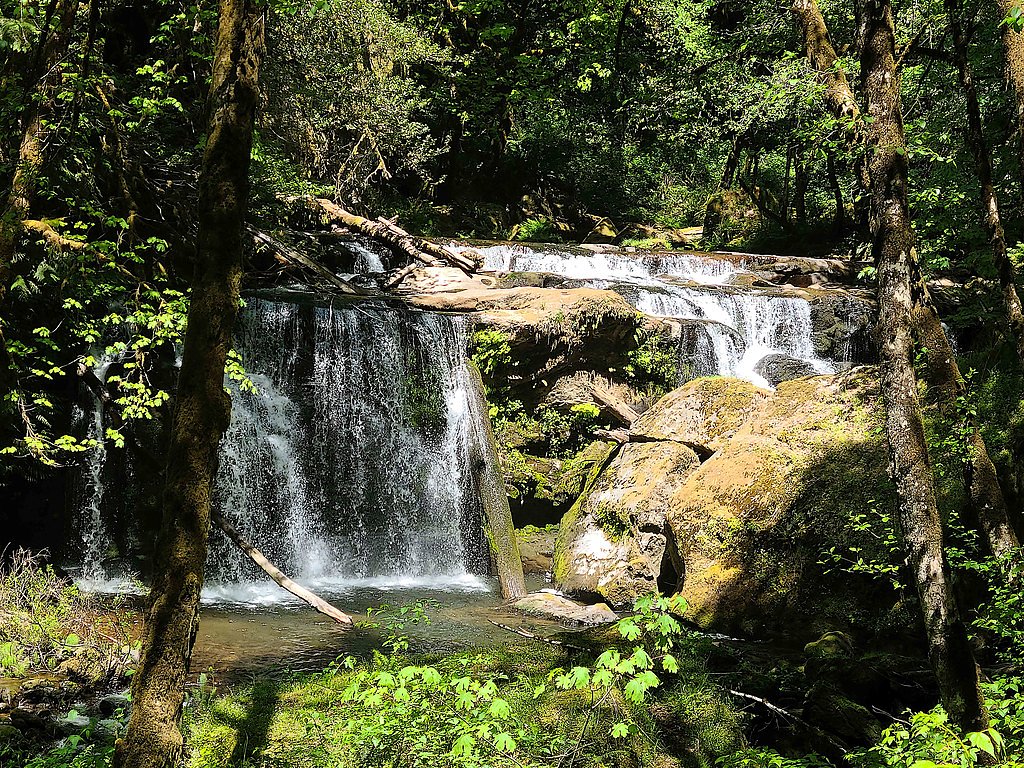
Photo Credits (5)
Difficulty
Easy
Trail Length
1.2 miles
Trail Type
Out And Back
Elevation Gain
200 ft
About Coquille River Falls
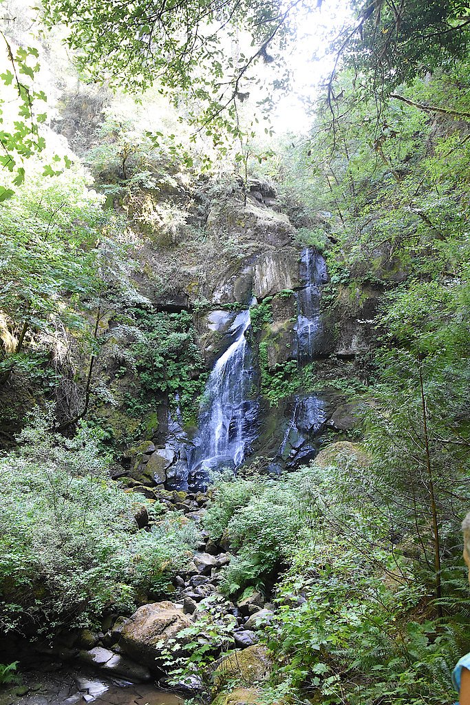
Coquille River Falls is a picturesque waterfall located in the Siskiyou National Forest in Oregon. It is surrounded by lush greenery and offers a serene, secluded experience for visitors. The falls cascade over moss-covered rocks, creating a tranquil and scenic environment.
The Setting
Coquille River Falls sits at 1,237 feet within Siskiyou National Forest, fed by the Rogue River, in the foothills of Oregon.
Trail & Hike Details
The Approach
The easy hike follows Coquille River Falls (#1257), a 1.2-mile out-and-back trail over natural surface. Expect 200 feet of elevation gain. The trail is developed (Class 3).
USFS Trail
COQUILLE RIVER FALLS #1257
Trail Class
Developed
Surface
USFS Segment
0.44 miTrail Description
The trail to Coquille River Falls is a short and relatively easy hike through a dense forest. The path is well-maintained but may be muddy or slippery after rain. The trail descends gently to the base of the falls, offering beautiful views of the surrounding forest and river.
What to Expect
Dogs are welcome.
Accessibility
The trail is not wheelchair accessible. Uneven terrain and elevation changes require steady footing.
Frequently Asked Questions
🐶 Are Dogs Allowed at Coquille River Falls?
✅ Dogs are allowed
Are There Any Fees or Permits Required?
🆖 No fees required
🏊 Is There Swimming at Coquille River Falls?
❌ Swimming is not allowed
When to Visit
Spring and early summer are the best times to visit, as the waterfall is most active due to snowmelt and rainfall.
Seasonal Access
The best time to visit is Spring, Summer, and Fall. Winter access may be limited. Check with Siskiyou National Forest for seasonal road closures.
Safety Information
Exercise caution near the waterfall, as rocks can be slippery. Be aware of changing weather conditions and avoid hiking during heavy rain or storms. Cell service may be unreliable in the area.
Current Water Conditions
1,680 ft³/s
Current discharge — how much water is flowing
Much lower than usual for this time of year
Based on 65 years of record
4.08 ft
Water depth at gauge
69°F
CoolRefreshing for swimming
7-Day Discharge Trend
What does this mean for your visit?
Flow is well below normal for this time of year, so the waterfall may be a trickle. Water temperature is a refreshing 69 degrees F, good for a quick swim.
About This Gauge
This gauge is on a nearby waterway and may not reflect exact conditions at the falls.
7-Day Flow Outlook
Based on the USGS gauge ROGUE RIVER NEAR AGNESS, OR (14 km away).
Today
Barely Flowing
1804 cfs
3/10Tomorrow
Low
1831 cfs
4/10Sun
Low
1767 cfs
4/10Mon
Barely Flowing
1640 cfs
5/10Tue
Barely Flowing
1566 cfs
5/10Wed
Barely Flowing
1496 cfs
5/10Thu
Barely Flowing
1591 cfs
3/10Best window: Mon — barely flowing flow, mostly sunny (trip score 5/10).
Best time of year: this gauge typically runs highest from early March to early April, peaking in January.
How we calculate this
This is a transparent outlook, not a precise forecast. We take the waterfall's current flow strength (how it ranks against its historical normal for today, from the nearest USGS stream gauge), carry that ranking forward along the gauge's seasonal curve, and nudge it for forecast rain. Confidence is highest for the next day or two and falls further out. Always check official conditions and your own judgment before visiting — high flows can be dangerous.
Know when to go.
Get a free email alert when waterfalls near Powers hit peak flow. We only send when conditions are worth the trip — no weekly newsletters, no spam.
Weather Forecast
Location & Access
Getting There
Coquille River Falls is located off Forest Road 33 in the Siskiyou National Forest. The trailhead can be accessed by driving approximately 20 miles east of Powers, Oregon. The road to the trailhead may be gravel and uneven in some sections, so a high-clearance vehicle is recommended.
Get Directions on Google MapsParking
There is a small parking area near the trailhead, but space may be limited.
Elevation
1,237 feet above sea level
Coordinates
42.717378° N, -124.021412° W
Land Management
Managed by USFS
Visitor Tips & Gear
Wear sturdy shoes as the trail can be slippery, especially after rain. Bring insect repellent during the summer months. Arrive early to secure parking, as the lot is small. Cell service may be limited in the area, so plan accordingly.
As an Amazon Associate, we earn from qualifying purchases.
This easy 1.2 miles hike is straightforward — comfortable trail shoes and plenty of water should do. Sun exposure on the trail makes good sun protection a must in summer.

Polarized Sunglasses (Knockaround)
Cuts glare off the water so you actually see the falls — and your photos turn out better too.

Columbia Watertight II Rain Jacket
Packs into its own pocket, seam-sealed, and keeps you dry from spray and surprise rain.

Earth Pak Waterproof Dry Bag
Keeps your phone and gear dry when waterfall mist soaks everything else.

Waterproof Phone Pouch (AiRunTech)
Cheap insurance — take photos right next to the falls without killing your phone.

JOBY GorillaPod Starter Kit
Wraps around railings and rocks for long-exposure waterfall shots — no flat surface needed.

Osprey Daylite Daypack
Light, organized, and just the right size for a day hike — fits water, snacks, and layers.
Where to Stay

The Whale

The Sunset

Porters Paradise

Pacific Reef Hotel & Light Show
Browse vacation cabins and private rentals nearby
Unique outdoor stays — tents, yurts, and treehouses
Rent a campervan or RV for your waterfall road trip
Some links are affiliate links. We may earn a commission at no extra cost to you.
Nearby Campground
BALD KNOB LOOKOUT
1.6 miles away · 1 sites
Overview Bald Knob Lookout is perched atop Bald Knob at an elevation of 3,630 feet in the Rogue River-Siskiyou National Forest. The lookout offers visitors a unique lodging experience and panoramic views of the surrounding area. Originally developed in 1931 as a lookout site, Bald Knob served as an Aircraft Warning Service (AWS) observation station between 1942 and 1944. The Forest Service removed and replaced the original with the present flat top structure in 1963. The lookout tower is availabl
Book on Recreation.govAdditional Information
Nearby Attractions
Nearby attractions include the Rogue River-Siskiyou National Forest and the town of Powers, Oregon, which offers additional hiking and outdoor activities.
Wildlife
The area is home to a variety of wildlife, including deer, birds, and small mammals. Visitors may also encounter insects such as mosquitoes during warmer months.
Cities near Coquille River Falls
Nearby Waterfalls
Writing about Coquille River Falls? Embed this waterfall on your site for free.