
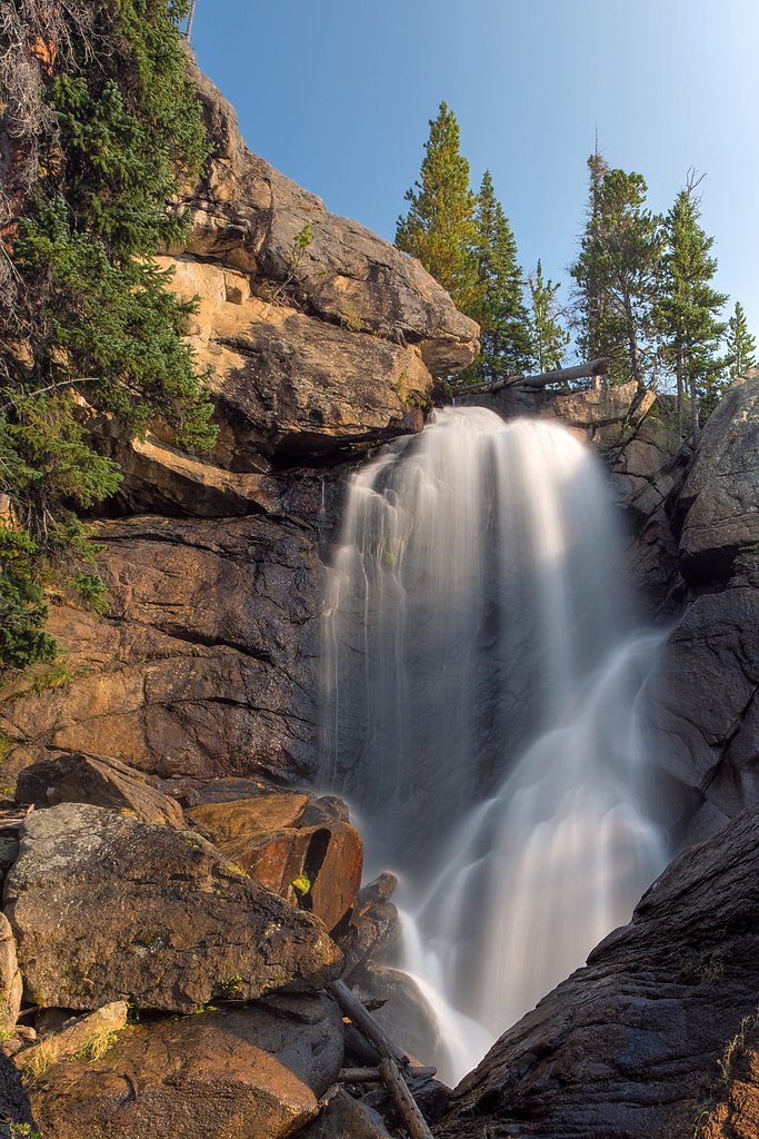
Copeland Falls
Colorado • Rocky Mountain National Park
By Armen Suny · Last verified May 2026
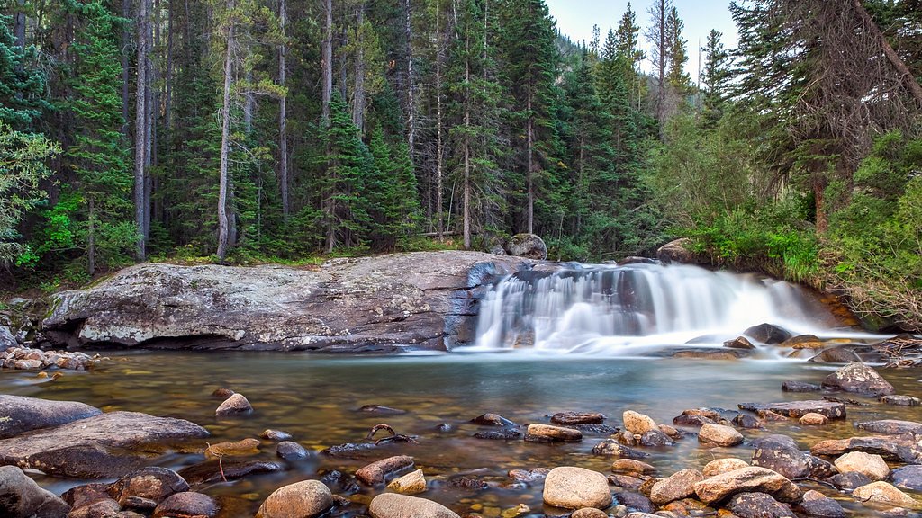
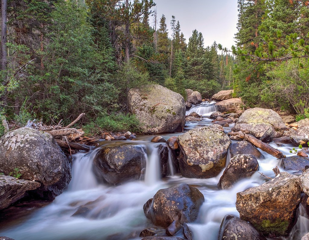
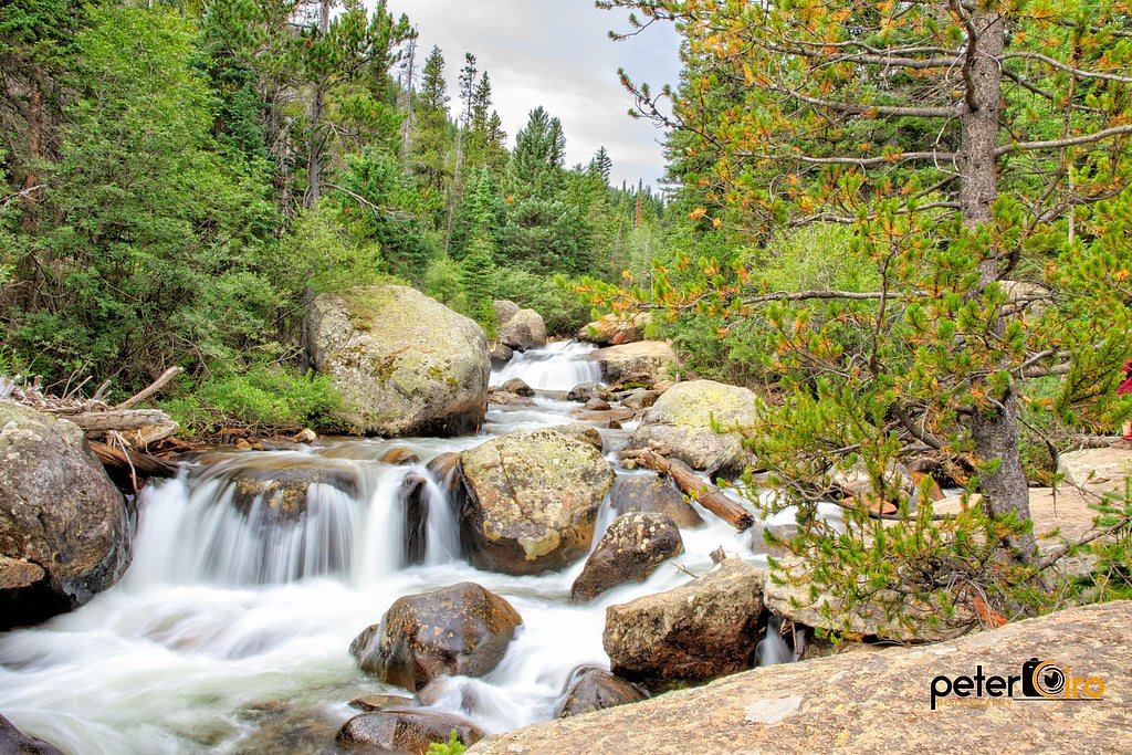
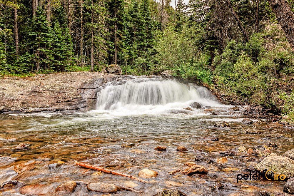

Photo Credits (5)
Difficulty
Easy
Trail Length
0.6 miles
Trail Type
Out And Back
Elevation Gain
50 ft
About Copeland Falls
Copeland Falls is a picturesque waterfall located in Rocky Mountain National Park, Colorado. It is part of the North Saint Vrain Creek and is known for its serene beauty and accessibility. The falls are divided into two sections: Upper and Lower Copeland Falls, both offering tranquil views amidst lush forest surroundings.
The Setting
Copeland Falls sits at 8,524 feet within Rocky Mountain National Park, in the high alpine of Colorado.
Trail & Hike Details
The Approach
The easy 0.6-mile out-and-back trail gains 50 feet of elevation on the way to the falls.
Trail Description
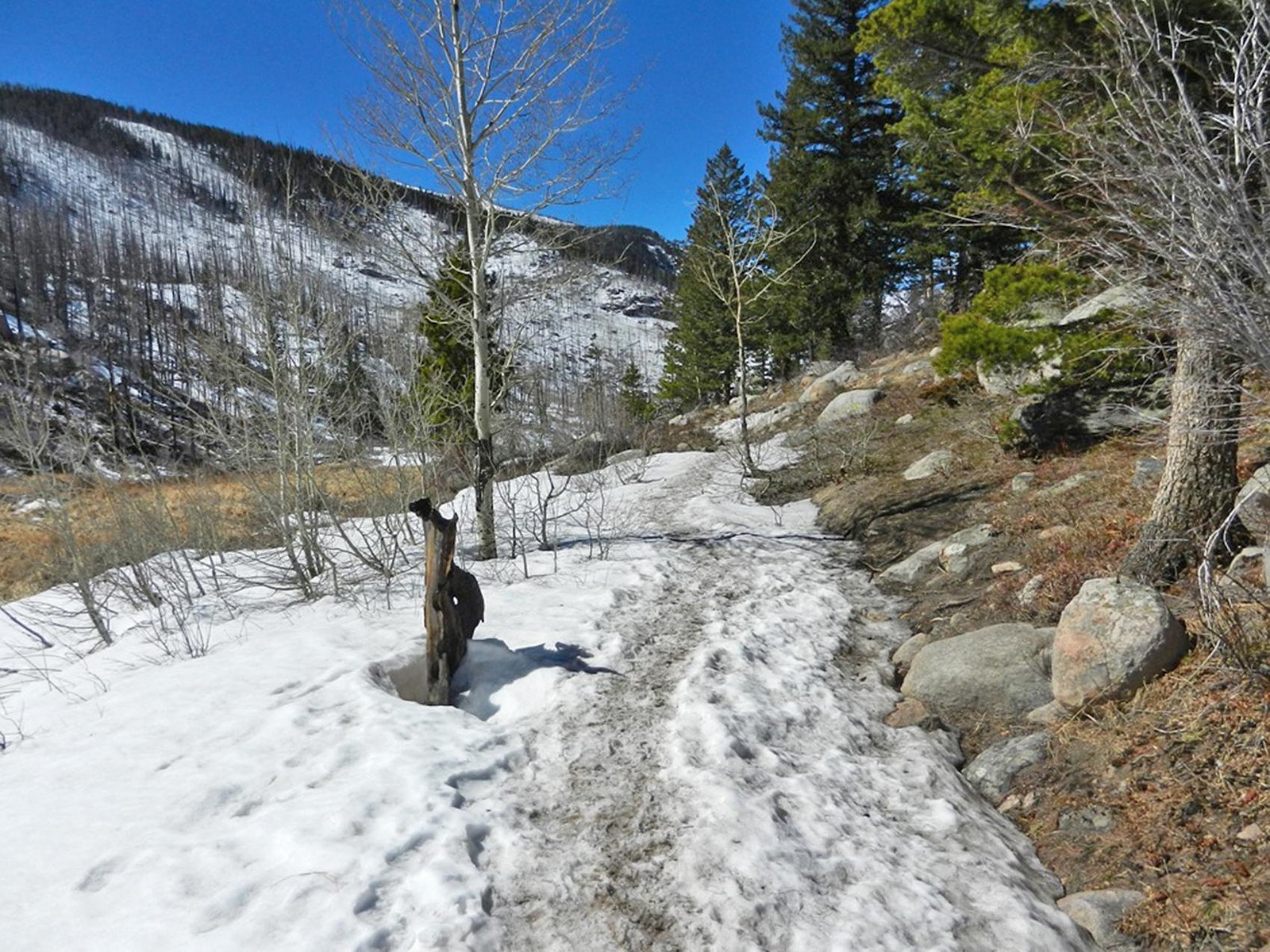
The trail to Copeland Falls is a short and easy hike along the Wild Basin Trail. The path is well-maintained and follows the North Saint Vrain Creek, offering scenic views and the soothing sound of flowing water. The trail leads to both the Lower and Upper Copeland Falls, which are only a short distance apart.
What to Expect
Visitors can expect a peaceful hike through a forested area with minimal elevation gain. The falls are not particularly tall but are charming and photogenic. Wildlife sightings, such as birds and small mammals, are common in the area.
Accessibility
The trail is short and relatively flat, but the surface may be uneven. Contact the managing agency for accessibility details.
Frequently Asked Questions
🐶 Are Dogs Allowed at Copeland Falls?
❌ Dogs are not allowed
Are There Any Fees or Permits Required?
🤑 Fee: $30.00
Permit required
A timed entry reservation is required to access Rocky Mountain National Park during peak season (May through October).
🏊 Is There Swimming at Copeland Falls?
❌ Swimming is not allowed
When to Visit
Spring and early summer are ideal for visiting, as the snowmelt increases the water flow. Fall offers beautiful foliage, while winter provides a serene, snowy landscape.
Seasonal Access
The best time to visit is Spring, Summer, Fall, and Winter. Check with Rocky Mountain National Park for current conditions.
Safety Information
Be cautious of slippery rocks near the falls, especially during wet or icy conditions. Stay on designated trails to avoid damaging the environment and for your safety.
Current Water Conditions
-443 ft³/s
Current discharge — how much water is flowing
About average for this time of year
Based on 15 years of record
8.65 ft
Water depth at gauge
64°F
CoolRefreshing for swimming
7-Day Discharge Trend
What does this mean for your visit?
Flow is about average for this time of year. Water temperature is a refreshing 64 degrees F, good for a quick swim. Expect crystal clear visibility. PH is alkaline at 8.7 and mineral content is typical.
Water Quality
pH
AlkalineAbove normal range (6.5-8.5)
Water Clarity
Crystal clearExcellent visibility
Conductance
Dissolved minerals in the water
About This Gauge
This gauge is on a nearby waterway and may not reflect exact conditions at the falls.
7-Day Flow Outlook
Based on the USGS gauge GRAND LAKE OUTLET BLW CHIPMUNK LN AT GRAND LK, CO (23 km away).
Today
Moderate
116 cfs
9/10Tomorrow
Moderate
169 cfs
9/10Mon
Moderate
160 cfs
9/10Tue
Moderate
145 cfs
9/10Wed
Moderate
71 cfs
9/10Thu
Moderate
13 cfs
9/10Fri
Moderate
19 cfs
9/10Best window: Today — moderate flow, sunny (trip score 9/10).
Best time of year: this gauge typically runs highest from early June to mid June, peaking in June.
How we calculate this
This is a transparent outlook, not a precise forecast. We take the waterfall's current flow strength (how it ranks against its historical normal for today, from the nearest USGS stream gauge), carry that ranking forward along the gauge's seasonal curve, and nudge it for forecast rain. Confidence is highest for the next day or two and falls further out. Always check official conditions and your own judgment before visiting — high flows can be dangerous.
Know when to go.
Get a free email alert when waterfalls near Allenspark hit peak flow. We only send when conditions are worth the trip — no weekly newsletters, no spam.
Weather Forecast
Location & Access
Getting There
Copeland Falls is located within Rocky Mountain National Park, near the Wild Basin Trailhead. From Estes Park, take Highway 7 south to the Wild Basin entrance. Follow the road to the Wild Basin Trailhead parking area.
Get Directions on Google MapsParking
Parking is available at the Wild Basin Trailhead, but it can fill up quickly, especially during peak seasons. Arrive early to secure a spot.
Elevation
8,524 feet above sea level
Coordinates
40.206374° N, -105.568612° W
Land Management
Managed by NPS
Visitor Tips & Gear
Arrive early to avoid crowds and secure parking. Wear sturdy shoes, as the trail can be muddy or icy depending on the season. Bring a camera to capture the beauty of the falls and surrounding area.
This trail sits at 8,524 ft — the air is noticeably thinner
High AltitudeSome visitors experience headaches, fatigue, or shortness of breath at this elevation. Take it slow, stay hydrated, and consider supplemental oxygen if you're coming from a lower altitude.
As an Amazon Associate, we earn from qualifying purchases.

Coppertone Sport SPF 50 Sunscreen
UV intensity jumps ~4% per 1,000 ft — at this elevation you can burn in half the time.

Sun Bum SPF 30 Lip Balm (3-Pack)
Lips have almost no natural UV protection and burn fast in thin, dry mountain air.

Liquid I.V. Electrolyte Packets
You lose moisture ~2x faster at elevation — electrolytes help you absorb water efficiently.

ROCKNIGHT Polarized UV400 Sunglasses
High-altitude glare off rock and water is intense — UV400 lenses block 99%+ of UVA/UVB.

Boost Oxygen 10L Canister (2-Pack)
Portable supplemental oxygen for quick relief from headaches and shortness of breath.

Altitude Rx OxyBoost Complex
Antioxidant formula designed to support your body's natural altitude acclimation.
As an Amazon Associate, we earn from qualifying purchases.
For this easy 0.6 miles trail, lightweight trail shoes and a water bottle are usually sufficient. Icy conditions are common in winter — traction cleats are a smart addition.
America the Beautiful Annual Pass
Covers entrance fees at 2,000+ federal recreation sites — required at most National Parks.

Columbia Watertight II Rain Jacket
Packs into its own pocket, seam-sealed, and keeps you dry from spray and surprise rain.

Polarized Sunglasses (Knockaround)
Cuts glare off the water so you actually see the falls — and your photos turn out better too.

Earth Pak Waterproof Dry Bag
Keeps your phone and gear dry when waterfall mist soaks everything else.

Waterproof Phone Pouch (AiRunTech)
Cheap insurance — take photos right next to the falls without killing your phone.

Kahtoola MICROspikes
Cult-favorite traction cleats that grip ice and wet rock — essential for winter waterfall hikes.

JOBY GorillaPod Starter Kit
Wraps around railings and rocks for long-exposure waterfall shots — no flat surface needed.
Where to Stay

Riversong Inn Retreat

Mountain Shadows Resort

Boulder Brook on Fall River

Murphy's River Lodge
Browse vacation cabins and private rentals nearby
Unique outdoor stays — tents, yurts, and treehouses
Rent a campervan or RV for your waterfall road trip
Some links are affiliate links. We may earn a commission at no extra cost to you.
Nearby Campground
CAMP DICK
5.9 miles away · 42 sites
Overview Camp Dick is the site of a Civilian Conservation Corps camp that was established in the 1930s. It is located just off the Peak to Peak Scenic Byway, on the Middle Saint Vrain Creek.Recreation The Middle Saint Vrain Creek is a good fly-fishing stream where anglers cast for rainbow, brown and cutthroat trout. Many trails in the vicinity are open to hiking and biking, including Sourdough and Buchanan Pass trails. The Indian Peaks Wilderness boundary is four miles from the west end of the ca
Book on Recreation.govNearby Hot Springs
Hot springs near Allenspark, Colorado

Idaho Springs
Idaho Springs surfaces at 115°F in Clear Creek County at 7,682 feet elevation, emerging near Soda Creek Road just 273 feet from...

Eldorado Springs
Eldorado Springs emerges at 79 degrees Fahrenheit in Boulder County's foothills as a low-mineralization thermal seep just 9 met...

Hot Sulphur Springs
Hot Sulphur Springs flows at 111°F along Parshall Divide Road in Grand County, emerging just 58 feet from the pavement in the s...
Looking for a soak after your hike? Explore more hot springs near Allenspark, Colorado on SoakingSprings.
Explore Colorado springsAdditional Information
Nearby Attractions
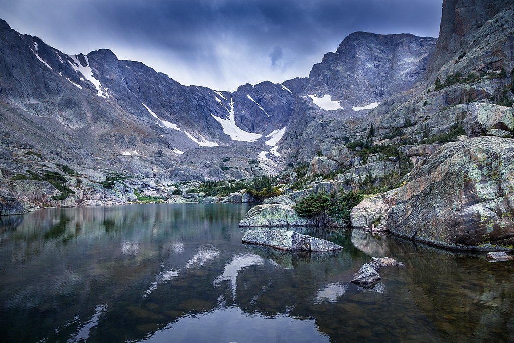
Other attractions in the Wild Basin area include Calypso Cascades and Ouzel Falls, which can be accessed via the same trail.
Wildlife
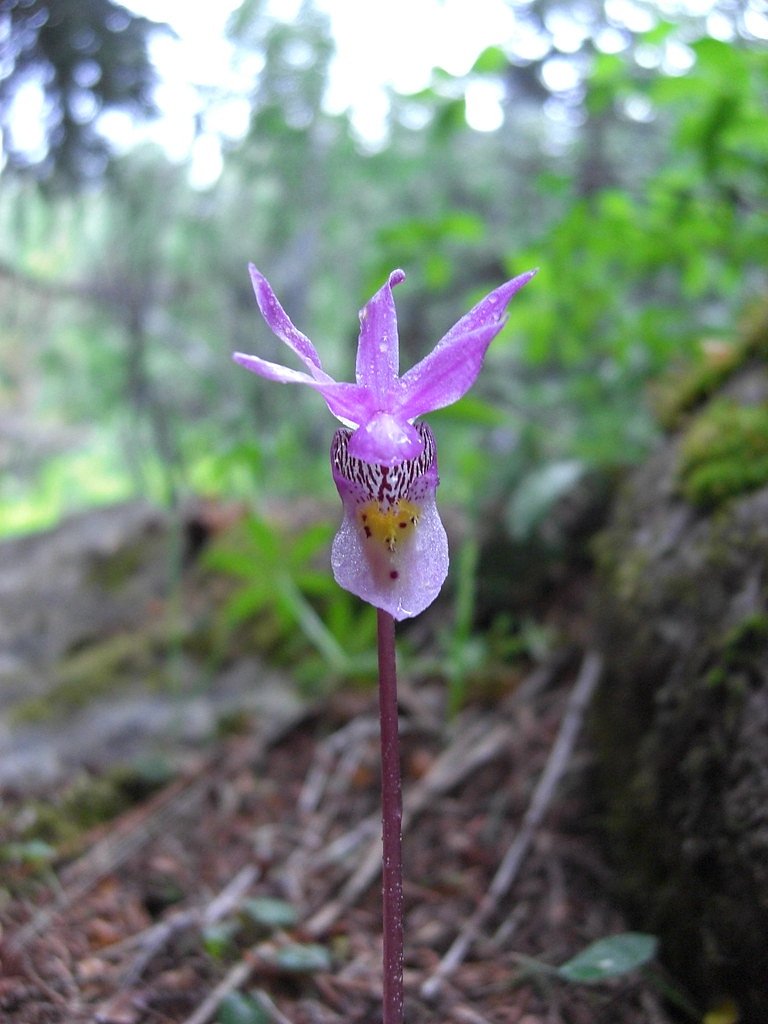
The area is home to a variety of wildlife, including deer, elk, birds, and small mammals. Be cautious and maintain a safe distance from any animals.
Cities near Copeland Falls
Nearby Waterfalls
Writing about Copeland Falls? Embed this waterfall on your site for free.