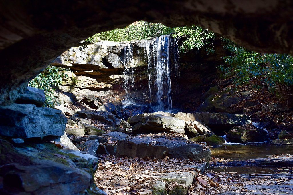
Cole Run Falls
Pennsylvania • 15 ft
By Armen Suny · Last verified May 2026
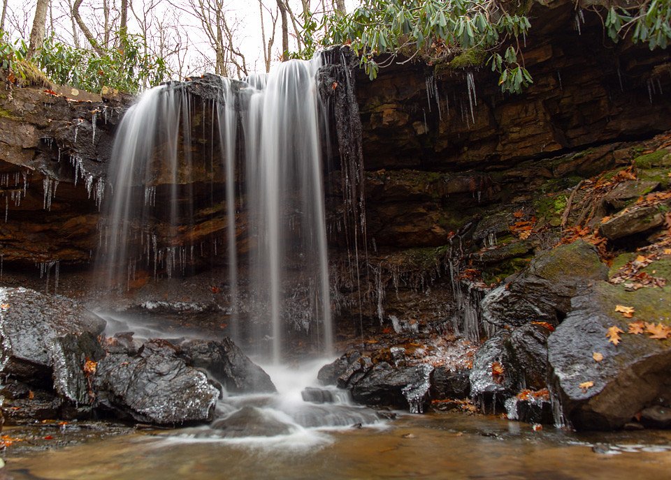
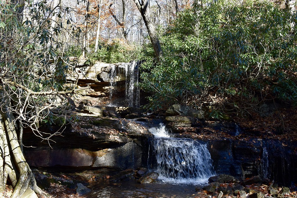

Photo Credits (4)
Difficulty
Moderate
Trail Length
2.4 miles
Trail Type
Out And Back
Elevation Gain
350 ft
About Cole Run Falls
Cole Run Falls is a picturesque waterfall located in the Forbes State Forest in Pennsylvania. It is known for its serene setting and easy accessibility, making it a popular spot for nature enthusiasts and photographers.
The Setting
Cole Run Falls sits at 2,192 feet within Forbes State Forest, fed by the Casselman River, in the hills of Pennsylvania. The falls drop 15 feet.
Height: 15 feet
Trail & Hike Details
The Approach
The moderate 2.4-mile out and back trail gains 350 feet of elevation on the way to the falls.
Trail Description
The trail to Cole Run Falls is very short and easy, making it accessible for most visitors. It is a well-maintained path that leads directly to the waterfall, with minimal elevation gain.
What to Expect
The falls drop a gentle 15 feet. Dogs are welcome.
Accessibility
The trail is not wheelchair accessible. Uneven terrain and elevation changes require steady footing.
Frequently Asked Questions
🐶 Are Dogs Allowed at Cole Run Falls?
✅ Dogs are allowed
Are There Any Fees or Permits Required?
🆖 No fees required
🏊 Is There Swimming at Cole Run Falls?
❌ Swimming is not allowed
When to Visit
Spring and early summer are ideal times to visit, as the waterfall is typically at its fullest due to seasonal rainfall. Fall offers beautiful foliage, while winter provides a chance to see the falls frozen in a stunning display.
Seasonal Access
The best time to visit is Spring, Summer, Fall, and Winter.
Safety Information
The rocks around the falls can be slippery, especially after rain. Exercise caution when walking near the edge. Cell phone service may be limited in the area, so plan accordingly.
Current Water Conditions
409 ft³/s
Current discharge — how much water is flowing
Higher than usual for this time of year
Based on 104 years of record
1.88 ft
Water depth at gauge
67°F
CoolRefreshing for swimming
7-Day Discharge Trend
What does this mean for your visit?
The water is flowing higher than usual for this time of year. Water temperature is a refreshing 67 degrees F, good for a quick swim. PH is normal at 8.0 and mineral content is typical.
Water Quality
pH
NormalWithin healthy range (6.5-8.5)
Conductance
Dissolved minerals in the water
About This Gauge
This gauge is on a nearby waterway and may not reflect exact conditions at the falls.
7-Day Flow Outlook
Based on the USGS gauge Casselman River at Markleton, PA (13 km away).
Today
Moderate
466 cfs
6/10Tomorrow
Moderate
401 cfs
8/10Tue
Moderate
359 cfs
8/10Wed
Moderate
326 cfs
8/10Thu
Moderate
322 cfs
8/10Fri
Moderate
457 cfs
6/10Sat
Moderate
453 cfs
6/10Best window: Tomorrow — moderate flow, patchy fog then mostly sunny (trip score 8/10).
Best time of year: this gauge typically runs highest from mid February to late April, peaking in March.
How we calculate this
This is a transparent outlook, not a precise forecast. We take the waterfall's current flow strength (how it ranks against its historical normal for today, from the nearest USGS stream gauge), carry that ranking forward along the gauge's seasonal curve, and nudge it for forecast rain. Confidence is highest for the next day or two and falls further out. Always check official conditions and your own judgment before visiting — high flows can be dangerous.
Know when to go.
Get a free email alert when waterfalls near Seven Springs hit peak flow. We only send when conditions are worth the trip — no weekly newsletters, no spam.
Weather Forecast
Location & Access
Getting There
Cole Run Falls is located near Rockwood, Pennsylvania, within the Forbes State Forest. It can be accessed via Cole Run Road, which is a short drive from Route 653.
Get Directions on Google MapsParking
There is a small parking area near the falls along Cole Run Road. Parking is free but limited, so it may fill up during peak seasons.
Hours
Elevation
2,192 feet above sea level
Coordinates
39.971742° N, -79.283922° W
Land Management
Managed by SDNR
Visitor Tips & Gear
Visit early in the morning or on weekdays to avoid crowds, especially during peak seasons. Wear sturdy shoes as the area around the falls can be slippery. Bring a camera to capture the scenic beauty.
As an Amazon Associate, we earn from qualifying purchases.
With 2.4 miles and 350 ft of elevation gain, sturdy boots and trekking poles will help on this moderate trail. Icy conditions are common in winter — traction cleats are a smart addition.

Columbia Watertight II Rain Jacket
Packs into its own pocket, seam-sealed, and keeps you dry from spray and surprise rain.

Polarized Sunglasses (Knockaround)
Cuts glare off the water so you actually see the falls — and your photos turn out better too.

Earth Pak Waterproof Dry Bag
Keeps your phone and gear dry when waterfall mist soaks everything else.

Waterproof Phone Pouch (AiRunTech)
Cheap insurance — take photos right next to the falls without killing your phone.

Timberland Euro Sprint Mid Waterproof
Trusted waterproof boot with premium leather and grippy rubber sole — reliable on rocky, wet trails.

TrailBuddy Trekking Poles
Lightweight aluminum, cork grips, and flip-locks that actually hold — a best-seller for good reason.
Where to Stay

Holiday Inn Express & Suites Donegal by IHG

Comfort Inn Connellsville Riverview

Comfort Inn Somerset

Ski-InandSki-Out Seven Springs Mtn Suite with Shuttle!
Browse vacation cabins and private rentals nearby
Unique outdoor stays — tents, yurts, and treehouses
Rent a campervan or RV for your waterfall road trip
Some links are affiliate links. We may earn a commission at no extra cost to you.
Nearby Campground
OUTFLOW CAMPING
12.3 miles away · 96 sites
Overview The Outflow Camping Area is located on Youghiogheny River Lake in the heart of the Laurel Highlands. The lake spans the Mason-Dixon Line between Pennsylvania and Maryland. Clean waters, forested mountains and steep-sided valleys provide an unsurpassed setting for recreational opportunities.Recreation Camping, fishing, boating, water skiing, hiking, biking, picnicking and sightseeing are the area's most popular activities. Boaters consider Youghiogheny River Lake, with its 16-mile length
Book on Recreation.govAdditional Information
Nearby Attractions
Nearby attractions include Laurel Hill State Park, the Great Allegheny Passage trail, and other waterfalls within Forbes State Forest.
Wildlife
The area is home to a variety of wildlife, including birds, deer, and small mammals. Visitors may also see wildflowers and other native plants.
Cities near Cole Run Falls
Writing about Cole Run Falls? Embed this waterfall on your site for free.