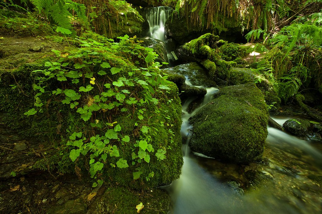
Clover Creek Falls
By Armen Suny · Last verified Mar 2026
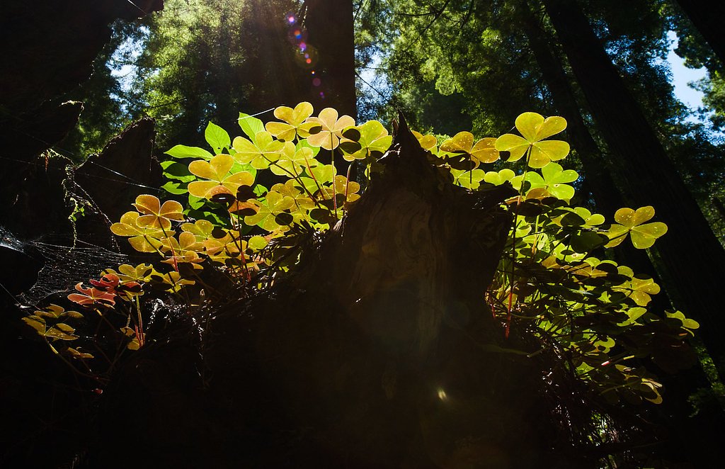
Photo Credits (3)
Difficulty
Moderate
Trail Length
2.4 miles
Trail Type
Out And Back
Elevation Gain
350 ft
About Clover Creek Falls
Clover Creek Falls is a seasonal waterfall tucked in Northern California near Redding, offering a compact but picturesque cascade that is most impressive in spring when snowmelt and early-season rains swell the creek. The falls make an excellent short-day destination for hikers and photographers who want a scenic payoff without a long trek; the water flow can vary greatly through the summer and into fall. The falls are commonly accessed via a short, family-friendly hike that provides close-up views of the cascade when flows are up. Plan for a moderate outing—the route is short enough for a half-day trip yet lively enough to feel like a proper hike, especially in wetter months when the falls are at their peak.
Trail & Hike Details
The Approach
The moderate 2.4-mile out-and-back trail gains 350 feet of elevation on the way to the falls.
Trail Description
Out-and-back trail, 2.4 miles round-trip with approximately 350 feet of elevation gain. Rated moderate in difficulty and suited to hikers comfortable with a steady, short climb and descent. No specific USFS trail number, surface, grade, or technical class information was provided in the available data.
What to Expect
Dogs are welcome.
Accessibility
The trail is not wheelchair accessible. Uneven terrain and elevation changes require steady footing.
Frequently Asked Questions
🐶 Are Dogs Allowed at Clover Creek Falls?
✅ Dogs are allowed
Are There Any Fees or Permits Required?
🆖 No fees required
🏊 Is There Swimming at Clover Creek Falls?
❌ Swimming is not allowed
When to Visit
Spring is the best time to visit Clover Creek Falls, as the water flow is strongest during this season.
Seasonal Access
The best time to visit is Spring, Summer, and Fall. Winter access may be limited.
Safety Information
The trail is generally safe, but visitors should watch for uneven terrain and avoid visiting during heavy rain, as the area may become muddy or slippery.
Current Water Conditions
Based on a USGS gauge 15.4 miles away
47 ft³/s
Current discharge — how much water is flowing
About average for this time of year
Based on 76 years of record
2.48 ft
Water depth at gauge
7-Day Discharge Trend
What does this mean for your visit?
Flow is about average for this time of year.
About This Gauge
This gauge is on a regional waterway. Conditions at the falls may differ, especially after local rain.
7-Day Flow Outlook
Based on the USGS gauge COW C NR MILLVILLE CA (25 km away).
Today
Barely Flowing
47 cfs
5/10Tomorrow
Barely Flowing
53 cfs
3/10Sun
Barely Flowing
50 cfs
5/10Mon
Barely Flowing
43 cfs
5/10Tue
Barely Flowing
44 cfs
5/10Wed
Barely Flowing
42 cfs
5/10Thu
Barely Flowing
41 cfs
5/10Best window: Today — barely flowing flow, sunny (trip score 5/10).
Best time of year: this gauge typically runs highest from late January to early April, peaking in March.
How we calculate this
This is a transparent outlook, not a precise forecast. We take the waterfall's current flow strength (how it ranks against its historical normal for today, from the nearest USGS stream gauge), carry that ranking forward along the gauge's seasonal curve, and nudge it for forecast rain. Confidence is highest for the next day or two and falls further out. Always check official conditions and your own judgment before visiting — high flows can be dangerous.
Know when to go.
Get a free email alert when waterfalls near Oak Run hit peak flow. We only send when conditions are worth the trip — no weekly newsletters, no spam.
Weather Forecast
Location & Access
Getting There
Clover Creek Falls is located within the Clover Creek Preserve in Redding, California. The preserve is easily accessible by car, and the trailhead is located near the parking area.
Get Directions on Google MapsParking
There is a designated parking area at Clover Creek Preserve, which is free to use. Parking availability may vary during peak seasons.
Elevation
1,125 feet above sea level
Coordinates
40.655988° N, -122.017775° W
Visitor Tips & Gear
Visit during the spring for the best chance to see the waterfall flowing. Bring water and wear comfortable walking shoes. Early mornings or weekdays are less crowded.
As an Amazon Associate, we earn from qualifying purchases.
With 2.4 miles and 350 ft of elevation gain, sturdy boots and trekking poles will help on this moderate trail. Sun exposure on the trail makes good sun protection a must in summer.

Polarized Sunglasses (Knockaround)
Cuts glare off the water so you actually see the falls — and your photos turn out better too.

Columbia Watertight II Rain Jacket
Packs into its own pocket, seam-sealed, and keeps you dry from spray and surprise rain.

Earth Pak Waterproof Dry Bag
Keeps your phone and gear dry when waterfall mist soaks everything else.

Waterproof Phone Pouch (AiRunTech)
Cheap insurance — take photos right next to the falls without killing your phone.

Timberland Euro Sprint Mid Waterproof
Trusted waterproof boot with premium leather and grippy rubber sole — reliable on rocky, wet trails.

TrailBuddy Trekking Poles
Lightweight aluminum, cork grips, and flip-locks that actually hold — a best-seller for good reason.
Where to Stay

Green Gables Motel & Suites

Comfort Suites Redding - Shasta Lake

Gaia Hotel & Spa Redding, an Ascend Collection Hotel

Holiday Inn Redding by IHG
Browse vacation cabins and private rentals nearby
Unique outdoor stays — tents, yurts, and treehouses
Rent a campervan or RV for your waterfall road trip
Some links are affiliate links. We may earn a commission at no extra cost to you.
Nearby Campground
Jones Valley Inlet West Dispersed Area (CA)
12.2 miles away · 42 sites
Overview Jones Valley Inlet West Dispersed/Day Use Area is located on the Pit River Arm of Shasta Lake, it has trash and portable restrooms provided in season. This is a shoreline area and doesn't have designated sites. This Campground is on a First Come - First Serve Basis, vistors are required to physically be at the campground to purchase and claim a site. You must also occupy the area the day you pay for it, no advance payments. We encourage our visitors to download the recreation.gov app t
Book on Recreation.govNearby Hot Springs
Hot springs near Oak Run, California
Big Bend Hot Springs
Big Bend Hot Springs surges at a scalding 180 degrees Fahrenheit from volcanic terrain at just 1,644 feet elevation, creating o...
Big Bend, California
Big Bend sits along a dramatic curve of the Pit River in Shasta County at 1,720 feet elevation, occupying territory historicall...
Hunt Hot Spring
Hunt Hot Spring produces 136-degree water from the forested slopes near McCloud in Siskiyou County at just 1,712 feet elevation...
Tuscan Springs
Tuscan Springs flows at 86°F in Tehama County near Red Bluff, with borax-impregnated waters chemically similar to the famous sp...

Mill Creek Springs
Mill Creek Springs flows at a spectacular 150°F within Lassen Volcanic National Park, making it one of California's hottest spr...

Sulphur Works, Tophet Hot Springs
Sulphur Works and Tophet Hot Springs emerge at a dramatic 199°F at 6,932 feet elevation within Lassen Volcanic National Park, o...
Looking for a soak after your hike? Explore more hot springs near Oak Run, California on SoakingSprings.
Explore California springsAdditional Information
Nearby Attractions
Nearby attractions include Turtle Bay Exploration Park and Sundial Bridge in Redding.
Wildlife
The preserve is home to various bird species and small mammals. Visitors may also see wildflowers in the spring.
Cities near Clover Creek Falls
Nearby Waterfalls
Writing about Clover Creek Falls? Embed this waterfall on your site for free.