
Photo Credits (2)
Difficulty
Moderate
Trail Length
2.0 miles
Trail Type
Out And Back
Elevation Gain
300 ft
About Clarke Falls
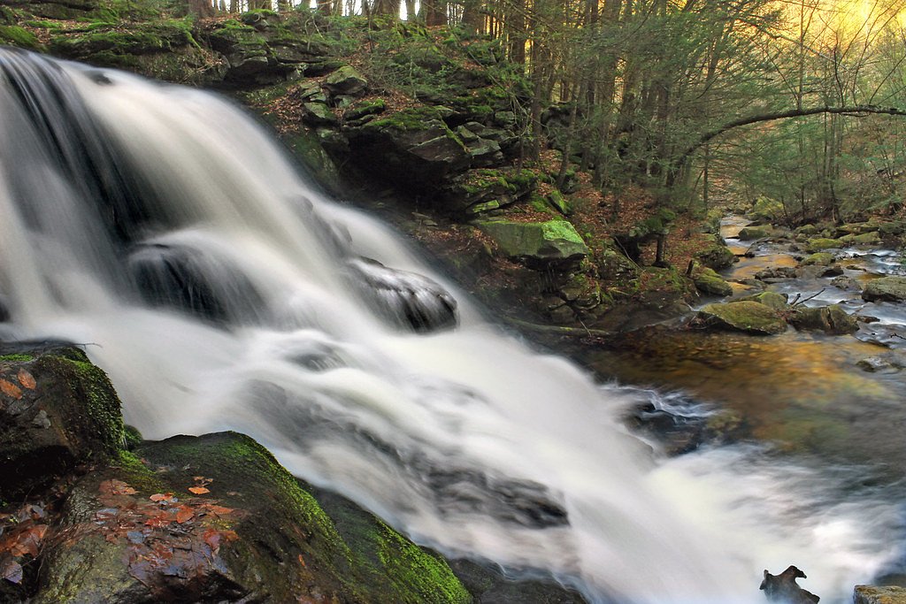
Clarke Falls is a scenic waterfall in Pennsylvania set in a quiet, forested pocket that rewards a short hike with a peaceful cascade and leafy surroundings. The approach is compact but satisfying — the route is typically described as a moderate, roughly 2.0-mile out-and-back that climbs about 300 feet, making it a popular half-day outing for local hikers and nature enthusiasts. The trail threads through shaded hardwoods with a mix of flatter stretches and moderately steep pitches; expect uneven footing with rocks and tree roots, so sturdy footwear is recommended. If you’re planning an overnight stay, the nearest campground is Alosa Campsites, about 20.94 km from the falls.
The Setting
Clarke Falls sits at 522 feet along the Brodhead Creek, in the foothills of Pennsylvania.
Trail & Hike Details
The Approach
The moderate 2.0-mile out-and-back trail gains 300 feet of elevation on the way to the falls.
Trail Description
This is a roughly 2.0-mile out-and-back route with approximately 300 feet of elevation gain and a moderate difficulty rating. The tread is natural forest trail—uneven in places—with exposed roots and rocky sections, and the grade alternates between flat walking and moderately steep pitches. Sturdy shoes and moderate hiking experience are recommended for safely navigating the surface; the route is straightforward and well-suited to hikers looking for a short, scenic outing.
What to Expect
Visitors can expect a peaceful hike through a wooded area leading to a picturesque waterfall. The falls are surrounded by lush greenery, making it a great spot for photography and relaxation.
Accessibility
The trail is not wheelchair accessible. Uneven terrain and elevation changes require steady footing.
Frequently Asked Questions
🐶 Are Dogs Allowed at Clarke Falls?
❌ Dogs are not allowed
Are There Any Fees or Permits Required?
🆖 No fees required
🏊 Is There Swimming at Clarke Falls?
❌ Swimming is not allowed
When to Visit
Spring and early summer are ideal for visiting Clarke Falls, as the water flow is typically strongest during these seasons. Fall offers beautiful foliage, while summer provides warm weather for hiking.
Seasonal Access
The best time to visit is Spring, Summer, and Fall. Winter access may be limited.
Safety Information
The trail may become slippery after rain, and there could be loose rocks or tree roots. Visitors should exercise caution and stay on marked paths. Cell phone reception may be limited in the area.
Current Water Conditions
50 ft³/s
Current discharge — how much water is flowing
About average for this time of year
Based on 68 years of record
1.80 ft
Water depth at gauge
73°F
ComfortablePleasant for swimming
7-Day Discharge Trend
What does this mean for your visit?
Flow is about average for this time of year. The water is a comfortable 73 degrees F, pleasant for swimming. Mineral content is typical.
Water Quality
Conductance
Dissolved minerals in the water
About This Gauge
7-Day Flow Outlook
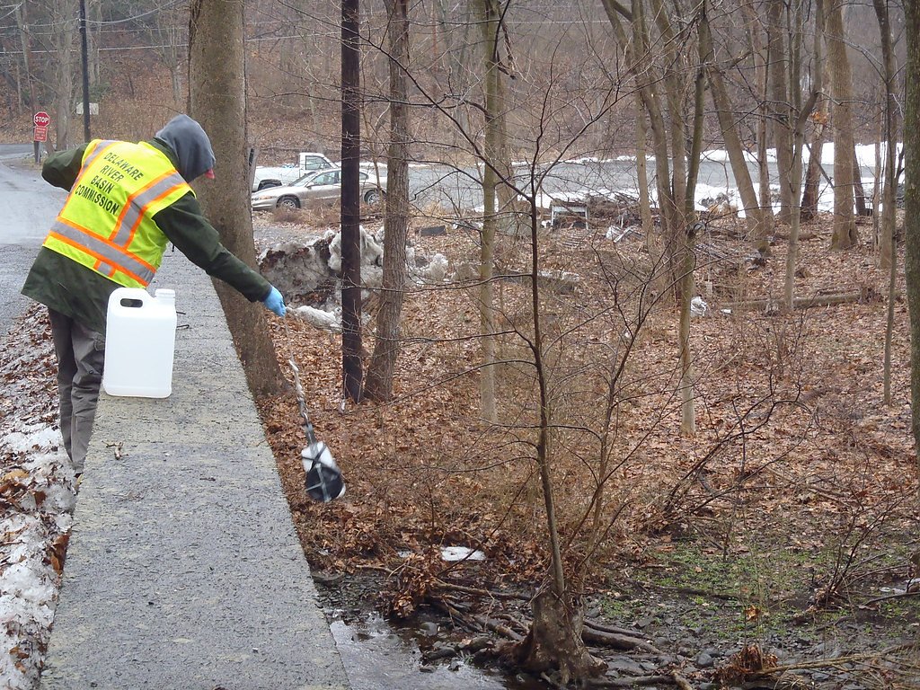
Based on the USGS gauge Brodhead Creek near Analomink, PA (4 km away).
Today
Barely Flowing
50 cfs
5/10Tomorrow
Barely Flowing
49 cfs
5/10Wed
Barely Flowing
51 cfs
5/10Thu
Barely Flowing
46 cfs
5/10Fri
Barely Flowing
44 cfs
5/10Sat
Low
46 cfs
4/10Sun
Low
51 cfs
3/10Best window: Today — barely flowing flow, sunny (trip score 5/10).
Best time of year: this gauge typically runs highest from late February to late May, peaking in April.
How we calculate this
This is a transparent outlook, not a precise forecast. We take the waterfall's current flow strength (how it ranks against its historical normal for today, from the nearest USGS stream gauge), carry that ranking forward along the gauge's seasonal curve, and nudge it for forecast rain. Confidence is highest for the next day or two and falls further out. Always check official conditions and your own judgment before visiting — high flows can be dangerous.
Know when to go.
Get a free email alert when waterfalls near Penn Estates hit peak flow. We only send when conditions are worth the trip — no weekly newsletters, no spam.
Weather Forecast
Location & Access
Getting There
Clarke Falls is located in a forested area in Pennsylvania. The exact directions may vary depending on your starting point, but it is typically accessed via local roads leading to a trailhead.
Get Directions on Google MapsParking
Parking is available near the trailhead, but the size and availability of the parking area are unclear. Visitors are advised to arrive early, especially during peak seasons.
Elevation
522 feet above sea level
Coordinates
41.053704° N, -75.222959° W
Visitor Tips & Gear
Wear sturdy hiking shoes and bring water, as the trail can be uneven and moderately challenging. Arrive early to secure parking and avoid crowds. Check weather conditions before visiting, as the trail may become slippery after rain.
As an Amazon Associate, we earn from qualifying purchases.
With 2.0 miles and 300 ft of elevation gain, sturdy boots and trekking poles will help on this moderate trail. Sun exposure on the trail makes good sun protection a must in summer.

Polarized Sunglasses (Knockaround)
Cuts glare off the water so you actually see the falls — and your photos turn out better too.

Columbia Watertight II Rain Jacket
Packs into its own pocket, seam-sealed, and keeps you dry from spray and surprise rain.

Earth Pak Waterproof Dry Bag
Keeps your phone and gear dry when waterfall mist soaks everything else.

Waterproof Phone Pouch (AiRunTech)
Cheap insurance — take photos right next to the falls without killing your phone.

Timberland Euro Sprint Mid Waterproof
Trusted waterproof boot with premium leather and grippy rubber sole — reliable on rocky, wet trails.

TrailBuddy Trekking Poles
Lightweight aluminum, cork grips, and flip-locks that actually hold — a best-seller for good reason.
Where to Stay

Pocono Mountain Villas MOD Collection by Sonesta

Cozy Corner

Hampton Inn & Suites Stroudsburg Bartonsville Poconos

Serenity Falls - Stylish 4Bdr Mountain Retreat, Hot Tub, Pool
Browse vacation cabins and private rentals nearby
Unique outdoor stays — tents, yurts, and treehouses
Rent a campervan or RV for your waterfall road trip
Some links are affiliate links. We may earn a commission at no extra cost to you.
Nearby Campground
Alosa Campsites
13 miles away · 6 sites
Overview The Alosa Campsites are boat-in only sites located on the west (Pennsylvanian) shore of the Delaware River near Bushkill, Pennsylvania. The side of the river with the campsites will be on your right while traveling downstream. This section of the river offers unspoiled views, excellent boating, fishing, and birding opportunities within the Delaware Water Gap National Recreation Area and the Middle Delaware National Scenic and Recreational River. These reservation-only campsites are avail
Book on Recreation.govAdditional Information
Nearby Attractions
The surrounding area may offer additional hiking trails and natural attractions, but specific details are not confirmed.
Wildlife
The area is home to typical Pennsylvania wildlife, including birds, deer, and small mammals. Visitors should be cautious of ticks and other insects.
Cities near Clarke Falls
Nearby Waterfalls
Writing about Clarke Falls? Embed this waterfall on your site for free.