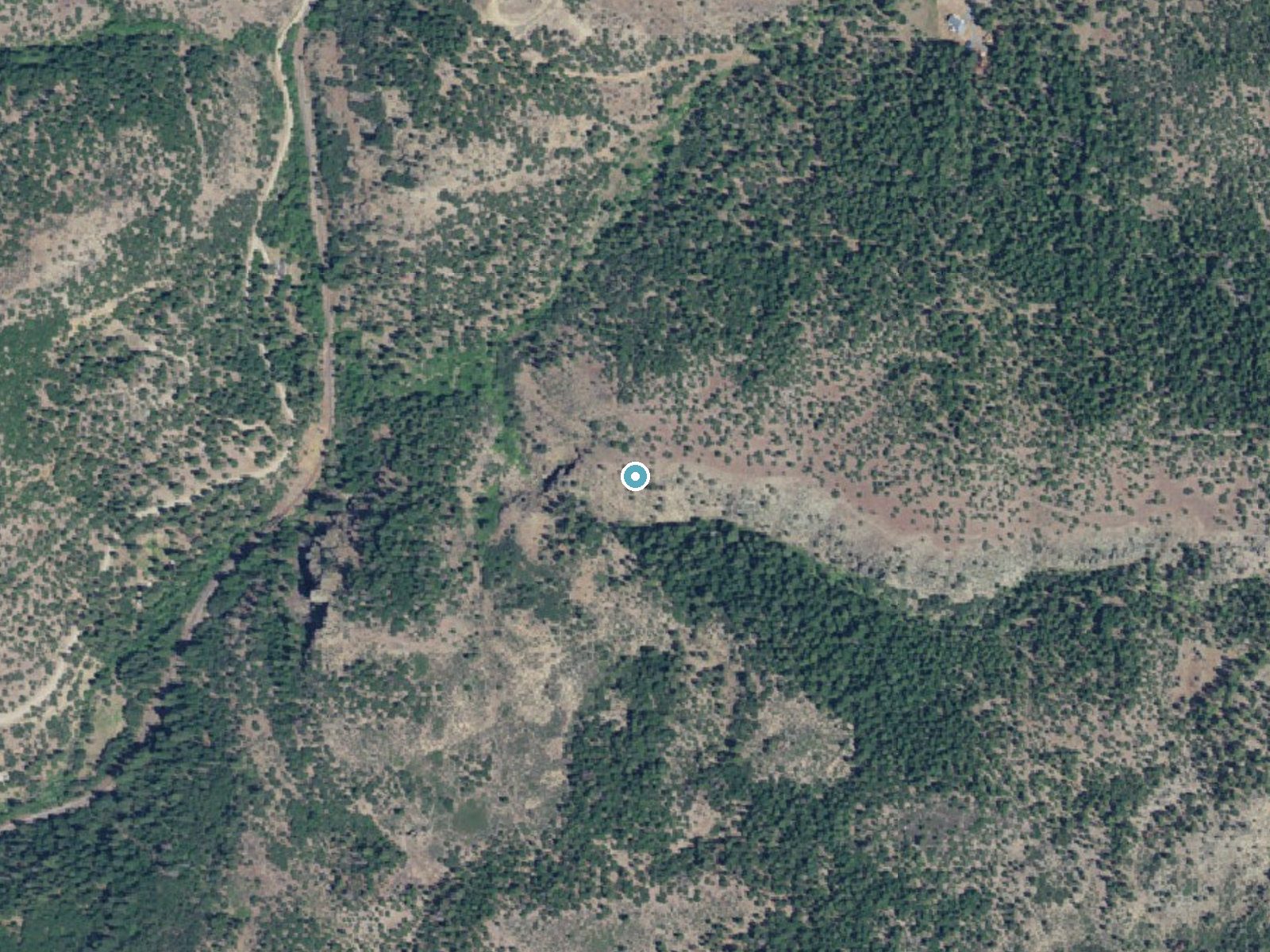
 Aerial view · USGS
Chocolate Falls
By Armen Suny · Last verified Oct 2026
3D terrainDifficulty
Easy
Trail Length
1.0 miles
Trail Type
Out And Back
About Chocolate Falls
Chocolate Falls, also called Upper Beaver Falls, is a small but picturesque waterfall tucked into Bear Gulch valley on the east side of the Klamath National Forest, south of Ashland in Jackson County, Oregon. The fall’s name comes from the brownish tint the water sometimes takes on when sediment is high; it’s reached from Colestin Road just south of the Trashi Chöling Buddhist Center and Temple Garden. The Pacific Crest Trail passes just north of the falls, making this a pleasant detour for through-hikers and day visitors alike. The site sits on lands owned by DESG and within the Cascade–Siskiyou National Monument, managed by the Bureau of Land Management, and the surrounding Mudusa Flat forest features meadows, several caves, and stands of old-growth sugar pine. Chocolate Falls is compact and photogenic — a rewarding stop for anyone exploring the rugged landscapes south of Ashland.
The Setting
Chocolate Falls sits at 3,215 feet within Cascade-Siskiyou National Monument, in the mountains of Oregon.
Trail & Hike Details
Trail Description
The trail wanders through forested sections of old-growth sugar pine and open meadows in Bear Gulch; the tread can be uneven and is often muddy in wet seasons. Access the trail from Colestin Road (south of the Trashi Chöling Buddhist Center); the waterfall is visible at the trail’s end and the Pacific Crest Trail runs just north of the site.
What to Expect
Visitors can expect a small but charming waterfall surrounded by lush greenery. The water may appear brownish during certain times of the year due to sediment, giving the falls its name. The area is peaceful and less crowded compared to other popular waterfalls in Oregon.
Accessibility
The trail is not wheelchair accessible. Uneven terrain and elevation changes require steady footing.
Frequently Asked Questions
🐶 Are Dogs Allowed at Chocolate Falls?
❌ Dogs are not allowed
Are There Any Fees or Permits Required?
🆖 No fees required
🏊 Is There Swimming at Chocolate Falls?
❌ Swimming is not allowed
When to Visit
Spring and early summer are ideal times to visit, as the water flow is typically stronger due to snowmelt and rain.
Seasonal Access
The best time to visit is Spring, Summer, Fall, and Winter.
Safety Information
Trail conditions may be slippery or muddy, especially after rain. Exercise caution near the waterfall as rocks may be slippery. Cell service may be limited in the area.
Current Water Conditions
These readings come from the USGS gauge on West Fork Ashland Creek, 9.7 miles away, not on Chocolate Falls's own stream. Use them as a sign of whether the area is running wet or dry.
3 ft³/s
Current discharge — how much water is flowing
Much higher than usual for this time of year
1.06 ft
Water depth at gauge
7-Day Discharge Trend
What does this mean for your visit?
The water is flowing much higher than usual, expect an impressive display.
About This Gauge
This gauge is on a nearby waterway and may not reflect exact conditions at the falls.
7-Day Flow Outlook
Based on the USGS gauge WEST FORK ASHLAND CREEK NEAR ASHLAND, OR (16 km away).
Today
Roaring
3 cfs
6/10Tomorrow
Roaring
3 cfs
9/10Sat
Roaring
3 cfs
9/10Sun
Roaring
3 cfs
9/10Mon
Roaring
3 cfs
6/10Tue
Roaring
3 cfs
9/10Wed
Roaring
3 cfs
9/10Best window: Tomorrow — roaring flow, sunny (trip score 9/10).
Best time of year: this gauge typically runs highest from early April to late June, peaking in May.
How we calculate this
This is a transparent outlook, not a precise forecast. We take the waterfall's current flow strength (how it ranks against its historical normal for today, from the nearest USGS stream gauge), carry that ranking forward along the gauge's seasonal curve, and nudge it for forecast rain. Confidence is highest for the next day or two and falls further out. Always check official conditions and your own judgment before visiting — high flows can be dangerous.
Know when to go.
Get a free email alert when waterfalls near Hornbrook hit peak flow. We only send when conditions are worth the trip — no weekly newsletters, no spam.
Weather Forecast
The Terrain Around Chocolate Falls
High-resolution lidar hasn't been flown here yet, so this is the aerial view of the ground around the falls. Open the 3D view to tilt and spin the landscape.
The dot marks the waterfall. The frame is about a mile across.
Aerial imagery: USGS The National Map. Public domain.
Location & Access
Getting There
Chocolate Falls is located near Beaver Creek in Oregon. Access is typically via local forest roads, which may require a high-clearance vehicle depending on conditions. Directions should be verified before visiting.
Get Directions on Google MapsParking
Parking is limited and may be located along the roadside or at small pullouts near the trailhead.
Elevation
3,215 feet above sea level
Coordinates
42.022518° N, -122.633392° W
Land Management
Managed by BLM
Visitor Tips & Gear
Wear sturdy shoes as the trail may be muddy, especially after rain. Bring water and snacks, as there are no facilities nearby. Check road and trail conditions before heading out.
Where to Stay

Ashland Hills Hotel & Suites

Callahan's Mountain Lodge

Best Western Windsor Inn

Holiday Inn Express Hotel & Suites Ashland by IHG
Browse vacation cabins and private rentals nearby
Unique outdoor stays — tents, yurts, and treehouses
Rent a campervan or RV for your waterfall road trip
Some links are affiliate links. We may earn a commission at no extra cost to you.
Nearby Campground
Hyatt Lake Recreation Area
13.2 miles away · 63 sites
Overview Nestled high in the Cascade Mountains among towering firs and pines, the Hyatt Lake Recreation Area is located in the northern corner of Cascade-Siskiyou National Monument on the shores of beautiful Hyatt Lake. At just above 5,000 feet of elevation, the 745-acre Hyatt Lake Recreation Area provides options for summertime camping, picnicking, hiking, horseback riding, biking, fishing, swimming, boating, and many other recreation opportunities. The recreation area offers dramatic views of M
Book on Recreation.govNearby Hot Springs
Hot springs near Medford, Oregon
Jackson Hot Springs
Jackson Hot Springs registers 95°F with highly alkaline chemistry, posting pH 9.3 in sodium-dominated waters containing 95 mg/L...
Bogus Soda Springs
Bogus Soda Springs flows at 76°F from Siskiyou County's volcanic landscape at 2,801 feet elevation. The name suggests early ske...
Klamath Hot Spring
Klamath Hot Spring discharges at 156°F just 27 feet from the nearest road near Montague in Siskiyou County, making it extraordi...
Howard Holiday
Howard Holiday flows at 77°F in Klamath County near Klamath Falls, emerging at 4,107 feet elevation approximately 157 meters fr...
Hardboard Spring
Hardboard Spring flows at 70°F from roadside terrain 36 meters from the nearest road in Klamath County near Klamath Falls, emer...
Sulphur Springs
Sulphur Springs flows at a impressive 84°F in Siskiyou County's temperate forest, reaching 29.5 degrees above the cool ambient ...
Looking for a soak after your hike? Explore more hot springs near Medford, Oregon on SoakingSprings.
Explore Oregon springsAdditional Information
Nearby Attractions
Beaver Creek State Natural Area and other small waterfalls in the region.
Wildlife
The area is home to various birds, deer, and other forest wildlife. Be cautious of ticks and other insects.
Cities near Chocolate Falls
Writing about Chocolate Falls? Embed this waterfall on your site for free.