Chittenango Falls
New York • 167 ft
By Armen Suny · Last verified Mar 2026
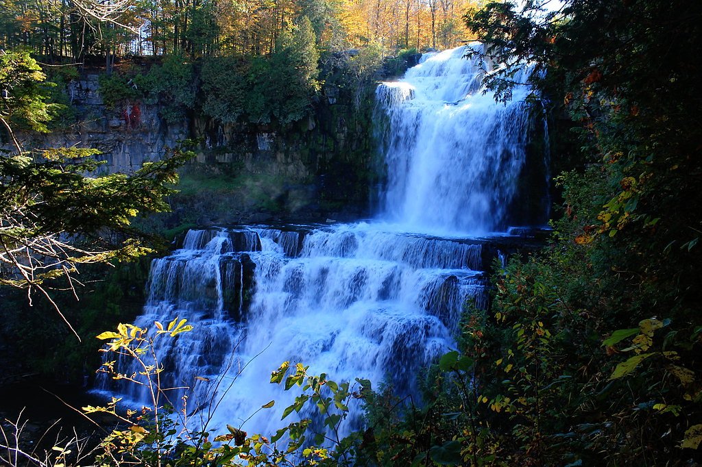
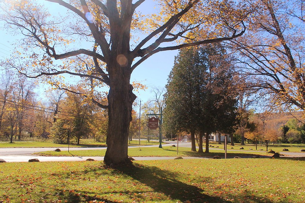
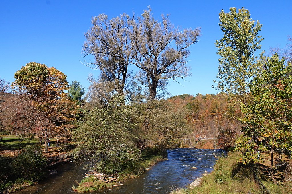
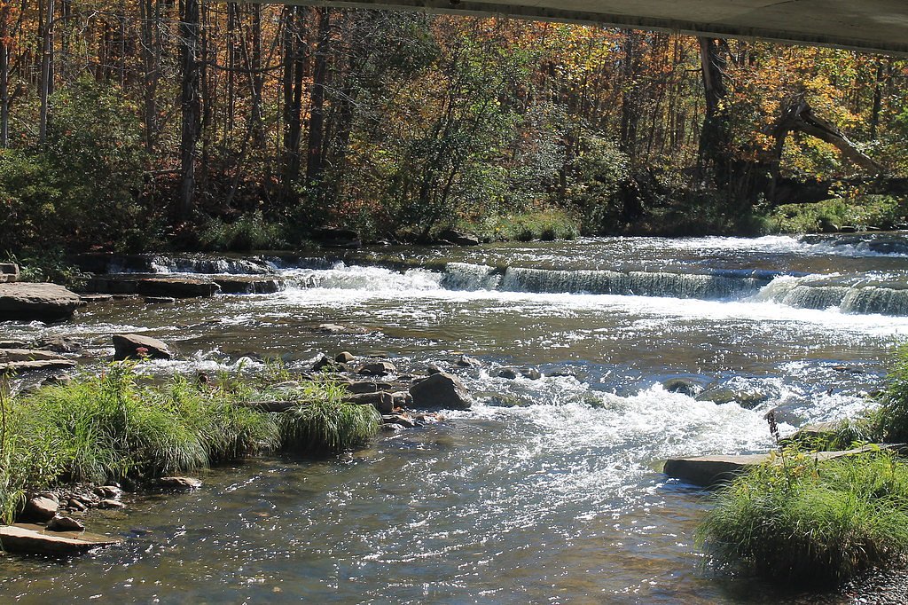

Photo Credits (5)
Difficulty
Easy
Trail Length
0.5 miles
Trail Type
Loop
Elevation Gain
100 ft
About Chittenango Falls
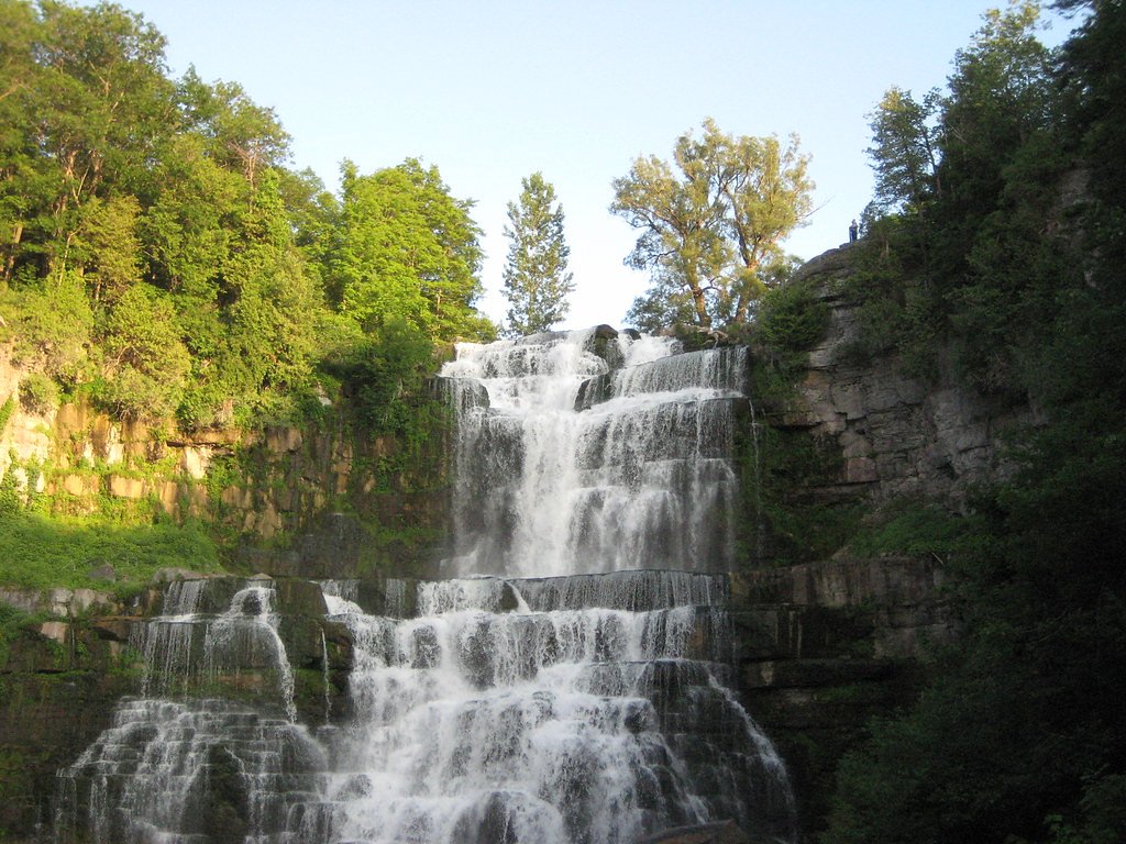
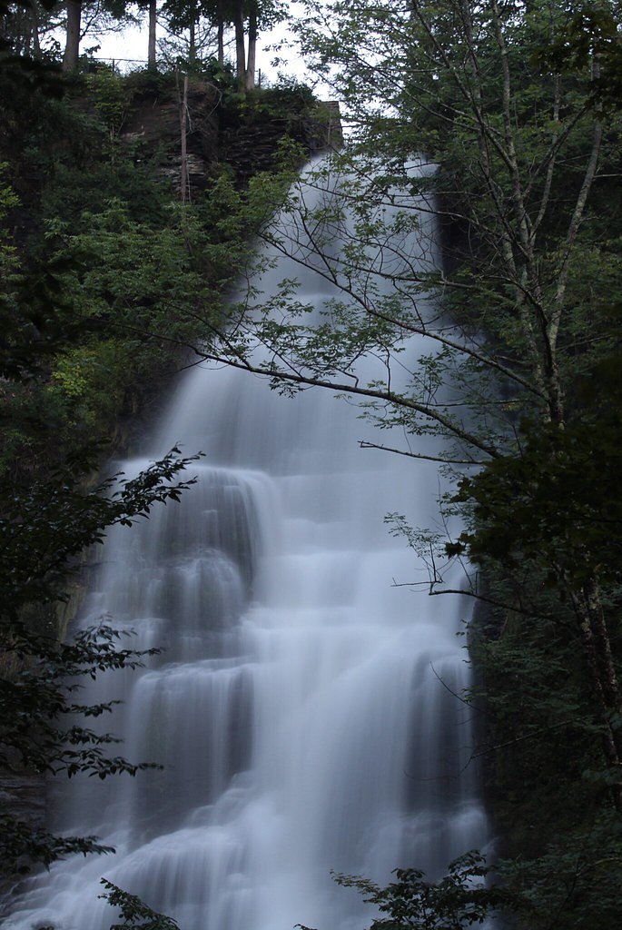
Chittenango Falls State Park is a compact 193-acre park east of Cazenovia Lake that centers on a dramatic 167-foot waterfall cascading over roughly 400-million-year-old bedrock. The narrow gorge and stepped rock make for striking photo opportunities, and at the bottom Chittenango Creek flows beneath a wooden bridge that frames classic views of the plunge. The park's natural setting draws photographers, families and casual hikers alike. The park sits on land owned by DESG within the Oneida Indian Nation Reservation (designation: TRIBL) and is managed by tribal authorities (TRIB). Amenities at the site include picnic tables with pavilions, a playground, a nature trail, and spots for fishing, making the falls an easy half-day outing with picnic and recreation options nearby.
The Setting
Chittenango Falls sits at 837 feet within Oneida Indian Nation Reservation, fed by the Chittenango Creek, in the foothills of New York. At 167 feet, it is among the taller waterfalls in New York.
Height: 167 feet
Nearby Falls Worth Visiting
Pratts Falls (137 ft) lies 8.4 miles to the west. Also nearby: Brickyard Falls (20 ft, 7.3 mi).
Trail & Hike Details
The Approach
The easy 0.5-mile loop trail gains 100 feet of elevation on the way to the falls.
Trail Description
The main loop to Chittenango Falls is a short 0.5-mile loop with about 100 feet of elevation gain and is rated easy. The route provides access to both the rim and the base of the 167-foot falls and follows a mix of dirt paths and stair sections; some stretches can be uneven or slippery after rain. Multiple viewpoints along the loop and the wooden bridge at the creek offer accessible vantage points for viewing and photographing the falls.
What to Expect
The falls plunge 167 feet. Dogs are welcome.
Accessibility
The trail is short and relatively flat, but the surface may be uneven. Contact the managing agency for accessibility details.
Frequently Asked Questions
🐶 Are Dogs Allowed at Chittenango Falls?
✅ Dogs are allowed
Are There Any Fees or Permits Required?
🤑 Fee: $5.00
🏊 Is There Swimming at Chittenango Falls?
❌ Swimming is not allowed
When to Visit
Spring is the best time to visit due to the high water flow from snowmelt. Summer and fall are also popular for their pleasant weather and vibrant foliage.
Seasonal Access
The best time to visit is Spring, Summer, and Fall. Winter access may be limited.
Safety Information
Exercise caution near the waterfall and on the trails, as rocks can be slippery. Stay on marked trails and avoid climbing on rocks near the falls. During winter, trails may be icy and require additional care.
Current Water Conditions
45 ft³/s
Current discharge — how much water is flowing
About average for this time of year
Based on 29 years of record
1.31 ft
Water depth at gauge
7-Day Discharge Trend
What does this mean for your visit?
Flow is about average for this time of year.
About This Gauge
7-Day Flow Outlook
Based on the USGS gauge CHITTENANGO CREEK NEAR CHITTENANGO NY (5 km away).
Today
Moderate
51 cfs
6/10Tomorrow
Moderate
53 cfs
8/10Fri
Moderate
51 cfs
6/10Sat
Moderate
51 cfs
6/10Sun
Moderate
51 cfs
6/10Mon
Moderate
54 cfs
6/10Tue
Moderate
55 cfs
6/10Best window: Tomorrow — moderate flow, sunny (trip score 8/10).
Best time of year: this gauge typically runs highest from late February to early May, peaking in April.
How we calculate this
This is a transparent outlook, not a precise forecast. We take the waterfall's current flow strength (how it ranks against its historical normal for today, from the nearest USGS stream gauge), carry that ranking forward along the gauge's seasonal curve, and nudge it for forecast rain. Confidence is highest for the next day or two and falls further out. Always check official conditions and your own judgment before visiting — high flows can be dangerous.
Know when to go.
Get a free email alert when waterfalls near Chittenango hit peak flow. We only send when conditions are worth the trip — no weekly newsletters, no spam.
Weather Forecast
Location & Access
Getting There
Chittenango Falls State Park is located in Madison County, New York, approximately 25 miles east of Syracuse. The park is accessible via NY-13, and the entrance is well-marked.
Get Directions on Google MapsParking
There is a designated parking area within Chittenango Falls State Park, located near the trailhead and viewing areas. Parking fees may apply during certain seasons.
Elevation
837 feet above sea level
Coordinates
42.978678° N, -75.841579° W
Land Management
Managed by TRIB
Visitor Tips & Gear
Wear sturdy shoes, as the trail can be uneven and slippery. Arrive early during weekends or holidays to secure parking. Bring a camera to capture the scenic views. Note that the trail may be icy or muddy during winter and early spring.
As an Amazon Associate, we earn from qualifying purchases.
For this easy 0.5 miles trail, lightweight trail shoes and a water bottle are usually sufficient. Sun exposure on the trail makes good sun protection a must in summer.

Polarized Sunglasses (Knockaround)
Cuts glare off the water so you actually see the falls — and your photos turn out better too.

Columbia Watertight II Rain Jacket
Packs into its own pocket, seam-sealed, and keeps you dry from spray and surprise rain.

Earth Pak Waterproof Dry Bag
Keeps your phone and gear dry when waterfall mist soaks everything else.

Waterproof Phone Pouch (AiRunTech)
Cheap insurance — take photos right next to the falls without killing your phone.

JOBY GorillaPod Starter Kit
Wraps around railings and rocks for long-exposure waterfall shots — no flat surface needed.

Osprey Daylite Daypack
Light, organized, and just the right size for a day hike — fits water, snacks, and layers.
Where to Stay

Comfort Inn & Suites Syracuse-Carrier Circle

Hampton Inn & Suites Cazenovia, NY

Westcott Suite Apartments

Holiday Inn Express Syracuse-Fairgrounds by IHG
Browse vacation cabins and private rentals nearby
Unique outdoor stays — tents, yurts, and treehouses
Rent a campervan or RV for your waterfall road trip
Some links are affiliate links. We may earn a commission at no extra cost to you.
Additional Information
Nearby Attractions
Nearby attractions include the Erie Canal Museum in Syracuse, Green Lakes State Park, and the village of Cazenovia with its charming shops and restaurants.
Wildlife
The park is home to a variety of wildlife, including birds, deer, and small mammals. The area around the falls also supports unique plant species, including some rare and protected ones.
Cities near Chittenango Falls
Nearby Waterfalls

Writing about Chittenango Falls? Embed this waterfall on your site for free.