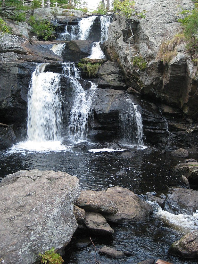
Chapman Falls
Connecticut • 60 ft
By Armen Suny · Last verified Mar 2026
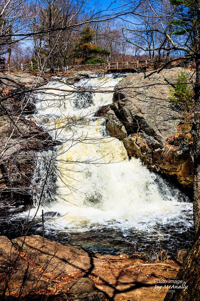
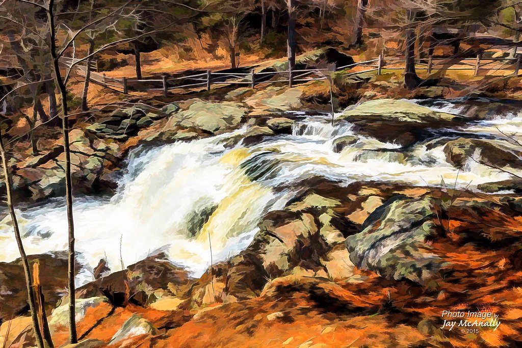
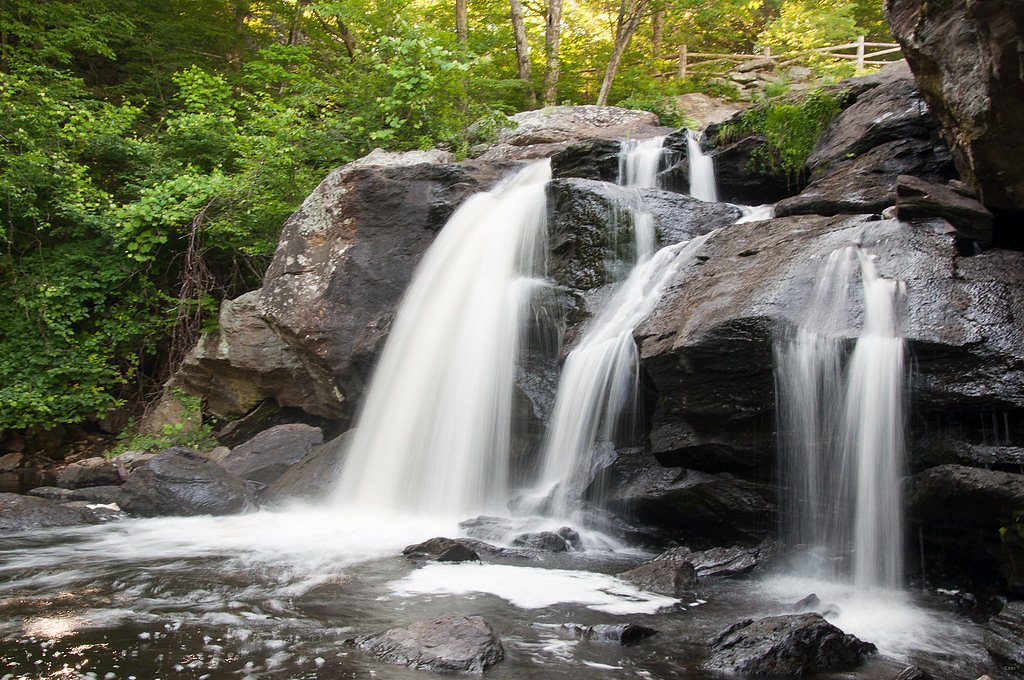
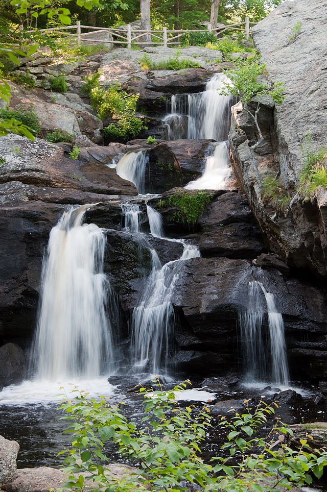
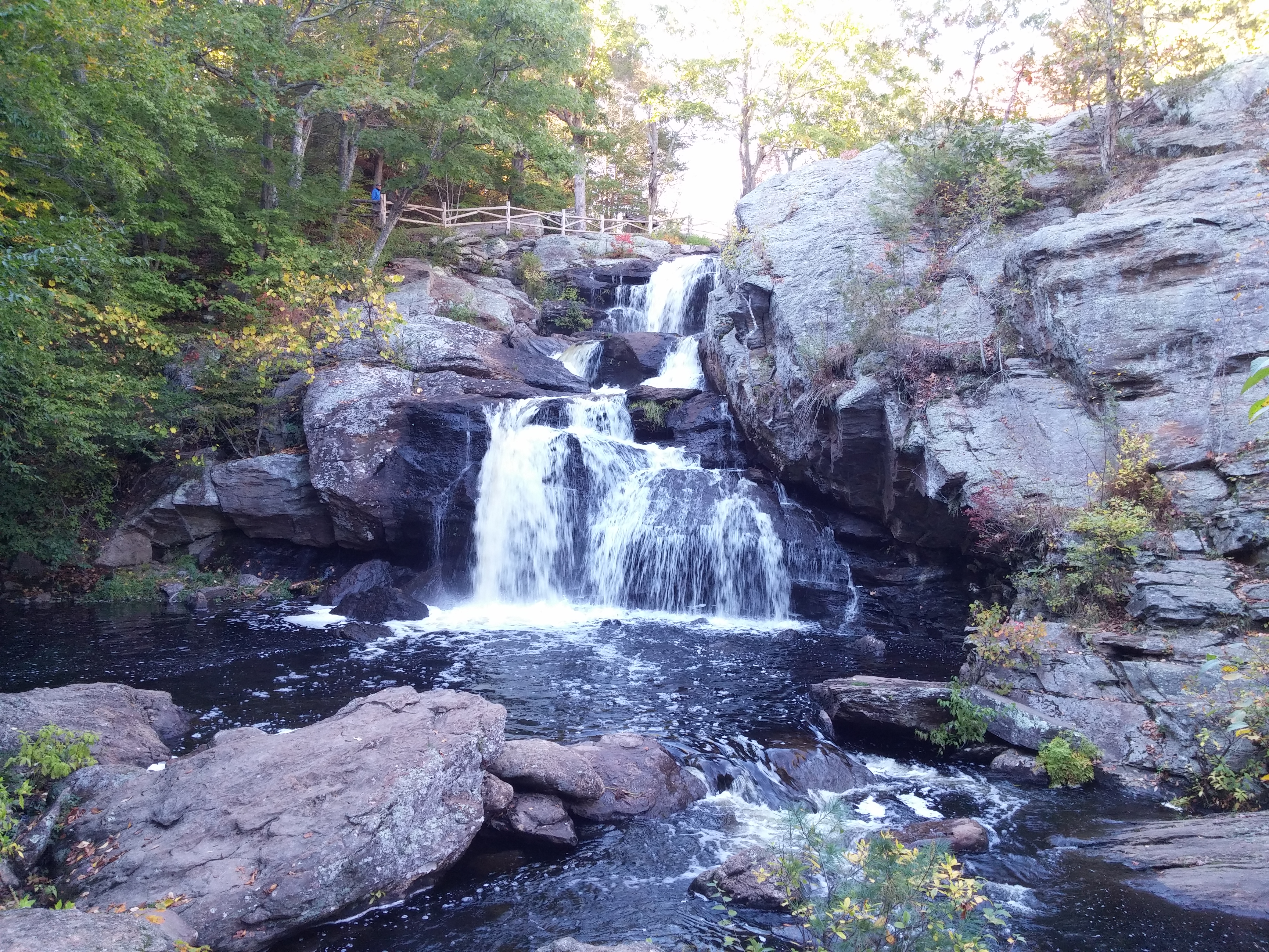
Photo Credits (5)
Difficulty
Moderate
Trail Length
2.4 miles
Trail Type
Out And Back
Elevation Gain
350 ft
About Chapman Falls
Chapman Falls is a scenic cascade tucked inside Devils Hopyard State Park in East Haddam, Connecticut. The stream tumbles over a series of rock ledges for a total drop of about 60 feet, creating layered cascades and photo-worthy viewpoints that draw families, photographers and day hikers to the state park. The falls sit on park land (designation: SP) within Devils Hopyard State Park and are a highlight of the park's river-carved landscape. Accessing Chapman Falls is a short but satisfying outing rather than just a roadside stop: the most common approach is a 2.4-mile out-and-back hike with roughly 350 feet of elevation gain and a moderate difficulty rating. That modest effort rewards you with close-up views of the full 60-foot drop and forested trails through the park—perfect for a half-day adventure in this Connecticut state park.
The Setting
Chapman Falls sits at 210 feet within Devils Hopyard State Park, fed by the Eightmile River, in the coastal lowlands of Connecticut. The falls drop 60 feet.
Height: 60 feet
Trail & Hike Details
The Approach
The moderate 2.4-mile out-and-back trail gains 350 feet of elevation on the way to the falls.
Trail Description
Trail to Chapman Falls (most common approach) is a 2.4-mile out-and-back route with about 350 feet of cumulative elevation gain and is rated moderate. The trail leads through Devils Hopyard State Park to viewpoints and the base of the 60-foot cascade; the route’s length and elevation make it a short day hike rather than a quick walk. Trail type: out-and-back; difficulty: moderate; approximate length: 2.4 miles; elevation gain: ~350 ft; waterfall height: ~60 ft.
What to Expect
The falls drop 60 feet. Dogs are welcome.
Accessibility
The trail is not wheelchair accessible. Uneven terrain and elevation changes require steady footing.
Frequently Asked Questions
🐶 Are Dogs Allowed at Chapman Falls?
✅ Dogs are allowed
Are There Any Fees or Permits Required?
🆖 No fees required
🏊 Is There Swimming at Chapman Falls?
❌ Swimming is not allowed
When to Visit
Spring is the best time to visit Chapman Falls, as the water flow is typically strongest due to snowmelt and seasonal rains. However, the falls are beautiful year-round.
Seasonal Access
The best time to visit is Spring, Summer, Fall, and Winter.
Safety Information
Exercise caution near the falls, as the rocks can be slippery. Stay on marked trails and avoid climbing on the rocks. During wet or icy conditions, the area may be hazardous.
Current Water Conditions
5 ft³/s
Current discharge — how much water is flowing
About average for this time of year
Based on 48 years of record
2.57 ft
Water depth at gauge
7-Day Discharge Trend
What does this mean for your visit?
Flow is about average for this time of year.
About This Gauge
7-Day Flow Outlook
Based on the USGS gauge EIGHTMILE RIVER AT NORTH PLAIN, CT (5 km away).
Today
Low
5 cfs
5/10Tomorrow
Low
5 cfs
6/10Wed
Moderate
5 cfs
4/10Thu
Low
6 cfs
6/10Fri
Moderate
6 cfs
4/10Sat
Moderate
6 cfs
4/10Sun
Moderate
7 cfs
4/10Best window: Tomorrow — low flow, partly sunny (trip score 6/10).
Best time of year: this gauge typically runs highest from early February to early May, peaking in March.
How we calculate this
This is a transparent outlook, not a precise forecast. We take the waterfall's current flow strength (how it ranks against its historical normal for today, from the nearest USGS stream gauge), carry that ranking forward along the gauge's seasonal curve, and nudge it for forecast rain. Confidence is highest for the next day or two and falls further out. Always check official conditions and your own judgment before visiting — high flows can be dangerous.
Know when to go.
Get a free email alert when waterfalls near Moodus hit peak flow. We only send when conditions are worth the trip — no weekly newsletters, no spam.
Weather Forecast
Location & Access
Getting There
Chapman Falls is located within Devil's Hopyard State Park, which is accessible via Route 82 in East Haddam, Connecticut. The falls are a short walk from the main parking area.
Get Directions on Google MapsParking
There is a designated parking area within Devil's Hopyard State Park, located close to the falls. Parking is typically free, but it is recommended to check for any updates on fees or restrictions.
Elevation
210 feet above sea level
Coordinates
41.483432° N, -72.340639° W
Land Management
Managed by UNK
Visitor Tips & Gear
Visit early in the morning or on weekdays to avoid crowds, especially during peak seasons. Wear sturdy shoes as the rocks near the falls can be slippery. Bring a camera to capture the scenic beauty.
As an Amazon Associate, we earn from qualifying purchases.
With 2.4 miles and 350 ft of elevation gain, sturdy boots and trekking poles will help on this moderate trail. Icy conditions are common in winter — traction cleats are a smart addition.

Columbia Watertight II Rain Jacket
Packs into its own pocket, seam-sealed, and keeps you dry from spray and surprise rain.

Polarized Sunglasses (Knockaround)
Cuts glare off the water so you actually see the falls — and your photos turn out better too.

Earth Pak Waterproof Dry Bag
Keeps your phone and gear dry when waterfall mist soaks everything else.

Waterproof Phone Pouch (AiRunTech)
Cheap insurance — take photos right next to the falls without killing your phone.

Timberland Euro Sprint Mid Waterproof
Trusted waterproof boot with premium leather and grippy rubber sole — reliable on rocky, wet trails.

TrailBuddy Trekking Poles
Lightweight aluminum, cork grips, and flip-locks that actually hold — a best-seller for good reason.
Where to Stay

Hyatt Place Uncasville - Casino Area

Comfort Suites Near Casinos

Microtel Inn & Suites by Wyndham Uncasville Casino Area

Hampton Inn Norwich
Browse vacation cabins and private rentals nearby
Unique outdoor stays — tents, yurts, and treehouses
Rent a campervan or RV for your waterfall road trip
Some links are affiliate links. We may earn a commission at no extra cost to you.
Additional Information
Nearby Attractions
Other attractions within Devil's Hopyard State Park include hiking trails, picnic areas, and scenic views of the Eightmile River. Nearby, visitors can explore the historic town of East Haddam and Gillette Castle State Park.
Wildlife
The area around Chapman Falls is home to a variety of wildlife, including birds, deer, and small mammals. Keep an eye out for native flora and fauna during your visit.
Cities near Chapman Falls
Nearby Waterfalls
Writing about Chapman Falls? Embed this waterfall on your site for free.