Photo Credits (5)
Difficulty
Easy
Trail Length
1.2 miles
Trail Type
Out And Back
Elevation Gain
200 ft
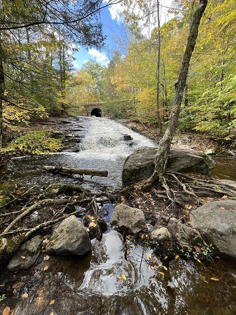
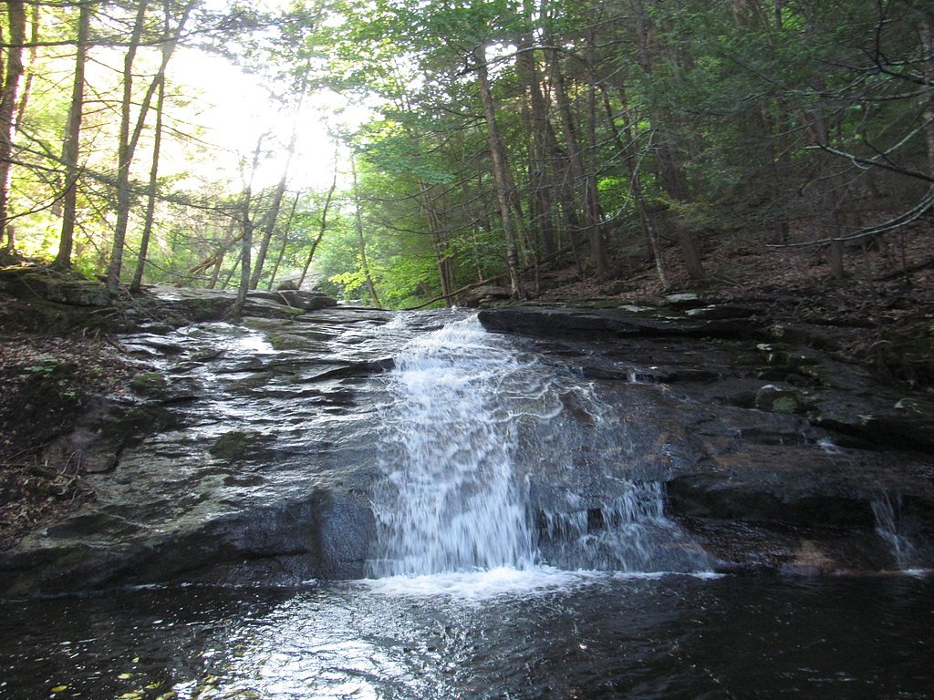
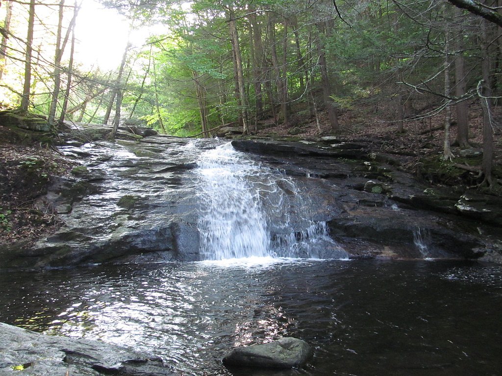
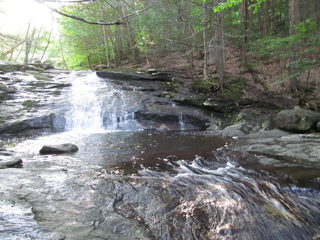
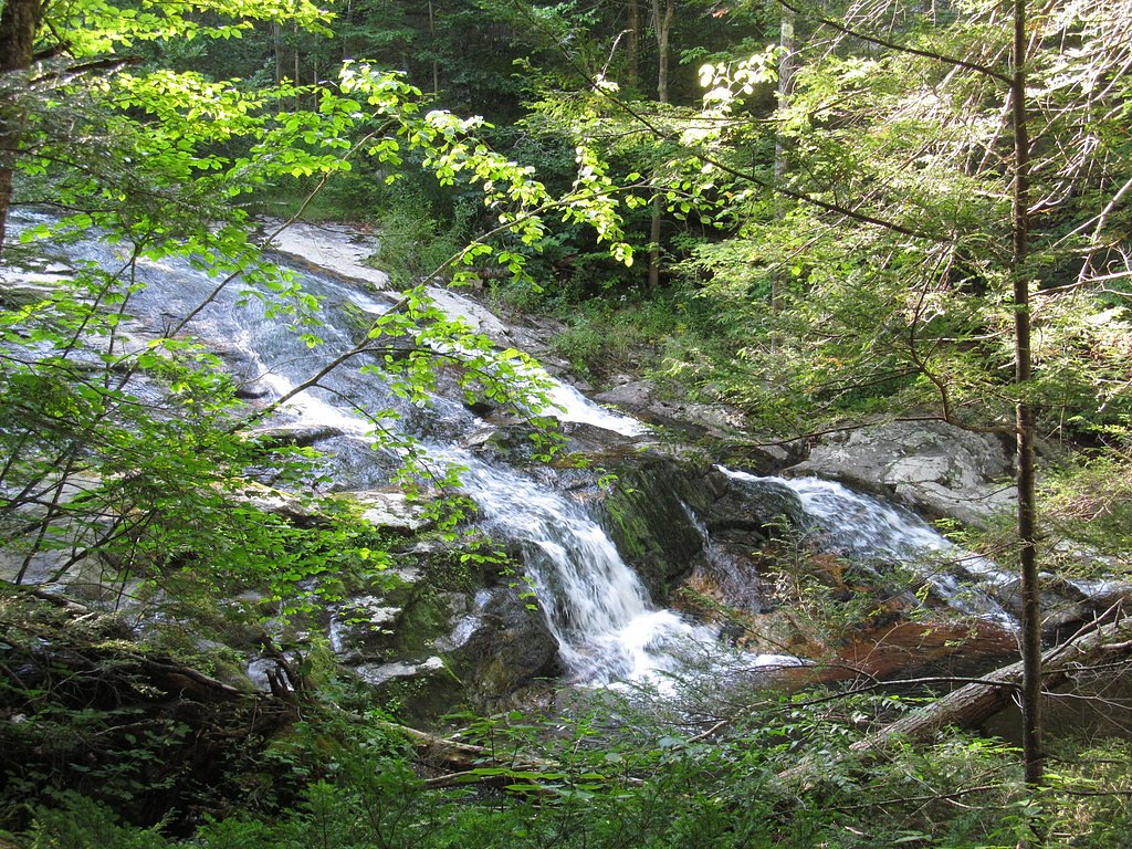
About Chapel Falls
Chapel Falls is a picturesque waterfall located in Ashfield, Massachusetts, within the Chapel Brook Reservation. It features a series of cascades and drops, surrounded by lush forest, making it a popular spot for nature enthusiasts and photographers.
The Setting
Chapel Falls sits at 1,161 feet within Chapel Brook Reservation, fed by the Avery Brook, in the foothills of Massachusetts.
Trail & Hike Details
The Approach
The easy 1.2-mile out-and-back trail gains 200 feet of elevation on the way to the falls.
Trail Description
The trail to Chapel Falls is a short and relatively easy hike through a wooded area. The path is well-marked and leads to a series of cascades and a main waterfall. The trail is suitable for most visitors, though it may be muddy or slippery after rain.
What to Expect
Dogs are welcome.
Accessibility
The trail is not wheelchair accessible. Uneven terrain and elevation changes require steady footing.
Frequently Asked Questions
🐶 Are Dogs Allowed at Chapel Falls?
✅ Dogs are allowed
Are There Any Fees or Permits Required?
🆖 No fees required
🏊 Is There Swimming at Chapel Falls?
❌ Swimming is not allowed
When to Visit
Spring and early summer are the best times to visit, as the water flow is strongest during these seasons. Fall offers stunning foliage, while winter may provide a unique view of the frozen falls.
Seasonal Access
The best time to visit is Spring, Summer, and Fall. Winter access may be limited.
Safety Information
Exercise caution near the falls, as rocks can be slippery. Avoid visiting during heavy rain or icy conditions. Stay on marked trails to protect the environment and ensure safety.
Current Water Conditions
1 ft³/s
Current discharge — how much water is flowing
About average for this time of year
Based on 6 years of record
3.92 ft
Water depth at gauge
7-Day Discharge Trend
What does this mean for your visit?
Flow is about average for this time of year.
About This Gauge
7-Day Flow Outlook
Based on the USGS gauge AVERY BROOK NR WHATELY, MA (7 km away).
Today
Low
1 cfs
3/10Tomorrow
Low
1 cfs
4/10Thu
Barely Flowing
1 cfs
5/10Fri
Barely Flowing
1 cfs
5/10Sat
Low
1 cfs
3/10Sun
Low
1 cfs
3/10Mon
Low
1 cfs
4/10Best window: Thu — barely flowing flow, sunny (trip score 5/10).
Best time of year: this gauge typically runs highest from early March to mid May, peaking in March.
How we calculate this
This is a transparent outlook, not a precise forecast. We take the waterfall's current flow strength (how it ranks against its historical normal for today, from the nearest USGS stream gauge), carry that ranking forward along the gauge's seasonal curve, and nudge it for forecast rain. Confidence is highest for the next day or two and falls further out. Always check official conditions and your own judgment before visiting — high flows can be dangerous.
Know when to go.
Get a free email alert when waterfalls near Shelburne Falls hit peak flow. We only send when conditions are worth the trip — no weekly newsletters, no spam.
Weather Forecast
Location & Access
Getting There
Chapel Falls is located off Williamsburg Road in Ashfield, Massachusetts. The trailhead is accessible via a short drive from Route 116.
Get Directions on Google MapsParking
There is a small parking area near the trailhead, but spaces may be limited during peak seasons.
Elevation
1,161 feet above sea level
Coordinates
42.482031° N, -72.759814° W
Land Management
Managed by UNK
Visitor Tips & Gear
Arrive early during weekends or peak seasons to secure parking. Wear sturdy shoes, as the trail can be muddy or uneven in places. Bring insect repellent during the summer months.
As an Amazon Associate, we earn from qualifying purchases.
This easy 1.2 miles hike is straightforward — comfortable trail shoes and plenty of water should do. Sun exposure on the trail makes good sun protection a must in summer.

Polarized Sunglasses (Knockaround)
Cuts glare off the water so you actually see the falls — and your photos turn out better too.

Columbia Watertight II Rain Jacket
Packs into its own pocket, seam-sealed, and keeps you dry from spray and surprise rain.

Earth Pak Waterproof Dry Bag
Keeps your phone and gear dry when waterfall mist soaks everything else.

Waterproof Phone Pouch (AiRunTech)
Cheap insurance — take photos right next to the falls without killing your phone.

JOBY GorillaPod Starter Kit
Wraps around railings and rocks for long-exposure waterfall shots — no flat surface needed.

Osprey Daylite Daypack
Light, organized, and just the right size for a day hike — fits water, snacks, and layers.
Where to Stay

Blooming Inn Shelburne Falls

Holiday Inn Club Vacations Oak n Spruce Resort in the Berkshires

Vacation Village in the Berkshires

Comfort Inn & Suites Hadley - Amherst
Browse vacation cabins and private rentals nearby
Unique outdoor stays — tents, yurts, and treehouses
Rent a campervan or RV for your waterfall road trip
Some links are affiliate links. We may earn a commission at no extra cost to you.
Nearby Campground
INDIAN HOLLOW
10.7 miles away · 2 sites
Overview With abundant wildlife, lush scenery and waterfront views, Indian Hollow Group Campground, located at the Knightville Dam and Reservoir, offers groups and clubs a recreational oasis.Recreation The rivers and streams at Knightville offer excellent trout fishing, and the river is stocked with trout in both the spring and fall. The surrounding hills provide prime upland game habitat, and the Commonwealth of Massachusetts stocks pheasants for the fall hunting season. Hunting and fishing are
Book on Recreation.govNearby Hot Springs
Hot springs near Shelburne Falls, Massachusetts

Lebanon Spring
Lebanon Spring discharges at 72°F at 663 feet elevation in Columbia County, flowing 24 degrees above ambient air temperature ju...
Sand Spring
Sand Spring surfaces at 75°F in Williamstown, Massachusetts — one of the few thermal features in New England. At just 670 feet ...
Looking for a soak after your hike? Explore more hot springs near Shelburne Falls, Massachusetts on SoakingSprings.
Explore Massachusetts springsAdditional Information
Nearby Attractions
Nearby attractions include the Ashfield Lake and the DAR State Forest, which offer additional hiking and recreational opportunities.
Wildlife
The area is home to various bird species, small mammals, and occasional deer sightings.
Cities near Chapel Falls
Other waterfalls named Chapel Falls
1 other waterfall shares this name across the U.S.
Writing about Chapel Falls? Embed this waterfall on your site for free.