Chandler Falls
By Armen Suny · Last verified May 2026
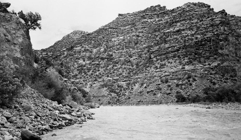
Photo Credits (1)
Difficulty
Moderate
Trail Length
2.4 miles
Trail Type
Out And Back
Elevation Gain
350 ft
About Chandler Falls
Chandler Falls is a quietly scenic waterfall tucked onto tribal lands within the Uintah and Ouray Reservation. Though lesser-known and not heavily documented, the falls offer a peaceful setting framed by native vegetation and rock—an inviting spot for hikers who prefer destinations off the beaten path. Because the site lies on reservation land, visitors should be mindful and respectful of the area; land ownership is listed as DESG with management by TRIB (designation TRIB). Access to Chandler Falls typically involves a short hike rather than a drive-up viewpoint. While specific measurements for the falls’ height and seasonal flow aren’t well recorded, the trek to reach the cascade rewards hikers with a close, personal experience of the landscape and a sense of solitude rarely found at busier waterfalls.
The Setting
Chandler Falls sits at 4,373 feet within Uintah and Ouray Reservation, fed by the Price River, in the mountains of Utah.
Trail & Hike Details
The Approach
The moderate 2.4-mile out-and-back trail gains 350 feet of elevation on the way to the falls.
Trail Description
The trail to Chandler Falls is an out-and-back route of about 2.4 miles round-trip with roughly 350 feet of elevation gain, and is commonly rated moderate in difficulty. Official USFS surface, grade, and class details are not available for this route; in practice the hike follows natural terrain and may include uneven footing and short climbs, so good trail shoes and basic hiking gear are recommended. Because the site is on the Uintah and Ouray Reservation (managed by TRIB, land owner DESG, designation TRIB), plan your visit with respect for tribal land and local rules. No managed campground is within 10 km of the falls according to available data, so plan day-trip logistics accordingly.
What to Expect
Visitors can expect a peaceful and scenic environment, though the waterfall's flow may vary depending on the season. The area is likely to be surrounded by natural vegetation and wildlife.
Accessibility
The trail is not wheelchair accessible. Uneven terrain and elevation changes require steady footing.
Frequently Asked Questions
🐶 Are Dogs Allowed at Chandler Falls?
❌ Dogs are not allowed
Are There Any Fees or Permits Required?
🆖 No fees required
🏊 Is There Swimming at Chandler Falls?
❌ Swimming is not allowed
When to Visit
Spring and early summer are likely the best times to visit, as the waterfall may have stronger flow due to snowmelt.
Seasonal Access
The best time to visit is Spring, Summer, and Fall. Winter access may be limited. Watch for flash flood warnings during monsoon season (July through September).
Safety Information
Trail conditions and access to Chandler Falls are not well-documented. Visitors should exercise caution, carry sufficient supplies, and inform someone of their plans before heading out.
Current Water Conditions
Based on a USGS gauge 22.3 miles away
0 ft³/s
Current discharge — how much water is flowing
Much lower than usual for this time of year
Based on 71 years of record
6.09 ft
Water depth at gauge
7-Day Discharge Trend
What does this mean for your visit?
Flow is well below normal for this time of year, so the waterfall may be a trickle.
About This Gauge
This gauge is on a regional waterway. Conditions at the falls may differ, especially after local rain.
7-Day Flow Outlook
Based on the USGS gauge PRICE RIVER AT WOODSIDE, UT (36 km away).
Today
Barely Flowing
0 cfs
5/10Tomorrow
Barely Flowing
0 cfs
5/10Mon
Barely Flowing
0 cfs
5/10Tue
Barely Flowing
0 cfs
5/10Wed
Barely Flowing
0 cfs
5/10Thu
Barely Flowing
0 cfs
5/10Fri
Barely Flowing
0 cfs
5/10Best window: Today — barely flowing flow, sunny (trip score 5/10).
Best time of year: this gauge typically runs highest from late April to early June, peaking in May.
How we calculate this
This is a transparent outlook, not a precise forecast. We take the waterfall's current flow strength (how it ranks against its historical normal for today, from the nearest USGS stream gauge), carry that ranking forward along the gauge's seasonal curve, and nudge it for forecast rain. Confidence is highest for the next day or two and falls further out. Always check official conditions and your own judgment before visiting — high flows can be dangerous.
Know when to go.
Get a free email alert when waterfalls near Green River hit peak flow. We only send when conditions are worth the trip — no weekly newsletters, no spam.
Weather Forecast
Location & Access
Getting There
The exact location and directions to Chandler Falls are not widely documented. Visitors are encouraged to consult local hiking resources or maps for guidance.
Get Directions on Google MapsParking
Parking availability is unclear. Visitors should plan ahead and check for nearby parking options or trailhead access points.
Elevation
4,373 feet above sea level
Coordinates
39.470521° N, -110.022092° W
Land Management
Managed by TRIB
Visitor Tips & Gear
Check local weather conditions before visiting. Bring appropriate footwear and supplies, as trail conditions and access details are unclear.
As an Amazon Associate, we earn from qualifying purchases.
With 2.4 miles and 350 ft of elevation gain, sturdy boots and trekking poles will help on this moderate trail. Sun exposure on the trail makes good sun protection a must in summer.

Polarized Sunglasses (Knockaround)
Cuts glare off the water so you actually see the falls — and your photos turn out better too.

Columbia Watertight II Rain Jacket
Packs into its own pocket, seam-sealed, and keeps you dry from spray and surprise rain.

Earth Pak Waterproof Dry Bag
Keeps your phone and gear dry when waterfall mist soaks everything else.

Waterproof Phone Pouch (AiRunTech)
Cheap insurance — take photos right next to the falls without killing your phone.

Timberland Euro Sprint Mid Waterproof
Trusted waterproof boot with premium leather and grippy rubber sole — reliable on rocky, wet trails.

TrailBuddy Trekking Poles
Lightweight aluminum, cork grips, and flip-locks that actually hold — a best-seller for good reason.
Where to Stay
Browse vacation cabins and private rentals nearby
Unique outdoor stays — tents, yurts, and treehouses
Rent a campervan or RV for your waterfall road trip
Some links are affiliate links. We may earn a commission at no extra cost to you.
Nearby Campground
Elliot Mesa Trailhead
20.1 miles away · 0 sites
Trailhead kiosk and info is on a road paralleling the Price River. The road up Mount Elliot was originally constructed to get a drilling rig up on Beckworth Plateau. It has not been maintained since making it a challenging climb for hikers, mtn bikers, ATVers, or full size trucks. The trail does not actually make it to the top of Mount Elliot. Close enough that a few hundred yards hiking and ledge climbing will get you there though. The view is awesome. 2400 feet of cliff will do that.
Book on Recreation.govAdditional Information
Nearby Attractions
Other natural attractions in Utah, such as Zion National Park or Bryce Canyon, may be worth exploring.
Wildlife
The area may feature local wildlife typical of Utah, such as deer, birds, and small mammals.
Cities near Chandler Falls
Other waterfalls named Chandler Falls
1 other waterfall shares this name across the U.S.
Writing about Chandler Falls? Embed this waterfall on your site for free.