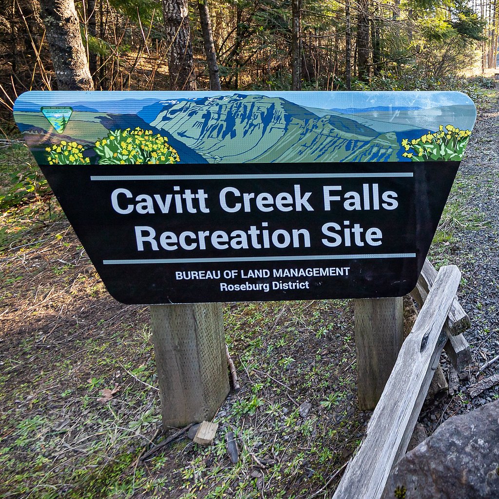
Cavitt Falls
By Armen Suny · Last verified Mar 2026
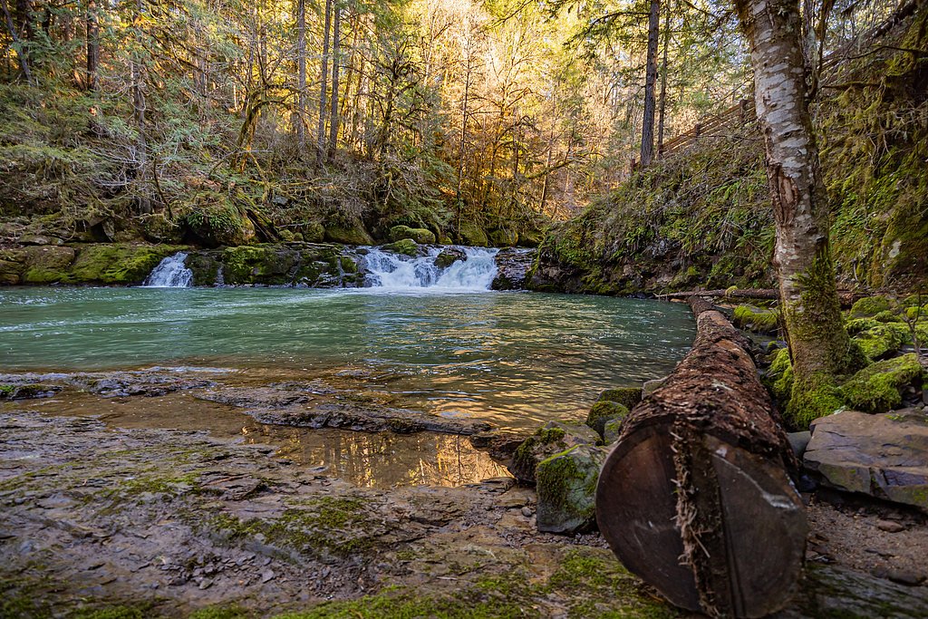

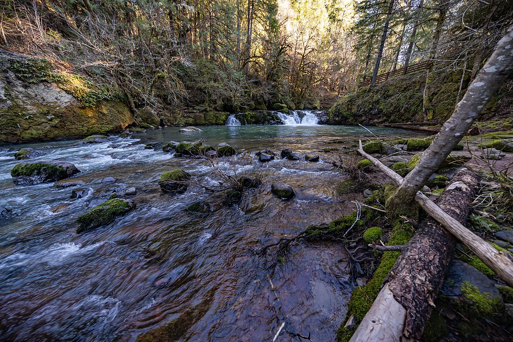
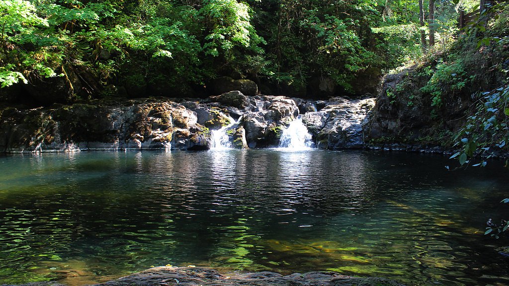
Photo Credits (5)
Difficulty
Moderate
Trail Length
2.4 miles
Trail Type
Out And Back
Elevation Gain
350 ft
About Cavitt Falls
Cavitt Falls is a small, picturesque waterfall in Douglas County, Oregon, that draws locals and visitors looking for a peaceful spot and a popular swimming hole in warmer months. The cascade and its pool offer a compact but scenic destination that’s perfect for a half-day outing and for photographers who enjoy intimate water features rather than large, crowded falls. Access to Cavitt Falls requires a short hike through the surrounding terrain — the approach is a pleasant way to stretch your legs before arriving at the water. The nearest developed camping is Three C Rock Campground, roughly 26.4 km away, so many visitors treat Cavitt Falls as a day-use stop while exploring the wider region.
The Setting
Cavitt Falls sits at 778 feet along the S Umpqua River, in the foothills of Oregon.
Trail & Hike Details
The Approach
The moderate 2.4-mile out-and-back trail gains 350 feet of elevation on the way to the falls.
Trail Description
The trail to Cavitt Falls is an out-and-back route measuring about 2.4 miles with roughly 350 feet of elevation gain and is rated moderate. Hikers can expect a relatively short hike with some sustained uphill sections given the stated elevation gain; overall difficulty is moderate rather than technical. Official surface, grade, and USFS trail class data were not provided in the available information.
What to Expect
Swimming is permitted. Dogs are welcome.
Accessibility
The trail is not wheelchair accessible. Uneven terrain and elevation changes require steady footing.
Frequently Asked Questions
🐶 Are Dogs Allowed at Cavitt Falls?
✅ Dogs are allowed
Are There Any Fees or Permits Required?
🤑 Fee: $5.00
🏊 Is There Swimming at Cavitt Falls?
✅ Swimming is allowed
When to Visit
The best time to visit is during late spring through early fall when the weather is warm, and the swimming hole is most enjoyable.
Seasonal Access
The best time to visit is Spring, Summer, and Fall. Winter access may be limited.
Safety Information
Rocks around the waterfall and swimming hole can be slippery. Always supervise children near the water and avoid swimming during high water levels or after heavy rain.
Current Water Conditions
74 ft³/s
Current discharge — how much water is flowing
Much lower than usual for this time of year
4.30 ft
Water depth at gauge
82°F
WarmVery comfortable
7-Day Discharge Trend
What does this mean for your visit?
Flow is well below normal for this time of year, so the waterfall may be a trickle. The water is warm at 82 degrees F, very comfortable for swimming.
About This Gauge
This gauge is on a nearby waterway and may not reflect exact conditions at the falls.
7-Day Flow Outlook
Based on the USGS gauge S UMPQUA RIVER AT CANYONVILLE, OR (11 km away).
Today
Barely Flowing
74 cfs
5/10Tomorrow
Barely Flowing
74 cfs
5/10Sat
Barely Flowing
80 cfs
3/10Sun
Low
88 cfs
3/10Mon
Low
85 cfs
4/10Tue
Barely Flowing
77 cfs
5/10Wed
Barely Flowing
74 cfs
5/10Best window: Today — barely flowing flow, mostly sunny (trip score 5/10).
How we calculate this
This is a transparent outlook, not a precise forecast. We take the waterfall's current flow strength (how it ranks against its historical normal for today, from the nearest USGS stream gauge), carry that ranking forward along the gauge's seasonal curve, and nudge it for forecast rain. Confidence is highest for the next day or two and falls further out. Always check official conditions and your own judgment before visiting — high flows can be dangerous.
Know when to go.
Get a free email alert when waterfalls near Myrtle Creek hit peak flow. We only send when conditions are worth the trip — no weekly newsletters, no spam.
Weather Forecast
Location & Access
Getting There
Cavitt Falls is located near Glide, Oregon, and can be accessed via Cavitt Creek Road. The falls are situated within a short distance of the Cavitt Creek Falls Campground.
Get Directions on Google MapsParking
Parking is available near the Cavitt Creek Falls Campground, which provides access to the waterfall.
Elevation
778 feet above sea level
Coordinates
43.020673° N, -123.203951° W
Visitor Tips & Gear
Arrive early during summer weekends to secure parking and enjoy a quieter experience. Bring water shoes if you plan to swim, as the rocks can be slippery.
As an Amazon Associate, we earn from qualifying purchases.
With 2.4 miles and 350 ft of elevation gain, sturdy boots and trekking poles will help on this moderate trail. Sun exposure on the trail makes good sun protection a must in summer.

Polarized Sunglasses (Knockaround)
Cuts glare off the water so you actually see the falls — and your photos turn out better too.

Columbia Watertight II Rain Jacket
Packs into its own pocket, seam-sealed, and keeps you dry from spray and surprise rain.

Earth Pak Waterproof Dry Bag
Keeps your phone and gear dry when waterfall mist soaks everything else.

Waterproof Phone Pouch (AiRunTech)
Cheap insurance — take photos right next to the falls without killing your phone.

Timberland Euro Sprint Mid Waterproof
Trusted waterproof boot with premium leather and grippy rubber sole — reliable on rocky, wet trails.

TrailBuddy Trekking Poles
Lightweight aluminum, cork grips, and flip-locks that actually hold — a best-seller for good reason.
Where to Stay

Blissful Solitude Cottage

Seven Feathers Casino Resort

Charming, Private Cottage in Myrtle Creek

Creekside Hotel & Suites
Browse vacation cabins and private rentals nearby
Unique outdoor stays — tents, yurts, and treehouses
Rent a campervan or RV for your waterfall road trip
Some links are affiliate links. We may earn a commission at no extra cost to you.
Nearby Campground
Three C Rock Campground
16.4 miles away · 6 sites
Overview Named after a historic Civilian Conservation Corps Camp that was built in the late 1930s, Three C Rock Campground is situated on the South Umpqua River. This campground, with five campsites, is a great spot for families to relax under a canopy of mixed conifers. If you enjoy fishing, then you are in luck as this is the only spot along the South Umpqua River where fishing is permitted. Be prepared for poison oak in the surrounding vegetation.Recreation HikingSwimmingFishingFacilities Five
Book on Recreation.govNearby Hot Springs
Hot springs near Myrtle Creek, Oregon

Umpqua Hot Springs
Umpqua Hot Springs flows at 117°F from multiple geothermal sources along the North Umpqua River in Lane County, forming cascadi...
Kitson Hot Springs
Kitson Hot Springs flows at 109°F within Willamette National Forest at 1,664 feet elevation, positioned just 17 meters from For...

Mccredie Springs
McCredie Springs flows at 163°F along Salt Creek in the Willamette National Forest, creating one of western Oregon's most popul...
Looking for a soak after your hike? Explore more hot springs near Myrtle Creek, Oregon on SoakingSprings.
Explore Oregon springsAdditional Information
Nearby Attractions
Nearby attractions include the Cavitt Creek Falls Campground and the Umpqua National Forest, which offers additional hiking and outdoor activities.
Wildlife
The area is home to various wildlife, including birds, deer, and small mammals. Be mindful of your surroundings and avoid feeding wildlife.
Cities near Cavitt Falls
Writing about Cavitt Falls? Embed this waterfall on your site for free.