
Cattail Falls
Texas • Big Bend National Park
By Armen Suny · Last verified Sep 2026
LiDAR & 3D terrain


Photo Credits (5)
Difficulty
Moderate
Trail Length
3.0 miles
Trail Type
Out And Back
Elevation Gain
500 ft
About Cattail Falls
Cattail Falls is a hidden gem located in Big Bend National Park, Texas. This seasonal waterfall flows most prominently after rainfall and is surrounded by lush vegetation, offering a stark contrast to the desert landscape of the park.
The Setting
Cattail Falls sits at 4,465 feet within Big Bend National Park, in the mountains of Texas.
Trail & Hike Details
The Approach
The moderate 3.0-mile out-and-back trail gains 500 feet of elevation on the way to the falls.
Trail Description
The trail to Cattail Falls is a moderately challenging hike through desert terrain, leading to a lush oasis where the waterfall is located. The path is unmarked but well-trodden, with some rocky sections and gradual elevation gain.
What to Expect
Visitors can expect a peaceful hike with stunning views of the Chisos Mountains and a rewarding sight of the waterfall, especially after recent rains. The area around the falls is shaded and cooler, providing a refreshing escape from the desert heat.
Accessibility
The trail is not wheelchair accessible. Uneven terrain and elevation changes require steady footing.
Frequently Asked Questions
🐶 Are Dogs Allowed at Cattail Falls?
❌ Dogs are not allowed
Are There Any Fees or Permits Required?
🤑 Fee: $30.00
🏊 Is There Swimming at Cattail Falls?
❌ Swimming is not allowed
When to Visit
The best time to visit is after recent rainfall, typically in the spring or fall, when the waterfall is most likely to be flowing.
Seasonal Access
The best time to visit is Spring, Fall, and Winter. Check with Big Bend National Park for current conditions.
Safety Information
Carry plenty of water and be prepared for desert conditions. Watch for loose rocks on the trail and avoid hiking during extreme heat. Be respectful of the fragile ecosystem around the falls.
Current Water Conditions
These readings come from the USGS gauge on Rio Grande, 14.8 miles away, not on Cattail Falls's own stream. Use them as a sign of whether the area is running wet or dry.
51 ft³/s
Current discharge — how much water is flowing
Lower than usual for this time of year
Based on 19 years of record
2.65 ft
Water depth at gauge
7-Day Discharge Trend
What does this mean for your visit?
Flow is lower than usual for this time of year.
About This Gauge
This gauge is on a nearby waterway and may not reflect exact conditions at the falls.
7-Day Flow Outlook
Based on the USGS gauge Rio Grande nr Castolon, TX (24 km away).
Today
Barely Flowing
51 cfs
5/10Tomorrow
Barely Flowing
45 cfs
5/10Sat
Barely Flowing
38 cfs
4/10Sun
Barely Flowing
37 cfs
3/10Mon
Low
37 cfs
3/10Tue
Barely Flowing
35 cfs
5/10Wed
Barely Flowing
36 cfs
5/10Best window: Today — barely flowing flow, partly sunny (trip score 5/10).
Best time of year: this gauge typically runs highest from early September to mid November, peaking in September.
How we calculate this
This is a transparent outlook, not a precise forecast. We take the waterfall's current flow strength (how it ranks against its historical normal for today, from the nearest USGS stream gauge), carry that ranking forward along the gauge's seasonal curve, and nudge it for forecast rain. Confidence is highest for the next day or two and falls further out. Always check official conditions and your own judgment before visiting — high flows can be dangerous.
Know when to go.
Get a free email alert when waterfalls near Terlingua hit peak flow. We only send when conditions are worth the trip — no weekly newsletters, no spam.
Weather Forecast
The Terrain, Seen by LiDAR
Aircraft-mounted lasers measured this ground to within inches. Trees and buildings are digitally stripped away, leaving the bare shape of the land the water has carved.
Along the line through the falls, the bare ground drops about 419 feet, most of it in one sheer step, the signature of a plunge waterfall. The ground at the falls is roughly 4,429 feet above sea level.
The whole reach is steep: about 160 feet of descent in the 500 feet above the falls and another 395 feet in the 500 feet below. The falls face northwest and glow in afternoon and evening light.
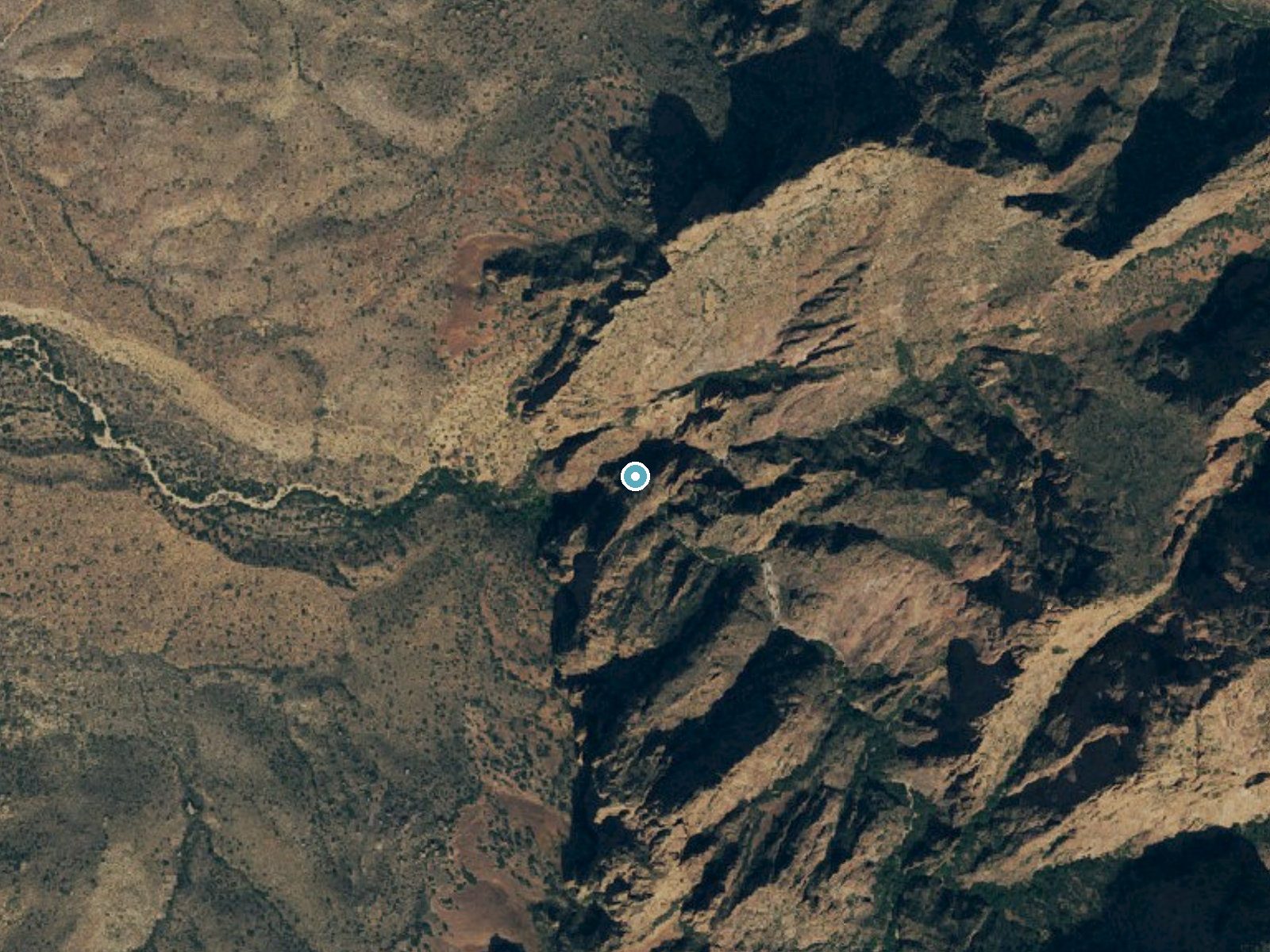
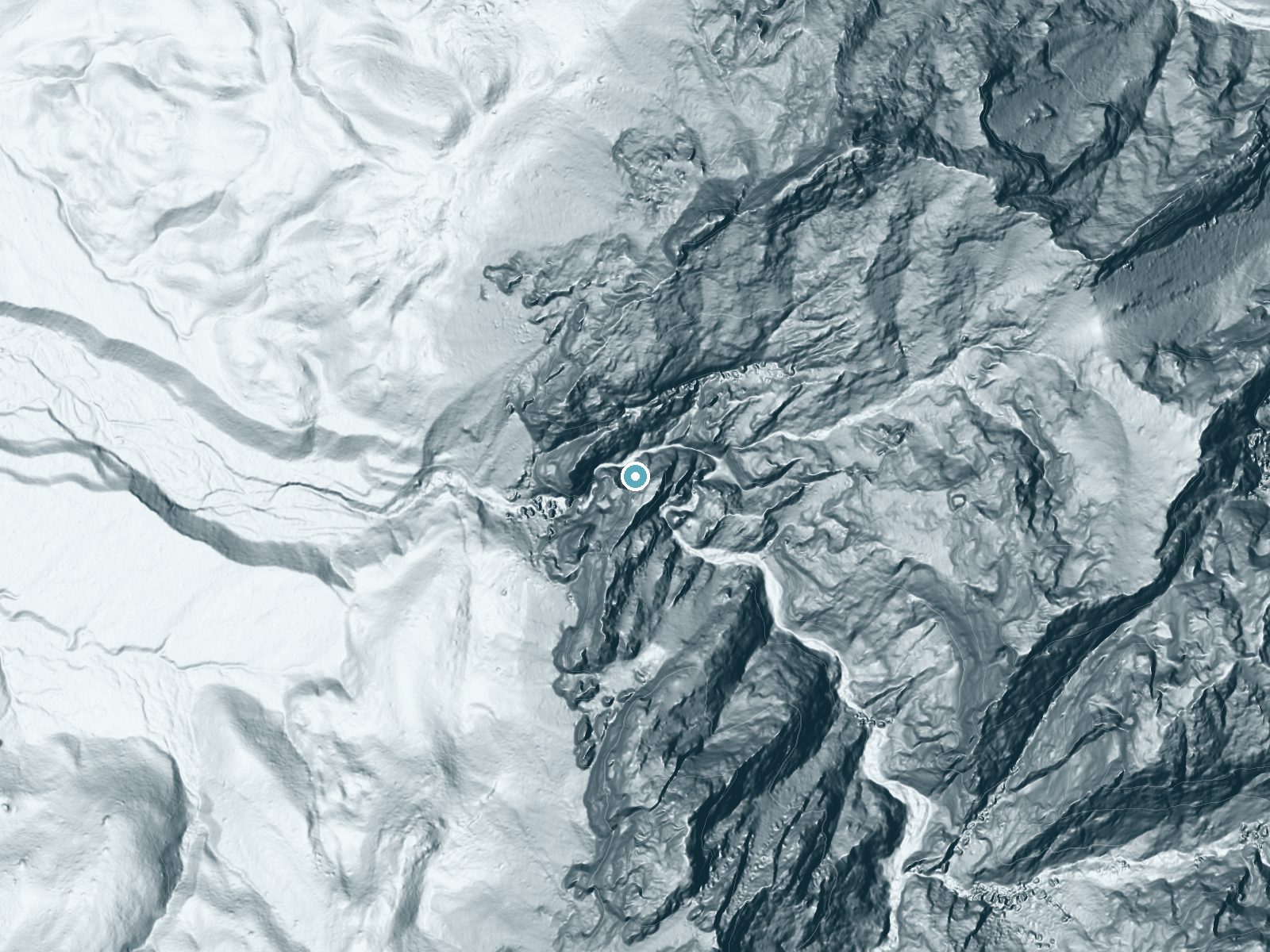
Drag to compare. The dot marks the waterfall. The frame is about a mile across.
- Ground elevation
- 4,429 feet
- Measured by 1-meter lidar
- Drop at the falls
- About 419 feet
- Change in ground height within ~250 feet of the falls
- Faces
- Northwest
- Glows in afternoon and evening light.
A slice through the lidar ground surface, from above the falls to downstream (heading northwest).
Elevation data: USGS 3D Elevation Program. Aerial imagery: USGS The National Map. Public domain.
Location & Access
Getting There
Cattail Falls is located in the Chisos Mountains area of Big Bend National Park. The trailhead is accessible via the Ross Maxwell Scenic Drive, with a short unmarked path leading to the start of the trail.
Get Directions on Google MapsParking
Parking is available at the Sam Nail Ranch parking area or nearby designated spots along the Ross Maxwell Scenic Drive.
Elevation
4,465 feet above sea level
Coordinates
29.273533° N, -103.334622° W
Land Management
Managed by NPS
Visitor Tips & Gear
Start your hike early in the day to avoid the heat, and bring plenty of water as there are no facilities along the trail. Be mindful of the fragile ecosystem around the falls and avoid disturbing the vegetation or wildlife.
As an Amazon Associate, we earn from qualifying purchases.
With 3.0 miles and 500 ft of elevation gain, sturdy boots and trekking poles will help on this moderate trail. Icy conditions are common in winter — traction cleats are a smart addition.
America the Beautiful Annual Pass
Covers entrance fees at 2,000+ federal recreation sites — required at most National Parks.

Columbia Watertight II Rain Jacket
Packs into its own pocket, seam-sealed, and keeps you dry from spray and surprise rain.

Earth Pak Waterproof Dry Bag
Keeps your phone and gear dry when waterfall mist soaks everything else.
Waterproof Phone Pouch (AiRunTech)
Cheap insurance — take photos right next to the falls without killing your phone.

Timberland Euro Sprint Mid Waterproof
Trusted waterproof boot with premium leather and grippy rubber sole — reliable on rocky, wet trails.

TrailBuddy Trekking Poles
Lightweight aluminum, cork grips, and flip-locks that actually hold — a best-seller for good reason.

Kahtoola MICROspikes
Cult-favorite traction cleats that grip ice and wet rock — essential for winter waterfall hikes.
Where to Stay
Terlingua Ranch Lodge

Container Home at Stardust Big Bend 5 min from Park

Stardust Big Bend Luxury A-Frame#9 with a fab view
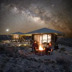
Camp Elena - Luxury Tents Minutes from Big Bend and Restaurants
Browse vacation cabins and private rentals nearby
Unique outdoor stays — tents, yurts, and treehouses
Rent a campervan or RV for your waterfall road trip
Some links are affiliate links. We may earn a commission at no extra cost to you.
Nearby Campground
Chisos Basin Group Campground (Big Bend, TX)
1.8 miles away · 7 sites
Overview Chisos Basin Group Campground, situated high in the rugged Chisos Mountains, is one of the most sought-after campgrounds in Big Bend National Park. It has seven group camping sites available for groups of nine to 20 people (size is site-dependent). At an altitude of 5,400 ft. (1646 m),, the campground is surrounded on all sides by tall, rocky cliffs and conveniently located near some of the park's most spectacular and popular trails. The Rio Grande is only a short drive away. Also found
Book on Recreation.govNearby Hot Springs
Hot springs near Cattail Falls, Texas
Hot Springs (Big Bend National Park)
Hot Springs (also known as Boquillas Hot Springs or Langford Hot Springs) sits just 270 feet from Hot Springs Road in Big Bend ...

Hot Springs
This 106°F hot spring flows along the Rio Grande in Big Bend National Park at 1,838 feet elevation, running 31 degrees above am...

Rio Grande Village Spring
Rio Grande Village Spring flows at 97°F within Big Bend National Park, emerging just 550 feet from the nearest road via short t...
Looking for a soak after your hike? Explore more hot springs near Cattail Falls, Texas on SoakingSprings.
Explore Texas springsAdditional Information
Nearby Attractions
Nearby attractions include the Chisos Basin, Santa Elena Canyon, and the Ross Maxwell Scenic Drive.
Wildlife
The area is home to diverse wildlife, including birds, lizards, and occasional sightings of larger animals like deer or javelinas.
Writing about Cattail Falls? Embed this waterfall on your site for free.