Photo Credits (3)
Difficulty
Easy
Trail Length
0.6 miles
Trail Type
Out And Back
Elevation Gain
75 ft
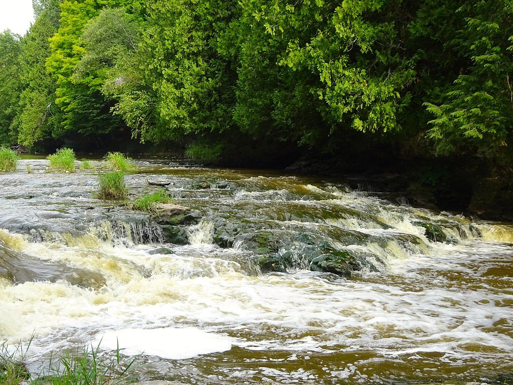
About Cato Falls
Cato Falls is a small, scenic cascade on the Manitowoc River tucked inside Cato Falls County Park in the town of Cato, Manitowoc County. Managed by Manitowoc County Parks, the site combines a peaceful riverside setting with picnic areas and short walking trails — a pleasant half-day stop for families and photographers. The town of Cato itself is a small rural community in Manitowoc County (population 1,616 at the 2000 census), and the park provides an easy, natural escape close to town. The falls are framed by a rocky ledge and a wooded river corridor that’s especially pretty in spring runoff and autumn color. The trail to the viewpoint is short and accessible: an easy 0.6-mile out-and-back with about 75 feet of elevation gain that delivers satisfying water-and-woods scenery without a long hike. Pack a picnic and plan for a relaxed visit — the park’s picnic areas make it a great spot to linger after taking in the falls.
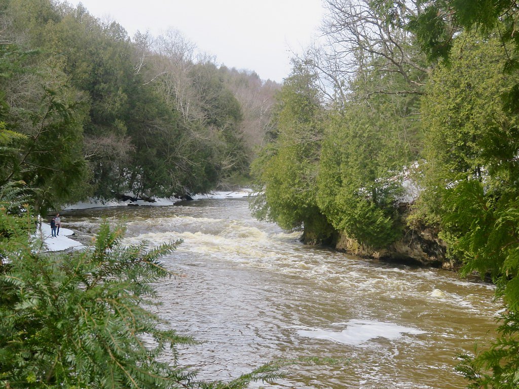
The Setting
Cato Falls sits at 791 feet along the Manitowoc River, in the foothills of Wisconsin.
Trail & Hike Details
The Approach
The easy 0.6-mile out-and-back trail gains 75 feet of elevation on the way to the falls.
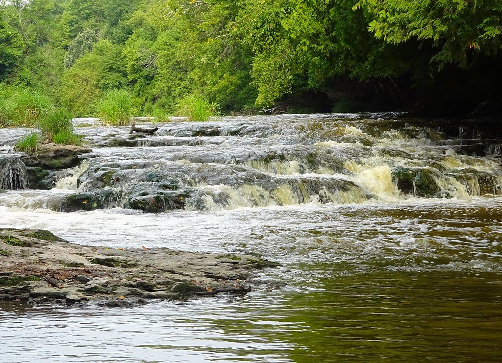
Trail Description
This is a brief, family-friendly out-and-back route of roughly 0.6 miles total with about 75 feet of elevation gain. The path winds through mixed woods on a compact dirt footpath and remains gently graded for most of the route, making it accessible for most hikers. Near the falls the trail crosses some rocky terrain and ledges where footing can be uneven, so sturdy shoes are recommended. Difficulty: easy.
What to Expect
Dogs are welcome.
Accessibility
The trail is short and relatively flat, but the surface may be uneven. Contact the managing agency for accessibility details.
Frequently Asked Questions
🐶 Are Dogs Allowed at Cato Falls?
✅ Dogs are allowed
Are There Any Fees or Permits Required?
🆖 No fees required
🏊 Is There Swimming at Cato Falls?
❌ Swimming is not allowed
When to Visit
Spring and early summer are the best times to visit, as the waterfall tends to have a stronger flow due to snowmelt and rainfall.
Seasonal Access
The best time to visit is Spring, Summer, and Fall. Winter access may be limited.
Safety Information
Exercise caution near the waterfall, as the rocks can be slippery. Avoid visiting during heavy rain or icy conditions.
Current Water Conditions
56 ft³/s
Current discharge — how much water is flowing
Lower than usual for this time of year
Based on 52 years of record
4.33 ft
Water depth at gauge
7-Day Discharge Trend
What does this mean for your visit?
Flow is lower than usual for this time of year.
About This Gauge
This gauge is on a nearby waterway and may not reflect exact conditions at the falls.
7-Day Flow Outlook
Based on the USGS gauge MANITOWOC RIVER AT MANITOWOC, WI (14 km away).
Today
Low
64 cfs
3/10Tomorrow
Low
58 cfs
6/10Wed
Low
64 cfs
3/10Thu
Low
66 cfs
3/10Fri
Low
59 cfs
3/10Sat
Low
53 cfs
3/10Sun
Low
50 cfs
3/10Best window: Tomorrow — low flow, sunny (trip score 6/10).
Best time of year: this gauge typically runs highest from early March to early June, peaking in March.
How we calculate this
This is a transparent outlook, not a precise forecast. We take the waterfall's current flow strength (how it ranks against its historical normal for today, from the nearest USGS stream gauge), carry that ranking forward along the gauge's seasonal curve, and nudge it for forecast rain. Confidence is highest for the next day or two and falls further out. Always check official conditions and your own judgment before visiting — high flows can be dangerous.
Know when to go.
Get a free email alert when waterfalls near Clarks Mills hit peak flow. We only send when conditions are worth the trip — no weekly newsletters, no spam.
Weather Forecast
Location & Access
Getting There
Cato Falls County Park is located near the town of Cato, Wisconsin. It is accessible via local roads, and the park entrance is well-marked.
Get Directions on Google MapsParking
There is a small parking lot available at Cato Falls County Park, located near the picnic area and trailheads.
Elevation
791 feet above sea level
Coordinates
44.093604° N, -87.889259° W
Visitor Tips & Gear
Wear sturdy shoes as the area near the waterfall may be rocky and uneven. Bring a picnic to enjoy in the park's designated areas. Visit after rainfall for a more impressive water flow.
As an Amazon Associate, we earn from qualifying purchases.
For this easy 0.6 miles trail, lightweight trail shoes and a water bottle are usually sufficient. Sun exposure on the trail makes good sun protection a must in summer.

Polarized Sunglasses (Knockaround)
Cuts glare off the water so you actually see the falls — and your photos turn out better too.

Columbia Watertight II Rain Jacket
Packs into its own pocket, seam-sealed, and keeps you dry from spray and surprise rain.

Earth Pak Waterproof Dry Bag
Keeps your phone and gear dry when waterfall mist soaks everything else.

Waterproof Phone Pouch (AiRunTech)
Cheap insurance — take photos right next to the falls without killing your phone.

JOBY GorillaPod Starter Kit
Wraps around railings and rocks for long-exposure waterfall shots — no flat surface needed.

Osprey Daylite Daypack
Light, organized, and just the right size for a day hike — fits water, snacks, and layers.
Where to Stay

Harbor Town, BW Signature Collection by Best Western

Frank Lloyd Wright student built riverfront home

Cobblestone Inn & Suites - Brillion

The Inn on Maritime Bay, an Ascend Collection Hotel
Browse vacation cabins and private rentals nearby
Unique outdoor stays — tents, yurts, and treehouses
Rent a campervan or RV for your waterfall road trip
Some links are affiliate links. We may earn a commission at no extra cost to you.
Additional Information
Nearby Attractions
The city of Manitowoc and Lake Michigan are nearby, offering additional recreational opportunities and attractions.
Wildlife
Visitors may encounter birds, squirrels, and other small wildlife typical of Wisconsin's wooded areas.
Cities near Cato Falls
Writing about Cato Falls? Embed this waterfall on your site for free.