Caribou Falls
By Armen Suny · Last verified Mar 2026
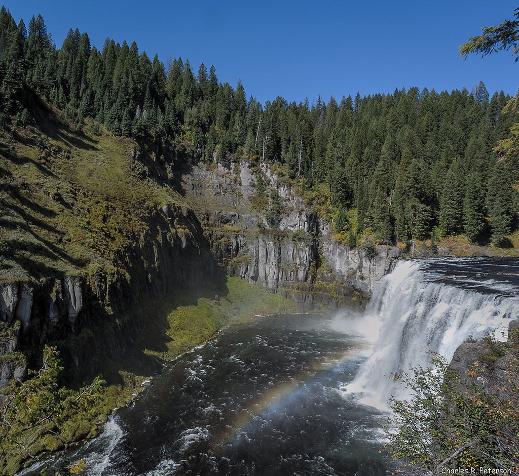
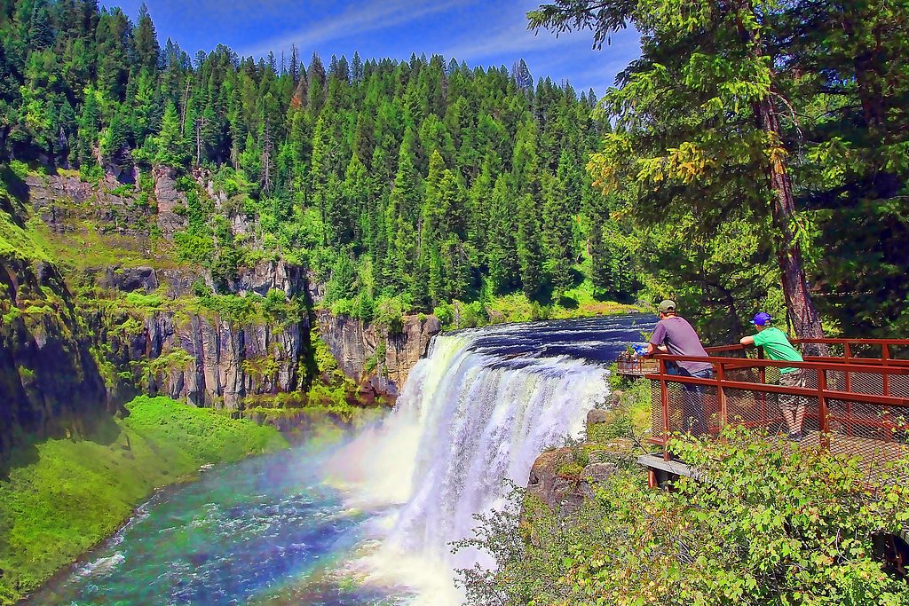
Photo Credits (5)
Difficulty
Easy
Trail Length
1.2 miles
Trail Type
Out And Back
Elevation Gain
200 ft
About Caribou Falls
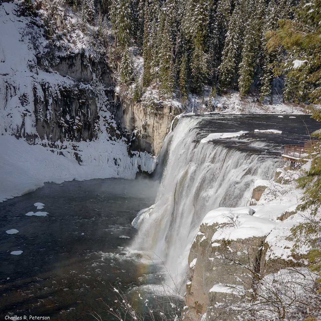
Caribou Falls is a scenic waterfall tucked into southeastern Idaho, offering a peaceful, relatively remote stop for day-hikers and photographers. Unlike waterfalls on federal forest land, Caribou Falls sits on state-managed lands overseen by the Idaho Department of Lands (SDOL) and is designated as a Special Recreation Management Area (SRMA), so facilities and management are handled at the state level. The setting is inviting for a short outdoor outing: the approach is brief but rewarding, with a well-maintained path that leads to viewpoints and a staircase down to the base of the falls. The nearest developed camping is Beaver Creek Campground, about 11.6 km away, so most visitors treat Caribou Falls as a half-day or day-trip destination rather than an immediate car-camp stop.
The Setting
Caribou Falls sits at 3,445 feet within Idaho Department of Lands, fed by the Boundary Creek, in the mountains of Idaho.
Trail & Hike Details
The Approach
The easy 1.2-mile out-and-back trail gains 200 feet of elevation on the way to the falls.
Trail Description
Trail type: out-and-back. Distance: 1.2 miles round trip (out-and-back); Elevation change: approximately 200 feet; Difficulty: easy. The route follows a well-maintained forest path that descends gently toward the falls, and the final approach includes a set of stairs that lead down to the waterfall base. No USFS trail number or additional surface/grade/class data is available for this state-managed route; expect a short, straightforward hike suitable for most abilities.
What to Expect
Dogs are welcome.
Accessibility
The trail is not wheelchair accessible. Uneven terrain and elevation changes require steady footing.
Frequently Asked Questions
🐶 Are Dogs Allowed at Caribou Falls?
✅ Dogs are allowed
Are There Any Fees or Permits Required?
🆖 No fees required
🏊 Is There Swimming at Caribou Falls?
❌ Swimming is not allowed
When to Visit
The best time to visit is in the spring or early summer when the waterfall is at its fullest due to snowmelt. Fall also offers beautiful foliage, while summer provides warm weather for hiking.
Seasonal Access
The best time to visit is Spring, Summer, and Fall. Winter access may be limited.
Safety Information
The trail can be slippery, especially near the waterfall and after rain. Visitors should exercise caution and stay on marked paths. Be aware of wildlife and carry bear spray if hiking in the area.
Current Water Conditions
Based on a USGS gauge 15.5 miles away
82 ft³/s
Current discharge — how much water is flowing
Much lower than usual for this time of year
Based on 98 years of record
10.07 ft
Water depth at gauge
7-Day Discharge Trend
What does this mean for your visit?
Flow is well below normal for this time of year, so the waterfall may be a trickle.
About This Gauge
This gauge is on a regional waterway. Conditions at the falls may differ, especially after local rain.
7-Day Flow Outlook
Based on the USGS gauge BOUNDARY CREEK NR PORTHILL ID (25 km away).
Today
Moderate
92 cfs
6/10Tomorrow
Moderate
87 cfs
6/10Wed
Moderate
81 cfs
6/10Thu
Moderate
71 cfs
6/10Fri
Moderate
71 cfs
6/10Sat
Moderate
60 cfs
9/10Sun
Moderate
54 cfs
9/10Best window: Sat — moderate flow, sunny (trip score 9/10).
Best time of year: this gauge typically runs highest from early April to early July, peaking in May.
How we calculate this
This is a transparent outlook, not a precise forecast. We take the waterfall's current flow strength (how it ranks against its historical normal for today, from the nearest USGS stream gauge), carry that ranking forward along the gauge's seasonal curve, and nudge it for forecast rain. Confidence is highest for the next day or two and falls further out. Always check official conditions and your own judgment before visiting — high flows can be dangerous.
Know when to go.
Get a free email alert when waterfalls near Coolin hit peak flow. We only send when conditions are worth the trip — no weekly newsletters, no spam.
Weather Forecast
Location & Access
Getting There
Caribou Falls is located near the Snake River in the Caribou-Targhee National Forest. Visitors typically access the trailhead via US-26, with the nearest town being Swan Valley, Idaho. The trailhead is marked but may require careful navigation due to its remote location.
Get Directions on Google MapsParking
Parking is available at the trailhead, but spaces may be limited, especially during peak seasons.
Elevation
3,445 feet above sea level
Coordinates
48.820495° N, -116.779201° W
Land Management
Managed by SDOL
Visitor Tips & Gear
Wear sturdy shoes as the trail can be uneven in places. Arrive early to secure parking, especially during weekends or holidays. Bring water and snacks, as there are no facilities at the trailhead.
As an Amazon Associate, we earn from qualifying purchases.
This easy 1.2 miles hike is straightforward — comfortable trail shoes and plenty of water should do. Sun exposure on the trail makes good sun protection a must in summer.

Polarized Sunglasses (Knockaround)
Cuts glare off the water so you actually see the falls — and your photos turn out better too.

Columbia Watertight II Rain Jacket
Packs into its own pocket, seam-sealed, and keeps you dry from spray and surprise rain.

Earth Pak Waterproof Dry Bag
Keeps your phone and gear dry when waterfall mist soaks everything else.

Waterproof Phone Pouch (AiRunTech)
Cheap insurance — take photos right next to the falls without killing your phone.

JOBY GorillaPod Starter Kit
Wraps around railings and rocks for long-exposure waterfall shots — no flat surface needed.

Osprey Daylite Daypack
Light, organized, and just the right size for a day hike — fits water, snacks, and layers.
Where to Stay

Unique Nordman Retreat 1 Mi to Priest Lake!

Beautiful Priest Lake Home on the Golf Course

Beautiful Bungalow and Bunk House, Close to Lake

Elegant Priest Lake Townhome ~ 1 Mi From Lake
Browse vacation cabins and private rentals nearby
Unique outdoor stays — tents, yurts, and treehouses
Rent a campervan or RV for your waterfall road trip
Some links are affiliate links. We may earn a commission at no extra cost to you.
Nearby Campground
BEAVER CREEK (IDAHO)
7.2 miles away · 42 sites
Overview Beaver Creek Campground sits in the Idaho Panhandle National Forest, offering phenomenal views of the Selkirk Mountains across the reflective waters of Priest Lake.Recreation A local beach is easily accessible, where swimming and boating are available. Visitors enjoy kayaking, canoeing or power boating up a 2.5-mile channel called Thoroughfare that leads to the Upper Priest Lake Scenic Area, where birding is a popular activity. Beaver Creek has two trailheads, one for the 9-mile Navigati
Book on Recreation.govAdditional Information
Nearby Attractions
Nearby attractions include the Snake River, Palisades Reservoir, and the town of Swan Valley, which is known for its scenic beauty and outdoor activities.
Wildlife
The area is home to a variety of wildlife, including deer, birds, and small mammals. Visitors should be cautious of potential encounters with bears or other larger animals.
Cities near Caribou Falls
Other waterfalls named Caribou Falls
1 other waterfall shares this name across the U.S.
Writing about Caribou Falls? Embed this waterfall on your site for free.