Canyon Creek Falls
By Armen Suny · Last verified Mar 2026
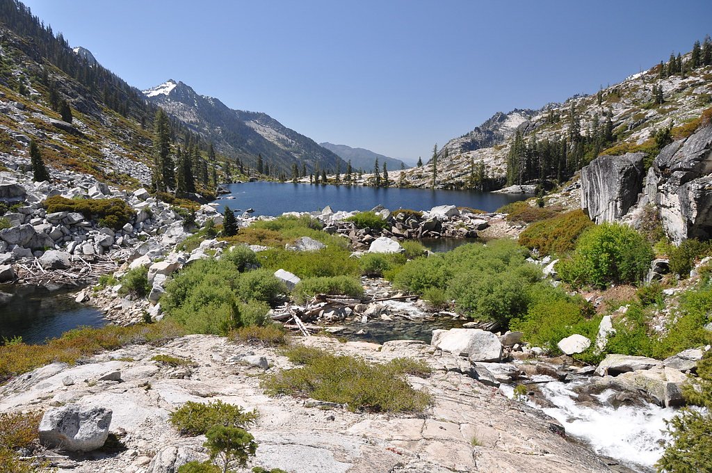
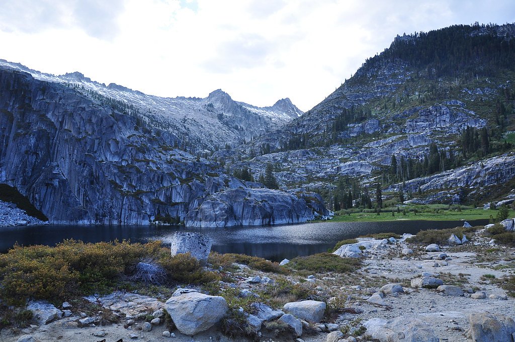
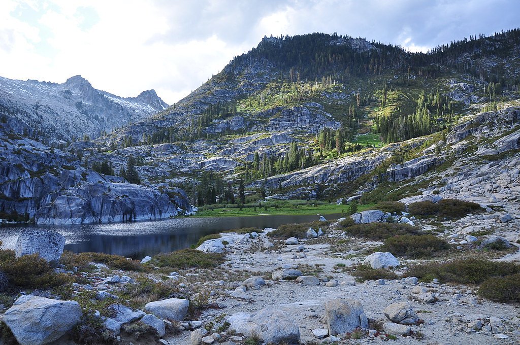
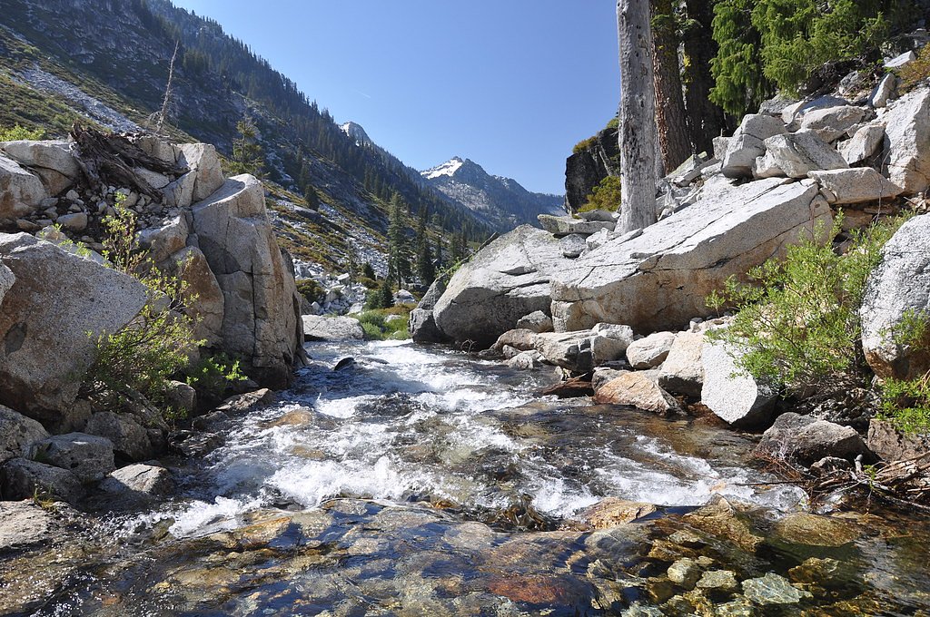

Photo Credits (5)
Difficulty
Hard
Trail Length
16.0 miles
Trail Type
Out And Back
Elevation Gain
2 ft
About Canyon Creek Falls
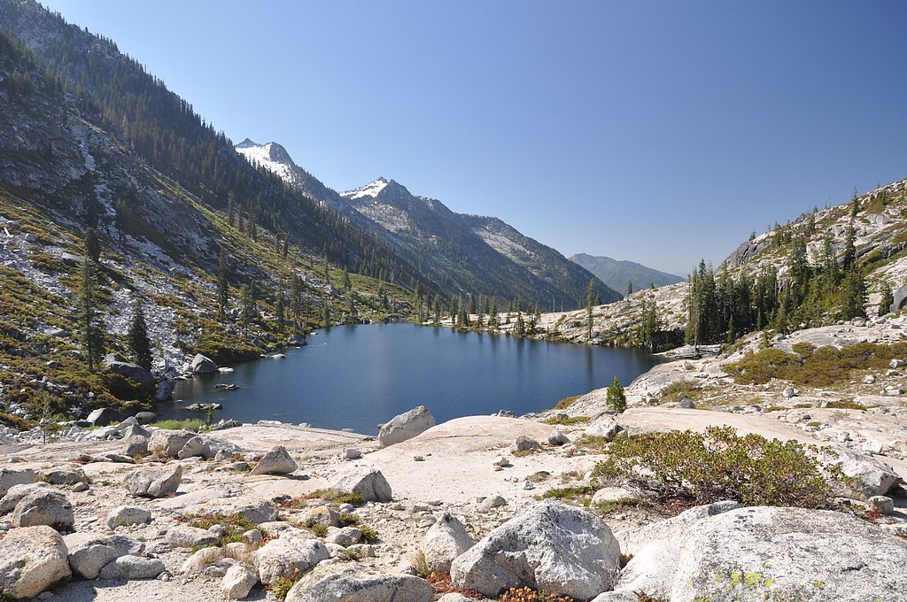
Canyon Creek Falls is a striking cascade tucked into the forests of northern California, set on lands managed by the U.S. Forest Service within Trinity National Forest. The falls are known for clear, plunging water framed by rocky cliffs and mixed-conifer forest, making it a favorite for hikers who enjoy dramatic creekside scenery and quiet wilderness immersion. Approaches follow tight channels and exposed rock, so give yourself time to savor the views and move carefully around slick stone. Access to the falls commonly uses the U.S. Forest Service’s BOULDER CREEK LAKES route (Trail #10W02). That official segment is recorded in Forest Service GIS at roughly 1.28 miles and is class 3 in difficulty on the USFS scale; the overall route to the falls is typically tackled as a long, hard out-and-back of about 16.0 miles. Expect native trail surfaces, steep pitches, and sections requiring hands-on scrambling and route-finding—bring proper footwear, navigation tools, and plan for a full-day backcountry outing.
The Setting
Canyon Creek Falls sits at 4,557 feet within Trinity National Forest, in the mountains of California.
Trail & Hike Details
The Approach
The hard hike follows Boulder Creek Lakes (#10W02), a 16.0-mile out-and-back trail over natural surface. Expect 2 feet of elevation gain with grades of 12-20%. The trail is developed (Class 3).
USFS Trail
BOULDER CREEK LAKES #10W02
Trail Class
Developed
Surface
Avg Grade
USFS Segment
1.28 miTrail Description
Trail: BOULDER CREEK LAKES (USFS Trail #10W02). Surface: native material. Class: 3 (requires scrambling and careful footing). Typical grade: 12-20% on sustained pitches. USFS GIS records a primary trail segment of about 1.28 miles, while the common approach to Canyon Creek Falls is described as an out-and-back near 16.0 miles total and is rated hard. The dataset lists a minimal recorded elevation gain (2 ft) but trail users should be prepared for significant ups-and-downs on steep, rocky tread and for route-finding around creek crossings and boulder fields. Expect uneven native tread, loose rock, and short exposed sections where hands-on scrambling is needed.
What to Expect
Swimming is permitted. Dogs are welcome.
Accessibility
The trail involves steep, uneven terrain with significant elevation change and is not accessible to mobility devices.
Frequently Asked Questions
🐶 Are Dogs Allowed at Canyon Creek Falls?
✅ Dogs are allowed
Are There Any Fees or Permits Required?
🆖 No fees required
Permit required
A free wilderness permit is required for overnight stays in the Trinity Alps Wilderness. Day hikes do not require a permit.
🏊 Is There Swimming at Canyon Creek Falls?
✅ Swimming is allowed
When to Visit
Spring and early summer are the best times to visit, as the waterfall is typically at its fullest due to snowmelt. Fall offers cooler temperatures and beautiful foliage, while summer can be hot but still rewarding.
Seasonal Access
The best time to visit is Spring, Summer, and Fall. Winter access may be limited. Check with Trinity National Forest for seasonal road closures.
Safety Information
Be prepared for changing weather conditions, as the area can experience sudden storms. Carry a first aid kit and let someone know your plans before heading out. Watch for loose rocks and slippery sections near the falls.
Current Water Conditions
725 ft³/s
Current discharge — how much water is flowing
About average for this time of year
Based on 21 years of record
9.68 ft
Water depth at gauge
61°F
CoolRefreshing for swimming
7-Day Discharge Trend
What does this mean for your visit?
Flow is about average for this time of year. Water temperature is a refreshing 61 degrees F, good for a quick swim.
About This Gauge
This gauge is on a nearby waterway and may not reflect exact conditions at the falls.
7-Day Flow Outlook
Based on the USGS gauge TRINITY R AB NF TRINITY R NR HELENA CA (20 km away).
Today
Barely Flowing
725 cfs
5/10Tomorrow
Barely Flowing
700 cfs
5/10Sun
Barely Flowing
710 cfs
5/10Mon
Barely Flowing
721 cfs
5/10Tue
Barely Flowing
702 cfs
5/10Wed
Barely Flowing
689 cfs
5/10Thu
Barely Flowing
782 cfs
3/10Best window: Today — barely flowing flow, sunny (trip score 5/10).
Best time of year: this gauge typically runs highest from mid April to mid June, peaking in May.
How we calculate this
This is a transparent outlook, not a precise forecast. We take the waterfall's current flow strength (how it ranks against its historical normal for today, from the nearest USGS stream gauge), carry that ranking forward along the gauge's seasonal curve, and nudge it for forecast rain. Confidence is highest for the next day or two and falls further out. Always check official conditions and your own judgment before visiting — high flows can be dangerous.
Know when to go.
Get a free email alert when waterfalls near Junction City hit peak flow. We only send when conditions are worth the trip — no weekly newsletters, no spam.
Weather Forecast
Location & Access
Getting There
Canyon Creek Falls is accessed via the Canyon Creek Trailhead, located near Junction City, California. The trailhead can be reached by driving along Canyon Creek Road, which is a paved but narrow road.
Get Directions on Google MapsParking
Parking is available at the Canyon Creek Trailhead, but it may be limited during peak seasons. Arrive early to secure a spot.
Elevation
4,557 feet above sea level
Coordinates
40.934308° N, -123.020588° W
Land Management
Managed by USFS
Visitor Tips & Gear
Start early in the day to allow plenty of time for the hike. Wear sturdy hiking boots and bring plenty of water, as the trail can be steep and exposed in some areas. Bug spray is recommended during warmer months.
As an Amazon Associate, we earn from qualifying purchases.
This challenging 16.0 miles trail gains 2 ft in elevation — come prepared with proper hiking boots and trekking poles. Sun exposure on the trail makes good sun protection a must in summer.

Sawyer Squeeze Water Filter
The backcountry standard — filters 99.9% of bacteria and weighs just 3 oz.

Polarized Sunglasses (Knockaround)
Cuts glare off the water so you actually see the falls — and your photos turn out better too.

Columbia Watertight II Rain Jacket
Packs into its own pocket, seam-sealed, and keeps you dry from spray and surprise rain.

Earth Pak Waterproof Dry Bag
Keeps your phone and gear dry when waterfall mist soaks everything else.

Waterproof Phone Pouch (AiRunTech)
Cheap insurance — take photos right next to the falls without killing your phone.

Timberland Euro Sprint Mid Waterproof
Trusted waterproof boot with premium leather and grippy rubber sole — reliable on rocky, wet trails.
Where to Stay

Lakeview Terrace Resort

Vibrant Weaverville Escape w/ Deck & Creek!

Comfort Suites Redding - Shasta Lake

Weaverville Hotel
Browse vacation cabins and private rentals nearby
Unique outdoor stays — tents, yurts, and treehouses
Rent a campervan or RV for your waterfall road trip
Some links are affiliate links. We may earn a commission at no extra cost to you.
Nearby Campground
Bridge Camp (CA)
6.9 miles away · 11 sites
Overview Bridge Camp Campground is located on Staurt Forts Creek, it has a total of 10 single sites with an average back in around 16ft. This campground has vault toilets and water spigots dependent on season. There are picnic tables and fire rings with grills on top located at each site. The campground is a horse camp and remote. This Campground is on a First Come - First Serve Basis, vistors are required to physically be at the campground to purchase and claim a site. You must also occupy the a
Book on Recreation.govNearby Hot Springs
Hot springs near Junction City, California
Stinking Springs
Stinking Springs flows at 101 degrees at 1,556 feet elevation in Tehama County near Rancho Tehama Reserve, providing water 39.6...

Hot Spring, Fumaroles
Hot Spring with fumaroles on Mount Shasta at 14,000 feet elevation represents one of California's highest thermal features, wit...
Tuscan Springs
Tuscan Springs flows at 86°F in Tehama County near Red Bluff, with borax-impregnated waters chemically similar to the famous sp...
Looking for a soak after your hike? Explore more hot springs near Junction City, California on SoakingSprings.
Explore California springsAdditional Information
Nearby Attractions
Other attractions in the Trinity Alps Wilderness include Emerald Lake, Sapphire Lake, and the Stuart Fork Trail.
Wildlife
The area is home to a variety of wildlife, including deer, black bears, and numerous bird species. Always practice caution and store food properly.
Cities near Canyon Creek Falls
Other waterfalls named Canyon Creek Falls
1 other waterfall shares this name across the U.S.
Writing about Canyon Creek Falls? Embed this waterfall on your site for free.