Photo Credits (3)
Difficulty
Moderate
Trail Length
2.4 miles
Trail Type
Out And Back
Elevation Gain
350 ft
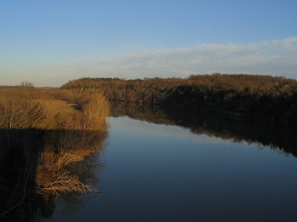
About Caney Falls
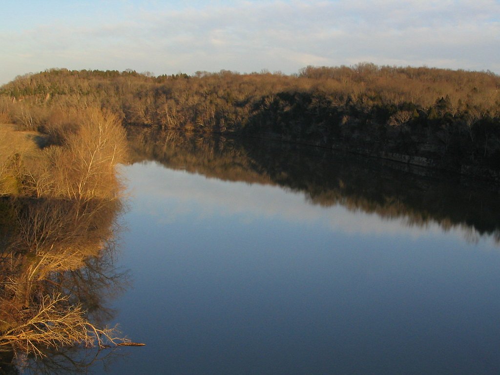
Caney Falls is a picturesque waterfall in Kentucky, celebrated for its serene surroundings and natural beauty. The falls draw nature enthusiasts and photographers looking for a quiet, scenic outing where the sound of cascading water provides a peaceful backdrop to a short day hike. Access to the falls involves a moderate hike: the route is an out-and-back of approximately 2.4 miles with about 350 feet of elevation gain. The trail is generally rated moderate and makes for a manageable half-day trip for many visitors; as trail names and managing agency details are not provided here, hikers should verify local access and current conditions before heading out.
The Setting
Caney Falls sits at 719 feet along the Little Sandy River, in the foothills of Kentucky.
Trail & Hike Details
The Approach
The moderate 2.4-mile out-and-back trail gains 350 feet of elevation on the way to the falls.
Trail Description
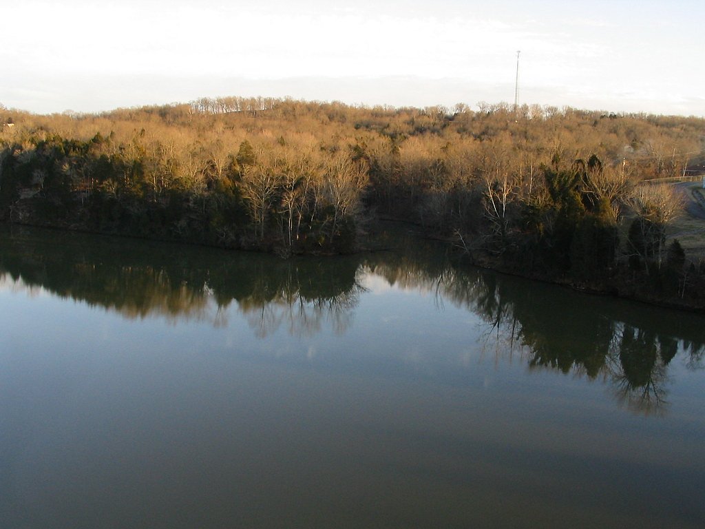
This approach to Caney Falls is an out-and-back trail of roughly 2.4 miles round trip with about 350 feet of cumulative elevation gain and a moderate difficulty rating. Specific USFS trail name/number and formal surface, grade, and trail class data are not available in the provided information, so visitors should be prepared for variable footing and bring appropriate footwear, water, and a map or GPS. Check local sources for up-to-date trail conditions and parking before you go.
What to Expect
Visitors can expect a tranquil natural setting with a cascading waterfall surrounded by lush greenery. The area may be less developed, offering a more rustic experience.
Accessibility
The trail is not wheelchair accessible. Uneven terrain and elevation changes require steady footing.
Frequently Asked Questions
🐶 Are Dogs Allowed at Caney Falls?
❌ Dogs are not allowed
Are There Any Fees or Permits Required?
🆖 No fees required
🏊 Is There Swimming at Caney Falls?
❌ Swimming is not allowed
When to Visit
Spring and fall are typically the best times to visit, as the waterfall may have higher flow and the surrounding foliage is vibrant.
Seasonal Access
The best time to visit is Spring, Summer, and Fall. Winter access may be limited.
Safety Information
Trail conditions and hazards are not well-documented. Visitors should be cautious of slippery rocks, uneven terrain, and potential wildlife encounters.
Current Water Conditions
42 ft³/s
Current discharge — how much water is flowing
About average for this time of year
Based on 28 years of record
86.20 ft
Water depth at gauge
62°F
CoolRefreshing for swimming
7-Day Discharge Trend
What does this mean for your visit?
Flow is about average for this time of year. Water temperature is a refreshing 62 degrees F, good for a quick swim.
About This Gauge
This gauge is on a nearby waterway and may not reflect exact conditions at the falls.
7-Day Flow Outlook
Based on the USGS gauge LITTLE SANDY RIVER BELOW GRAYSON DAM NEAR LEON, KY (16 km away).
Today
Barely Flowing
42 cfs
5/10Tomorrow
Low
50 cfs
3/10Sat
Moderate
53 cfs
4/10Sun
Moderate
53 cfs
4/10Mon
Low
44 cfs
6/10Tue
Barely Flowing
41 cfs
5/10Wed
Barely Flowing
42 cfs
5/10Best window: Mon — low flow, sunny (trip score 6/10).
Best time of year: this gauge typically runs highest from mid January to late March, peaking in February.
How we calculate this
This is a transparent outlook, not a precise forecast. We take the waterfall's current flow strength (how it ranks against its historical normal for today, from the nearest USGS stream gauge), carry that ranking forward along the gauge's seasonal curve, and nudge it for forecast rain. Confidence is highest for the next day or two and falls further out. Always check official conditions and your own judgment before visiting — high flows can be dangerous.
Know when to go.
Get a free email alert when waterfalls near Blaine hit peak flow. We only send when conditions are worth the trip — no weekly newsletters, no spam.
Weather Forecast
Location & Access
Getting There
The exact location and directions to Caney Falls are not well-documented. Visitors are advised to consult local resources or hiking guides for accurate directions.
Get Directions on Google MapsParking
Parking availability is unclear. Visitors should prepare for limited or informal parking options near the trailhead.
Elevation
719 feet above sea level
Coordinates
38.162439° N, -82.843704° W
Visitor Tips & Gear
Wear sturdy footwear and bring water, as trail conditions and amenities are unclear. Check local weather and trail reports before visiting.
As an Amazon Associate, we earn from qualifying purchases.
With 2.4 miles and 350 ft of elevation gain, sturdy boots and trekking poles will help on this moderate trail. Sun exposure on the trail makes good sun protection a must in summer.

Polarized Sunglasses (Knockaround)
Cuts glare off the water so you actually see the falls — and your photos turn out better too.

Columbia Watertight II Rain Jacket
Packs into its own pocket, seam-sealed, and keeps you dry from spray and surprise rain.

Earth Pak Waterproof Dry Bag
Keeps your phone and gear dry when waterfall mist soaks everything else.

Waterproof Phone Pouch (AiRunTech)
Cheap insurance — take photos right next to the falls without killing your phone.

Timberland Euro Sprint Mid Waterproof
Trusted waterproof boot with premium leather and grippy rubber sole — reliable on rocky, wet trails.

TrailBuddy Trekking Poles
Lightweight aluminum, cork grips, and flip-locks that actually hold — a best-seller for good reason.
Where to Stay

Fairfield Inn & Suites Ashland

Hampton Inn Ashland

Days Inn by Wyndham Grayson

Days Inn by Wyndham Ashland
Browse vacation cabins and private rentals nearby
Unique outdoor stays — tents, yurts, and treehouses
Rent a campervan or RV for your waterfall road trip
Some links are affiliate links. We may earn a commission at no extra cost to you.
Nearby Campground
Lawrence County Recreation Area
9.8 miles away · 0 sites
This recreation area is part of Yatesville Lake
Book on Recreation.govAdditional Information
Nearby Attractions
Nearby attractions are not well-documented, but visitors may find other natural areas or hiking trails in the region.
Wildlife
The area may host typical Kentucky wildlife, including birds, deer, and small mammals. Visitors should be cautious of ticks and other insects.
Cities near Caney Falls
Writing about Caney Falls? Embed this waterfall on your site for free.